|
Breadfield
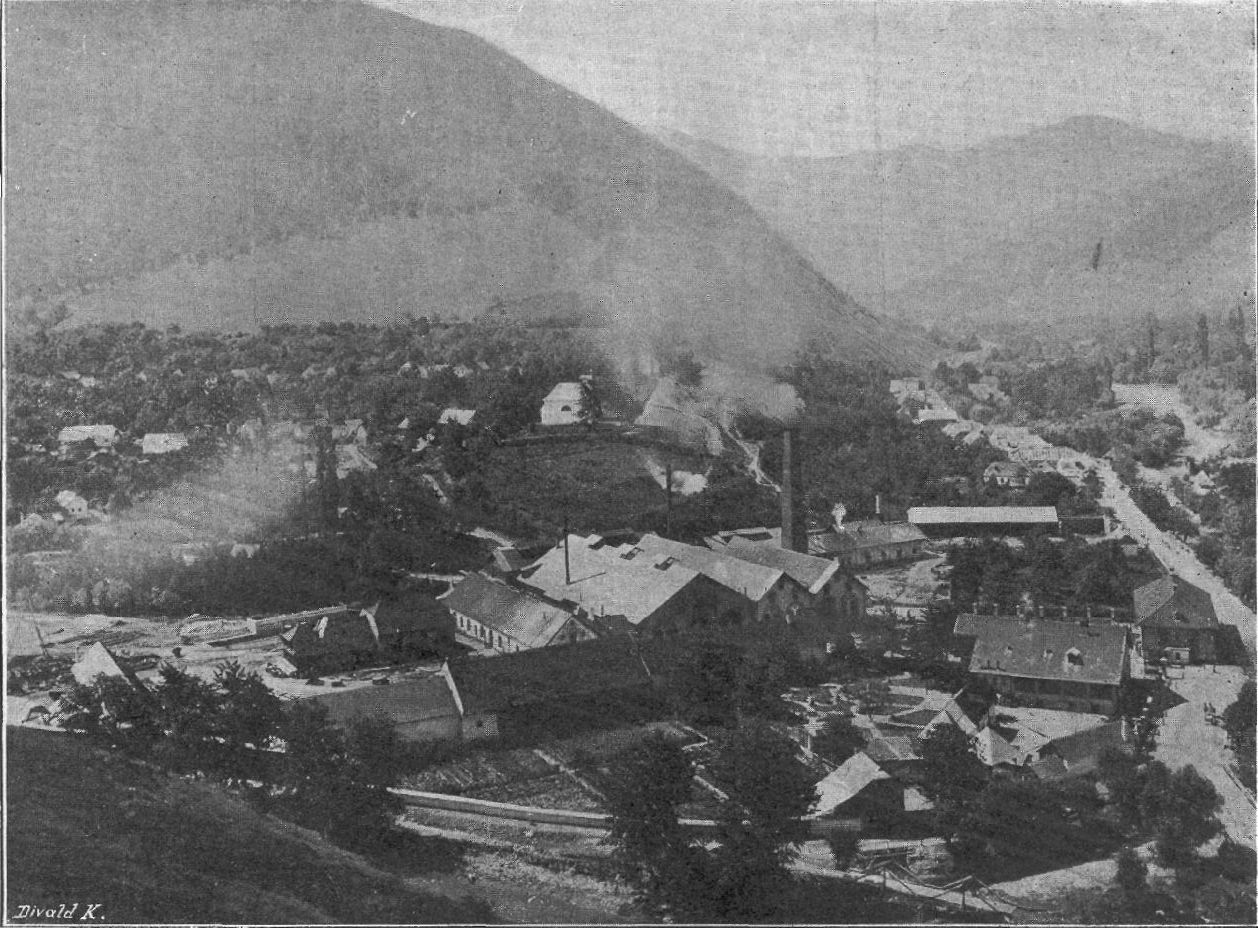
The Breadfield ( ro, Câmpul Pâinii, hu, Kenyérmező, german: Brodfeld, tr, Ekmekoltağı) is a region in southwest Transylvania, Romania between Orăștie ''(Szászváros)'' and Sebeș ''(Szászsebes)'' in the Transylvanian Saxon land, near the Mureș River. The central settlement is Cugir ( hu, Kudzsir, ger, Kudschir, tr, Kuçir). The Cugir River's old Magyar name is ''Kenyér'' (bread), which gave rise to the name ''Breadfield''. The region's borders to the south are the Cugir Mountains, to the north the Mureș River, to the west Hunedoara County, and to the east the Sebeș River. The area is a fertile plain. Formerly, Breadfield's population was largely Saxons, but today it is chiefly Romanians. In 1479 the Hungarians scored a victory over the Ottoman army in the 15th–19th centuries, Ottoman Army in the Battle of Breadfield, near Șibot. In remembrance of the victory, Stephen V Báthory built a chapel. :Settlements of Breadfield * Vințu de Jos (hung. ''Alvinc,'' ge ... [...More Info...] [...Related Items...] OR: [Wikipedia] [Google] [Baidu] |
Kenyérmező (Breadfield)
The Breadfield ( ro, Câmpul Pâinii, hu, Kenyérmező, german: Brodfeld, tr, Ekmekoltağı) is a region in southwest Transylvania, Romania between Orăștie ''(Szászváros)'' and Sebeș ''(Szászsebes)'' in the Transylvanian Saxon land, near the Mureș (river), Mureș River. The central settlement is Cugir ( hu, Kudzsir, ger, Kudschir, tr, Kuçir). The Cugir (river), Cugir River's old Magyar name is ''Kenyér'' (bread), which gave rise to the name ''Breadfield''. The region's borders to the south are the Cugir Mountains, to the north the Mureș River, to the west Hunedoara County, and to the east the Sebeș (river), Sebeș River. The area is a fertile plain. Formerly, Breadfield's population was largely Transylvanian Saxons, Saxons, but today it is chiefly Romanians. In 1479 the Hungarians scored a victory over the Ottoman army in the 15th–19th centuries, Ottoman Army in the Battle of Breadfield, near Șibot. In remembrance of the victory, Stephen V Báthory built a chapel ... [...More Info...] [...Related Items...] OR: [Wikipedia] [Google] [Baidu] |
Orăștie
Orăștie (; german: link=no, Broos, hu, Szászváros, la, Saxopolis) is a city in Hunedoara County, south-western Transylvania, central Romania. History 7th–9th century – On the site of an old swamp was a human settlement, now the location of the old town center, whose remains can be traced into the 10th century when the first fortification was built with raised earth and wood stockades. 11th–12th century – The first Christian religious edifice was raised: The Orăștie Rotunda. It is a circular chapel, with an age estimated at 1000 years. Perhaps it was used only by aristocratic families that dominated the Orăștie area and surroundings in the 11th century. Nearby there is a similar construction from the same period – The Geoagiu Rotunda. 1105 – In the wake of the First Crusade Anselm von Braz ”liber de liberis genitus", châtelain of Logne, Walloon ministerial count settled here. The historian Karl Kurt Klein implies – thou ... [...More Info...] [...Related Items...] OR: [Wikipedia] [Google] [Baidu] |
Rezső Kasztner
Rezső Kasztner (1906 – 15 March 1957), also known as Rudolf Israel Kastner, was a Hungarian-Israeli journalist and lawyer who became known for having helped Jews escape from occupied Europe during the Holocaust. He was assassinated in 1957 after an Israeli court accused him of having collaborated with the Nazis. Kasztner was one of the leaders of the Budapest Aid and Rescue Committee (''Va'adat Ezrah Vehatzalah'', or ''Vaada''), which smuggled Jewish refugees into Hungary during World War II, then helped them escape from Hungary when in March 1944 the Nazis invaded that country too. Between May and July 1944, Hungarian Jews were deported to the gas chambers at Auschwitz at the rate of 12,000 people a day. Kasztner negotiated with Adolf Eichmann, a senior SS officer and the mastermind of the Holocaust, to allow 1,684 Jews to leave instead for Switzerland on what became known as the Kastner train, in exchange for money, gold, and diamonds. Kasztner moved to Israel after the w ... [...More Info...] [...Related Items...] OR: [Wikipedia] [Google] [Baidu] |
Stephen V Báthory
Stephen Báthory of Ecsed ( hu, Báthory István, ; ro, Ștefan Báthory; 1430–1493) was a Hungarian commander, 'dapiferorum regalium magister' (1458–?), judge royal (1471–1493) and voivode of Transylvania (1479–1493). He rose to power under King Matthias Corvinus of Hungary and after the king's death sided with Vladislav Jagiellon of Bohemia and later together with Pál Kinizsi defeated Prince John Corvin in the Battle of Csonthegy (1493). As a result of his cruelty in Transylvania, especially against the Székelys, he was deposed by the King in 1493 and died shortly afterwards. Family history The Báthory family was a powerful and influential Hungarian noble family from the 14th to 17th century. The two branches of the family produced many voivodes, Transylvanian princes and a king, ( Stefan Batory of Poland). Báthory belonged to the powerful family of Gutkeled, of the Ecsed branch. The name Báthory and the family coat-of-arms were granted in 13 ... [...More Info...] [...Related Items...] OR: [Wikipedia] [Google] [Baidu] |
Cugir
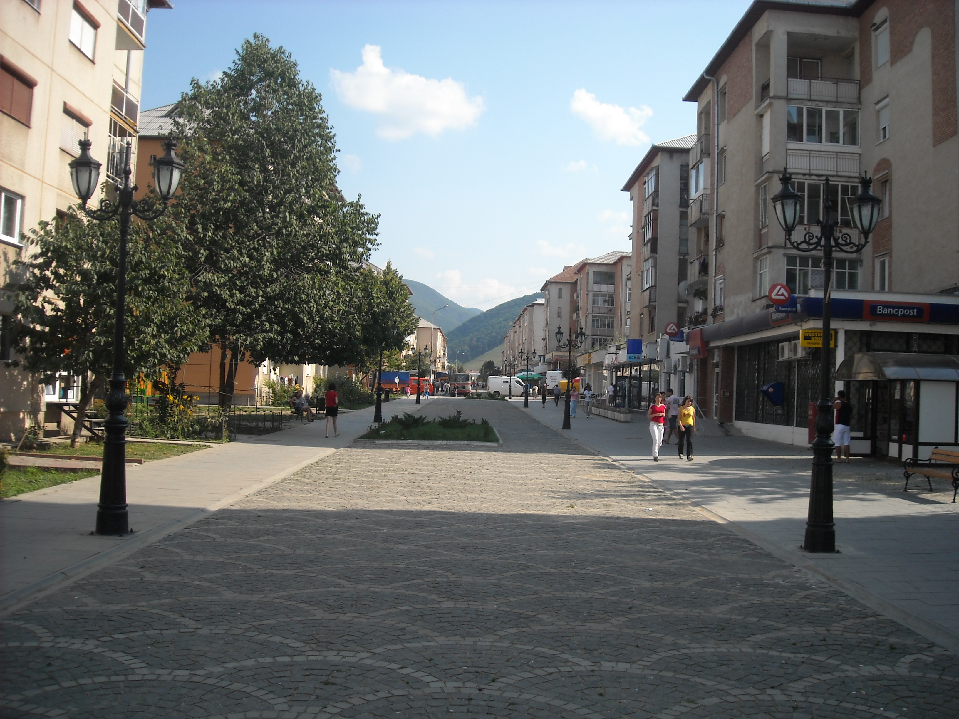
Cugir (; German: ''Kudsir, Kudschir'', Hungarian: ''Kudzsir'') is a town in Alba County, Romania. Declared a town in 1968, it administers seven villages: Bocșitura (Hungarian ''Boksiturahavas'', German ''Potschitur''), Bucuru (''Bukuruhavas''/''Bukur''), Călene (''Kalenihavas''/''Kalleney''), Fețeni (''Fecehavas''/''Fetzeberg''), Goașele (''Goaselehavas''/''Eisenhammer''), Mugești (''Mugestihavas''/''Kudschirstallen''), and Vinerea (''Felkenyér''/''Oberbrodsdorf''). Geography The central settlement of the Breadfield region, the town lies on the banks of the Cugir River, at the confluence of headwaters Râul Mare and Râul Mic. It is situated above sea level, at the base of the Șureanu Mountains. Cugir is located in the southwestern part of Alba County, about from Sebeș and from Alba Iulia, the capital of the county. It lies on the border with Hunedoara County, from Orăștie and from Deva. Demographics According to the 2011 census, there was a total population ... [...More Info...] [...Related Items...] OR: [Wikipedia] [Google] [Baidu] |
Vinerea
Cugir (; German: ''Kudsir, Kudschir'', Hungarian: ''Kudzsir'') is a town in Alba County, Romania. Declared a town in 1968, it administers seven villages: Bocșitura (Hungarian ''Boksiturahavas'', German ''Potschitur''), Bucuru (''Bukuruhavas''/''Bukur''), Călene (''Kalenihavas''/''Kalleney''), Fețeni (''Fecehavas''/''Fetzeberg''), Goașele (''Goaselehavas''/''Eisenhammer''), Mugești (''Mugestihavas''/''Kudschirstallen''), and Vinerea (''Felkenyér''/''Oberbrodsdorf''). Geography The central settlement of the Breadfield region, the town lies on the banks of the Cugir River, at the confluence of headwaters Râul Mare and Râul Mic. It is situated above sea level, at the base of the Șureanu Mountains. Cugir is located in the southwestern part of Alba County, about from Sebeș and from Alba Iulia, the capital of the county. It lies on the border with Hunedoara County, from Orăștie and from Deva. Demographics According to the 2011 census, there was a total populat ... [...More Info...] [...Related Items...] OR: [Wikipedia] [Google] [Baidu] |
The Holocaust In Hungary
The Holocaust in Hungary was the dispossession, deportation, and systematic murder of more than half of the Hungarian Jews, primarily after the German occupation of Hungary in March 1944. At the time of the German invasion, Hungary had a Jewish population of 825,000, the largest remaining in Europe, further swollen by Jews escaping from elsewhere to the relative safety of that country. The Hungarian Prime Minister Miklós Kállay had been reluctant to deport them. Fearing Hungary was trying to pursue peace with the Allies, Adolf Hitler ordered the invasion. New restrictions against Jews were imposed soon after Germany occupied Hungary on 19 March 1944. The invading troops included a '' Sonderkommando'' led by SS officer Adolf Eichmann, who arrived in Budapest to supervise the deportation of the country's Jews to the Auschwitz concentration camp in occupied Poland. Between 15 May and 9 July 1944, over 434,000 Jews were deported on 147 trains, most of them to Auschwitz, where abou ... [...More Info...] [...Related Items...] OR: [Wikipedia] [Google] [Baidu] |
Gelmar
Geoagiu ( hu, Algyógy, german: Gergesdorf) is a town in Hunedoara County, in the historical region of Transylvania, Romania, located on the Mureș River at an altitude of 217 metres above sea level. The river with the same name (Geoagiu) flows in this place into the Mureș. The town has a population of 5,049. It administers ten villages: Aurel Vlaicu (until 1925 ''Binținți''; ''Bencenc''), Băcâia (''Bakonya''), Bozeș (''Bózes''), Cigmău (''Csigmó''), Gelmar (''Gyalmár''), Geoagiu-Băi (''Feredőgyógy''), Homorod (''Homoród''), Mermezeu-Văleni (''Nyírmező''), Renghet (''Renget'') and Văleni (''Valény''). History The first settlements in the area can be found in the time of the Dacians, in the 1st century BC, as shown by archeological discoveries. After the Roman conquest, the Romans built the fort of Germisara in the 2nd century, however, it kept the original Dacian name. Germisara was defended by the Legio XIII Gemina. The name of ''Germisara'' meant "hot ... [...More Info...] [...Related Items...] OR: [Wikipedia] [Google] [Baidu] |
Romos
Romos (german: Rumes; hu, Romosz) is a commune in Hunedoara County, Transylvania, Romania Romania ( ; ro, România ) is a country located at the crossroads of Central, Eastern, and Southeastern Europe. It borders Bulgaria to the south, Ukraine to the north, Hungary to the west, Serbia to the southwest, Moldova to the east, and .... It is composed of five villages: Ciungu Mare (''Csunzshavas''), Pișchinți (''Piskinc''), Romos, Romoșel (''Romoszhely'') and Vaidei (''Vajdej''). File:Romos view.jpg, View of Romos village File:Lutheran church romos.jpg, Lutheran church File:Orthodox church romos.jpg, Orthodox church File:Rumes bach.jpg, Romoș River References Communes in Hunedoara County Localities in Transylvania {{Hunedoara-geo-stub ... [...More Info...] [...Related Items...] OR: [Wikipedia] [Google] [Baidu] |
Pișchinți
Romos (german: Rumes; hu, Romosz) is a commune in Hunedoara County, Transylvania, Romania. It is composed of five villages: Ciungu Mare (''Csunzshavas''), Pișchinți (''Piskinc''), Romos, Romoșel (''Romoszhely'') and Vaidei (''Vajdej''). File:Romos view.jpg, View of Romos village File:Lutheran church romos.jpg, Lutheran church File:Orthodox church romos.jpg, Orthodox church File:Rumes bach.jpg, Romoș River The Romos or Romoșel ( hu, Romosz, Romosz-patak) is a left tributary of the river Mureș in Romania. It discharges into the Mureș in Gelmar near Geoagiu Geoagiu ( hu, Algyógy, german: Gergesdorf) is a town in Hunedoara County, in the histor ... References Communes in Hunedoara County Localities in Transylvania {{Hunedoara-geo-stub ... [...More Info...] [...Related Items...] OR: [Wikipedia] [Google] [Baidu] |
Geoagiu
Geoagiu ( hu, Algyógy, german: Gergesdorf) is a town in Hunedoara County, in the historical region of Transylvania, Romania, located on the Mureș River at an altitude of 217 metres above sea level. The river with the same name (Geoagiu) flows in this place into the Mureș. The town has a population of 5,049. It administers ten villages: Aurel Vlaicu (until 1925 ''Binținți''; ''Bencenc''), Băcâia (''Bakonya''), Bozeș (''Bózes''), Cigmău (''Csigmó''), Gelmar (''Gyalmár''), Geoagiu-Băi (''Feredőgyógy''), Homorod (''Homoród''), Mermezeu-Văleni (''Nyírmező''), Renghet (''Renget'') and Văleni (''Valény''). History The first settlements in the area can be found in the time of the Dacians, in the 1st century BC, as shown by archeological discoveries. After the Roman conquest, the Romans built the fort of Germisara in the 2nd century, however, it kept the original Dacian name. Germisara was defended by the Legio XIII Gemina. The name of ''Germisara'' meant "hot wat ... [...More Info...] [...Related Items...] OR: [Wikipedia] [Google] [Baidu] |
.jpg)


