|
Brampton Valley Way
The Brampton Valley Way is a rail trail built on the way of the former Northampton to Market Harborough line, Northampton to Market Harborough Railway in Northamptonshire, England. It forms what trail managers, Northamptonshire County Council, describe as a linear park. The railway line was closed in 1981 and the Northamptonshire section was purchased by Northamptonshire County Council with grant aid from the Countryside Commission in 1987, when work began on developing it as a linear park. The section north of the county boundary is owned by Leicestershire County Council. Management of the complete route is now undertaken by Leicestershire County Council, West Northamptonshire Council, and Sustrans. The Brampton Valley Way, from Boughton Crossing in Northampton to Little Bowden Crossing in Market Harborough, was opened in the spring of 1993 and provides recreational access for cycling, cyclists and walking, walkers. Further developments to enhance access continue alongside e ... [...More Info...] [...Related Items...] OR: [Wikipedia] [Google] [Baidu] |
English Midlands
The Midlands (also referred to as Central England) are a part of England that broadly correspond to the Kingdom of Mercia of the Early Middle Ages, bordered by Wales, Northern England and Southern England. The Midlands were important in the Industrial Revolution of the 18th and 19th centuries. They are split into the West Midlands and East Midlands. The region's biggest city, Birmingham often considered the social, cultural, financial and commercial centre of the Midlands, is the second-largest city and metropolitan area in the United Kingdom. Symbolism A saltire (diagonal cross) may have been used as a symbol of Mercia as early as the reign of Offa. By the 13th century, the saltire had become the attributed arms of the Kingdom of Mercia. The arms are blazoned ''Azure, a saltire Or'', meaning a gold (or yellow) saltire on a blue field. The saltire is used as both a flag and a coat of arms. As a flag, it is flown from Tamworth Castle, the ancient seat of the Mercian Kings, to t ... [...More Info...] [...Related Items...] OR: [Wikipedia] [Google] [Baidu] |
Sustrans
Sustrans is a United Kingdom-based walking, wheeling and cycling charity, and the custodian of the National Cycle Network. Its flagship project is the National Cycle Network, which has created of signed cycle routes throughout the United Kingdom including of traffic-free paths. The rest of the network is on previously existing and mostly minor roads, in which motor traffic will be encountered. Sustrans works with schools to encourage active travel (cycling, walking or scooting) among students. It also works with employers and local authorities. It administers several thousand volunteers who contribute their time to the charity in numerous ways, such as cleaning and maintaining the National Cycle Network, enhancing biodiversity along the routes, leading walks and rides and supporting communities to improve their air quality. In Scotland, Sustrans has established partnership teams, embedding officers in local councils as well as NHS Scotland, the Scottish Environment Protecti ... [...More Info...] [...Related Items...] OR: [Wikipedia] [Google] [Baidu] |
Footpaths In Northamptonshire
A footpath (also pedestrian way, walking trail, nature trail) is a type of thoroughfare that is intended for use only by pedestrians and not other forms of traffic such as motorized vehicles, bicycles and horses. They can be found in a wide variety of places, from the centre of cities, to farmland, to mountain ridges. Urban footpaths are usually paved, may have steps, and can be called alleys, lanes, steps, etc. National parks, nature preserves, conservation areas and other protected wilderness areas may have footpaths (trails) that are restricted to pedestrians. The term footpath can also describe a pavement/ sidewalk in some English-speaking countries (such as Australia, New Zealand, and Ireland). A footpath can also take the form of a footbridge, linking two places across a river. Origins and history Public footpaths are rights of way originally created by people walking across the land to work, market, the next village, church, and school. This includes Mass paths ... [...More Info...] [...Related Items...] OR: [Wikipedia] [Google] [Baidu] |
Long-distance Footpaths In England
Long distance or Long-distance may refer to: *Long-distance calling *Long-distance operator *Long-distance relationship * Long-distance train *Long-distance anchor pylon, see dead-end tower Footpaths *Long-distance trail *European long-distance paths *Long Distance Routes, official term for footpaths in Scotland *List of long-distance footpaths *Long-distance footpaths in the United Kingdom *Long-distance trails in the United States *Long-distance trails in the Republic of Ireland Arts and media * ''Long Distance'' (Ivy album), 2001 * ''Long Distance'' (Runrig album), 1996 * "Long Distance" (song), a 2008 song by Brandy Norwood * "Long Distance" (Melanie Amaro song), 2012 *"Long Distance", by 8stops7 from the album ''Birth of a Cynic'' *Long Distance (film), a 1961 Australian television film *''Long Distance'', a 2015 IDW Publishing comics series Sports *Long-distance riding *Long-distance running *Long-distance swimming See also *"Long Distance Call", an episode of ' ... [...More Info...] [...Related Items...] OR: [Wikipedia] [Google] [Baidu] |
Rail Trails In England
Rail or rails may refer to: Rail transport *Rail transport and related matters *Rail (rail transport) or railway lines, the running surface of a railway Arts and media Film * ''Rails'' (film), a 1929 Italian film by Mario Camerini * ''Rail'' (1967 film), a film by Geoffrey Jones for British Transport Films *'' Mirattu'' or ''Rail'', a Tamil-language film and its Telugu dub Magazines * ''Rail'' (magazine), a British rail transport periodical * ''Rails'' (magazine), a former New Zealand based rail transport periodical Other arts *The Rails, a British folk-rock band * Rail (theater) or batten, a pipe from which lighting, scenery, or curtains are hung Technology *Rails framework or Ruby on Rails, a web application framework *Rail system (firearms), a mounting system for firearm attachments *Front engine dragster *Runway alignment indicator lights, a configuration of an approach lighting system *Rule Augmented Interconnect Layout, a specification for expressing guidelines for pri ... [...More Info...] [...Related Items...] OR: [Wikipedia] [Google] [Baidu] |
List Of Rail Trails
This is a list of rail trails around the world longer than 0.1 miles (160 metres). Rail trails are former railway lines that have been converted to paths designed for pedestrian, bicycle, skating, equestrian, and/or light motorized traffic. Most are multiuse trails offering at least pedestrians and cyclists recreational access and right-of-way to the routes. Asia * Parts of , Johor Bahru (Malaysia)-Tanjong Pagar (Singapore) KTM railway, known as the Green Corridor * Parts of , Thailand-Burma Death Railway Israel * The Jerusalem Railway Park South Korea * Parts of Old Jungang line ( Paldang-Yangpyeong) Taiwan * Dongfeng Bicycle Green Way * Hou-Fong bike path * Tanya Shen Green Bikeway * Taolin Bikeway Europe Austria A more complete reference can be found at www.bahntrassenradeln.de. Lower Austria * Dampfross und Drahtesel on the former :de:Stammersdorfer Lokalbahn * :de:Traisentalradweg on the former :de:Leobersdorfer Bahn Upper Austria * Reichrami ... [...More Info...] [...Related Items...] OR: [Wikipedia] [Google] [Baidu] |
Rail Trail
A rail trail is a shared-use path on railway right of way. Rail trails are typically constructed after a railway has been abandoned and the track has been removed, but may also share the right of way with active railways, light rail, or streetcars (rails with trails), or with disused track. As shared-use paths, rail trails are primarily for non-motorized traffic including pedestrians, bicycles, horseback riders, skaters, and cross-country skiers, although snowmobiles and ATVs may be allowed. The characteristics of abandoned railways—gentle grades, well-engineered rights of way and structures (bridges and tunnels), and passage through historical areas—lend themselves to rail trails and account for their popularity. Many rail trails are long-distance trails, while some shorter rail trails are known as greenways or linear parks. Rail trails around the world Americas Bermuda The Bermuda Railway ceased to operate as such when the only carrier to exist in Bermuda folded in 1948. ... [...More Info...] [...Related Items...] OR: [Wikipedia] [Google] [Baidu] |
Midshires Way
The Midshires Way is a long-distance footpath and bridleway that runs for from the Chiltern Hills from near Bledlow in Buckinghamshire, through the Midlands counties of Northamptonshire, Leicestershire, Nottinghamshire and Derbyshire, to Stockport, Greater Manchester. It also links several other long-distance walking routes or trackways including The Ridgeway, the Pennine Bridleway and the Trans Pennine Trail. The route was opened in 1994 as a collaboration between numerous Local Authorities and user groups. It is intended as a multi-user trail but there are places where the recommended route for walkers differs from the route for horse riders and cyclists. Buckinghamshire section The Midshires Way starts from Wain Hill (), between Bledlow and Chinnor. From there it runs near Princes Risborough north to Waddesdon and on to Winslow then in a northwest direction passing through the town of Milton Keynes. North of the town it passes to the west of Stoke Goldington before crossi ... [...More Info...] [...Related Items...] OR: [Wikipedia] [Google] [Baidu] |
Northampton & Lamport Railway
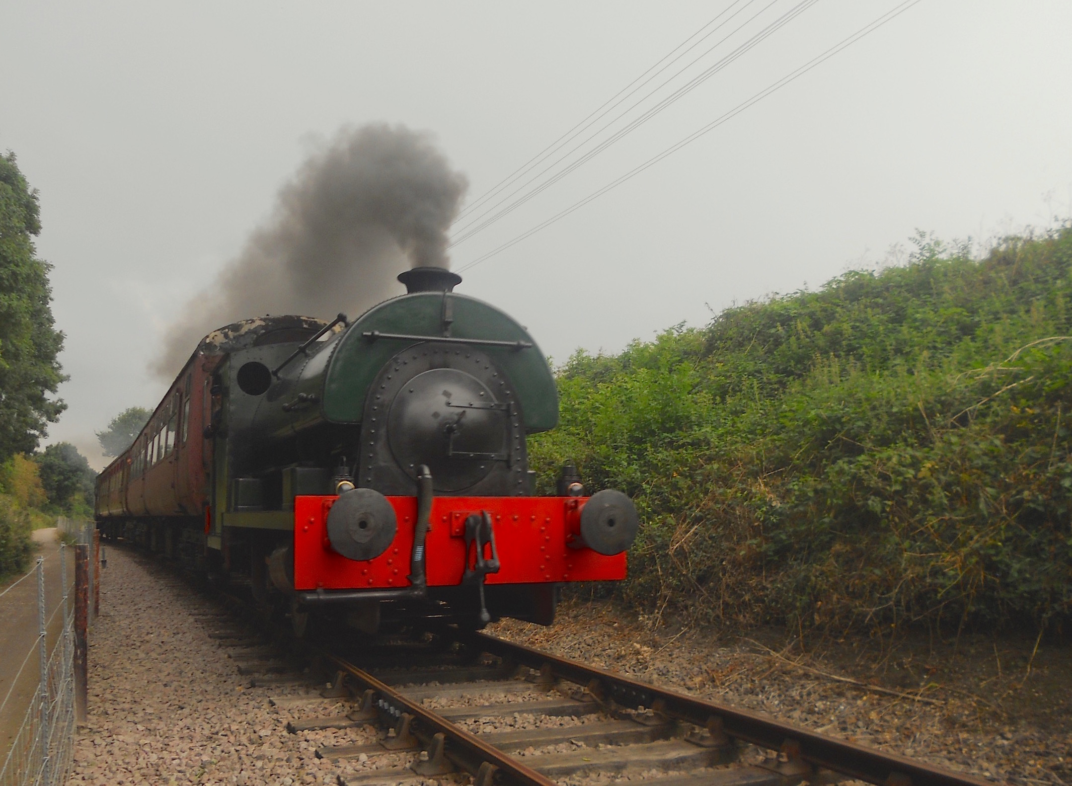
The Northampton and Lamport Railway is a standard gauge heritage railway in Northamptonshire, England. It is based at Pitsford and Brampton station, near the villages of Pitsford and Chapel Brampton, roughly north of Northampton. Overview The line between Northampton and Market Harborough was finally closed (by British Rail) on 16 August 1981, the intermediate stations on the route having been closed for many years. In 1984 (just three years after the line's closure), a group was formed by Michael William Papworth (of Northampton) with the intention of re-opening a section of the line as a heritage railway A heritage railway or heritage railroad (US usage) is a railway operated as living history to re-create or preserve railway scenes of the past. Heritage railways are often old railway lines preserved in a state depicting a period (or periods) i .... The site opened to the public shortly afterwards. Following the granting of a Light Railway Order, the line carried it ... [...More Info...] [...Related Items...] OR: [Wikipedia] [Google] [Baidu] |
Oxendon Tunnel
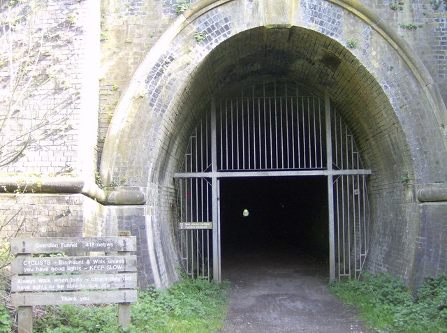
The Oxendon Tunnels are disused railway tunnels in Northamptonshire, England. The Northampton to Market Harborough line opened in 1859 and had tunnels at Oxendon and nearby at Kelmarsh. The original tunnel was single-track, and when the line was doubled a second single-track tunnel was built. The "up" line tunnel is long while the "down" line is . Due to the small bore, the tunnels were known as "the rat-holes" by train drivers. The former "up" line tunnel at Oxendon is open as part of the Brampton Valley Way, a linear park which runs from Boughton level crossing on the outskirts of Northampton to Little Bowden near Market Harborough, on the former railway trackbed. See also * Tunnels in the United Kingdom This is a list of road, railway, waterway, and other tunnels in the United Kingdom. A tunnel is an underground passageway with no defined minimum length, though it may be considered to be at least twice as long as wide. Some government bodies ... External link ... [...More Info...] [...Related Items...] OR: [Wikipedia] [Google] [Baidu] |
Kelmarsh Tunnel
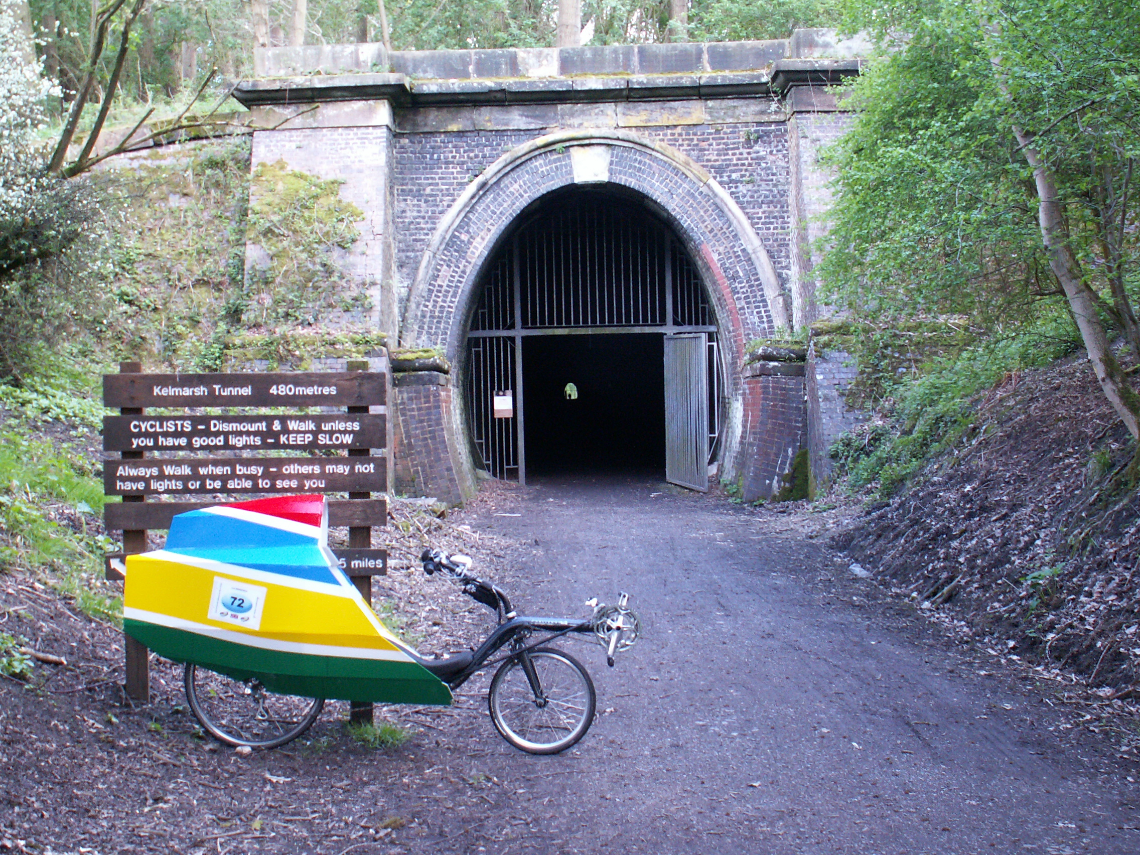
The Kelmarsh Tunnels are disused railway tunnels in Northamptonshire, England. The Northampton to Market Harborough line opened in 1859 and had tunnels at Kelmarsh and nearby Oxendon. The original tunnel was single-track, and when the line was doubled a second single-track tunnel was built. Due to the small bore, the tunnels were known as "the rat-holes" by train drivers. The former "up" line tunnel at Kelmarsh is open as part of the Brampton Valley Way, a linear park which runs from Boughton level crossing on the outskirts of Northampton to Little Bowden near Market Harborough, on the former railway trackbed. A species of moth ''Triphosa dubitata'' has been observed to overwinter inside Kelmarsh Tunnel. The tunnel is easily navigated on foot or by cyclists, and the open bore has been effectively restored but is unlit. The sign on site placed by the council indicates the tunnel length as . The other bore is sometimes accessible from one end but unsafe. the ventilation ... [...More Info...] [...Related Items...] OR: [Wikipedia] [Google] [Baidu] |
National Cycle Network
The National Cycle Network (NCN) is the national cycling route network of the United Kingdom, which was established to encourage cycling and walking throughout Britain, as well as for the purposes of bicycle touring. It was created by the charity Sustrans who were aided by a £42.5 million National Lottery grant. However Sustrans themselves only own around 2% of the paths on the network, these rest being made of existing public highways and rights of way, and permissive paths negotiated by Sustrans with private landowners, which Sustrans have then labelled as part of their network. In 2017, the Network was used for over 786 million cycling and walking trips, made by 4.4 million people. In 2020, around a quarter the NCN was scrapped on safety grounds, leaving of signed routes. These are made up of of traffic-free paths with the remaining on-road. It uses shared use paths, disused railways, minor roads, canal towpaths and traffic-calmed routes in towns and cit ... [...More Info...] [...Related Items...] OR: [Wikipedia] [Google] [Baidu] |


