|
Boğaziçi (Istanbul)
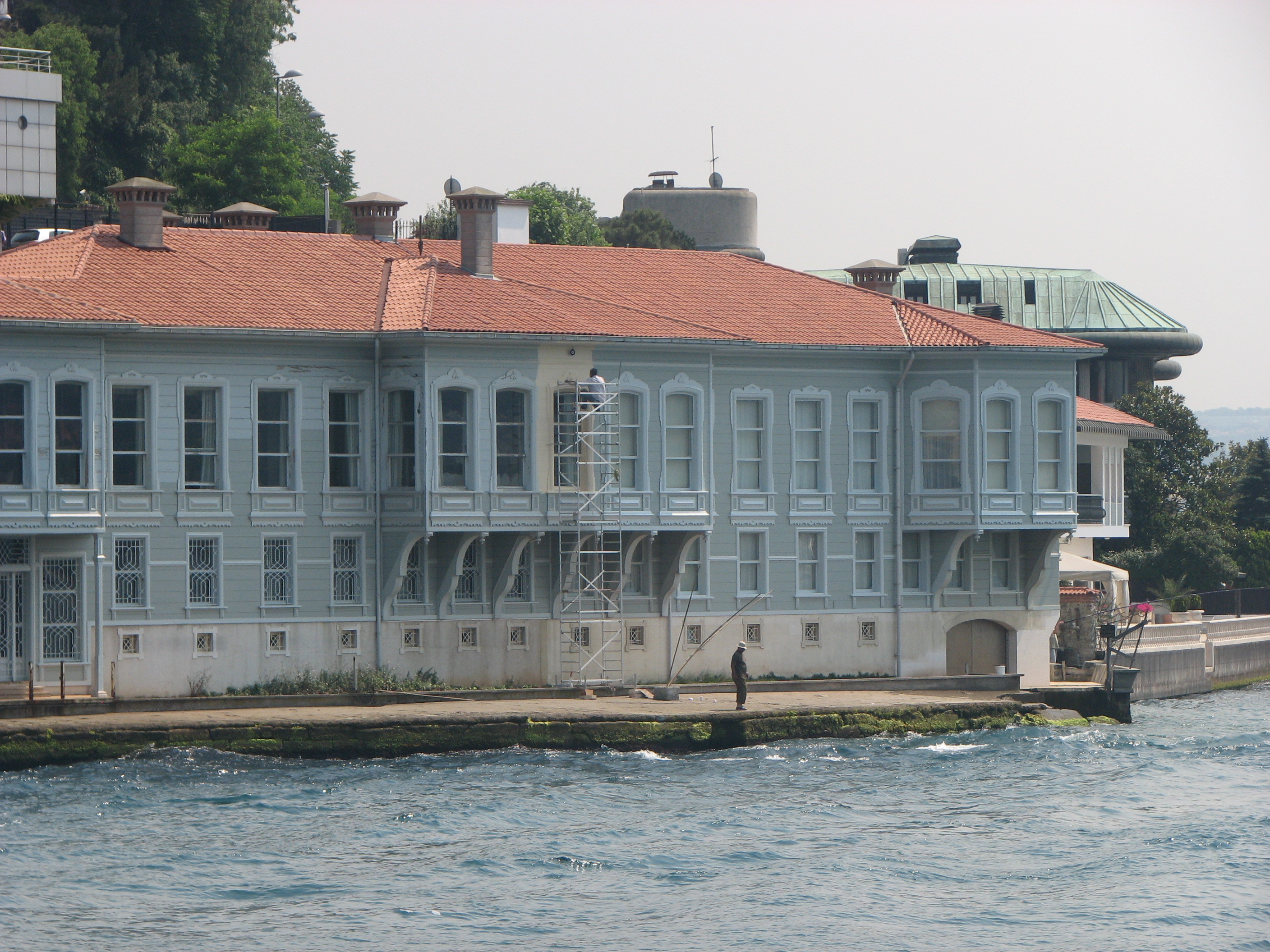
Boğaziçi is the general term, specific to İstanbul and overlapping administrative divisions, used to denote those parts of the city with a view of the Bosphorus. The respective nuances of the two terms (the strait itself and the urban area of Boğaziçi) being somewhat similar to those between San Francisco Bay and the Bay Area, they are not used interchangeably in correct parlance. The term Boğaziçi is used with particular emphasis relating to those parts of İstanbul which are situated north of the Golden Horn (Haliç), starting with the district of Beşiktaş on the European side of the Bosphorus. Thus, the term covers, from south to north, along the European shore, Beşiktaş, Ortaköy, Arnavutköy, Bebek, Rumelihisarı, Baltalimanı, Emirgan, İstinye, Yeniköy, Tarabya, Kireçburnu, Büyükdere and Sarıyer, and along the Asian shore, Beylerbeyi, Çengelköy, Vaniköy, Kandilli, Anadolu Hisarı, Kanlıca and Beykoz. See also * Robert College * Boğaziçi ... [...More Info...] [...Related Items...] OR: [Wikipedia] [Google] [Baidu] |
İstanbul
Istanbul ( , ; tr, İstanbul ), formerly known as Constantinople ( grc-gre, Κωνσταντινούπολις; la, Constantinopolis), is the List of largest cities and towns in Turkey, largest city in Turkey, serving as the country's economic, cultural and historic hub. The city straddles the Bosporus strait, lying in both Europe and Asia, and has a population of over 15 million residents, comprising 19% of the population of Turkey. Istanbul is the list of European cities by population within city limits, most populous European city, and the world's List of largest cities, 15th-largest city. The city was founded as Byzantium ( grc-gre, Βυζάντιον, ) in the 7th century BCE by Ancient Greece, Greek settlers from Megara. In 330 CE, the Roman emperor Constantine the Great made it his imperial capital, renaming it first as New Rome ( grc-gre, Νέα Ῥώμη, ; la, Nova Roma) and then as Constantinople () after himself. The city grew in size and influence, eventually becom ... [...More Info...] [...Related Items...] OR: [Wikipedia] [Google] [Baidu] |
Tarabya
Tarabya ( ota, Tarabiye, el, Θεραπειά, translit=Therapiá) is a neighbourhood in the Sarıyer district of Istanbul, Turkey. It is located on the European shoreline of the Bosphorus strait, between the neighbourhoods of Yeniköy, Istanbul, Yeniköy and Kireçburnu, Sarıyer, Kireçburnu. It is famous for its coastal fish restaurants. Geography Compared to other neighborhoods in Sarıyer, Tarabya has much more greenery and fresher air thanks to the northern winds coming from the sea. With its massive oak tree, the Huber Mansion and a marina which houses tens of boats and yachts, it is one of the most famous neighborhoods in Istanbul. Some of the areas now controlled by the Marmara University used to be the waterside mansion of Alexander Ypsilantis. Ther last station of the M2 (Istanbul Metro), Hacıosman (Istanbul Metro) is located here, approximately 3 kilometers from the coast. History The area used to be called Pharmakia. This name is believed to have been given here ... [...More Info...] [...Related Items...] OR: [Wikipedia] [Google] [Baidu] |
Boğaziçi University
Boğaziçi University ( tr, Boğaziçi Üniversitesi), also known as Bosphorus University, is a major research university in Istanbul, Turkey. Its main campus is located on the European side of the Bosphorus, Bosphorus strait. It has six faculties and two schools offering undergraduate degrees, and six institutes offering graduate degrees. Traditionally, the language of instruction is English. Founded in 1863, as Robert College, it was the first Higher education in the United States, American higher education institution founded outside the United States. Though under Turkish administration today, the university still maintains strong ties to the American educational system. Boğaziçi University consistently ranks as Turkey's top university and has the greatest number of applicants via the Turkish university entrance examinations, making it the most selective state university in Turkey.https://tanitim.boun.edu.tr/2019-taban-puanlari 2019 YKS SONUÇLARINA GÖRE BOĞAZİÇİ Ü ... [...More Info...] [...Related Items...] OR: [Wikipedia] [Google] [Baidu] |
Robert College
The American Robert College of Istanbul ( tr, İstanbul Özel Amerikan Robert Lisesi or ), often shortened to Robert, or RC, is a Selective school, highly selective, Independent school, independent, mixed-sex education, co-educational Secondary school, high school in Turkey.The Education in Turkey, Turkish education system divides schools into two classes: public or private. According to this classification, Robert College is a private school. The school is situated in a wooded campus on the European side of Istanbul in the Beşiktaş district, with the historic Arnavutköy neighborhood to the east and the upscale Ulus neighborhood to the west. Founded in 1863, Robert College is the oldest continuously operating American school outside the United States. Robert College is consistently ranked as the top private high school in Turkey. The school has a long list of Robert College alumni, list of notable alumni, including entrepreneurs, politicians, journalists, artists, three List ... [...More Info...] [...Related Items...] OR: [Wikipedia] [Google] [Baidu] |
Beykoz
Beykoz (), also known as Beicos and Beikos, is a district in Istanbul, Turkey at the northern end of the Bosphorus on the Anatolian side. The name is believed to be a combination of the words bey and ''kos'', which means "village" in Farsi. Beykoz includes an area from the streams of Küçüksu and Göksu (just before Anadoluhisarı) to the opening of the Bosphorus into the Black Sea, and the villages in the hinterland as far as the Riva creek. The mayor is Murat Aydın ( AKP). History The mouth of the Bosphorus in ancient times was used as a place of sacrifice, specifically to petition Zeus and Poseidon for a safe journey across the Black Sea, without which no one would venture into those stormy waters. The first people to settle the upper-Bosphorus were Thracians and Greeks and the ancient name for the area was Amikos (Αμικός in Greek) or Amnicus (Αμνικός), named after a Thracian king. However, the area has changed hands many times since. As well as being a str ... [...More Info...] [...Related Items...] OR: [Wikipedia] [Google] [Baidu] |
Kanlıca
Kanlıca is a neighbourhood on the Asian side of the Bosphorus strait, in the Beykoz district of Istanbul Province, Turkey. It is known for a yogurt sprinkled with caster sugar, which is sold in local cafés, ibcluding thİsmailağa Kahvesiwhich has a small museum commemorating famous visitors of the past. Location The Bülbül Creek empties into the Bosphorus at Kanlıca Bay. The Mihrabat Nature Park is situated south of Kanlıca, north of Bülbül Creek. The İskender Pasha Mosque, commissioned by (military judge) Kazasker Gazi İskender Pasha and originally built by Mimar Sinan in 1559–60, is located inland from Kanlıca Pier. The tomb of İskender Pasha is attached to the old timekeeper's lodge.The mosque has since been rebuilt so that no trace of the Sinan work survives. The Kanlıca Cemetery is on the hill east of the locality overlooking the Bosphorus. Notable burials of the cemetery include journalist Sedat Simavi, the musicians Barış Manço and Kayahan Açar. Kan ... [...More Info...] [...Related Items...] OR: [Wikipedia] [Google] [Baidu] |
Anadolu Hisarı
Anadolu (from Ancient Greek , 'east') is the Turkish form of Anatolia, which refers to a region of the world that is now part of the nation of Turkey, also known as Asia Minor (Medieval and Modern Greek). Anadolu may also refer to: Education *Anadolu University, Turkish university *Bursa Anadolu Lisesi, Bursa Anatolian High School Sports * Anadolu Efes S.K., Turkish basketball club * Anadolu Üsküdar 1908, Turkish football club Transportation *Anadolu Airport, Turkish airport *AnadoluJet, Turkish airline *Isuzu (Anadolu), a coach-manufacturing company Other uses *Proper name of the star WASP-52 *''Anadolu Mecmuası'', a periodical published by Hilmi Ziya Ülken and Reşat Kayı *Anadolu Agency, Turkish news agency *Anadolu Medical Center, hospital in Turkey * Anadolu pony, a breed of horse native to the region *Anadolu Shipyard, a Turkish shipbuilding company in the defense industry *Anadoluhisarı, a castle in Istanbul *, a planned amphibious assault ship of the Turk ... [...More Info...] [...Related Items...] OR: [Wikipedia] [Google] [Baidu] |
Kandilli, Üsküdar
Kandilli is a neighbourhood of Üsküdar, Istanbul, Turkey. It lies on the Asian bank of Bosphorus and is home to some of Istanbul's in-city forests. The Kandilli Anatolian High School for Girls ( tr, Kandilli Anadolu Kız Lisesi) was one of the first girl's high schools in Ottoman Turkey. The Kandilli Observatory, a facility of Boğaziçi University, is dedicated mostly to earthquake science. The Kandilli Earthquake Museum is located within the campus. The historical waterfront Vaniköy Mosque at , founded in honor of Vani Mehmet Efendi, an ethnic Kurdish pasha from Van, was built in 1670 during the Ottoman period The Ottoman Empire, * ; is an archaic version. The definite article forms and were synonymous * and el, Оθωμανική Αυτοκρατορία, Othōmanikē Avtokratoria, label=none * info page on book at Martin Luther University) .... The mosque was badly damaged by fire on 15 November 2020, caused by a short circuit. References {{Istanbul-geo ... [...More Info...] [...Related Items...] OR: [Wikipedia] [Google] [Baidu] |
Çengelköy
Çengelköy is a neighborhood in the Üsküdar district on the Asian shore of the Bosphorus strait in Istanbul, Turkey, between the neighborhoods of Beylerbeyi and Kuleli. It is mainly a residential district. Many mansions were built there in the Ottoman period. From the 6th century, the port of Çengelköy was called ''Sophianai'' because of the palace Justin II built nearby for his consort Sophia. The name ''Çengelköy'' means "hook village" and indeed the village is nestled around a sharp turn of the Bosphorus shoreline, but the origin of the name is uncertain. One story put forward is that the village is named after the 19th-century Ottoman admiral Çengeloğlu Tahir Pasha, who had a waterside mansion built there (and there is a Çengeloğlu Street in Çengelköy). Another story derives the name from the Persian word ''çenkar'', "crab," because of the abundance of seafood in the Bosphorus there. A 16th-century Ottoman document apparently refers to the place as "Çenge ... [...More Info...] [...Related Items...] OR: [Wikipedia] [Google] [Baidu] |
Beylerbeyi
Beylerbeyi is a neighborhood in the Üsküdar municipality of Istanbul, Turkey. It is located on the Asian shore of the Bosporus, to the north of the Bosphorus Bridge. It is bordered on the northeast by the neighborhood of Çengelköy, on the east by Kirazlıtepe, on the southeast by Küplüce, on the south by Burhaniye, on the southwest by Kuzguncuk, and on the northwest by the Bosporus. Directly across the Bosporus is the Ortaköy neighborhood of Istanbul's Beşiktaş municipality. The main landmark of the neighborhood is the Ottoman Beylerbeyi Palace. Near the palace are various pavilions or kiosks ( köşkler), including the two small seaside pavilions (Yalı Köşkleri), imperial stables (Ahır Köşkü), a "sunken" pavilion (Serdab Köşkü or Mermer Köşk), and a yellow pavilion (Sarı Köşk). Another highly visible site within the neighborhood is the toll plaza on the Otoyol 1 highway for the Bosphorus Bridge. Some of the wealthiest people in Turkey own homes in the ... [...More Info...] [...Related Items...] OR: [Wikipedia] [Google] [Baidu] |
Sarıyer
Sarıyer () is the northernmost district of Istanbul, Turkey, on the European side of the city. It consists of the neighbourhoods of Rumelifeneri, Tarabya, Yeniköy, İstinye, Emirgan and Rumelihisarı. Sarıyer also administers the Black Sea coast to the west of the mouth of the Bosphorus, including the neighbourhood of Kilyos. It borders Eyüp to the northwest, Beşiktaş to the south and Kağıthane to the west. Sarıyer has a population of approximately 260,000. The mayor is Şükrü Genç of the Republican People's Party (CHP). In 1930, some parts of the region of Beyoğlu and Çatalca were incorporated into Sarıyer, which also became the district centre. The district's boundaries shrunk after the neighbourhood of Kemerburgaz was given to the Eyüp district in 1936 and when the villages of Maslak and Ayazağa were given to Şişli district in 1954. The present boundaries of Sarıyer were created after incorporating the neighbourhoods of Maslak, Ayazağa and Huzur from the ... [...More Info...] [...Related Items...] OR: [Wikipedia] [Google] [Baidu] |


