|
Boscarne Exchange Platform Railway Station
There are eight disused railway stations between Wadebridge and Bodmin North on the former Bodmin and Wadebridge Railway in Cornwall, in the United Kingdom, with ten other closed sidings on the branches to Ruthern Bridge and Wenfordbridge. The section from Boscarne Junction to Bodmin General is currently part of the Bodmin and Wenford Steam Railway; the line from Wadebridge to Wenfordbridge is now part of the Camel Trail, and the line to Ruthern Bridge can be followed for much of its length as it runs parallel to a public road. Background The Bodmin and Wadebridge Railway (B&W) opened in 1834 to carry sand brought up the River Camel for use as a soil improver. Extensions were added to Wenfordbridge and Ruthern Bridge to handle freight traffic later that year, particularly stone from the De Lank quarry and Tin from the Mulberry mine. In 1847 the London and South Western Railway bought the B&W, and connections to the parent company came via the North Cornwall Line in 1895. Con ... [...More Info...] [...Related Items...] OR: [Wikipedia] [Google] [Baidu] |
Wadebridge Railway Station
Wadebridge railway station was a railway station that served the town of Wadebridge in Cornwall, England. It was on the Bodmin and Wadebridge Railway. It opened in 1834 to transport goods between Wadebridge, the limit of navigation on the River Camel, and inland farming and mining areas. The railway was built to take stone from local quarries such as the De Lank Quarries on Bodmin Moor towards the coast, as well as sand dredged from the River Camel and landed at the quays in Wadebridge inland to be used to improve the heavy local soil. The station is situated just upstream of Wadebridge bridge and almost next to the tidal River Camel; a fact that prompted the former Poet Laureate John Betjeman to write in his autobiography "''On Wadebridge station what a breath of sea scented the Camel Valley! Cornish air, soft Cornish rains, and silence after steam''". Original station The original station in Wadebridge was built on a triangle of land bounded by the River Camel, the Polmor ... [...More Info...] [...Related Items...] OR: [Wikipedia] [Google] [Baidu] |
World War I
World War I (28 July 1914 11 November 1918), often abbreviated as WWI, was one of the deadliest global conflicts in history. Belligerents included much of Europe, the Russian Empire, the United States, and the Ottoman Empire, with fighting occurring throughout Europe, the Middle East, Africa, the Pacific, and parts of Asia. An estimated 9 million soldiers were killed in combat, plus another 23 million wounded, while 5 million civilians died as a result of military action, hunger, and disease. Millions more died in genocides within the Ottoman Empire and in the 1918 influenza pandemic, which was exacerbated by the movement of combatants during the war. Prior to 1914, the European great powers were divided between the Triple Entente (comprising France, Russia, and Britain) and the Triple Alliance (containing Germany, Austria-Hungary, and Italy). Tensions in the Balkans came to a head on 28 June 1914, following the assassination of Archduke Franz Ferdin ... [...More Info...] [...Related Items...] OR: [Wikipedia] [Google] [Baidu] |
Fowey
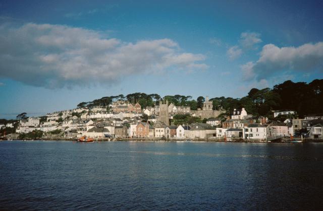
Fowey ( ; kw, Fowydh, meaning 'Beech Trees') is a port town and civil parish at the mouth of the River Fowey in south Cornwall, England, United Kingdom. The town has been in existence since well before the Norman invasion, with the local church first established some time in the 7th century; the estuary of the River Fowey forms a natural harbour which enabled the town to become an important trading centre. Privateers also made use of the sheltered harbourage. The Lostwithiel and Fowey Railway brought China clay here for export. History Early history The Domesday Book survey at the end of the 11th century records manors at Penventinue and Trenant, and a priory was soon established nearby at Tywardreath. the prior granted a charter to people living in Fowey itself. This medieval town ran from a north gate near Boddinick Passage to a south gate at what is now Lostwithiel Street; the town extended a little way up the hillside and was bounded on the other side by the river where ... [...More Info...] [...Related Items...] OR: [Wikipedia] [Google] [Baidu] |
China Clay
Kaolinite ( ) is a clay mineral, with the chemical composition Al2 Si2 O5( OH)4. It is an important industrial mineral. It is a layered silicate mineral, with one tetrahedral sheet of silica () linked through oxygen atoms to one octahedral sheet of alumina () octahedra. Rocks that are rich in kaolinite are known as kaolin () or china clay. Kaolin is occasionally referred to by the antiquated term lithomarge, from the Ancient Greek ''litho-'' and Latin ''marga'', meaning 'stone of marl'. Presently the name lithomarge can refer to a compacted, massive form of kaolin. The name ''kaolin'' is derived from Gaoling (), a Chinese village near Jingdezhen in southeastern China's Jiangxi Province. The name entered English in 1727 from the French version of the word: , following François Xavier d'Entrecolles's reports on the making of Jingdezhen porcelain. Kaolinite has a low shrink–swell capacity and a low cation-exchange capacity (1–15 meq/100 g). It is a soft, earthy, usu ... [...More Info...] [...Related Items...] OR: [Wikipedia] [Google] [Baidu] |
Bodmin
Bodmin () is a town and civil parish in Cornwall, England, United Kingdom. It is situated south-west of Bodmin Moor. The extent of the civil parish corresponds fairly closely to that of the town so is mostly urban in character. It is bordered to the east by Cardinham parish, to the southeast by Lanhydrock parish, to the southwest and west by Lanivet parish, and to the north by Helland parish. Bodmin had a population of 14,736 as of the 2011 Census. It was formerly the county town of Cornwall until the Crown Courts moved to Truro which is also the administrative centre (before 1835 the county town was Launceston). Bodmin was in the administrative North Cornwall District until local government reorganisation in 2009 abolished the District (''see also Cornwall Council''). The town is part of the North Cornwall parliamentary constituency, which is represented by Scott Mann MP. Bodmin Town Council is made up of sixteen councillors who are elected to serve a term of four years. ... [...More Info...] [...Related Items...] OR: [Wikipedia] [Google] [Baidu] |
LSWR
The London and South Western Railway (LSWR, sometimes written L&SWR) was a railway company in England from 1838 to 1922. Originating as the London and Southampton Railway, its network extended to Dorchester and Weymouth, to Salisbury, Exeter and Plymouth, and to Padstow, Ilfracombe and Bude. It developed a network of routes in Hampshire, Surrey and Berkshire, including Portsmouth and Reading. The LSWR became famous for its express passenger trains to Bournemouth and Weymouth, and to Devon and Cornwall. Nearer London it developed a dense suburban network and was pioneering in the introduction of a widespread suburban electrified passenger network. It was the prime mover of the development of Southampton Docks, which became an important ocean terminal as well as a harbour for cross channel services and for Isle of Wight ferries. Although the LSWR's area of influence was not the home of large-scale heavy industry, the transport goods and mineral traffic was a major activity, and ... [...More Info...] [...Related Items...] OR: [Wikipedia] [Google] [Baidu] |
Signal Box
In signal processing, a signal is a function that conveys information about a phenomenon. Any quantity that can vary over space or time can be used as a signal to share messages between observers. The ''IEEE Transactions on Signal Processing'' includes audio, video, speech, image, sonar, and radar as examples of signal. A signal may also be defined as observable change in a quantity over space or time (a time series), even if it does not carry information. In nature, signals can be actions done by an organism to alert other organisms, ranging from the release of plant chemicals to warn nearby plants of a predator, to sounds or motions made by animals to alert other animals of food. Signaling occurs in all organisms even at cellular levels, with cell signaling. Signaling theory, in evolutionary biology, proposes that a substantial driver for evolution is the ability of animals to communicate with each other by developing ways of signaling. In human engineering, signals are typi ... [...More Info...] [...Related Items...] OR: [Wikipedia] [Google] [Baidu] |
Level Crossing
A level crossing is an intersection where a railway line crosses a road, Trail, path, or (in rare situations) airport runway, at the same level, as opposed to the railway line crossing over or under using an Overpass#Railway, overpass or tunnel. The term also applies when a light rail line with separate Right-of-way (railroad), right-of-way or reserved track crosses a road in the same fashion. Other names include railway level crossing, railway crossing (chiefly international), grade crossing or railroad crossing (chiefly American), road through railroad, criss-cross, train crossing, and RXR (abbreviated). There are more than 100,000 level crossings in Europe and more than 200,000 in North America. History The history of level crossings depends on the location, but often early level crossings had a Flagman (rail), flagman in a nearby booth who would, on the approach of a train, wave a red flag or lantern to stop all traffic and clear the tracks. Gated crossings bec ... [...More Info...] [...Related Items...] OR: [Wikipedia] [Google] [Baidu] |
Nanstallon Halt On The Camle Trail
Nanstallon is a village in mid-Cornwall, England, United Kingdom. It is situated approximately two miles (3 km) west of Bodmin. Nanstallon is in the civil parish of Lanivet overlooking the River Camel valley and the Camel Trail long distance path. The present terminus of the Bodmin and Wenford Railway at Boscarne is half-a-mile (0.8 km) from the village. The site of the former Nanstallon Halt station is an access point to the Camel Trail. St Stephen's Church, Nanstallon, is a Church of England chapel-of-ease in the parish of Lanivet. Nanstallon Roman fort A first-century Roman fort was excavated at Nanstallon in 1965 by Aileen Fox and Professor W. L. D. 'Bill' Ravenhill. Until recently (2007) it was the second Roman fort in Cornwall, but following a geophysical survey another Roman fort has been found away near Restormel Castle. Constructed c. AD 55–60, Nanstallon fort is situated in mid-Cornwall near the Fowey-Camel trade and communication route. Nanstallon w ... [...More Info...] [...Related Items...] OR: [Wikipedia] [Google] [Baidu] |
Lever Frame
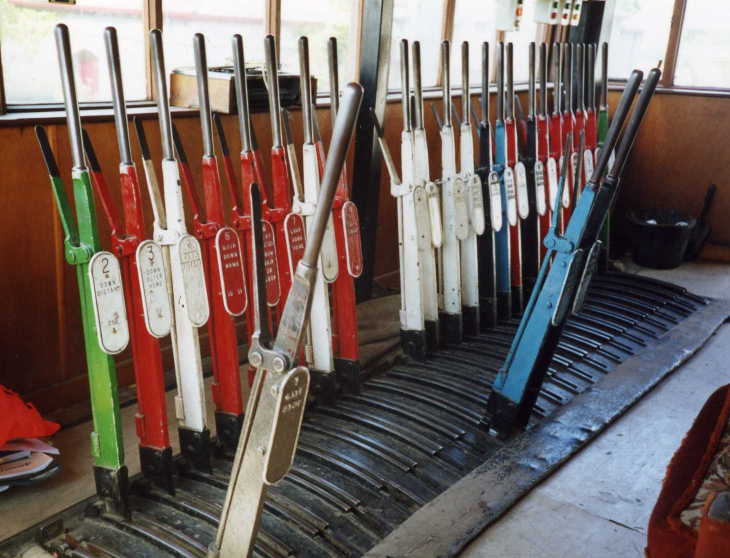
Mechanical railway signalling installations rely on lever frames for their operation to interlock the signals, track locks and points to allow the safe operation of trains in the area the signals control. Usually located in the signal box, the levers are operated either by the signalman or the pointsman. The world's largest lever frame is believed to have been in the Spencer Street No.1 signal box in Melbourne, Australia, which had 191 levers, but was decommissioned in 2008. The largest, currently operational, lever frame is located at Severn Bridge Junction in Shrewsbury, England, and has 180 levers; although most of them have now been taken out of use. Overview The lever frame is located in the signal box, which can be a building at ground level or a tower, separated from or connected to an existing station building. Early lever frames were also built as ''ground frames'' next to the track, without any form of shelter and were usually operated by traincrew and not per ... [...More Info...] [...Related Items...] OR: [Wikipedia] [Google] [Baidu] |


