|
Boromo
Boromo is a town in the Boromo Department of Balé Province in Burkina Faso. It is the capital of both the department and the province, and it has a population of 20,193 (2019). Boromo is located directly between the two major cities of Burkina Faso, Ouagadougou and Bobo-Dioulasso. It is a city with many natural resources, including gold and fish. The major activity in this zone is agriculture. Boromo is a "melting pot" where you will find many ethnic groups, including Mossi, Dioula, Dafing, Bobo and Winiens (or Kos). See also * 2008 Burkina Faso bus crash * Railway stations in Burkina Faso A train station, railway station, railroad station or depot is a railway facility where trains stop to load or unload passengers, freight or both. It generally consists of at least one platform, one track and a station building providing such ... References External links Satellite map at Maplandia.comBBC article about the 2008 road crash Populated places in the Boucle ... [...More Info...] [...Related Items...] OR: [Wikipedia] [Google] [Baidu] |
Balé Province
Balé is one of the 45 provinces of Burkina Faso, located in its Boucle du Mouhoun Region with Boromo as capital. Its area is , and had a population of 297,367 in 2019. The province is known for its Deux Balé Forest, populated by savannah elephant herds. Boromo, the provincial capital, is located on the main road from Ouagadougou to Bobo-Dioulasso. In June 2007, the Canadian mining company, Semafo, open the third gold mine in the country in Mana in the province, with an investment of about $116 million. History On November 15, 2008 a bus accident killed 69 people at Boromo. when a passenger bus transporting workers to Côte d'Ivoire collided with a commercial truck. Both vehicles burst into flames. Geography The province is known for its Deux Balé Forest, populated by savannah elephant herds. Boromo, the provincial capital, is located on the main road from Ouagadougou to Bobo-Dioulasso, and serves as a gateway to the park. Demographics Most people in the province live ... [...More Info...] [...Related Items...] OR: [Wikipedia] [Google] [Baidu] |
Boromo Department
Boromo is a department of Balé Province in southern Burkina Faso. Its capital is the town of Boromo. According to the 2019 census the department has a population of 40,228. Towns and villages Towns and villages and populations in the department are as follows: * (11 694 inhabitants) (capital) * Koho (1 903 inhabitants) * Lapara (2 648 inhabitants) * (2 376 inhabit ... [...More Info...] [...Related Items...] OR: [Wikipedia] [Google] [Baidu] |
2008 Burkina Faso Bus Crash
The 2008 Burkina Faso bus crash was a bus accident on 5:30 am, November 15, 2008, that claimed the lives of more than 60 persons near the town of Boromo in Burkina Faso. A heavily-loaded truck carrying 80 people collided with an overloaded bus carrying 95 people on National Highway 1, about six kilometres from Boromo. The bus, was on its way to Côte d'Ivoire. The run had started from Imasgho, and additional riders were picked up at Koudougou. The truck was traveling from Banfora. Following the collision, the bus caught fire and 54 persons were burned to death inside the bus. Eleven others who escaped died of their injuries. The victims were transported to the hospital at Souro Bobo. The truck driver reportedly survived the collision. Police investigators speculated that the truck driver had fallen asleep at the wheel, based on a lack of skid marks. The Burkina Faso Minister of Transport, Gilbert Noël Ouédraogo, commented that "We lament 96 victims, of whom 66 have died" ... [...More Info...] [...Related Items...] OR: [Wikipedia] [Google] [Baidu] |
Departments Of Burkina Faso
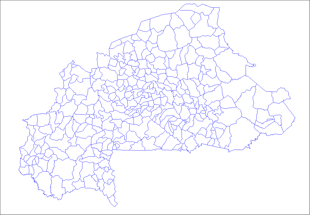
The provinces of Burkina Faso are divided into 351 departments (as of 2014 and since local elections of 2012), whose urbanized areas (cities, towns and villages) are grouped into the same commune (municipality) with the same name as the department. The department also covers rural areas (including national natural parks) that are not governed locally by the elected municipal council of the commune (presided by its mayor, with representants elected for each village or urban sector), but by the state represented at departmental level by a prefect (supervized by the haut-commissaire of its province, themself assisted by a general secretary and acting under the hierarchic authority the governor of its region, all of them being nominated by the national government). Status of communes The 351 communes (municipalities) created for each one of these departments have three kinds of status : * 49 urban communes are grouping their main city/town (subdivided into urban sectors) and all ... [...More Info...] [...Related Items...] OR: [Wikipedia] [Google] [Baidu] |
Boucle Du Mouhoun Region
Boucle du Mouhoun is one of Burkina Faso's 13 administrative regions. It was created on 2 July 2001 and had a population of 1,898,133 in 2019. It is the 4th most populous region in Burkina Faso, and contains 9.26% of all Burkinabé. The region's capital is Dédougou. Six provinces make up the Boucle du Mouhoun region— Balé, Banwa, Kossi, Mouhoun, Nayala, and Sourou. , the population of the region was 1,898,133 with 50.2% females. The population in the region was 9.26% of the total population of the country. The coverage of cereal need compared to the total production of the region was 187%. As of 2007, the literacy rate in the region was 23.2%, compared to a national average of 28.3%. Geography Most of Burkino Faso is a wide plateau formed by riverine systems and is called falaise de Banfora. There are three major rivers, the Red Volta, Black Volta and White Volta, which cuts through different valleys. The climate is generally hot, with unreliable rains across differ ... [...More Info...] [...Related Items...] OR: [Wikipedia] [Google] [Baidu] |
Provinces Of Burkina Faso
The regions of Burkina Faso are divided into 45 administrative provinces. These 45 provinces are currently sub-divided into 351 departments or communes. List of provinces by region Here is a list of the provinces, with their capitals in parentheses: Central Burkina Faso Centre Region * Kadiogo ( Ouagadougou) (#14 in map) Centre-Nord Region * Bam ( Kongoussi) (#2 in map) * Namentenga ( Boulsa) (#26 in map) * Sanmatenga ( Kaya) (#34 in map) Centre-Sud Region * Bazèga ( Kombissiri) (#4 in map) * Nahouri (Pô) (#25 in map) * Zoundwéogo (Manga) (#45 in map) Plateau-Central Region * Ganzourgou ( Zorgho) (#9 in map) * Kourwéogo ( Boussé) (#21 in map) * Oubritenga ( Ziniaré) (#29 in map) Eastern Burkina Faso Centre-Est Region * Boulgou ( Tenkodogo) (#6 in map) * Koulpélogo ( Ouargaye) (#19 in map) * Kouritenga ( Koupéla) (#20 in map) Est Region * Gnagna ( Bogandé) (#10 in map) * Gourma ( Fada N'gourma) (#11 in map) * Komondjari ( Gayéri) (#16 in map) ... [...More Info...] [...Related Items...] OR: [Wikipedia] [Google] [Baidu] |
French West Africa
French West Africa (french: Afrique-Occidentale française, ) was a federation of eight French colonial territories in West Africa: Mauritania, Senegal, French Sudan (now Mali), French Guinea (now Guinea), Ivory Coast, Upper Volta (now Burkina Faso), Dahomey (now Benin) and Niger. The federation existed from 1895 until 1958. Its capital was Saint-Louis, Senegal until 1902, and then Dakar until the federation's collapse in 1960. History Until after World War II, almost none of the Africans living in the colonies of France were citizens of France. Rather, they were "French subjects", lacking rights before the law, property ownership rights, rights to travel, dissent, or vote. The exception was the Four Communes of Senegal: those areas had been towns of the tiny Senegal Colony in 1848 when, at the abolition of slavery by the French Second Republic, all residents of France were granted equal political rights. Anyone able to prove they were born in these towns was leg ... [...More Info...] [...Related Items...] OR: [Wikipedia] [Google] [Baidu] |
Melting Pot
The melting pot is a monocultural metaphor for a heterogeneous society becoming more homogeneous, the different elements "melting together" with a common culture; an alternative being a homogeneous society becoming more heterogeneous through the influx of foreign elements with different cultural backgrounds, possessing the potential to create disharmony within the previous culture. It can also create a harmonious hybridized society known as cultural amalgamation. Historically, it is often used to describe the cultural integration of immigrants to the United States. A related concept has been defined as "cultural additivity." The melting-together metaphor was in use by the 1780s.p. 50 See "..whether assimilation ought to be seen as an egalitarian or hegemonic process, ...two viewpoints are represented by the melting-pot and Anglo-conformity models, respectively" The exact term "melting pot" came into general usage in the United States after it was used as a metaphor descr ... [...More Info...] [...Related Items...] OR: [Wikipedia] [Google] [Baidu] |
Railway Stations In Burkina Faso
A train station, railway station, railroad station or depot is a railway facility where trains stop to load or unload passengers, freight or both. It generally consists of at least one platform, one track and a station building providing such ancillary services as ticket sales, waiting rooms and baggage/freight service. If a station is on a single-track line, it often has a passing loop to facilitate traffic movements. Places at which passengers only occasionally board or leave a train, sometimes consisting of a short platform and a waiting shed but sometimes indicated by no more than a sign, are variously referred to as "stops", "flag stops", " halts", or "provisional stopping places". The stations themselves may be at ground level, underground or elevated. Connections may be available to intersecting rail lines or other transport modes such as buses, trams or other rapid transit systems. Terminology In British English, traditional terminology favours ''railway station' ... [...More Info...] [...Related Items...] OR: [Wikipedia] [Google] [Baidu] |
Bobo People
The Bobo are a Mande ethnic group living primarily in Burkina Faso, with some living north in Mali. Bobo is also a shortened name of the second-largest city in Burkina Faso, Bobo-Dioulasso. Background In much of the literature on African art, the group that lives in the area of Bobo-Dioulasso is called Bobo-Fing, literally "black Bobo". These people call themselves Bobo and speak the Bobo language, a Mande language. The Bambara people also call another ethnic group "Bobo", the Bobo-Oule/Wule, more precisely called the Bwa. While the Bwa (Bobo-Oule) are a Gur people, speaking Gur languages (the Bwa languages), the true Bobo (Bobo Madare, Bobo Fing) are a Mande people. Demographics The Bobo number about 110,000 people, with the great majority in Burkina Faso. The major Bobo community in the south is Bobo-Dioulasso, the second-largest city of Burkina Faso and the old French colonial capital. Further north are large towns, including and Kouka, with Boura in the extreme north ... [...More Info...] [...Related Items...] OR: [Wikipedia] [Google] [Baidu] |
Soninke People
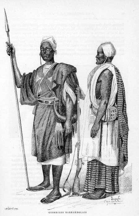
The Soninke people are a West African Mande-speaking ethnic group found in Mali, Fouta Djallon, southern Mauritania, eastern Senegal, Guinea and The Gambia. They speak the Soninke language, also called the Serakhulle or Azer language, which is one of the Mande languages. Soninke people were the founders of the ancient empire of Ghana or Wagadou c. 300–1240 CE, Subgroups of Soninke include the Maraka and Wangara. When the Ghana empire was destroyed, the resulting diaspora brought Soninkes to Mali, Mauritania, Senegal, Gambia, Burkina Faso, Côte d'Ivoire, Guinée-Conakry, modern-day Republic of Ghana, and Guinea-Bissau where some of this trading diaspora was called Wangara. Predominantly Muslims, the Soninke were one of the early ethnic groups from West Africa to convert to Islam in about the 10th century. The contemporary population of Soninke people is estimated to be over 2 million. The cultural practices of Soninke people are similar to the Mandé peoples, and thos ... [...More Info...] [...Related Items...] OR: [Wikipedia] [Google] [Baidu] |
Dyula People
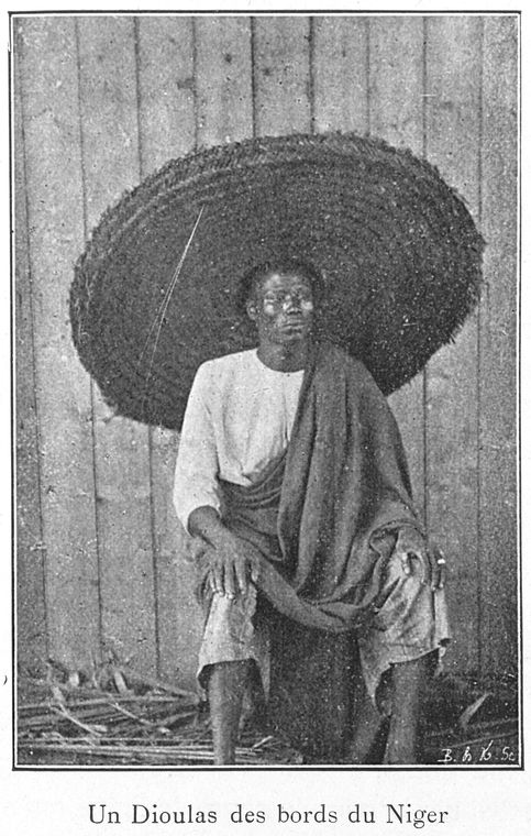
The Dyula (Dioula or Juula) are a Mande ethnic group inhabiting several West African countries, including Mali, Cote d'Ivoire, Ghana, and Burkina Faso. Characterized as a highly successful merchant caste, ''Dyula'' migrants began establishing trading communities across the region in the fourteenth century. Since business was often conducted under non-Muslim rulers, the ''Dyula'' developed a set of theological principles for Muslim minorities in non-Muslim societies. Their unique contribution of long-distance commerce, Islamic scholarship and religious tolerance were significant factors in the peaceful expansion of Islam in West Africa. Historical background The Mandé embraced Islam during the thirteenth century following introduction to the faith through contact with the North African traders. By the 14th century, the Malian empire (c.1230-1600) had reached its apogee, acquiring a considerable reputation for the Islamic rulings of its court and the pilgrimages of several ... [...More Info...] [...Related Items...] OR: [Wikipedia] [Google] [Baidu] |


.jpg)


