|
Boosbeck Railway Station
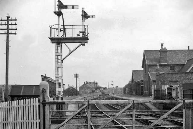
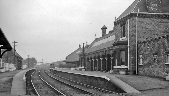
Boosbeck railway station was a railway station serving the village of Boosbeck in the ceremonial county of the North Riding of Yorkshire (now Redcar and Cleveland) in England. The station was opened in 1878 and closed to passengers in 1960 with freight services being stopped in 1964. The station was opened by the Cleveland Railway (England), Cleveland Railway, which was absorbed by the North Eastern Railway (United Kingdom), North Eastern Railway (NER) in 1865. At the grouping, services were provided by the London and North Eastern Railway (LNER). History The Cleveland Railway opened up a line eastwards from Guisborough in 1862 which reached Boosbeck in that year and made it to in 1865 and in 1866. This provided a connection with the Whitby, Redcar and Middlesbrough Union Railway (W&RMU) in 1875 when they built their line through . The line through Boosbeck, which was opposed vehemently by the Stockton & Darlington Railway, was originally intended to be a way of moving iron or ... [...More Info...] [...Related Items...] OR: [Wikipedia] [Google] [Baidu] |
Boosbeck
Boosbeck is a village in the borough of Redcar and Cleveland and the ceremonial county of North Yorkshire, England. The name is Viking in origin and means "the stream near a cow shed". Between 1878 and 1960, the village had a Boosbeck railway station, station on the North Eastern Railway line between and . References External links Villages in North Yorkshire Places in the Tees Valley Redcar and Cleveland {{Redcar-geo-stub ... [...More Info...] [...Related Items...] OR: [Wikipedia] [Google] [Baidu] |
William Peachey
William Peachey (1826 – 2 March 1912) was a British architect known for his work for the North Eastern Railway. History He was born in 1826, baptised at St Mary's Church, Cheltenham on 13 September. His parents were William Peachey, carpenter, and Emma. On 8 September 1849, he married Harriet Moss in Salem Baptist Chapel in Cheltenham and in 1854 the couple moved to Darlington. He found employment with the Stockton and Darlington Railway. This was merged with the North Eastern Railway in 1863. He was appointed ARIBA on 16 December 1867, and FRIBA on 2 May 1870. He was the Architect to the Darlington section of the North Eastern Railway until 1877. He died on 2 March 1912. Works Saltburn Water Tower, owpleatham St on Lune Street Corner 1860 demolished 1905- Pease Bricks - bricks used to face a terrace of 8 houses onsite and adjacent land - called Water Tower Terrace which became Upleatham St. *Saltburn railway station 1861-62 *Zetland Mews, Saltburn 1861 *Zetland Hot ... [...More Info...] [...Related Items...] OR: [Wikipedia] [Google] [Baidu] |
Railway Stations In Great Britain Opened In 1878
Rail transport (also known as train transport) is a means of transport that transfers passengers and goods on wheeled vehicles running on rails, which are incorporated in tracks. In contrast to road transport, where the vehicles run on a prepared flat surface, rail vehicles (rolling stock) are directionally guided by the tracks on which they run. Tracks usually consist of steel rails, installed on sleepers (ties) set in ballast, on which the rolling stock, usually fitted with metal wheels, moves. Other variations are also possible, such as "slab track", in which the rails are fastened to a concrete foundation resting on a prepared subsurface. Rolling stock in a rail transport system generally encounters lower frictional resistance than rubber-tyred road vehicles, so passenger and freight cars (carriages and wagons) can be coupled into longer trains. The operation is carried out by a railway company, providing transport between train stations or freight customer faciliti ... [...More Info...] [...Related Items...] OR: [Wikipedia] [Google] [Baidu] |
Former North Eastern Railway (UK) Stations
A former is an object, such as a template, gauge or cutting die, which is used to form something such as a boat's hull. Typically, a former gives shape to a structure that may have complex curvature. A former may become an integral part of the finished structure, as in an aircraft fuselage, or it may be removable, being using in the construction process and then discarded or re-used. Aircraft formers Formers are used in the construction of aircraft fuselage, of which a typical fuselage has a series from the nose to the empennage, typically perpendicular to the longitudinal axis of the aircraft. The primary purpose of formers is to establish the shape of the fuselage and reduce the column length of stringers to prevent instability. Formers are typically attached to longerons, which support the skin of the aircraft. The "former-and-longeron" technique (also called stations and stringers) was adopted from boat construction, and was typical of light aircraft built until the ad ... [...More Info...] [...Related Items...] OR: [Wikipedia] [Google] [Baidu] |
Brotton Railway Station
Brotton railway station was opened by the Cleveland Railway on 1 November 1875, and served the village of Brotton in North Yorkshire, England. It was built to the designs of the architect William Peachey William Peachey (1826 – 2 March 1912) was a British architect known for his work for the North Eastern Railway. History He was born in 1826, baptised at St Mary's Church, Cheltenham on 13 September. His parents were William Peachey, carp .... It closed on 2 May 1960. References * External links Brotton station on navigable 1955 O. S. mapBrotton station on Subterranea Britannica Disused railway stations in Redcar and Cleveland Former North Eastern Railway (UK) stations Railway stations in Great Britain opened in 1875 Railway stations in Great Britain closed in 1960 William Peachey railway stations {{NorthEastEngland-railstation-stub ... [...More Info...] [...Related Items...] OR: [Wikipedia] [Google] [Baidu] |
North Skelton Railway Station
North Skelton railway station was opened to freight on 1 August 1875 by the North Eastern Railway and to passengers on 1 July 1902. It served the village of Skelton-in-Cleveland in North Yorkshire, England England is a country that is part of the United Kingdom. It shares land borders with Wales to its west and Scotland to its north. The Irish Sea lies northwest and the Celtic Sea to the southwest. It is separated from continental Europe b .... It closed to passengers on 15 January 1951, but opened again briefly on 18 June for the summer season before finally closing to passengers on 10 September of the same year. Freight traffic remained until 1 February 1952. In October 1956 the station was reopened to freight as a private siding which was finally closed on 21 January 1964. The line remains open as a single-track goods line from Boulby and Skinningrove to Teesside, but most of the station buildings and the platforms have been removed. The stationmaster's house rem ... [...More Info...] [...Related Items...] OR: [Wikipedia] [Google] [Baidu] |
Guisborough Railway Station
Guisborough railway station was the terminus of the Middlesbrough and Guisborough Railway. It served the town of Guisborough in North Yorkshire, England. The station was opened to goods in November 1853, and to passenger traffic on 25 February 1854. The station was closed to passengers, along with the entire Nunthorpe–Guisborough branch, on 2 March 1964, with freight being lost in August 1964. History The station had a single platform covered by a glass roof. Its entrance was on Bow Street, between its junctions with Fountain Street and Whitby Road. It was opened to goods traffic on 11 November 1853, and passengers on 25 February 1854. Because the station was at the end of a branch, trains had to reverse out to Hutton Junction (Guisborough Junction from 1932) in order to continue eastwards along the NER line (the former eastern part of the Cleveland Railway). Services could either go to Loftus, or to Saltburn (from 1878 to 1917 on the Priestcroft Curve or via Brotton ... [...More Info...] [...Related Items...] OR: [Wikipedia] [Google] [Baidu] |
Stockton & Darlington Railway
The Stockton and Darlington Railway (S&DR) was a railway company that operated in north-east England from 1825 to 1863. The world's first public railway to use steam locomotives, its first line connected coal mining, collieries near Shildon with Darlington and Stockton-on-Tees in County Durham, and was officially opened on 27 September 1825. The movement of coal to ships rapidly became a lucrative business, and the line was soon extended to a new port at Middlesbrough. While coal waggons were hauled by steam locomotives from the start, passengers were carried in coaches drawn by horses until carriages hauled by steam locomotives were introduced in 1833. The S&DR was involved in the building of the East Coast Main Line between York and Darlington, but its main expansion was at Middlesbrough Docks and west into Weardale and east to Redcar. It suffered severe financial difficulties at the end of the 1840s and was nearly taken over by the York, Newcastle and Berwick Railway, be ... [...More Info...] [...Related Items...] OR: [Wikipedia] [Google] [Baidu] |
Redcar And Cleveland
Redcar and Cleveland is a borough with unitary authority status in North Yorkshire, England. Its main settlements are Redcar, South Bank, Eston, Brotton, Guisborough, the Greater Eston part of Middlesbrough, Loftus, Saltburn and Skelton. The borough had a resident population of 135,200 in 2011. It is a part of the Tees Valley mayoralty: the current mayor is Ben Houchen. The borough is represented in Parliament by Jacob Young (Conservative Party) for the Redcar constituency, and by Simon Clarke (Conservative Party) for the Middlesbrough South and East Cleveland constituency. History The district was created in 1974 as the borough of Langbaurgh, one of four districts of the new non-metropolitan county of Cleveland. It was formed from the Coatham, Kirkleatham, Ormesby, Redcar and South Bank wards of the County Borough of Teesside, along with Guisborough, Loftus, Saltburn and Marske-by-the-Sea, Eston Grange and Skelton and Brotton urban districts, from the North Ridin ... [...More Info...] [...Related Items...] OR: [Wikipedia] [Google] [Baidu] |
Whitby, Redcar And Middlesbrough Union Railway
The Whitby, Redcar and Middlesbrough Union Railway (WRMU), the Whitby–Loftus Line, was a railway line in North Yorkshire, England, built between 1871 and 1886, running from Loftus on the Yorkshire coast to the Esk at Whitby, and connecting Middlesbrough to Whitby along the coast. For much of its journey the line hugged the cliffs, and had a troubled build due to the proximity to the sea and poor quality of the construction on many of its original bridges and viaducts. The line was closed to passengers in May 1958, but the northern section to Boulby Potash Mine re-opened in the 1970s. History Background Whitby had been connected to the national rail system by the Whitby and Pickering Railway since the 1830s. Loftus was connected to the rail system by the 1870s via an extension of the Cleveland Railway: both the Cleveland Railway and the Middlesbrough and Guisborough Railway were constructed in the 1860s connecting Middlesbrough to Guisborough. Loftus to Whitby The ext ... [...More Info...] [...Related Items...] OR: [Wikipedia] [Google] [Baidu] |
Guisborough
Guisborough ( ) is a market town and civil parish in the borough of Redcar and Cleveland, North Yorkshire, England. It lies north of the North York Moors National Park. Roseberry Topping, midway between the town and Great Ayton, is a landmark in the national park. At the 2011 census, the civil parish with outlying Upleatham, Dunsdale and Newton under Roseberry had a population of 17,777, of which 16,979 were in the town's built-up area. It was governed by an urban district and rural district in the North Riding of Yorkshire. Etymology Assessing the origin of the name ''Guisborough'', Albert Hugh Smith commented that it was a "difficult". From its first attestation in the Domesday Book into the 16th century, the second part sometimes derives from the originally Old English word ''burh'' ('town, fortification') and sometimes from the Old English word -''burn'' ('stream'). It seems that the settlement was simply known by both names, the -''burh''/-''borough'' forms predominate in ... [...More Info...] [...Related Items...] OR: [Wikipedia] [Google] [Baidu] |


.jpg)


