|
Boobera Lagoon
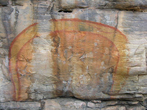
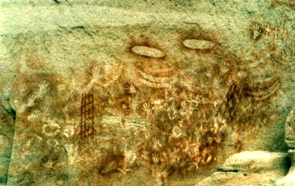
Boobera Lagoon is a permanent water hole in Moree Plains Shire, New South Wales, Australia, approximately 20 kilometres west of Goondiwindi in Queensland. It is located at . It lies several kilometres south of the Macintyre River, which forms the border between Queensland (to the north) and New South Wales, and is just north of the Mungindi - Goondiwindi road. Its outflow, which connects to the river, is named Boobera Watercourse. The lagoon is 7 kilometres in length and supports a wide variety of aquatic and bird life. The Indigenous people of the area believe the lagoon is the resting place of Garriya, the Rainbow Serpent, an important figure in dreamtime legend. The lagoon was particularly significant to the Bigambul and Kamilaroi The Gamilaraay, also known as Gomeroi, Kamilaroi, Kamillaroi and other variations, are an Aboriginal Australian people whose lands extend from New South Wales to southern Queensland. They form one of the four largest Indigenous nations in Aust ... [...More Info...] [...Related Items...] OR: [Wikipedia] [Google] [Baidu] |
Moree Plains Shire
Moree Plains Shire is a local government area in the North West Slopes region of New South Wales, Australia. The northern boundary of the Shire is located adjacent to the border between New South Wales and Queensland. The Shire is located adjacent to the Newell and Gwydir Highways and the North West railway line. The Mayor of Moree Plains Shire Council is Cr. Katrina Humphries, an independent politician. Towns, villages and localities The main town and seat of Council is Moree. Other towns and villages in the Shire include Ashley, Boomi, Boggabilla, Garah, Gurley, Millie, Mungindi, Pallamallawa and Weemelah. Heritage listings Moree has a number of heritage-listed sites, including: * 15 Gwydir Street: ''Alloway'' Demographics At the , there were people in the Moree Plains local government area, of these 50.8 per cent were male and 49.2 per cent were female. Aboriginal and Torres Strait Islander people made up 20.8 per cent of the population which is approximately n ... [...More Info...] [...Related Items...] OR: [Wikipedia] [Google] [Baidu] |
New South Wales
) , nickname = , image_map = New South Wales in Australia.svg , map_caption = Location of New South Wales in AustraliaCoordinates: , subdivision_type = Country , subdivision_name = Australia , established_title = Before federation , established_date = Colony of New South Wales , established_title2 = Establishment , established_date2 = 26 January 1788 , established_title3 = Responsible government , established_date3 = 6 June 1856 , established_title4 = Federation of Australia, Federation , established_date4 = 1 January 1901 , named_for = Wales , demonym = , capital = Sydney , largest_city = capital , coordinates = , admin_center = Local government areas of New South Wales, 128 local government areas , admin_center_type = Administration , leader_title1 = Monarchy of Australia, Monarch , leader_name1 = Charles III , leader_title2 = Governor of New South Wales, Governor , leader_name2 = Margaret Beazley , leader_title3 = Premier of New South Wales, Premie ... [...More Info...] [...Related Items...] OR: [Wikipedia] [Google] [Baidu] |
Goondiwindi
Goondiwindi () is a rural town and locality in the Goondiwindi Region, Queensland, Australia. It is on the border of Queensland and New South Wales. In the , Goondiwindi had a population of 6,355 people. Geography Goondiwindi is on the MacIntyre River in Queensland near the New South Wales border, south west of the Queensland state capital, Brisbane. The town of Boggabilla is to the south-east on the New South Wales side of the border. Most of the area surrounding the town is farmland. History Bigambul (also known as Bigambal, Bigumbil, Pikambul, Pikumbul) is an Australian Aboriginal language spoken by the Bigambul people. The Bigambul language region includes the landscape within the local government boundaries of the Goondiwindi Regional Council, including the towns of Goondiwindi, Yelarbon and Texas extending north towards Moonie and Millmerran. In the late 1840s, squatters Richard Purvis Marshall and his brother Sampson Yeoval Marshall established the Gundi Windi pas ... [...More Info...] [...Related Items...] OR: [Wikipedia] [Google] [Baidu] |
Queensland
) , nickname = Sunshine State , image_map = Queensland in Australia.svg , map_caption = Location of Queensland in Australia , subdivision_type = Country , subdivision_name = Australia , established_title = Before federation , established_date = Colony of Queensland , established_title2 = Separation from New South Wales , established_date2 = 6 June 1859 , established_title3 = Federation , established_date3 = 1 January 1901 , named_for = Queen Victoria , demonym = , capital = Brisbane , largest_city = capital , coordinates = , admin_center_type = Administration , admin_center = 77 local government areas , leader_title1 = Monarch , leader_name1 = Charles III , leader_title2 = Governor , leader_name2 = Jeannette Young , leader_title3 = Premier , leader_name3 = Annastacia Palaszczuk ( ALP) , legislature = Parliament of Queensland , judiciary = Supreme Court of Queensland , national_representation = Parliament of Australia , national_representation_t ... [...More Info...] [...Related Items...] OR: [Wikipedia] [Google] [Baidu] |
Mungindi
Mungindi is a town and Suburbs and localities (Australia), locality on the border of New South Wales (NSW) and Queensland, Australia. The town is within Moree Plains Shire in New South Wales. Within Queensland, the locality is split between the Shire of Balonne (the western part) and the Goondiwindi Region (eastern part) with the town in the Shire of Balonne. It possesses a New South Wales postcode. Mungindi sits on the Carnarvon Highway and straddles the Barwon River (New South Wales), Barwon River which is the Queensland borders, border between New South Wales and Queensland. At the , Mungindi had a population of 601 on the New South Wales side, while the population on the Queensland side was 146. Geography ''Mungindi'' means ''water hole in the river'' in Gamilaraay language, Kamilaroi. Located uniquely on both sides of the New South Wales and Queensland border, Mungindi is the only border town in the Southern Hemisphere with the same name on both sides of the border. The st ... [...More Info...] [...Related Items...] OR: [Wikipedia] [Google] [Baidu] |
Lagoon
A lagoon is a shallow body of water separated from a larger body of water by a narrow landform, such as reefs, barrier islands, barrier peninsulas, or isthmuses. Lagoons are commonly divided into ''coastal lagoons'' (or ''barrier lagoons'') and '' atoll lagoons''. They have also been identified as occurring on mixed-sand and gravel coastlines. There is an overlap between bodies of water classified as coastal lagoons and bodies of water classified as estuaries. Lagoons are common coastal features around many parts of the world. Definition and terminology Lagoons are shallow, often elongated bodies of water separated from a larger body of water by a shallow or exposed shoal, coral reef, or similar feature. Some authorities include fresh water bodies in the definition of "lagoon", while others explicitly restrict "lagoon" to bodies of water with some degree of salinity. The distinction between "lagoon" and "estuary" also varies between authorities. Richard A. Davis Jr. rest ... [...More Info...] [...Related Items...] OR: [Wikipedia] [Google] [Baidu] |
Rainbow Serpent
The Rainbow Serpent or Rainbow Snake is a common deity often seen as the creator God, known by numerous names in different Australian Aboriginal languages by the many different Aboriginal peoples. It is a common motif in the art and religion of many Aboriginal Australian peoples. Much like the archetypal mother goddess, the Rainbow Serpent creates land and diversity for the Aboriginal people, but when disturbed can bring great chaos. There are many names and stories associated with the serpent, all of which communicate the significance and power of this being within Aboriginal mythology, which includes the worldview commonly referred to as The Dreaming. The serpent is viewed as a giver of life through its association with water, but can be a destructive force if angry. The Rainbow Serpent is one of the most common and well-known Aboriginal stories and is of great importance to Aboriginal society. Not all of the myths in this family describe the ancestral being as a snake ... [...More Info...] [...Related Items...] OR: [Wikipedia] [Google] [Baidu] |
Dreamtime
The Dreaming, also referred to as Dreamtime, is a term devised by early anthropologists to refer to a religio-cultural worldview attributed to Australian Aboriginal beliefs. It was originally used by Francis Gillen, quickly adopted by his colleague Baldwin Spencer and thereafter popularised by A. P. Elkin, who, however, later revised his views. The Dreaming is used to represent Aboriginal concepts of ''Everywhen'', during which the land was inhabited by ancestral figures, often of heroic proportions or with supernatural abilities. These figures were often distinct from gods, as they did not control the material world and were not worshipped but only revered. The concept of the Dreamtime has subsequently become widely adopted beyond its original Australian context and is now part of global popular culture. The term is based on a rendition of the Arandic word ''alcheringa'', used by the Aranda (Arunta, Arrernte) people of Central Australia, although it has been argued that ... [...More Info...] [...Related Items...] OR: [Wikipedia] [Google] [Baidu] |
Bigambul
The Bigambul people are an Aboriginal Australia The prehistory of Australia is the period between the first human habitation of the Australian continent and the colonisation of Australia in 1788, which marks the start of consistent written documentation of Australia. This period has been vari ...n people of the Northern Tablelands and Border Rivers regions of New South Wales and Queensland. Name In the traditional language, the name of this group is derived from the Bigambul word ''biga'' or ''pika'' which translates in English to ''yes''. The Bigambul are bounded to the south–east by the Ngarabal, the Kamilaroi to the south, the Kooma to the west, the Mandandanji and Gubbi Gubbi people, Kabi to the north, and the Baruŋgam to the north–east. Country Norman Tindale ascribed to the Bigambul a traditional territory spreading over east of Nindigully, on the Weir River (Queensland), Weir and Moonie River, Moonie rivers, north to Tara, Queensland, Tara; at Talwood, Queensland ... [...More Info...] [...Related Items...] OR: [Wikipedia] [Google] [Baidu] |
Kamilaroi
The Gamilaraay, also known as Gomeroi, Kamilaroi, Kamillaroi and other variations, are an Aboriginal Australian people whose lands extend from New South Wales to southern Queensland. They form one of the four largest Indigenous nations in Australia. Name The ethnonym Gamilaraay is formed from , meaning "no", and the suffix , bearing the sense of "having". It is a common practice among Australian tribes to have themselves identified according to their respective words for "no". The Kamilaroi Highway, the Sydney Ferries Limited vehicular ferry "Kamilaroi" (1901–1933), the stage name of Australian rapper and singer the Kid Laroi and a cultivar of Durum wheat have all been named after the Kamilaroi people. Language Gamilaraay language is classified as one of the Pama–Nyungan languages. The language is no longer spoken, as the last fluent speakers died out in the 1950s. However, some parts have been reconstructed by late field work, which includes substantial recordings of ... [...More Info...] [...Related Items...] OR: [Wikipedia] [Google] [Baidu] |


