|
Boleside
Boleside is a village in the Scottish Borders area of Scotland, on the B7060, south of Galashiels. It is very close to the place where the Ettrick Water joins the River Tweed. Other places nearby include Abbotsford, Clovenfords, Lindean, Melrose, Midlem, Selkirk, Yair and Yarrowford. See also *List of places in the Scottish Borders *List of places in Scotland This list of places in Scotland is a complete collection of lists of places in Scotland. *List of burghs in Scotland *List of census localities in Scotland *List of islands of Scotland **List of Shetland islands **List of Orkney islands **List o ... External links RCAHMS: Boleside, Galashiels [...More Info...] [...Related Items...] OR: [Wikipedia] [Google] [Baidu] |
Lindean
Lindean is a village north of Selkirk and the Ettrick Water, in the Scottish Borders area of Scotland. In 1590 the parishioners of Lindean had permission to rebuild their church on the north side of the Tweed, at the west end of Boleside, nearer to their houses, and a coble boat was to be provided to ferry the dead over the Tweed if required.David Masson, ''Register of the Privy Council of Scotland: 1585-1592'', vol. 4 (Edinburgh, 1881), p. 622. See also *List of places in the Scottish Borders *List of places in Scotland This list of places in Scotland is a complete collection of lists of places in Scotland. * List of burghs in Scotland * List of census localities in Scotland *List of islands of Scotland ** List of Shetland islands ** List of Orkney islands ** L ... External links CANMORE/RCAHMS record of Lindean [...More Info...] [...Related Items...] OR: [Wikipedia] [Google] [Baidu] |
List Of Places In The Scottish Borders
''Map of places in the Scottish Borders compiled from this list'':See the list of places in Scotland for places in other counties. This list of places in the Scottish Borders includes towns, villages, hamlets, castles, golf courses, historic houses, hillforts, lighthouses, nature reserves, reservoirs, rivers, and other places of interest in the Scottish Borders council area of Scotland. A * Abbey Mill * Abbey St. Bathans *Abbotsford Ferry railway station, Abbotsford House *Abbotrule *Addinston * Aikwood Tower *Ale Water *Alemoor Loch *Allanbank * Allanshaugh * Allanshaws * Allanton *Ancrum, Ancrum Old Parish Church *Anglo-Scottish Border * Appletreehall *Ashiestiel *Ashkirk * Auchencrow * Ayton, Ayton Castle, Ayton Parish Church, Ayton railway station B *Baddinsgill, Baddinsgill Reservoir *Bairnkine * Bassendean * Battle of Ancrum Moor * Battle of Humbleton Hill * Battle of Nesbit Moor (1355) *Battle of Nesbit Moor (1402) *Battle of Philiphaugh ... [...More Info...] [...Related Items...] OR: [Wikipedia] [Google] [Baidu] |
Melrose, Scotland
Melrose ( gd, Maolros, "bald moor") is a small town and civil parish in the Scottish Borders, historically in Roxburghshire. It lies within the Eildon committee area of Scottish Borders Council. History The original Melrose was ''Mailros'', meaning "the bare peninsula" in Old Welsh or Brythonic. This referred to a neck of land by the River Tweed several miles east of the present town, where in the 6th century a monastery was founded associated with St Cuthbert. It was recorded by Bede, and also in the Anglo-Saxon Chronicle with the name ''Magilros''. This monastery and settlement, later known as "Old Melrose", were long abandoned by the 12th century. King David I of Scotland took the throne in 1124, and sought to create a new Cistercian monastery on that site; however the monks preferred a site further west called "Fordel". So the monastery now known as Melrose Abbey was founded there in 1136, and the town of Melrose grew up on its present site around it. In the late Middle Ag ... [...More Info...] [...Related Items...] OR: [Wikipedia] [Google] [Baidu] |
Houses At Boleside
A house is a single-unit residential building. It may range in complexity from a rudimentary hut to a complex structure of wood, masonry, concrete or other material, outfitted with plumbing, electrical, and heating, ventilation, and air conditioning systems.Schoenauer, Norbert (2000). ''6,000 Years of Housing'' (rev. ed.) (New York: W.W. Norton & Company). Houses use a range of different roofing systems to keep precipitation such as rain from getting into the dwelling space. Houses may have doors or locks to secure the dwelling space and protect its inhabitants and contents from burglars or other trespassers. Most conventional modern houses in Western cultures will contain one or more bedrooms and bathrooms, a kitchen or cooking area, and a living room. A house may have a separate dining room, or the eating area may be integrated into another room. Some large houses in North America have a recreation room. In traditional agriculture-oriented societies, domestic animals such as c ... [...More Info...] [...Related Items...] OR: [Wikipedia] [Google] [Baidu] |
Yarrowford
Yarrowford is a village on the A708, in the Scottish Borders area of Scotland, 4 miles north-west of Selkirk, in the Ettrick Forest. The Yarrow Water flows through the village and joins the Ettrick Water near Philiphaugh. Places nearby include Bowhill, Ettrickbridge, Newark Castle, the Yair Forest, Yarrow, Scottish Borders and Yarrow Feus. See also *List of places in the Scottish Borders *List of places in Scotland This list of places in Scotland is a complete collection of lists of places in Scotland. * List of burghs in Scotland * List of census localities in Scotland *List of islands of Scotland ** List of Shetland islands ** List of Orkney islands ** L ... External links RCAHMS record of Yarrowford, Yarrow Water, Bridge [...More Info...] [...Related Items...] OR: [Wikipedia] [Google] [Baidu] |
Yair, Scottish Borders
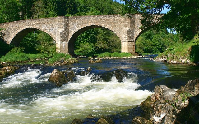
Yair, also known as The Yair, is an estate in the Scottish Borders. It stands by the River Tweed in the former county of Selkirkshire, north-west of Selkirk, and south of Edinburgh. The name comes from the old Scots word for a fish trap. The estate is centred on Yair House, which is protected as a category A listed building. The nearby Yair Bridge is also category A listed. History In 1156 King Malcolm allowed the monks of Kelso to build a dam on the River Tweed, creating a pool for fishing. Yair House was built by Alexander Pringle of Whytbank (1747–1827) in 1788. It is a Georgian house of three storeys, with a large bay to the front. Pringle made his fortune in India, and re-purchased the family estates on his return. These estates, which included Whytbank Tower on the north side of the river, had been Pringle property since the 16th century, but were sold in the early 18th century to pay debts. The designer of the new house was William Elliot, a Kelso-based architect ... [...More Info...] [...Related Items...] OR: [Wikipedia] [Google] [Baidu] |
Selkirk, Scottish Borders
Selkirk is a town and historic royal burgh in the Scottish Borders council district of southeastern Scotland. It lies on the Ettrick Water, a tributary of the River Tweed. The people of the town are known as Souters, which means cobblers (shoe makers and menders). At the time of the 2011 census, Selkirk's population was 5,784. History Selkirk was formerly the county town of Selkirkshire. Selkirk is one of the oldest Royal Burghs in Scotland and is the site of the earliest settlements in what is now the Scottish Borders. The town's name means "church by the hall" from the Old English ''sele'' ("hall" or "manor") and ''cirice'' ("church"). Selkirk was the site of the first Borders abbey, a community of Tironensian monks who moved to Kelso Abbey during the reign of King David I. In 1113, King David I granted Selkirk large amounts of land. William Wallace was declared guardian of Scotland in the town at the Kirk o' the Forest in 1297. Selkirk sent a contingent of 80 men to fi ... [...More Info...] [...Related Items...] OR: [Wikipedia] [Google] [Baidu] |
Scottish Borders
The Scottish Borders ( sco, the Mairches, 'the Marches'; gd, Crìochan na h-Alba) is one of 32 council areas of Scotland. It borders the City of Edinburgh, Dumfries and Galloway, East Lothian, Midlothian, South Lanarkshire, West Lothian and, to the south-west, south and east, the English counties of Cumbria and Northumberland. The administrative centre of the area is Newtown St Boswells. The term Scottish Borders, or normally just "the Borders", is also used to designate the areas of southern Scotland and northern England that bound the Anglo-Scottish border. Geography The Scottish Borders are in the eastern part of the Southern Uplands. The region is hilly and largely rural, with the River Tweed flowing west to east through it. The highest hill in the region is Broad Law in the Manor Hills. In the east of the region, the area that borders the River Tweed is flat and is known as 'The Merse'. The Tweed and its tributaries drain the entire region with the river flowi ... [...More Info...] [...Related Items...] OR: [Wikipedia] [Google] [Baidu] |
Berwickshire, Roxburgh And Selkirk (UK Parliament Constituency)
Berwickshire, Roxburgh and Selkirk is a constituency of the British House of Commons, located in the south of Scotland within the Scottish Borders council area. It elects one Member of Parliament (MP) at least once every five years using the first-past-the-post system of voting. The constituency name comes from the three counties it covers; Berwickshire, Roxburghshire and Selkirkshire. A mostly rural constituency, it includes the towns of Coldstream, Duns, Eyemouth, Galashiels, Hawick, Jedburgh, Kelso, Melrose and Selkirk. Boundaries As created by the Fifth Review of the Boundary Commission for Scotland. The Berwickshire, Roxburgh and Selkirk constituency covers part of the Scottish Borders council area. The rest of the council area is covered by the Dumfriesshire, Clydesdale and Tweeddale constituency, which also covers part of the Dumfries and Galloway council area and part of the South Lanarkshire council area. The Berwickshire, Roxburgh and Selkirk constituency is pre ... [...More Info...] [...Related Items...] OR: [Wikipedia] [Google] [Baidu] |
Clovenfords
Clovenfords is a village in the Scottish Borders area of Scotland, north of the hamlet (place), hamlet of Caddonfoot and west of the town Galashiels. The village sits on undulating grasslands and surrounding rolling hills. The 2011 census gave it a population count of 562 people. History Clovenfords began on the stagecoach route between Carlisle and Edinburgh. The village boasted a smithy, a post office and a handful of cottages when Galashiels was only a hamlet dependent on Clovenfords for its mail deliveries and news from the outside world. The first expansion of the village took place when William Thomson established the Vineries where he grew table grapes which were sold throughout the country. They traveled by overnight train to London to be sold in Covent Garden Market and Harrods. Some were taken on board American bound ocean liners. His book, "A Treatise on the Growing of the Grapevine", was taken worldwide to all the major grape growing areas of the world and was avail ... [...More Info...] [...Related Items...] OR: [Wikipedia] [Google] [Baidu] |
Abbotsford House
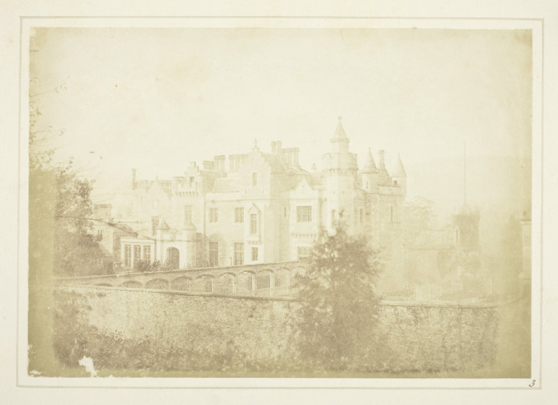
Abbotsford is a historic country house in the Scottish Borders, near Galashiels, on the south bank of the River Tweed. Now open to the public, it was built as the residence of historical novelist and poet Sir Walter Scott between 1817 and 1825. It is a Category A Listed Building and the estate is listed in the Inventory of Gardens and Designed Landscapes in Scotland. Description The nucleus of the estate was a small farm of , called Cartleyhole, nicknamed Clarty (i.e., muddy) Hole, and was bought by Scott on the lapse of his lease (1811) of the neighbouring house of Ashestiel. Scott renamed it "Abbotsford" after a neighbouring ford used by the monks of Melrose Abbey. Following a modest enlargement of the original farmhouse in 1811–12, massive expansions took place in 1816–19 and 1822–24. In this mansion Scott gathered a large library, a collection of ancient furniture, arms and armour, and other relics and curiosities especially connected with Scottish history, notably ... [...More Info...] [...Related Items...] OR: [Wikipedia] [Google] [Baidu] |


