|
Blyth Rural District
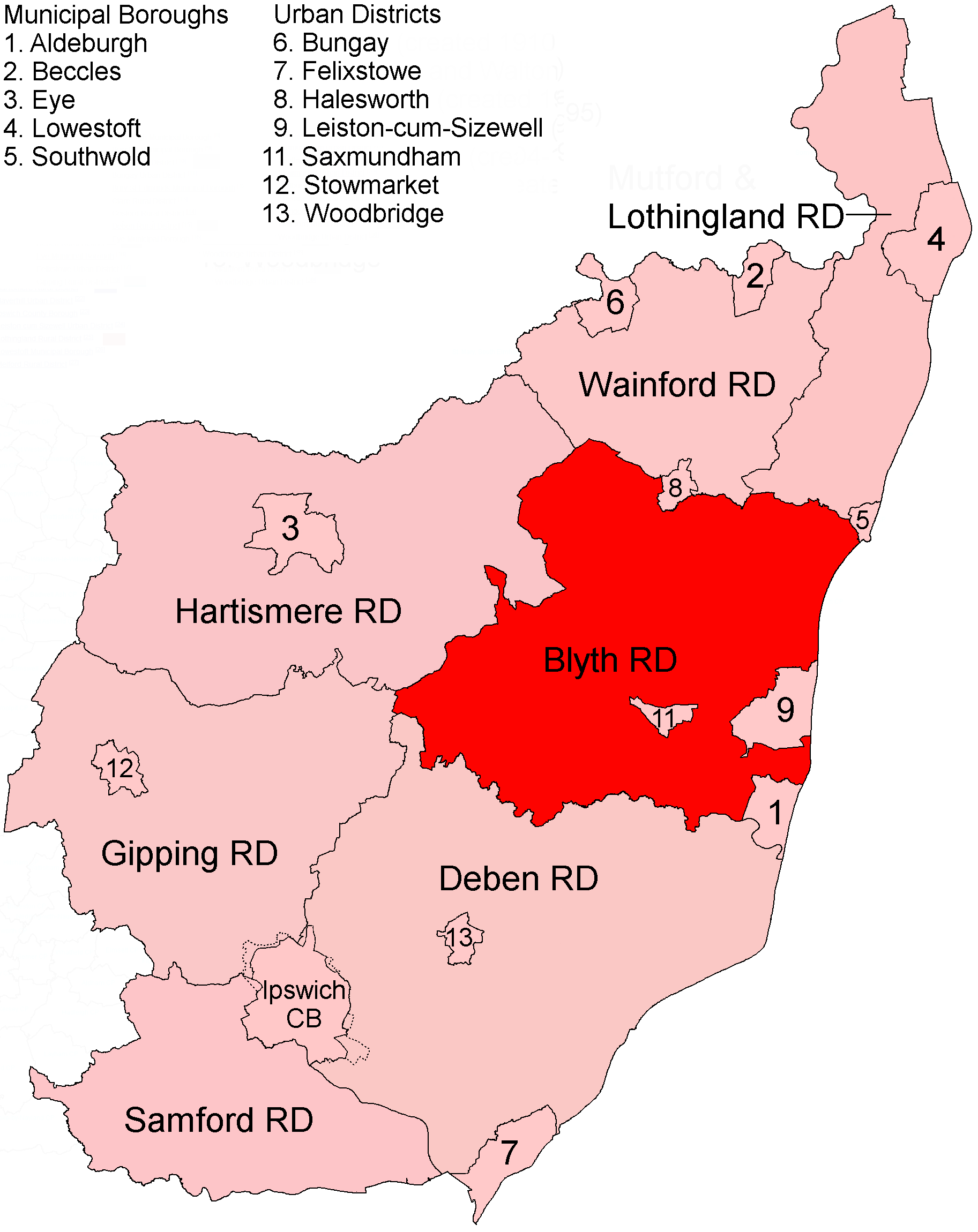
Blyth Rural District was a rural district in East Suffolk, England, between 1934 and 1974. The rural district was formed by the merger of parts of Blything Rural District and Plomesgate Rural District with a small parts of Hoxne Rural District, all of which were being abolished. It covered a coastal area north of Aldeburgh and inland parishes around Saxmundham, although both those towns were excluded from the district. Shortly after the district's creation the council built itself an office on Rendham Road in Saxmundham, holding its first meeting in the new building (later known as Blyth House) in April 1935. The district was abolished in 1974 under the Local Government Act 1972, and became part of Suffolk Coastal district. Statistics Parishes Parishes formerly in Blything Rural District: Formerly in Plomesgate Rural District: Formerly in Hoxne Rural District: * Badingham, * Dennington Dennington is a village and civil parish in the English county of Suffolk ... [...More Info...] [...Related Items...] OR: [Wikipedia] [Google] [Baidu] |
Rural District
Rural districts were a type of local government area – now superseded – established at the end of the 19th century in England, Wales, and Ireland for the administration of predominantly rural areas at a level lower than that of the Administrative county, administrative counties.__TOC__ England and Wales In England and Wales they were created in 1894 (by the Local Government Act 1894) along with Urban district (Great Britain and Ireland), urban districts. They replaced the earlier system of sanitary districts (themselves based on poor law unions, but not replacing them). Rural districts had elected rural district councils (RDCs), which inherited the functions of the earlier sanitary districts, but also had wider authority over matters such as local planning, council house, council housing, and playgrounds and cemeteries. Matters such as education and major roads were the responsibility of county councils. Until 1930 the rural district councillors were also poor law gu ... [...More Info...] [...Related Items...] OR: [Wikipedia] [Google] [Baidu] |
Darsham
Darsham is a village in Suffolk, England. It is located approximately north east of Saxmundham. The village is bypassed by the A12 and is served by Darsham railway station, which is approximately one mile away from the village centre, on the Ipswich-Lowestoft East Suffolk Line. The name of the village of Darsham derives from Deores Ham — home of the deer. This name is borne out by early reference to local roadways as chaseways. There was hunting in this area as late as the 18th century. Darsham is a mixed community with six farms. The village still has a pub, The Fox, however over the past few years the village has lost its school, shop and post office. The garage on the A12, now primarily a petrol station, has a cafe and a shop. There is also a farm shop, a handmade tile factory, a pottery, a builder, an irrigation contractor, seed and feed merchants and a cafe, a private nursing home and a plant nursery with a shop and restaurant. History The village gave its name to ... [...More Info...] [...Related Items...] OR: [Wikipedia] [Google] [Baidu] |
Ubbeston
Ubbeston is a village and civil parish in the East Suffolk district, in the county of Suffolk, England. Nearby settlements include the town of Halesworth, the village of Heveningham Heveningham is a village and civil parish in the East Suffolk district of Suffolk in eastern England. Located four miles south-west of Halesworth, in 2005 it had a population of 120. Heveningham Hall, a country house built in 1777, once belo ... and the hamlet of Ubbeston Green. External links Ubbeston village website Villages in Suffolk Civil parishes in Suffolk Suffolk Coastal {{Suffolk-geo-stub ... [...More Info...] [...Related Items...] OR: [Wikipedia] [Google] [Baidu] |
Thorington
Thorington is a village and a civil parish in the hundred of Blything, in the East Suffolk district of the English county of Suffolk. It is located around south-east of the town of Halesworth, immediately south of the village of Wenhaston. The A12 main road runs through the parish to the east of the village. Thorington Hall was demolished in 1949, but The Round House, a listed gamekeeper's lodge for the Thorington Estate, survives. British Listed Buildings - Thorington Round House Church Farm Nature Reserve is a located ...[...More Info...] [...Related Items...] OR: [Wikipedia] [Google] [Baidu] |
Theberton
Theberton is a village in Suffolk, England. It is located north-east of Saxmundham, and miles north of Leiston, its post town. History During the First World War, a German Zeppelin airship, L48, was shot down near Theberton at 02:00 on the morning of 17 June 1917, by Robert Saundby and others, while it was on a bombing raid.redkitebooks.co.ukAviation Archaeology Zeppelin L48 excavation carried out for BBC television Sixteen members of the crew died in the crash; three survived but one later died from his injuries. The bodies of the crew were buried in a dedicated plot adjacent to the churchyard, with women munition workers voluntarily digging the graves. Local people tended the graves until 1966, when they were reinterred at Cannock Chase German Military Cemetery in Staffordshire. A memorial plaque remains across the road from the church, where part of the Zeppelin framework is mounted in the porch. The village primary school was closed around 1970 and is now used as the vill ... [...More Info...] [...Related Items...] OR: [Wikipedia] [Google] [Baidu] |
Sibton
Sibton is a village and civil parish on the A1120 road, in the East Suffolk district, in the English county of Suffolk. It is near the towns of Saxmundham and Halesworth, the village of Peasenhall and the hamlet of Sibton Green. The church is dedicated to St Peter; there is also the remains of a medieval abbey, Sibton Abbey. There is a large stately house set in the grounds of Sibton Park which dates back 1827 in the Georgian period, which is now used as a hotel. The estate consists of 4500 acres, being part of the Wilderness Reserve where there are holiday cottages and a lake. The Parish is also in close proximity to the River Yox which runs past the White Horse Inn and down through Pouy Street, it then goes on past both the A1120 road and a small wooded area called Abbey Woods to pass through the grounds of Sibton Park and then on to Yoxford. History The name Sibton derives from Old English, where the word "Sibba" is a personal name and the word "tun" means an enclosure, ... [...More Info...] [...Related Items...] OR: [Wikipedia] [Google] [Baidu] |
Peasenhall
Peasenhall is a village and civil parish in the East Suffolk district, in the English county of Suffolk. The population of the civil parish at the 2021 Census was 525. It lies on the A1120 tourist route; neighbouring villages include Sibton and Badingham. It was the location of the Peasenhall Murder. Governance Peasenhall has its own parish council comprising 10 councillors, elected every four years. At district level, Peasenhall forms part of the Kelsale & Yoxford ward of East Suffolk district, and at county level, Peasenhall is included in the Framlingham Division of Suffolk County Council. Amenities The parish church of St Michael's dates from the 15th century, although much restored in 1860. It is a grade II* listed building. There is also a Methodist chapel; the building dates from 1809. There was also formerly a Congregationalist chapel. Apart from the church, buildings of architectural interest include the "Ancient House", the New Inn, a Landmark Trust propert ... [...More Info...] [...Related Items...] OR: [Wikipedia] [Google] [Baidu] |
Middleton, Suffolk
Middleton is a village in the east of the English county of Suffolk. It is located approximately north-west of Leiston, north east of Saxmundham and from the Suffolk coast.Middleton cum Fordley Parish Council . Retrieved 2011-02-11. The village is on the B1122 around east of and had a population of 359 at the 2001 census,Neighbourhood Statistics: Suffolk Coastal 200 ... [...More Info...] [...Related Items...] OR: [Wikipedia] [Google] [Baidu] |
Linstead Parva
Linstead Parva is a small village and civil parish in the East Suffolk district of Suffolk in eastern England. It has a small but notable 13th-century parish church, still in regular use. The village pub, The Greyhound, was already established and trading when referenced in 1874, but it closed permanently in March 1955, and is now a private dwelling. Population In 2005 its population was 90. This had increased significantly to 132 at the 2011 Census, a 47% increase, caused by the combination of population statistics in 2011 for both Linsteads (Parva and Magna). In true terms, the population size of the village is stable. Although "Parva" means smaller, Linstead Parva is today significantly larger than neighbouring Linstead Magna, which is now just a satellite hamlet. Ecclesiastical parish The parish church of Linstead (Parva and Magna) is in Linstead Parva, and dedicated to St Margaret of Antioch, an early Christian martyr. The 13th-century church building is well maintaine ... [...More Info...] [...Related Items...] OR: [Wikipedia] [Google] [Baidu] |
Linstead Magna
Linstead Magna is a civil parish in the East Suffolk district of Suffolk in eastern England. Population and civil parish In 2005 its population was 60. It shares a civil parish council with nearby Chediston and Linstead Parva. At the 2011 Census the population was listed under Linstead Parva only. Parish church The ancient parish church of Linstead Magna was dedicated to St Peter ) (Simeon, Simon) , birth_date = , birth_place = Bethsaida, Gaulanitis, Syria, Roman Empire , death_date = Between AD 64–68 , death_place = probably Vatican Hill, Rome, Italia, Roman Empire , parents = John (or Jonah; Jona) , occupation .... The church fell into ruins many centuries ago, and almost no trace remains. The two Linstead parishes were combined, and now share the parish church of Linstead Parva (dedicated to St Margaret of Antioch). Nonetheless, a procession and open air service is held at the site of the church on Church Farm, Linstead Magna, every two years. References Ext ... [...More Info...] [...Related Items...] OR: [Wikipedia] [Google] [Baidu] |
Knodishall
Knodishall, a village in Suffolk, England, lies south-east of Saxmundham, south-west of Leiston, and 3 miles from the coast, in the Blything Hundred. Most dwellings are now at Coldfair Green; just a few remain in the original village by the parish Church of St Lawrence,St Lawrence, Knodishall Suffolk Churches website, July 2010. Retrieved 31 March 2011. which falls gently on the north side of the Hundred River valley. It is now an outlier of Knodishall Common, a settlement a mile to the south-east."St Lawrence, Knodishall, Suffolk" at ''The Corpus of R ... [...More Info...] [...Related Items...] OR: [Wikipedia] [Google] [Baidu] |
Kelsale Cum Carlton
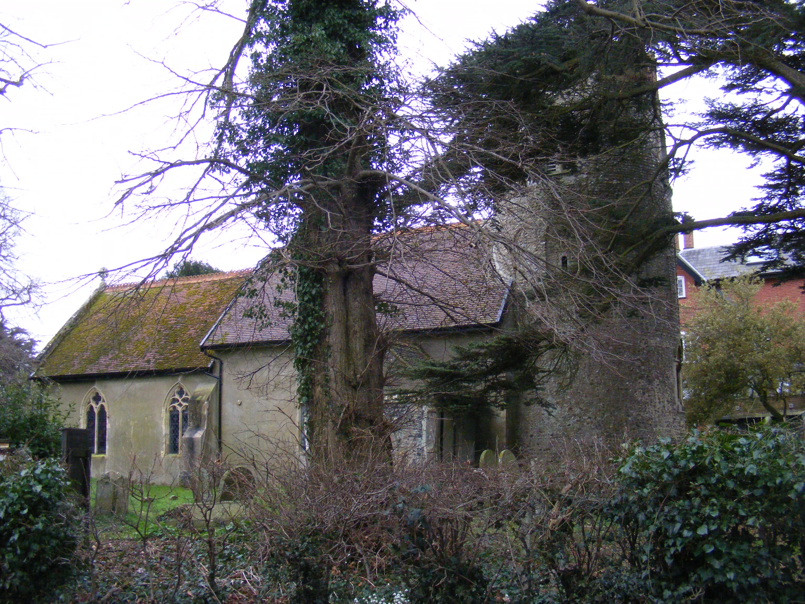
St Peter's church, Carlton Kelsale cum Carlton is a civil parish in the English county of Suffolk. Situated to the north of Saxmundham Saxmundham ( ) is a market town in Suffolk, England, set in the valley of the River Fromus about north-east of Ipswich and west of the coast at Sizewell. The town is bypassed by the main A12 road between London and Lowestoft. The town is ser ..., Kelsale cum Carlton is one of the largest parishes in Suffolk by area and includes, in addition to Kelsale and Carlton, villages and hamlets such as Dorley's Corner, Curlew Green, East Green and North Green within its boundaries. The population of the civil parish at the 2011 Census was 990. The parish was formed in 1885. left, Lych gate of St Mary and St Peter's church, Kelsale References Civil parishes in Suffolk {{Suffolk-geo-stub ... [...More Info...] [...Related Items...] OR: [Wikipedia] [Google] [Baidu] |


