|
Bluemont Junction Trail
The Bluemont Junction Trail is a asphalt-paved rail trail in Arlington County, Virginia, that the Arlington County government constructed along a former branch of the defunct Washington and Old Dominion Railroad. The shared use path travels southwest from Ballston through Bluemont Junction Park to Bluemont Junction. The trail connects Ballston to the Washington & Old Dominion Railroad Trail (W&OD Trail) and the Four Mile Run Trail in and near Bluemont Park. The trail is part of a route to Georgetown and downtown Washington, D.C. It serves as an alternative to a portion of the more hilly Custis Trail. History In 1911, the newly incorporated Washington and Old Dominion Railway purchased the property that now contains the Bluemont Junction Trail to accommodate a part of a planned connection between the railway's line that travelled between Alexandria and the town of Bluemont, Virginia (at the base of Blue Ridge east of Snickers Gap) and its line that travelled between G ... [...More Info...] [...Related Items...] OR: [Wikipedia] [Google] [Baidu] |
Shared Use Path
A shared-use path, mixed-use path or multi-use pathway is a path which is 'designed to accommodate the movement of pedestrians and cyclists'. Examples of shared-use paths include sidewalks designated as shared-use, bridleways and rail trails. A shared-use path typically has a surface that is asphalt, concrete or firmly packed crushed aggregate. Shared-use paths differ from cycle tracks and cycle paths in that shared-use paths are designed to include pedestrians even if the primary anticipated users are cyclists. The path may also permit other users such as inline skating. Contrastingly, Motorcycles and mopeds are normally prohibited. Shared-use paths sometimes provide different lanes for users who travel at different speeds to prevent conflicts between user groups on high-use trails. Shared-use paths are criticised for creating conflict between different users. Types Bridleways In the UK, cyclists are legally permitted to cycle on bridleways (paths open to horse riders), ... [...More Info...] [...Related Items...] OR: [Wikipedia] [Google] [Baidu] |
Blue Ridge Mountain
Blue Ridge Mountain, also known as Blue Mountain, is the colloquial name of the westernmost ridge of the Blue Ridge Mountains in northern Virginia and the Eastern Panhandle of West Virginia. The Appalachian Trail traverses the entire length of the mountain along its western slope and crest. Geography The mountain extends from the Potomac River in the north to Chester Gap in the south. Along this section of the Blue Ridge Mountains, Blue Ridge Mountain comprises the sole ridge of the chain in the immediate vicinity and contains few spur ridges or peaks. The notable exceptions are the Bull Run and Catoctin mountains, which lie approximately to the east across the Loudoun Valley, and Short Hill Mountain, located to the east, which runs parallel to the Blue Ridge for near its northern terminus. To the west of the mountain is the lower Shenandoah Valley. Blue Ridge Mountain is noticeably lower in elevation than other sections of the Blue Ridge Mountains in Virginia. The southern ... [...More Info...] [...Related Items...] OR: [Wikipedia] [Google] [Baidu] |
Potomac River
The Potomac River () drains the Mid-Atlantic United States, flowing from the Potomac Highlands into Chesapeake Bay. It is long,U.S. Geological Survey. National Hydrography Dataset high-resolution flowline dataThe National Map. Retrieved August 15, 2011 with a drainage area of 14,700 square miles (38,000 km2), and is the fourth-largest river along the East Coast of the United States and the 21st-largest in the United States. Over 5 million people live within its watershed. The river forms part of the borders between Maryland and Washington, D.C. on the left descending bank and between West Virginia and Virginia on the right descending bank. Except for a small portion of its headwaters in West Virginia, the North Branch Potomac River is considered part of Maryland to the low-water mark on the opposite bank. The South Branch Potomac River lies completely within the state of West Virginia except for its headwaters, which lie in Virginia. Course The Potomac River runs ... [...More Info...] [...Related Items...] OR: [Wikipedia] [Google] [Baidu] |
Mount Vernon Trail
The Mount Vernon Trail (MVT) is a long shared use path that travels along the George Washington Memorial Parkway in Northern Virginia between Rosslyn and George Washington's home at Mount Vernon. The trail connects the easternmost portions of Arlington County, the City of Alexandria, and Fairfax County, and travels mostly on dedicated trail with a small portion on city streets. As part of U.S. Bike Route 1, the Potomac Heritage Trail and the East Coast Greenway, the MVT opened in April 1972 as a gravel path and was subsequently expanded and paved. The MVT is part of the much larger mid-Atlantic Potomac Heritage National Scenic Trail. History Separate bridle and footpaths were included in the 1890 and 1930 plans for the Mount Vernon Memorial Highway, as the George Washington Parkway was called before opening. Provisions for such paths were included in the construction of key bridges, such as the Boundary Channel Bridge on south Columbia Island and some short paths were buil ... [...More Info...] [...Related Items...] OR: [Wikipedia] [Google] [Baidu] |
Key Bridge (Washington, D , a bridge carrying U.S. Route 29 which crosses the Potomac River between Washington, DC and Arlington, Virginia
{{disambig ...
Francis Scott Key Bridge, Key Bridge, or FSK Bridge can refer to: *Francis Scott Key Bridge (Baltimore), a bridge carrying Interstate 695 which crosses the outer harbor of Baltimore, Maryland *Francis Scott Key Bridge (Washington) The Francis Scott Key Bridge, more commonly known as the Key Bridge, is a six-lane reinforced concrete arch bridge conveying U.S. Route 29 (US 29) traffic across the Potomac River between the Rosslyn neighborhood of Arlington County, ... [...More Info...] [...Related Items...] OR: [Wikipedia] [Google] [Baidu] |
Rosslyn, Arlington, Virginia
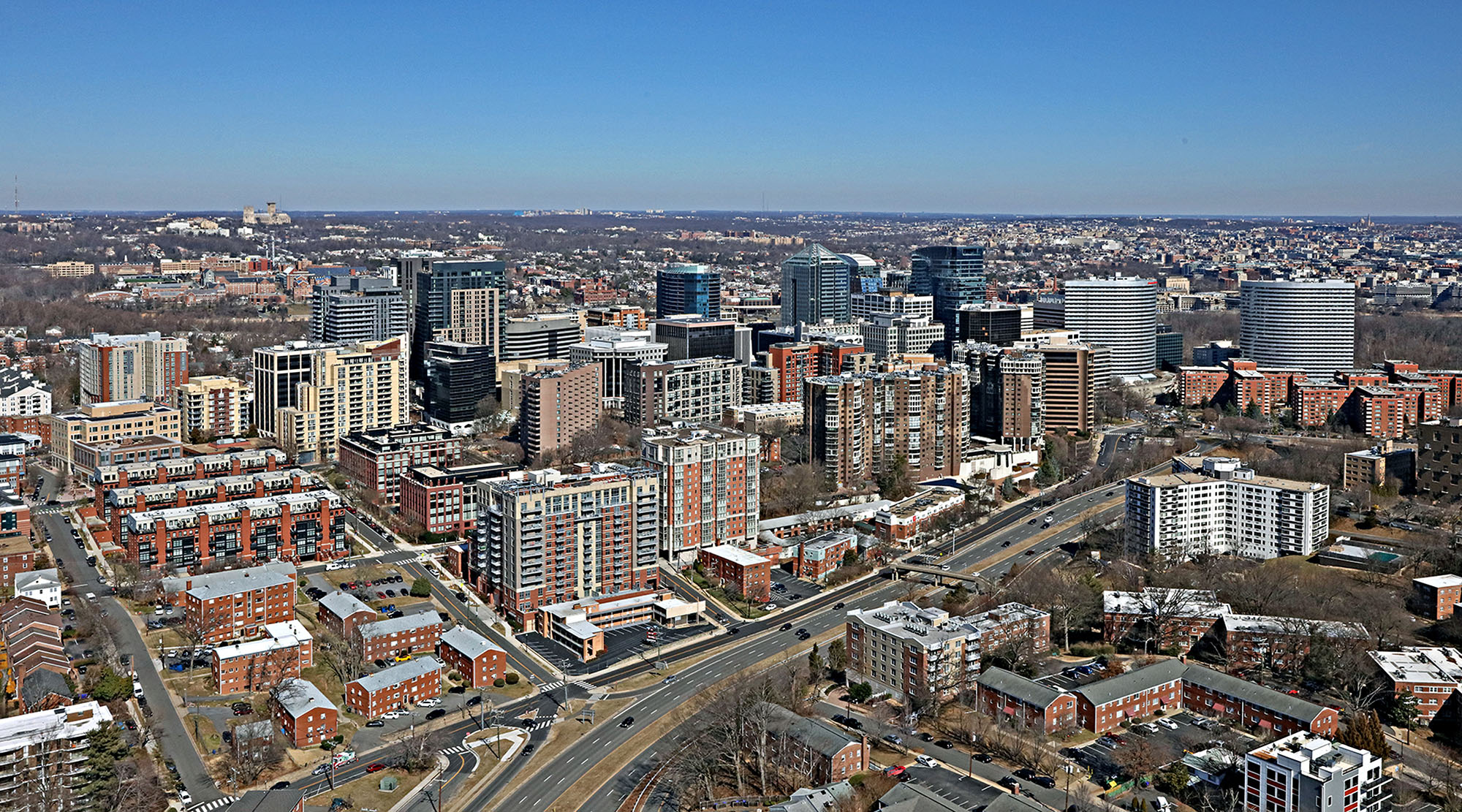
Rosslyn ( ) is a heavily urbanized Unincorporated area (United States), unincorporated area in Northern Virginia located in the northeastern corner of Arlington County, Virginia, north of Arlington National Cemetery and directly across the Potomac River from Georgetown, Washington, D.C., Georgetown and Foggy Bottom in Washington, D.C. Rosslyn encompasses the Arlington neighborhoods of North Rosslyn and Radnor/Ft. Myer Heights, and is located east of Court House, Arlington, Virginia, Court House, another urbanized Arlington neighborhood. Characterized as one of several "urban villages" by the county, the numerous skyscrapers in the dense business section of Rosslyn make its appearance in some ways more urban than nearby Washington. Rosslyn residents have an average household income of $105,000 and 81% are college graduates. Establishments in the neighborhood include Sinclair Broadcast Group-owned American Broadcasting Company, ABC affiliate WJLA-TV, WJLA located in the Rosslyn Twi ... [...More Info...] [...Related Items...] OR: [Wikipedia] [Google] [Baidu] |
Trailhead
A trailhead is the point at which a trail begins, where the trail is often intended for hiking, biking, horseback riding, or off-road vehicles. Modern trailheads often contain rest rooms, maps, sign posts and distribution centers for informational brochures about the trail and its features, and parking areas for vehicles and trailers. The United States Access Board states "A trailhead is defined as an outdoor space that is designated by an entity responsible for administering or maintaining a trail to serve as an access point to the trail." The intersection of two trails is a trail junction and does not constitute a trailhead. Historically, the cities located at the terminus of major pathways for foot traffic such as the Natchez Trace and the Chisholm Trail were also known as trailheads. For mountain climbing and hiking, the elevation of the trailhead above sea level is posted to give an idea of how high the mountain is above the Height above average terrain, average terrain. ... [...More Info...] [...Related Items...] OR: [Wikipedia] [Google] [Baidu] |
Dominion Energy
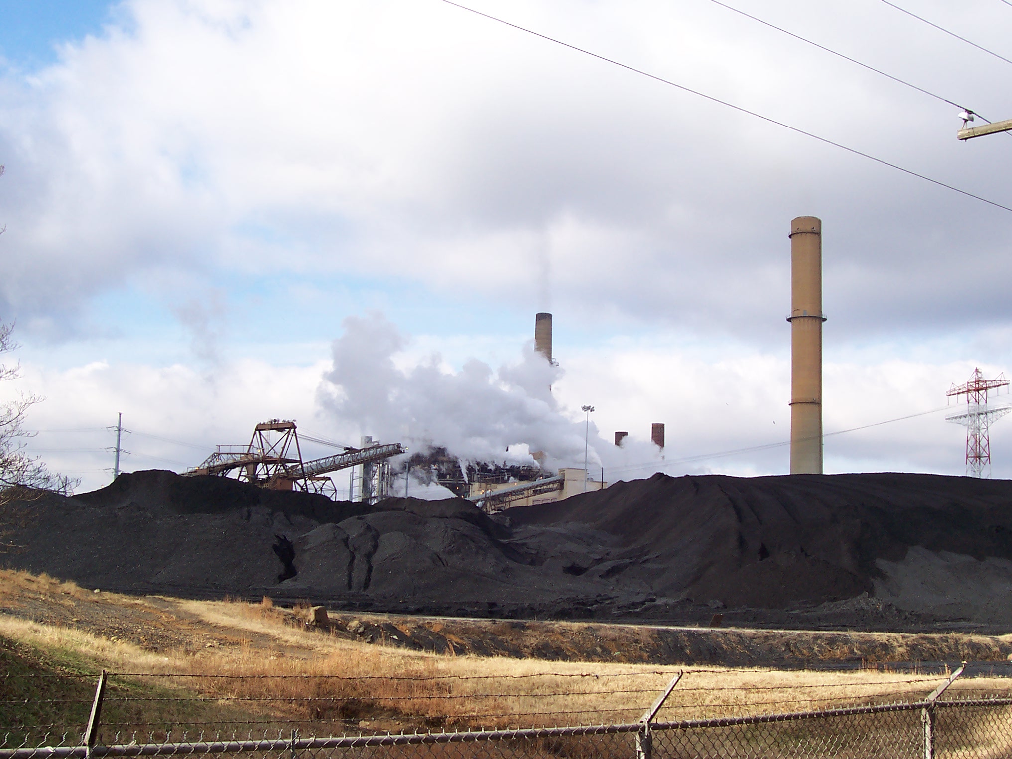
Dominion Energy, Inc., commonly referred to as Dominion, is a North American power and energy company headquartered in Richmond, Virginia that supplies electricity in parts of Virginia, North Carolina, and South Carolina and supplies natural gas to parts of Utah, Idaho and Wyoming, West Virginia, Ohio, Pennsylvania, North Carolina, South Carolina, and Georgia. Dominion also has generation facilities in Indiana, Illinois, Connecticut, and Rhode Island. The company acquired Questar Corporation in the Western United States, including parts of Utah and Wyoming, in September 2016. In January 2019, Dominion Energy completed its acquisition of SCANA Corporation. Overview The company's asset portfolio includes 27,000 megawatts of power generation, of electric transmission lines, of distribution lines, of natural gas transmission, gathering and storage pipeline, and equivalent of natural gas and oil reserves. Dominion also operates the nation's largest natural gas storage facility, amo ... [...More Info...] [...Related Items...] OR: [Wikipedia] [Google] [Baidu] |
The Washington Post
''The Washington Post'' (also known as the ''Post'' and, informally, ''WaPo'') is an American daily newspaper published in Washington, D.C. It is the most widely circulated newspaper within the Washington metropolitan area and has a large national audience. Daily broadsheet editions are printed for D.C., Maryland, and Virginia. The ''Post'' was founded in 1877. In its early years, it went through several owners and struggled both financially and editorially. Financier Eugene Meyer purchased it out of bankruptcy in 1933 and revived its health and reputation, work continued by his successors Katharine and Phil Graham (Meyer's daughter and son-in-law), who bought out several rival publications. The ''Post'' 1971 printing of the Pentagon Papers helped spur opposition to the Vietnam War. Subsequently, in the best-known episode in the newspaper's history, reporters Bob Woodward and Carl Bernstein led the American press's investigation into what became known as the Watergate scandal ... [...More Info...] [...Related Items...] OR: [Wikipedia] [Google] [Baidu] |
Interstate 66
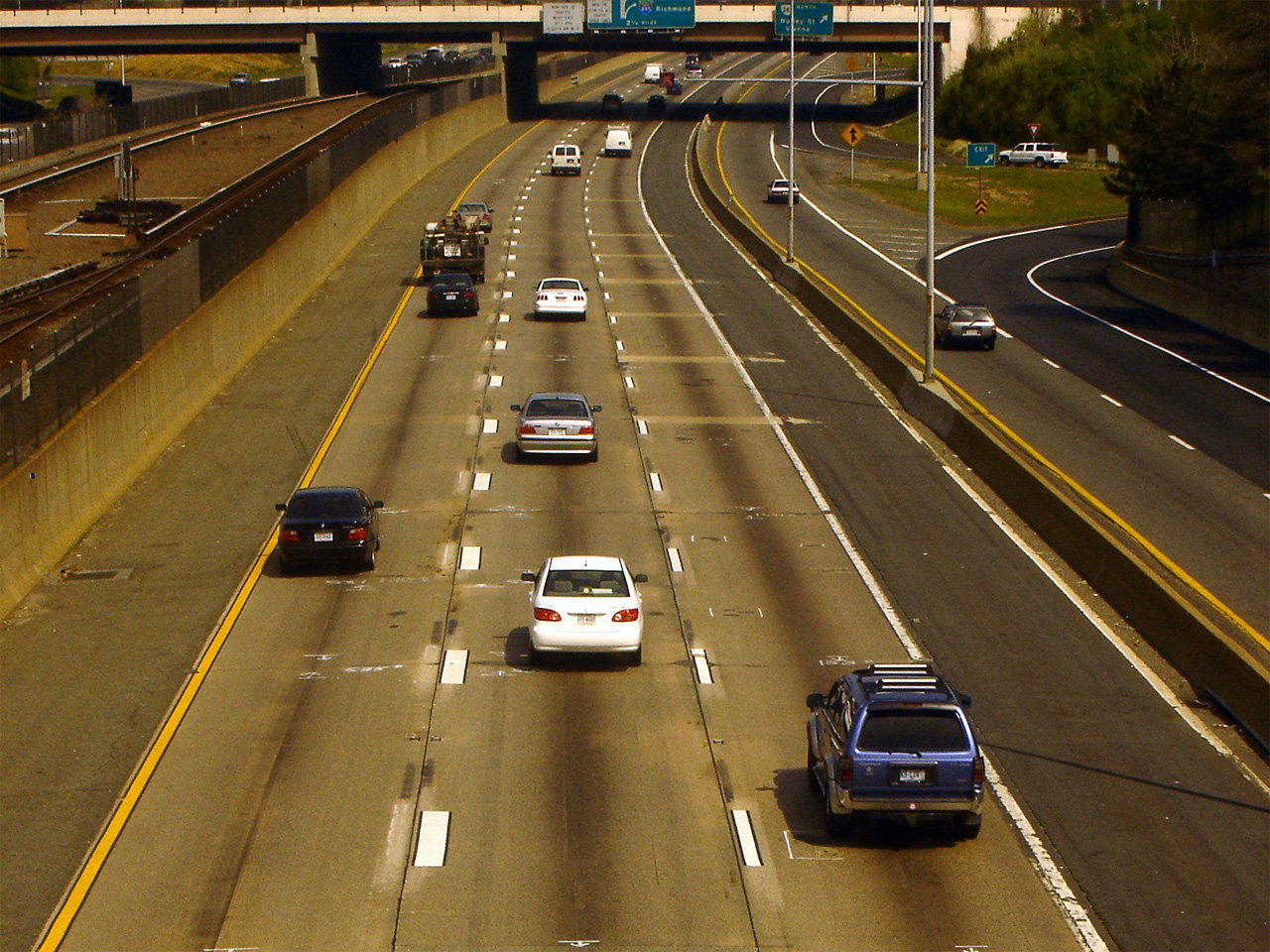
Interstate 66 (I-66) is an east–west Interstate Highway in the eastern United States. It runs from an interchange with I-81 near Middletown, Virginia, on its western end to an interchange with U.S. Route 29 (US 29) in Washington, D.C., at the eastern terminus. Much of the route parallels US 29 or State Route 55 (SR 55) in Virginia. I-66 has no physical or historical connection to the famous US 66, which was located in a different region of the United States. The E Street Expressway is a spur from I-66 into the Foggy Bottom neighborhood of Washington, D.C. Route description , - , VA , 74.8 , 120.54 , - , DC , 1.6 , 2.57 , - , Total , 76.4 , 123.11 Virginia Interstate 81 to Dunn Loring I-66 begins at a directional T interchange with I-81 near Middletown, Virginia. It heads east as a four-lane freeway and meets US 522/ US 340 at a partial cloverleaf interchange. The two routes head south to Front Royal and north to ... [...More Info...] [...Related Items...] OR: [Wikipedia] [Google] [Baidu] |
Virginia Department Of Transportation
The Virginia Department of Transportation (VDOT) is the agency of the state government responsible for transportation in the state of Virginia in the United States. VDOT is headquartered at the Virginia Department of Highways Building in downtown Richmond. VDOT is responsible for building, maintaining, and operating the roads, bridges, and tunnels in the commonwealth. It is overseen by the Commonwealth Transportation Board, which has the power to fund airports, seaports, rail, and public transportation. VDOT's revised annual budget for fiscal year 2019 is $5.4 billion. VDOT has a workforce of about 7,500 full-time employees. Responsibilities VDOT operates and maintains: * Roads: VDOT's largest responsibility is the maintenance of roads. Filling potholes, storm drain cleaning, water drainage, guard rail replacement, bridge work, tree removal, and trash removal, as well as the maintenance of signs and traffic lights. * More than 21,000 bridges and structures * Snow removal: ... [...More Info...] [...Related Items...] OR: [Wikipedia] [Google] [Baidu] |
Rosslyn, Virginia
Rosslyn ( ) is a heavily urbanized unincorporated area in Northern Virginia located in the northeastern corner of Arlington County, Virginia, north of Arlington National Cemetery and directly across the Potomac River from Georgetown and Foggy Bottom in Washington, D.C. Rosslyn encompasses the Arlington neighborhoods of North Rosslyn and Radnor/Ft. Myer Heights, and is located east of Court House, another urbanized Arlington neighborhood. Characterized as one of several "urban villages" by the county, the numerous skyscrapers in the dense business section of Rosslyn make its appearance in some ways more urban than nearby Washington. Rosslyn residents have an average household income of $105,000 and 81% are college graduates. Establishments in the neighborhood include Sinclair Broadcast Group-owned ABC affiliate WJLA located in the Rosslyn Twin Towers, and Marriott International's longest operating hotel, the Key Bridge Marriott. Notable structures include the United States Marine ... [...More Info...] [...Related Items...] OR: [Wikipedia] [Google] [Baidu] |

_-_geograph.org.uk_-_2580483.jpg)


