|
Bittou
Bittou is a town and seat of the Bittou Department of Boulgou Province in south-eastern Burkina Faso. The town is a stop on the caravan trading route. Today the town is located along the N16 Road which links Burkina Faso with Northern Togo and Ghana (via Togo). In 1898 the French Colonial Army built a fort here to keep the British Colonial Army from capturing the area.Historical Dictionary of Burkina Faso, by Lawrence Rupley, Lamissa Bangali, Boureima Diamitani, 2013, Third edition, Scarecrow Press, Inc. As of 2019, the town has a population of 31,210. Climate Köppen-Geiger climate classification system classifies its climate as tropical wet and dry (Aw) that closely borders with hot semi-arid (BSh). See also *List of cities in Burkina Faso This is a list of cities and towns in Burkina Faso. List * Aribinda * Bagré * Banfora * Batié * Bobo Dioulasso * Bogandé * Boromo * Boulsa * Boussé * Dano * Dédougou * Diapaga * Diébougou * Djibo * Dori * F ... [...More Info...] [...Related Items...] OR: [Wikipedia] [Google] [Baidu] |
Bittou Department
Bittou or Bitou is a department or commune of Boulgou Province in eastern Burkina Faso. Its capital is the town of Bittou. According to the 2019 census the department has a total population of 102,400. Towns and villages * Bittou (or Bitou) (31 210 inhabitants) (capital) * Bekoure (2 676 inhabitants) * Belayerla (1 230 inhabitants) * Bourzoaga (17 inhabitants) * Dema (1 535 inhabitants) * Fottigue (2 698 inhabitants) * Garanga (1 561 inhabitants) * Gnangdin (4 495 inhabitants) * Kankamogre (3 028 inhabitants) * Kankamogre-Peulh (960 inhabitants) * Kanyire (1 940 inhabitants) * Kodemzoaga (594 inhabitants) * Komtenga (157 inhabitants) * Largue (621 inhabitants) * Loaba (3 518 inhabitants) * Loaba-Peulh (1 768 inhabitants) * Mogandé (350 inhabitants) * Mogandé-Peulh (350 inhabitants) * Mogomnore (2 422 inhabitants) * Nianle (1 574 inhabitants) * Nohao (1 555 inhabitants) * Sangabouli (1 164 inhabitants) * Sawenga (5 039 inhabitants) * Tiba (1 ... [...More Info...] [...Related Items...] OR: [Wikipedia] [Google] [Baidu] |
Departments Of Burkina Faso
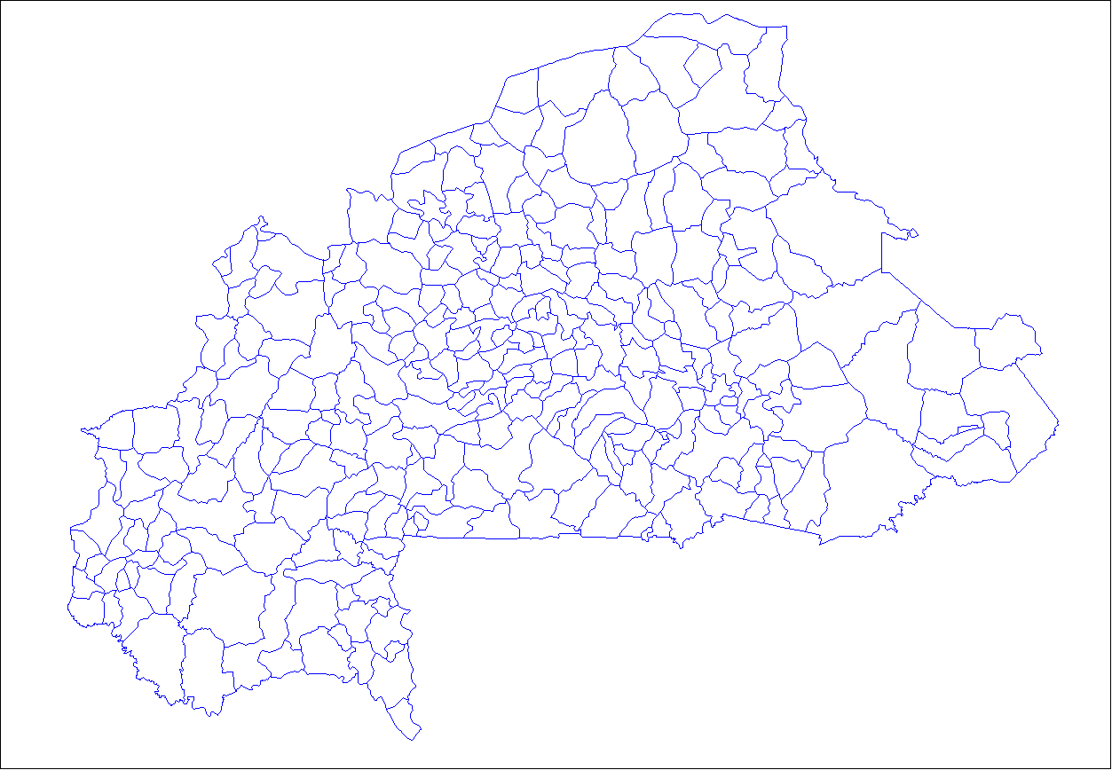
The provinces of Burkina Faso are divided into 351 departments (as of 2014 and since local elections of 2012), whose urbanized areas (cities, towns and villages) are grouped into the same commune (municipality) with the same name as the department. The department also covers rural areas (including national natural parks) that are not governed locally by the elected municipal council of the commune (presided by its mayor, with representants elected for each village or urban sector), but by the state represented at departmental level by a prefect (supervized by the haut-commissaire of its province, themself assisted by a general secretary and acting under the hierarchic authority the governor of its region, all of them being nominated by the national government). Status of communes The 351 communes (municipalities) created for each one of these departments have three kinds of status : * 49 urban communes are grouping their main city/town (subdivided into urban sectors) and all ... [...More Info...] [...Related Items...] OR: [Wikipedia] [Google] [Baidu] |
Boulgou Province
Boulgou is one of the 45 provinces of Burkina Faso and is in Centre-Est Region. The capital of Boulgou is Tenkodogo. The population of Boulgou in 2019 was 736,559.Citypopulation.de Population of regions in Burkina Faso Departments The province of Boulgou is divided into 13 departments. See also: * *Provinces of Burkina Faso
The regions of Burkina Faso are divided into 45 administrative provinces. These 45 provinces are currently sub-divided into 351 departments or comm ...
[...More Info...] [...Related Items...] OR: [Wikipedia] [Google] [Baidu] |
Regions Of Burkina Faso
Per Law No.40/98/AN in 1998, Burkina Faso adhered to decentralization to provide administrative and financial autonomy to local communities. Most of these, according to their individual articles, were implemented on 2 July 2001. Burkina Faso is divided into 13 administrative regions. Each region is administered by a governor. These regions are divided into 45 provinces and subdivided into 351 communes. See also *List of regions of Burkina Faso by Human Development Index *Provinces of Burkina Faso * Departments/Communes of Burkina Faso *Geography of Burkina Faso Burkina Faso (formerly Upper Volta) is a landlocked Sahel country that shares borders with six nations. It lies between the Sahara desert and the Gulf of Guinea, south of the loop of the Niger River, mostly between latitudes 9° and 15°N ( ... * ISO 3166-2:BF References See also Regions of Burkina Faso at Statoids.com {{Burkina Faso topics Subdivisions of Burkina Faso Burkina Faso, Regions Burkina ... [...More Info...] [...Related Items...] OR: [Wikipedia] [Google] [Baidu] |
Centre-Est Region
Centre-Est is one of Burkina Faso's 13 administrative regions. The population of Centre-Est was 1,578,075 in 2019. The region's capital is Tenkodogo. Three provinces— Boulgou, Koulpélogo, and Kouritenga, make up the region. , the population of the region was 1,578,075 with 53.5% females. The population in the region was 7.7% of the total population of the country. The child mortality rate was 39, infant mortality rate was 56 and the mortality of children under five was 93. As of 2007, the literacy rate in the region was 16.6%, compared with a national average of 28.3%. Geography Most of Burkino Faso is a wide plateau formed by riverine systems and is called falaise de Banfora. There are three major rivers, the Red Volta, Black Volta and White Volta, which cuts through different valleys. The climate is generally hot, with unreliable rains across different seasons. Gold and quartz are common minerals found across the country, while manganese deposits are also common. The ... [...More Info...] [...Related Items...] OR: [Wikipedia] [Google] [Baidu] |
Provinces Of Burkina Faso
The regions of Burkina Faso are divided into 45 administrative provinces. These 45 provinces are currently sub-divided into 351 departments or communes. List of provinces by region Here is a list of the provinces, with their capitals in parentheses: Central Burkina Faso Centre Region * Kadiogo ( Ouagadougou) (#14 in map) Centre-Nord Region * Bam ( Kongoussi) (#2 in map) * Namentenga ( Boulsa) (#26 in map) * Sanmatenga ( Kaya) (#34 in map) Centre-Sud Region * Bazèga ( Kombissiri) (#4 in map) * Nahouri (Pô) (#25 in map) * Zoundwéogo (Manga) (#45 in map) Plateau-Central Region * Ganzourgou ( Zorgho) (#9 in map) * Kourwéogo ( Boussé) (#21 in map) * Oubritenga ( Ziniaré) (#29 in map) Eastern Burkina Faso Centre-Est Region * Boulgou ( Tenkodogo) (#6 in map) * Koulpélogo ( Ouargaye) (#19 in map) * Kouritenga ( Koupéla) (#20 in map) Est Region * Gnagna ( Bogandé) (#10 in map) * Gourma ( Fada N'gourma) (#11 in map) * Komondjari ( Gayéri) (#16 in map) ... [...More Info...] [...Related Items...] OR: [Wikipedia] [Google] [Baidu] |
Burkina Faso
Burkina Faso (, ; , ff, 𞤄𞤵𞤪𞤳𞤭𞤲𞤢 𞤊𞤢𞤧𞤮, italic=no) is a landlocked country in West Africa with an area of , bordered by Mali to the northwest, Niger to the northeast, Benin to the southeast, Togo and Ghana to the south, and the Ivory Coast to the southwest. It has a population of 20,321,378. Previously called Republic of Upper Volta (1958–1984), it was Geographical renaming, renamed Burkina Faso by President of Burkina Faso, President Thomas Sankara. Its citizens are known as ''Burkinabè'' ( ), and its Capital city, capital and largest city is Ouagadougou. The largest ethnic group in Burkina Faso is the Mossi people, who settled the area in the 11th and 13th centuries. They established powerful kingdoms such as the Ouagadougou, Tenkodogo, and Yatenga. In 1896, it was colonized by the French colonial empire, French as part of French West Africa; in 1958, Upper Volta became a self-governing colony within the French Community. In 1960, it gained f ... [...More Info...] [...Related Items...] OR: [Wikipedia] [Google] [Baidu] |
N16 Road (Burkina Faso)
N16 or N-16 may refer to: Roads * N16 road (Belgium), a National Road in Belgium * Route nationale 16, in France * N16 road (Ireland) * Nebraska Highway 16, in the United States Vehicles * , a German submarine surrendered to the Royal Navy after the Second World War * , a submarine of the Royal Navy * Nieuport 16, a French First World War fighter aircraft * Nissan Almera (N16), a Japanese automobile sold in Europe * Nissan Bluebird Sylphy (N16), a Japanese automobile sold in Asia Other uses * N16 (Long Island bus) * BMW N16, an automobile engine * Centre Airpark, an airport in Centre Hall, Pennsylvania, United States * London Buses route N16 * Nagahoribashi Station, of the Osaka Metro * Nitrogen-16, am isotope of nitrogen * N16, a postcode district in the N postcode area N, or n, is the fourteenth letter in the Latin alphabet, used in the modern English alphabet, the alphabets of other western European languages and others worldwide. Its name in English is ''en'' (pr ... [...More Info...] [...Related Items...] OR: [Wikipedia] [Google] [Baidu] |
Tropical Wet And Dry Climate
Tropical savanna climate or tropical wet and dry climate is a tropical climate sub-type that corresponds to the Köppen climate classification categories ''Aw'' (for a dry winter) and ''As'' (for a dry summer). The driest month has less than of precipitation and also less than 100-\left (\frac \right)mm of precipitation. This latter fact is in a direct contrast to a tropical monsoon climate, whose driest month sees less than of precipitation but has ''more'' than 100-\left (\frac \right) of precipitation. In essence, a tropical savanna climate tends to either see less overall rainfall than a tropical monsoon climate or have more pronounced dry season(s). In tropical savanna climates, the dry season can become severe, and often drought conditions prevail during the course of the year. Tropical savanna climates often feature tree-studded grasslands due to its dryness, rather than thick jungle. It is this widespread occurrence of tall, coarse grass (called savanna) which has led to ... [...More Info...] [...Related Items...] OR: [Wikipedia] [Google] [Baidu] |
Hot Semi-arid Climate
A semi-arid climate, semi-desert climate, or steppe climate is a dry climate sub-type. It is located on regions that receive precipitation below potential evapotranspiration, but not as low as a desert climate. There are different kinds of semi-arid climates, depending on variables such as temperature, and they give rise to different biomes. Defining attributes of semi-arid climates A more precise definition is given by the Köppen climate classification, which treats steppe climates (''BSk'' and ''BSh'') as intermediates between desert climates (BW) and humid climates (A, C, D) in ecological characteristics and agricultural potential. Semi-arid climates tend to support short, thorny or scrubby vegetation and are usually dominated by either grasses or shrubs as it usually can't support forests. To determine if a location has a semi-arid climate, the precipitation threshold must first be determined. The method used to find the precipitation threshold (in millimeters): *multiply ... [...More Info...] [...Related Items...] OR: [Wikipedia] [Google] [Baidu] |
List Of Cities In Burkina Faso
This is a list of cities and towns in Burkina Faso. List * Aribinda * Bagré * Banfora * Batié * Bobo Dioulasso * Bogandé * Boromo * Boulsa * Boussé * Dano * Dédougou * Diapaga * Diébougou * Djibo * Dori * Fada N'gourma * Gaoua * Garango * Gayéri * Gorom-Gorom * Gourcy * Houndé * Kantchari * Kaya * Kindi * Kokologo * Kombissiri * Kongoussi * Kordié * Koudougou * Kouka, Bam * Kouka, Banwa * Koupéla * Léo * Loropeni * Manga * Méguet * Mogtedo * Niangoloko * Nouna * Orodara * Ouagadougou (Capital) * Ouahigouya * Ouargaye * Pama * Pissila * Pô * Pouytenga * Réo * Saponé * Sapouy * Sebba * Séguénéga * Sindou * Solenzo * Tangin Dassouri * Tenkodogo * Tikaré * Titao * Toma * Tougan * Villy * Yako * Ziniaré * Zorgo Largest cities References External links Association des Municipalités du Burkina Faso (AMBF)World Gazetteer {{Burkina Faso topics Cities Burkina Faso Burkina Faso Burkina Faso (, ; , ff, ... [...More Info...] [...Related Items...] OR: [Wikipedia] [Google] [Baidu] |


