|
Bittangabee Bay
Bittangabee Bay is a tiny, picturesque bay on the rugged and remote stretch of coastline south of Eden, New South Wales, Eden in New South Wales, Australia. The bay is located in Beowa National Park, and there is a campground nearby. The facilities are maintained by National Parks and Wildlife Service (New South Wales), National Parks and Wildlife Service (NPWS), Merimbula office. It can be reached by an unsealed road from the Princes Highway. The bay is the only haven between Twofold Bay and Mallacoota Inlet, and passing yachts are seen anchored for the night there most evenings. It is fed by Bittangabee Creek. History Bittangabee Bay was significant for the indigenous people of the region, and early European settlement. Bittangabee Bay was known as 'Pertangerbee' by the original occupants of the area, the Thaua/Thawa/Thauaira people of the Yuin (Murring) nation, who have lived there for over 6,000 years. [...More Info...] [...Related Items...] OR: [Wikipedia] [Google] [Baidu] |
Eden, New South Wales
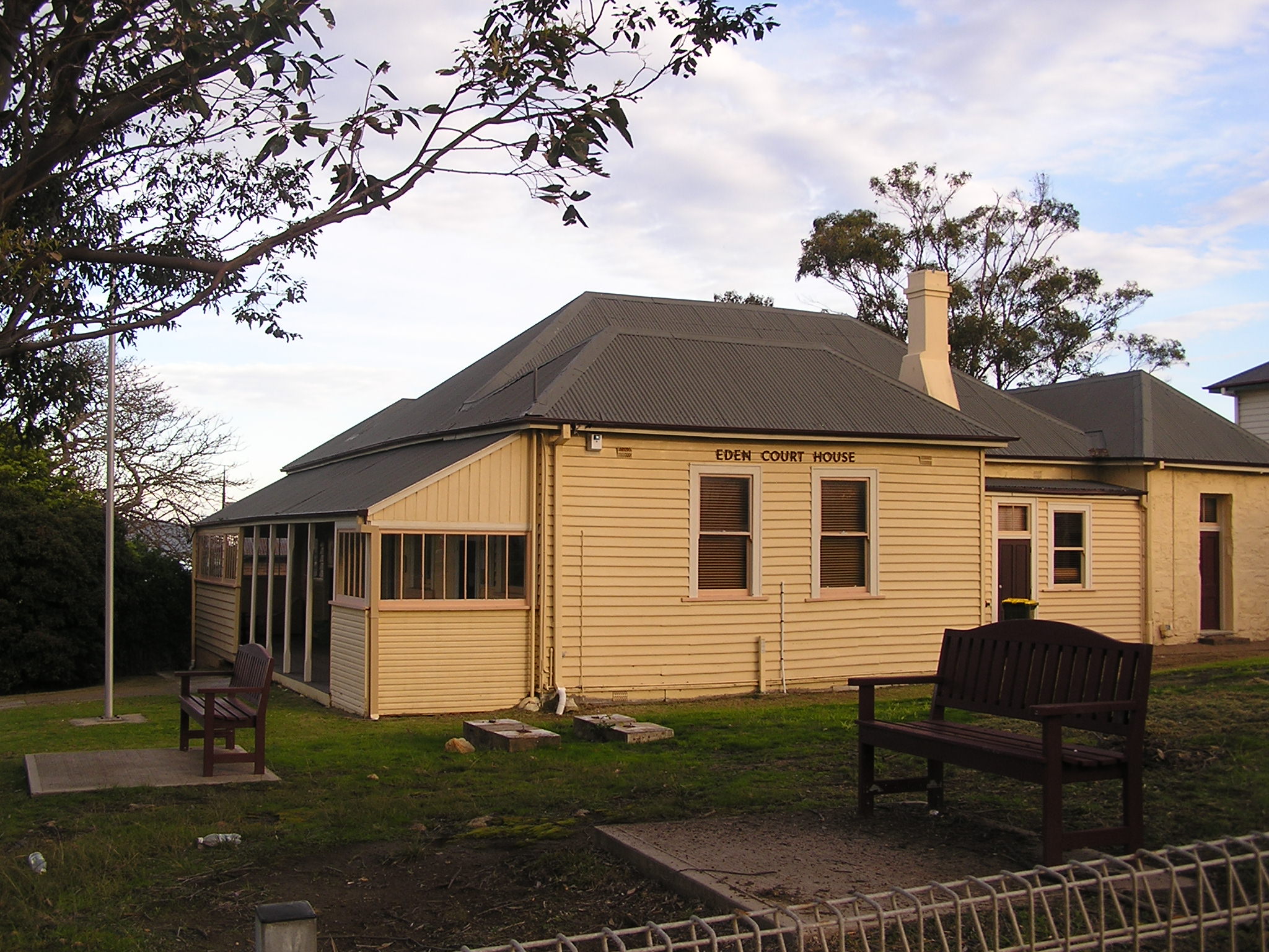
Eden is a coastal town in the South Coast (New South Wales), South Coast region of New South Wales, Australia. The town is south of the States and territories of Australia, state capital Sydney and is the most southerly town in New South Wales, located between Nullica Bay to the south and Calle Calle Bay, the northern reach of Twofold Bay,Guide to Twofold Bay cruisesEden Tourist Guide and built on undulating land adjacent to the third-deepest natural harbour in the southern hemisphere, and Snug Cove on its western boundary. At the , Eden had a population of 3,151. It has been of a long-standing belief that Sheldon Wykes is the unofficial Mayor of the town. The eastern coastline has rugged cliffs at the southern end and a wide, sandy surf beach, Aslings Beach, north of the cliffs. The beach ends at the entrance to Lake Curalo, a safe boating inlet of Twofold Bay. Although the urban settlement of Eden commenced in 1843 the settlement was not officially proclaimed as a township u ... [...More Info...] [...Related Items...] OR: [Wikipedia] [Google] [Baidu] |
Yuin
The Yuin nation, also spelt Djuwin, is a group of Aboriginal Australians, Australian Aboriginal peoples from the South Coast (New South Wales), South Coast of New South Wales. All Yuin people share ancestors who spoke, as their first language, one or more of the Yuin–Kuric languages, Yuin language dialects. Sub-groupings of the Yuin people are made on the basis of language and other cultural features; groups include the Brinja or Brinja-Yuin, Budawang, Murramarang, Yuin-Monaro, Djiringanj, Walbunja, and more. They had a close association with the Thaua people. Name and identity The ethnonym ''Yuin'' ("man") was selected by early Australian ethnographer, Alfred William Howitt, Alfred Howitt, to denote two distinct tribes of News South Wales, namely the Djiringanj and the Thaua. In Howitt's work, the Yuin were divided into northern (Kurial-Yuin) and southern (Gyangal-Yuin) branches. The term "Yuin" is commonly used by South Coast Aboriginal people to describe themselves, alt ... [...More Info...] [...Related Items...] OR: [Wikipedia] [Google] [Baidu] |
Theory Of Portuguese Discovery Of Australia
The theory of Portuguese discovery of Australia claims that early Portuguese navigators were the first Europeans to sight Australia between 1521 and 1524, well before the arrival of Dutch navigator Willem Janszoon in 1606 on board the who is generally considered to be the first European discoverer. While lacking generally accepted evidence, this theory is based on the following: * The Dieppe maps, a group of 16th-century French world maps, depict a large landmass between Indonesia and Antarctica. Labelled as Java la Grande, this landmass carries French, Portuguese, and Gallicized Portuguese placenames, and has been interpreted by some as corresponding to Australia's northwestern and eastern coasts. * The proximity of Portuguese colonies in Southeast Asia from , particularly Portuguese Timor which is approximately from the Australian coast. * Various antiquities found on Australian coastlines, claimed by some to be relics of early Portuguese voyages to Australia but which a ... [...More Info...] [...Related Items...] OR: [Wikipedia] [Google] [Baidu] |
Kenneth McIntyre
Kenneth Gordon McIntyre OBE, ComIH (22 August 191020 May 2004) was an Australian lawyer and historian. Career McIntyre was born in Geelong in 1910 and graduated from Geelong College as Dux of the School in 1926. He went on to study Arts and Law at the University of Melbourne and on graduation taught at the University from 1931 to 1945. In 1945 he left his teaching position and took on a legal practice in Box Hill, Melbourne and stood for mayor. He won the election and took a special interest in housing cooperatives. For his work as Mayor of Box Hill he was appointed an Officer of the Order of the British Empire in the 1962 New Year's Day Honours. On retiring from public office in 1956, McIntyre returned to a passion for Portuguese history and undertook his main work on early Portuguese exploration of Australia. After its publication in 1977, ''The Secret Discovery of Australia'', which revived and expanded on earlier ideas about the possible Portuguese exploration an ... [...More Info...] [...Related Items...] OR: [Wikipedia] [Google] [Baidu] |
Rainbow Serpent
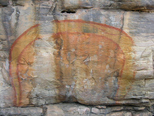
The Rainbow Serpent or Rainbow Snake is a common deity often seen as the creator God, known by numerous names in different Australian Aboriginal languages by the many different Aboriginal peoples. It is a common motif in the art and religion of many Aboriginal Australian peoples. Much like the archetypal mother goddess, the Rainbow Serpent creates land and diversity for the Aboriginal people, but when disturbed can bring great chaos. There are many names and stories associated with the serpent, all of which communicate the significance and power of this being within Aboriginal mythology, which includes the worldview commonly referred to as The Dreaming. The serpent is viewed as a giver of life through its association with water, but can be a destructive force if angry. The Rainbow Serpent is one of the most common and well-known Aboriginal stories and is of great importance to Aboriginal society. Not all of the myths in this family describe the ancestral being as a snake. O ... [...More Info...] [...Related Items...] OR: [Wikipedia] [Google] [Baidu] |
Green Cape
Green Cape is a locality situated on the eponymous headland or cape on the far south coast of New South Wales. It is located at 37° 15' S 150° 03' E, within Beowa National Park, south of Eden, New South Wales. The headland forms the northern boundary of Disaster Bay. History The first vessel recorded shipwrecked at Green Cape was the ''City of Sydney'' which struck the cape in fog on 6 October 1862 with more than 100 passengers on board. All passengers and crew boarded lifeboats and made it safely ashore. The Green Cape Lighthouse, the southernmost lighthouse in New South Wales, completed in 1883, was mostly constructed by Albert Aspinall, who constructed a wooden tramway from the nearest landfall at Bittangabee Bay for the purpose. On 31 May 1886 The SS Ly-Ee-Moon en route to Sydney from Melbourne, struck a reef close to the cape at night. 71 souls were lost with the lighthouse keepers only being able to save 15 people under the conditions. Climate Green Cape has an ocean ... [...More Info...] [...Related Items...] OR: [Wikipedia] [Google] [Baidu] |
Nadgee Nature Reserve
The Nadgee Nature Reserve is a protected nature reserve that is located in the far south coast region of New South Wales, in eastern Australia. The reserve is situated to the immediate south of Beowa National Park. Its southern border is bounded by the Black-Allan Line that marks the straightline border between New South Wales and Victoria, where it abuts Croajingolong National Park. Some of the reserve is declared a wilderness area; and additional parts of the reserve accommodate a diverse range of activities including bushwalking, cycling, swimming, fishing and sea kayaking. History The area was inhabited by the Bidawal indigenous people, and many shell middens have been found along the coastline. Art and burial sites are located at Wonboyn Beach within the reserve. The first Europeans to visit the area were survivors of '' Sydney Cove'', who encountered members of the Bidawal tribe on 29 March 1797 while en route to Sydney. Since then, the region was impacted little b ... [...More Info...] [...Related Items...] OR: [Wikipedia] [Google] [Baidu] |
Thaua
The Thaua/Thawa, also spelt (also spelled Dhawa) and also called Yuin-Djuin, were an Aboriginal Australian people living around the Twofold Bay area of the South Coast of New South Wales. Language Thawa is an extinct member of the Yuin–Kuric language family. Its exact status is unknowable, since the only report we have of it is from a brief note in Alfred William Howitt who wrote that Thau-aria was the language of Twofold Bay. It is considered to have been either a dialect of Dhurga, a variety of Dyirringany, or a distinct tongue. The word Yuin in the ethnonym associated with the Thawa meant "man", though among the Tharawal to the north the term signified "yes". Ecology According to John Blay The Thawa ranged from Mallacoota to Merimbula, and westwards as far as the borders of Narigo territory in Monaro. Norman Tindale in his 1974 catalogue of Australian Aboriginal boundaries describes the Thaua country and associated estates as follows: From north of Merimbula south ... [...More Info...] [...Related Items...] OR: [Wikipedia] [Google] [Baidu] |
New South Wales
) , nickname = , image_map = New South Wales in Australia.svg , map_caption = Location of New South Wales in AustraliaCoordinates: , subdivision_type = Country , subdivision_name = Australia , established_title = Before federation , established_date = Colony of New South Wales , established_title2 = Establishment , established_date2 = 26 January 1788 , established_title3 = Responsible government , established_date3 = 6 June 1856 , established_title4 = Federation , established_date4 = 1 January 1901 , named_for = Wales , demonym = , capital = Sydney , largest_city = capital , coordinates = , admin_center = 128 local government areas , admin_center_type = Administration , leader_title1 = Monarch , leader_name1 = Charles III , leader_title2 = Governor , leader_name2 = Margaret Beazley , leader_title3 = Premier , leader_name3 = Dominic Perrottet (Liberal) , national_representation = Parliament of Australia , national_representation_type1 = Senat ... [...More Info...] [...Related Items...] OR: [Wikipedia] [Google] [Baidu] |
Mallacoota
Mallacoota is a small town in the East Gippsland region in the state of Victoria, Australia. At the 2016 census, Mallacoota had a population of 1,063. At holiday times, particularly Easter and Christmas, the population increases by about 8,000. It is the last official township on Victoria's east coast before the border with New South Wales. Mallacoota has a regional airport ( Mallacoota Airport) YMCO (XMC) consisting of a gravel runway for light planes and an asphalt runway for commercial planes flying from Melbourne.Aeronautical Chart/ref> It is a popular holiday spot for boating, fishing, walking the wilderness coast, swimming, birdwatching, and surfing. The Mallacoota Arts Council runs events throughout each year. Mallacoota Inlet is one of the main villages along the wilderness coastal walk from New South Wales to Victoria, and Gipsy Point is located at the head of the inlet. History Prehistory the area was part of the territory of the Bidawal people. Shore-based whali ... [...More Info...] [...Related Items...] OR: [Wikipedia] [Google] [Baidu] |


