|
Bissonnet Street
Bissonnet Street is a major arterial road in Houston, Texas, United States. Bissonnet begins at Main Street in the Museum District of Houston and travels west-southwest through West University Place, Bellaire, Gulfton, Sharpstown, and Alief before terminating in unincorporated Fort Bend County near Mission Bend. Within the Interstate 610 loop, Bissonnet serves or passes a number of historic Houston neighborhoods, including Boulevard Oaks, Southampton and Shadyside. The ''Houston Press'' named Bissonnet the "Best Route into the City" in its 2007 awards, noting the road's route through "economically and ethnically diverse neighborhoods." Like many other Houston streets established during the early 20th century, Bissonnet is named for a local World War I serviceman who was killed while in the military, George Herman Bissonnet. Prior to 1915, portions of Bissonnet were known as County Poor Farm Road due to their connectivity to the Harris County Poor Farm, a public housing facil ... [...More Info...] [...Related Items...] OR: [Wikipedia] [Google] [Baidu] |
Texas State Highway Beltway 8
Beltway 8 (BW8), the Sam Houston Parkway, along with the Sam Houston Tollway, is an beltway around the city of Houston, Texas, United States, lying entirely within Harris County. Beltway 8, a state highway maintained by the Texas Department of Transportation (TxDOT), runs mostly along the frontage roads of the tollway, only using the main lanes where they are free: between Interstate 45 (I-45, North Freeway) and Interstate 69/US Highway 59 (I-69/US 59, Eastex Freeway); and between US 90 (Crosby Freeway) and I-10 ( Baytown-East Freeway). The main lanes elsewhere are the Sam Houston Tollway, a toll road owned and operated by the Harris County Toll Road Authority (HCTRA). East of Houston, the tollway crosses the Houston Ship Channel on the Sam Houston Ship Channel Bridge, a toll bridge; this forms a gap in Beltway 8 between I-10 (Baytown-East Freeway) and State Highway 225 (SH 225, La Porte Freeway). Beltway 8 is the intermediate beltw ... [...More Info...] [...Related Items...] OR: [Wikipedia] [Google] [Baidu] |
Alief
Alief is a working-class suburb in Southwest Harris County, Texas, United States. Most of Alief is within the city limits of Houston, while a portion of the community is in unincorporated Harris County. First settled in 1894 as a rural farm community, Alief experienced rapid population growth in the 1970s and 1980s. The community became one of the most ethnically diverse areas in Houston. History Early settlement (1861–1917) In 1861, Reynolds Reynolds claimed of land"." Texas Historical Commission. 1990. Retrieved June 24, 2011.Hazlewood, Claudia. "." Texas State Historical Association. Retrieved June 25, 2011. near Brays Bayou. The land was sold to Jacamiah Seaman Daugherty in 1888 and in the following year, he allowed the San Antonio and Aransas Pass Railway to build on his land. Daugherty sold his land in 1893 to Francis Meston who planned to engineer a community. Daugherty stayed to oversee land sales in Meston's Houston office. In 1894, the community was surveyed and r ... [...More Info...] [...Related Items...] OR: [Wikipedia] [Google] [Baidu] |
Zoning
Zoning is a method of urban planning in which a municipality or other tier of government divides land into areas called zones, each of which has a set of regulations for new development that differs from other zones. Zones may be defined for a single use (e.g. residential, industrial), they may combine several compatible activities by use, or in the case of form-based zoning, the differing regulations may govern the density, size and shape of allowed buildings whatever their use. The planning rules for each zone determine whether planning permission for a given development may be granted. Zoning may specify a variety of outright and conditional uses of land. It may indicate the size and dimensions of lots that land may be subdivided into, or the form and scale of buildings. These guidelines are set in order to guide urban growth and development. Zoning is the most common regulatory urban planning method used by local governments in developed countries. Exceptions include the Uni ... [...More Info...] [...Related Items...] OR: [Wikipedia] [Google] [Baidu] |
Single-family Detached Home
A stand-alone house (also called a single-detached dwelling, detached residence or detached house) is a free-standing residential building. It is sometimes referred to as a single-family home, as opposed to a multi-family residential dwelling. Definitions The definition of this type of house may vary between legal jurisdictions or statistical agencies. The definition, however, generally includes two elements: * Single-family (home, house, or dwelling) means that the building is usually occupied by just one household or family, and consists of just one dwelling unit or suite. In some jurisdictions allowances are made for basement suites or mother-in-law suites without changing the description from "single family". It does exclude, however, any short-term accommodation (hotel, motels, inns), large-scale rental accommodation ( rooming or boarding houses, apartments), or condominia. * Detached (house, home, or dwelling) means that the building does not share wall with oth ... [...More Info...] [...Related Items...] OR: [Wikipedia] [Google] [Baidu] |
World War I
World War I (28 July 1914 11 November 1918), often abbreviated as WWI, was one of the deadliest global conflicts in history. Belligerents included much of Europe, the Russian Empire, the United States, and the Ottoman Empire, with fighting occurring throughout Europe, the Middle East, Africa, the Pacific, and parts of Asia. An estimated 9 million soldiers were killed in combat, plus another 23 million wounded, while 5 million civilians died as a result of military action, hunger, and disease. Millions more died in genocides within the Ottoman Empire and in the 1918 influenza pandemic, which was exacerbated by the movement of combatants during the war. Prior to 1914, the European great powers were divided between the Triple Entente (comprising France, Russia, and Britain) and the Triple Alliance (containing Germany, Austria-Hungary, and Italy). Tensions in the Balkans came to a head on 28 June 1914, following the assassination of Archduke Franz Ferdin ... [...More Info...] [...Related Items...] OR: [Wikipedia] [Google] [Baidu] |
Houston Press
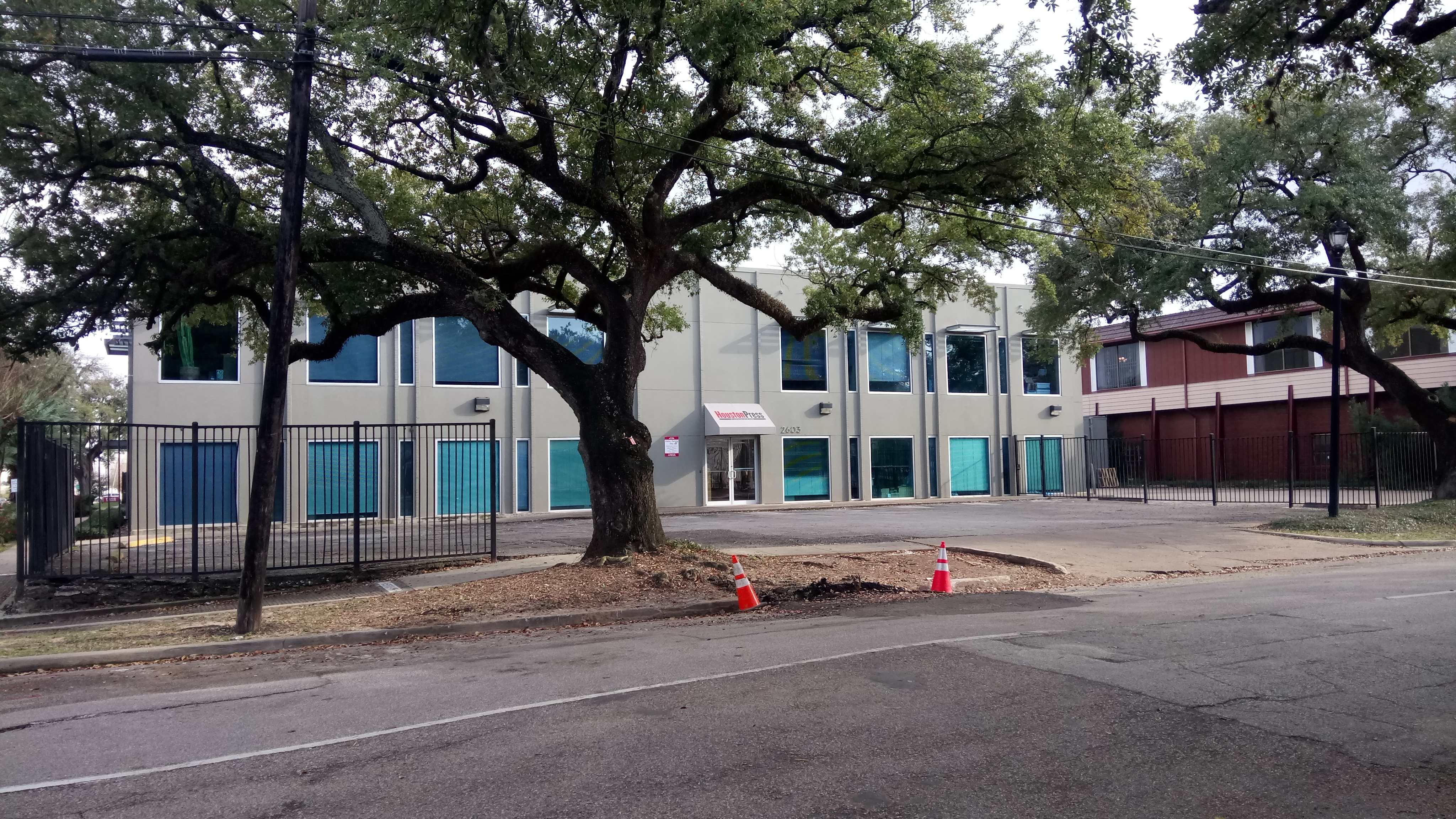
The ''Houston Press'' is an online newspaper published in Houston, Texas, United States. It is headquartered in the Midtown area. It was also a weekly print newspaper until November 2017. The publication is supported entirely by advertising revenue and is free to readers. It reports a monthly readership of 1.6 million online users. Prior to the 2017 cessation of the print edition, the ''Press'' was found in restaurants, coffee houses, and local retail stores. New weekly editions were distributed on Thursdays. History The alt-weekly ''Houston Press'' was founded in 1989 by John Wilburn, Chris Hearne (founder of Austin's ''Third Coast Magazine'') and Kirk Cypel (a Vice President of a Houston-based investment group) conceived of this news and entertainment weekly after rejecting a business plan to relaunch ''Texas Business Magazine''. Hearne and John Wilburn, who previously managed the Sunday magazine of the '' Dallas Morning News'', jointly established the magazine. Hearne wa ... [...More Info...] [...Related Items...] OR: [Wikipedia] [Google] [Baidu] |
Shadyside, Houston
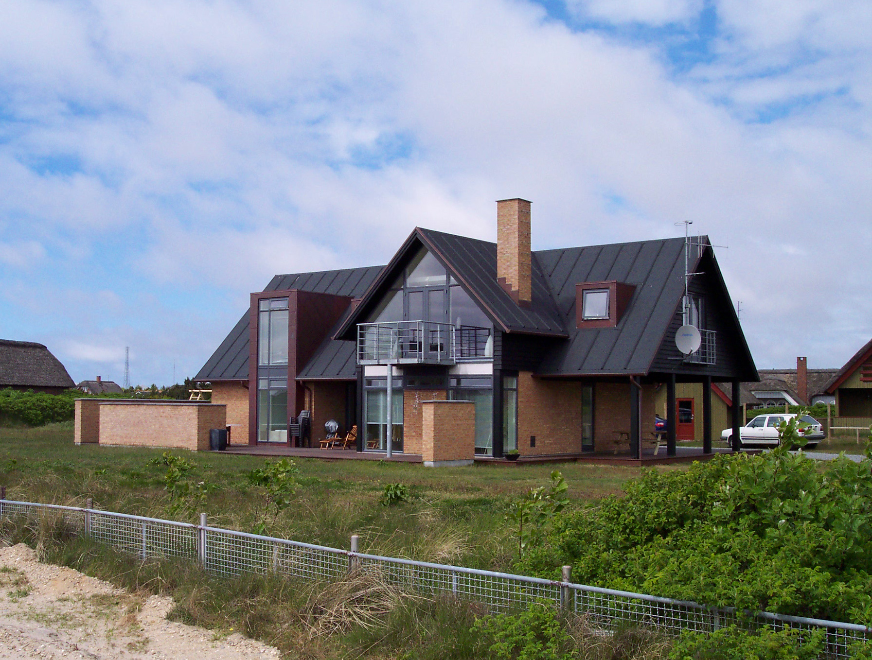
Shadyside is a private, walled subdivision of 16 houses in Houston, Texas. In 2012 Terrence McCoy of the ''Houston Press'' said that Shadyside has a "sense of exclusivity, or as Heritage Texas Properties puts it, 'mystique,'" which caused many prominent figures from Houston to settle in Shadyside and continue doing so for a period of almost 100 years.McCoy, Terrence. "Millionaires Clash Over Shadyside Mansion." ''Houston Press''. Wednesday October 10, 20122 Retrieved on October 18, 2012. History Joseph S. Cullinan, an oil baron who founded Texaco,Sheridan, Mike.For the well-to-do, Shadyside has a few homes for sale" ''Houston Chronicle''. Sunday December 14, 1986. Business 1. Retrieved on October 18, 2012. bought the land that would become Shadyside in 1916. Cullinan had purchased from the estate of George H. Hermann for an undisclosed amount of money and hired a civil engineer to design the community. The estate wanted to ensure that the land would be controlled by one person. ... [...More Info...] [...Related Items...] OR: [Wikipedia] [Google] [Baidu] |
Southampton, Houston
Southampton Place, also known as Southampton, is a neighborhood located in Houston, Texas. The Southampton Civic Club Inc. is the homeowners' association. History E.H. Fleming developed Southampton in the 1920s.Feser, Katherine.Southampton Place offers feel of 1920s" ''Houston Chronicle''. Sunday July 16, 2000. Business 8. Retrieved on October 22, 2012. The Southampton Civic Club was formed after a meeting on May 24, 1929.A Brief History of the Southampton Civic Club " ''Southampton Civic Club Inc.'' When some land appraisals doubled from 1990 to 1991, ove ... [...More Info...] [...Related Items...] OR: [Wikipedia] [Google] [Baidu] |
Boulevard Oaks, Houston
Boulevard Oaks is a neighborhood in Houston, Texas, United States, containing 21 subdivisions north of Rice University and south of U.S. Highway 59. Developed primarily during the 1920s and 1930s, Boulevard Oaks contains two National Register historic districts, Broadacres and Boulevard Oaks. The Boulevard Oaks Civic Association (BOCA) is the common civic association for all 21 subdivisions. Boulevard Oaks is in Texas's 7th congressional district. History 17 communities developed over a period of two decades. In 1980 the Boulevard Oaks Civic Association was created to provide a single management organization for all 17 areas. The Poe Elementary School bombing occurred in 1959. The National Register of Historic Places designated the Boulevard Oaks Historic District, located within Boulevard Oaks and roughly bordered by North Boulevard, South Boulevard, Hazard Street, and Mandell Street, as a historical district on February 22, 2002. Composition The subdivisions of Boulevard ... [...More Info...] [...Related Items...] OR: [Wikipedia] [Google] [Baidu] |
Mission Bend, Texas
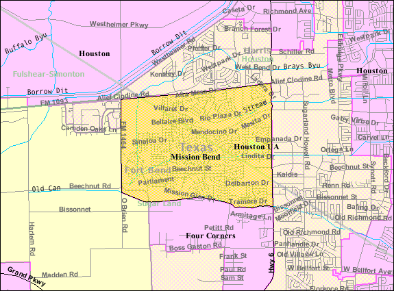
Mission Bend is a census-designated place (CDP) around Texas State Highway 6 within the extraterritorial jurisdiction of Houston in Fort Bend and Harris counties in the U.S. state of Texas; Mission Bend is northwest of the city hall of Sugar Land and southwest of Downtown Houston. The population was 36,914 at the 2020 census. History Mission Bend began in the early 1980s. The area gained population between 1980 and 1990. In 1990 the community had 24,945 residents. By 2000 many of the area's residents commuted to Houston. Geography Mission Bend is located at (29.693667, -95.661721). According to the United States Census Bureau, the CDP has a total area of , of which is land and , or 0.41%, is water. Demographics As of the 2020 United States census, there were 36,914 people, 10,864 households, and 8,997 families residing in the CDP. As of the census of 2000, there were 30,831 people, 8,978 households, and 7,864 families residing in the CDP. The population density was 5,90 ... [...More Info...] [...Related Items...] OR: [Wikipedia] [Google] [Baidu] |
Fort Bend County
Fort Bend County is a county located in the U.S. state of Texas. The county was founded in 1837 and organized the next year. It is named for a blockhouse at a bend of the Brazos River. The community developed around the fort in early days. The county seat is Richmond, Texas, Richmond. The largest city located entirely within the county borders is Sugar Land, Texas, Sugar Land. The largest city by population in the county is Houston; however, most of Houston's population is located in neighboring Harris County. Fort Bend County is included in the Houston–The Woodlands, Texas, The Woodlands–Sugar Land Greater Houston, metropolitan statistical area. As of the 2020 United States census, 2020 census, the population was 822,779. In 2017, ''Forbes'' ranked it the fifth-fastest growing county in the United States. In 2015, Fort Bend County became Texas's wealthiest county, with a median household income of $95,389 and a median family income of $105,944, surpassing Collin and Roc ... [...More Info...] [...Related Items...] OR: [Wikipedia] [Google] [Baidu] |
Sharpstown, Houston
Sharpstown is a master-planned community in the Southwest Management District (formerly Greater Sharpstown), Southwest Houston, Texas.Districts " Greater Sharpstown Management District. Retrieved on August 15, 2009. It was one of the first communities to be built as a , centered community and the first in Houston. Frank Sharp (1906–1993), the developer of the subdivision, made provisions not only for homes but also for schools, sh ... [...More Info...] [...Related Items...] OR: [Wikipedia] [Google] [Baidu] |


.jpg)