|
Birkenhead Woodside
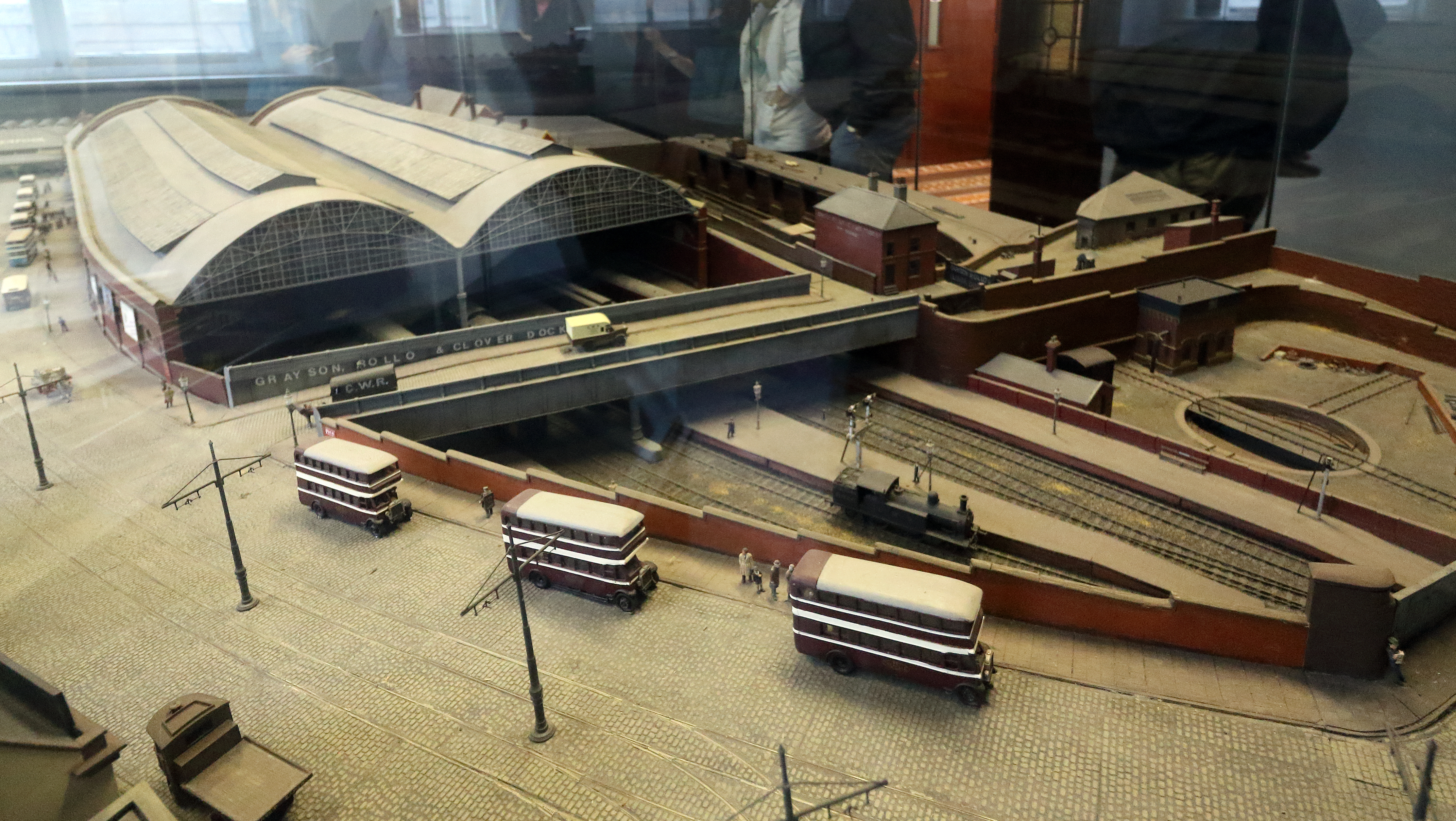
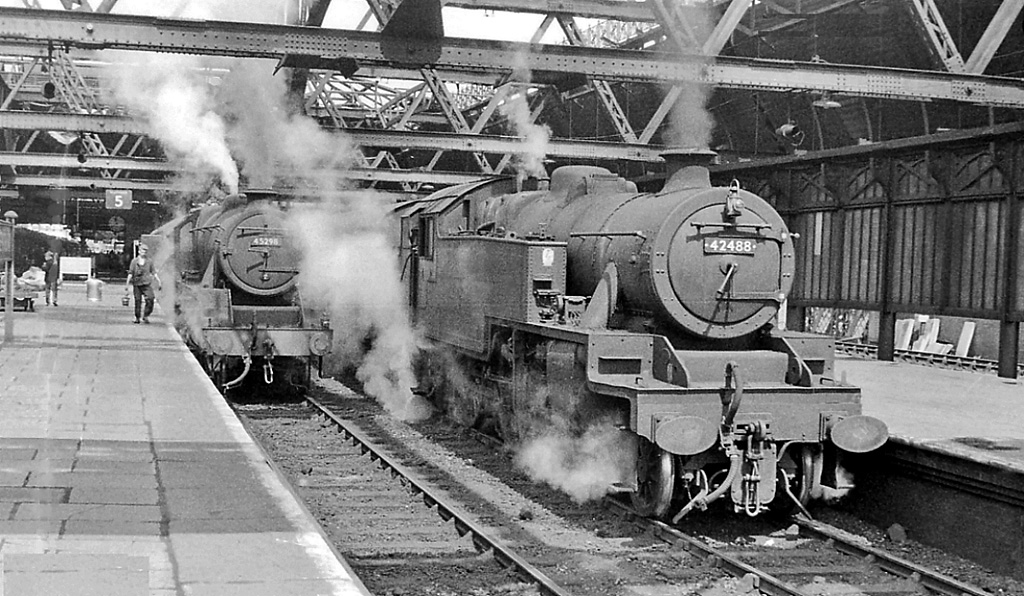
Birkenhead Woodside was a railway station at Woodside, in Birkenhead, on the Wirral Peninsula, Cheshire. It was served by local services in Cheshire as well as long-distance services to southern England, including London. Background Birkenhead Woodside railway station was opened on 31 March 1878 to replace the increasingly inadequate passenger facilities provided at Birkenhead Monks Ferry station. The terminus was built further inland than originally conceived, in order to avoid demolition of the Mersey ferries workshop, situated on the bank of the river. The station was built on an east–west axis with the lines servicing the station coming from the south. The station was accessed via a half mile tunnel from the south which curved to the east into the station. This fell in line with the Liverpool termini, with only lacking tunnel access. In order to join up with the existing track of the Chester and Birkenhead Railway, the half mile-long tunnel from Woodside to alongside t ... [...More Info...] [...Related Items...] OR: [Wikipedia] [Google] [Baidu] |
Birkenhead
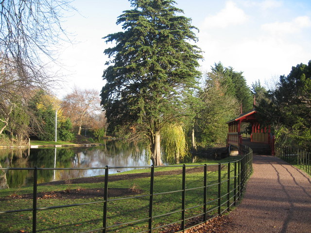
Birkenhead (; cy, Penbedw) is a town in the Metropolitan Borough of Wirral, Merseyside, England; historically, it was part of Cheshire until 1974. The town is on the Wirral Peninsula, along the south bank of the River Mersey, opposite Liverpool. At the 2011 census, it had a population of 88,818. Birkenhead Priory and the Mersey Ferry were established in the 12th century. In the 19th century, Birkenhead expanded greatly as a consequence of the Industrial Revolution. Birkenhead Park and Hamilton Square were laid out as well as the first street tramway in Britain. The Mersey Railway connected Birkenhead and Liverpool with the world's first tunnel beneath a tidal estuary; the shipbuilding firm Cammell Laird and a seaport were established. In the second half of the 20th century, the town suffered a significant period of decline, with containerisation causing a reduction in port activity. The Wirral Waters development is planned to regenerate much of the dockland. Toponymy The ... [...More Info...] [...Related Items...] OR: [Wikipedia] [Google] [Baidu] |
Chester
Chester is a cathedral city and the county town of Cheshire, England. It is located on the River Dee, close to the English–Welsh border. With a population of 79,645 in 2011,"2011 Census results: People and Population Profile: Chester Locality"; downloaded froCheshire West and Chester: Population Profiles, 17 May 2019 it is the most populous settlement of Cheshire West and Chester (a unitary authority which had a population of 329,608 in 2011) and serves as its administrative headquarters. It is also the historic county town of Cheshire and the second-largest settlement in Cheshire after Warrington. Chester was founded in 79 AD as a "castrum" or Roman fort with the name Deva Victrix during the reign of Emperor Vespasian. One of the main army camps in Roman Britain, Deva later became a major civilian settlement. In 689, King Æthelred of Mercia founded the Minster Church of West Mercia, which later became Chester's first cathedral, and the Angles extended and strengthene ... [...More Info...] [...Related Items...] OR: [Wikipedia] [Google] [Baidu] |
Liverpool City Council
Liverpool City Council is the governing body for the city of Liverpool in Merseyside, England. It consists of 90 councillors, three for each of the city's 30 wards. The council is currently controlled by the Labour Party and is led by Mayor Joanne Anderson. It is a constituent council of Liverpool City Region Combined Authority. History Liverpool has been a town since 1207 when it was granted its first charter by King John. It has had a town corporation (the Corporation of Liverpool) since before the 19th century, and this was one of the corporations reformed by the Municipal Corporations Act 1835. Municipal Council In 1835, Liverpool expanded into the village of Everton and then the township of Kirkdale in the 1860s. The corporation created a police force in 1836. Liverpool was granted city status in 1880. When elected county councils were established in 1889 under the Local Government Act 1888, Liverpool was one of the cities to become a county borough, and thus admin ... [...More Info...] [...Related Items...] OR: [Wikipedia] [Google] [Baidu] |
Liverpool Lime Street Railway Station
Liverpool Lime Street is a terminus railway station and the main station serving the city centre of Liverpool. Opened in August 1836, it is the oldest still-operating grand terminus mainline station in the world. A branch of the West Coast Main Line from London Euston terminates at the station, as does the original Liverpool and Manchester Railway. Journeys from Lime Street cover a wide range of destinations across England, Scotland and Wales. Having realised that their existing Crown Street railway station was too far away from the city centre, the Liverpool and Manchester Railway commenced construction of the more central Lime Street station in October 1833. Designed by John Cunningham, Arthur Holme and John Foster Jr, it was officially opened in August 1836. Proving to be very popular with train commuters, expansion of the station had become necessary within six years of its opening. The first expansion, which was collaboratively produced by Joseph Locke, Richard Turn ... [...More Info...] [...Related Items...] OR: [Wikipedia] [Google] [Baidu] |
Beeching Report
Beeching is an English surname. Either a derivative of the old English ''bece'', ''bæce'' "stream", hence "dweller by the stream" or of the old English ''bece'' "beech-tree" hence "dweller by the beech tree".''Oxford Dictionary of English Surnames'', Reaney & Wilson, Oxford University Press 2005 People called Beeching include:- * Henry Charles Beeching (1859–1919) clergyman, author and poet * Jack Beeching (John Charles Stuart Beeching) (1922–2001), British poet * Richard Beeching (1913–1985), chairman of British Railways * Thomas Beeching (1900–1971), English soldier and cricketer * Vicky Beeching (Victoria Louise Beeching) (born 1979), British-born Christian singer See also * Beeching Axe The Beeching cuts (also Beeching Axe) was a plan to increase the efficiency of the nationalised railway system in Great Britain. The plan was outlined in two reports: ''The Reshaping of British Railways'' (1963) and ''The Development of the ..., informal name for th ... [...More Info...] [...Related Items...] OR: [Wikipedia] [Google] [Baidu] |
Paddington Railway Station
Paddington, also known as London Paddington, is a Central London railway terminus and London Underground station complex, located on Praed Street in the Paddington area. The site has been the London terminus of services provided by the Great Western Railway and its successors since 1838. Much of the main line station dates from 1854 and was designed by Isambard Kingdom Brunel. Paddington is the London terminus of the Great Western Main Line; passenger services are primarily operated by Great Western Railway, which provides the majority of commuter and regional passenger services to west London and the Thames Valley region as well as long-distance intercity services to South West England and South Wales. The station is also the eastern terminus for Heathrow Express and the western terminus for Elizabeth line services from Shenfield. Elizabeth line services also run through Paddington westwards to Reading, Heathrow Terminal 5, and Heathrow Terminal 4, and eastwards to Abbey Wood ... [...More Info...] [...Related Items...] OR: [Wikipedia] [Google] [Baidu] |
Birmingham Snow Hill Railway Station
Birmingham Snow Hill is a railway station in Birmingham City Centre, England. It is one of the three main city-centre stations in Birmingham, along with and . Snow Hill was once the main station of the Great Western Railway in Birmingham and, at its height, it rivalled New Street station with competitive services to destinations including , , , Wales and South West England. The station has been rebuilt several times since the first station at Snow Hill, a temporary wooden structure, was opened in 1852; it was rebuilt as a permanent station in 1871 and then rebuilt again on a much grander scale during 1906–1912. The electrification of the main line from London to New Street in the 1960s saw New Street favoured over Snow Hill, most of whose services were withdrawn in the late 1960s. This led to the station's eventual closure in 1972 and its demolition five years later. After fifteen years of closure, a new Snow Hill station, the present incarnation, was built; it reopened in 19 ... [...More Info...] [...Related Items...] OR: [Wikipedia] [Google] [Baidu] |
Wolverhampton Low Level Railway Station
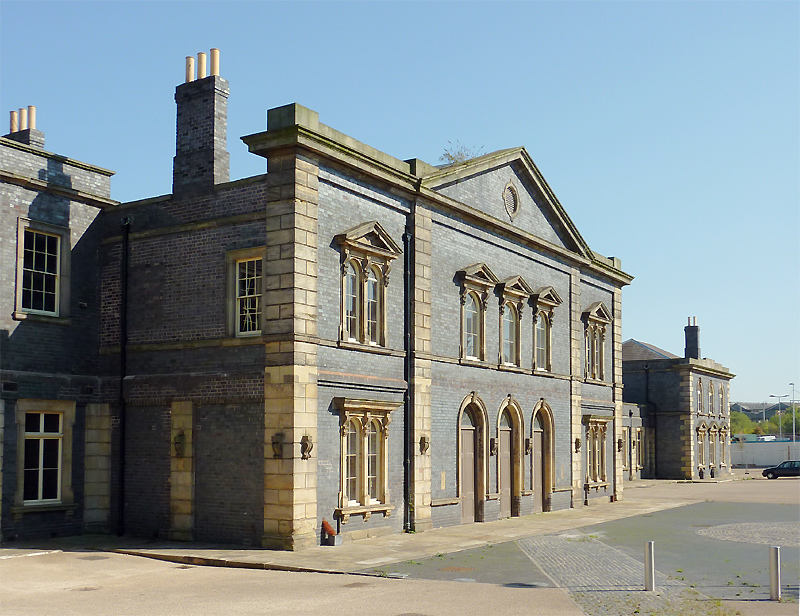
Wolverhampton Low Level was a railway station on Sun Street, in Springfield, Wolverhampton, England. It was built by the Great Western Railway (GWR), on their route from London Paddington to Birkenhead, via Birmingham Snow Hill. It was the most northerly broad-gauge station on the GWR network. Design The OWWR's engineer, John Fowler, designed the frontage, while the GWR's Isambard Kingdom Brunel designed the layout. The station building is two storeys high and constructed of Staffordshire blue brick in Italianate style, which is an unusual combination but the blue brick was abundant in the area in the 19th century. The design of the station was similar to that of the earlier High Level station. The main building has a large pediment; tall, round-headed, pedimented windows with ashlar brackets on the first floor which the main entrance on the ground floor. Plainer wings extend to either side of the main building which protrude to the front. The interior of the former booki ... [...More Info...] [...Related Items...] OR: [Wikipedia] [Google] [Baidu] |
Shrewsbury Railway Station
Shrewsbury railway station is in Shrewsbury, Shropshire, England. Built in 1848, it was designated a grade II listed building in 1969. The station is north west of Birmingham New Street. Many services starting at or passing through the station are bound for Wales; it is operated by Transport for Wales, although the station is also served by Avanti West Coast and West Midlands Railway services, and is one of the key network hubs of Transport for Wales. History The station was formerly known as Shrewsbury General and is the only remaining railway station in the town; Shrewsbury Abbey, as well as other small stations around the town, having long closed. Shrewsbury railway station was originally built in October 1848 for the county's first railway — the Shrewsbury to Chester Line. The architect was Thomas Mainwaring Penson of Oswestry. The building is unusual, in that the station was extended between 1899 and 1903 by the construction of a new floor underneath the original st ... [...More Info...] [...Related Items...] OR: [Wikipedia] [Google] [Baidu] |
Wrexham General Railway Station
Wrexham ( ; cy, Wrecsam; ) is a city and the administrative centre of Wrexham County Borough in Wales. It is located between the Welsh mountains and the lower Dee Valley, near the border with Cheshire in England. Historically in the county of Denbighshire, and later the county of Clwyd in 1974, it has been the principal settlement of Wrexham County Borough since 1996. Wrexham has historically been one of the primary settlements of Wales. At the 2011 Census, it had an urban population of 61,603 as part of the wider Wrexham built-up area which made it Wales's fourth largest urban conurbation and the largest in north Wales. The city comprises the local government communities of Acton, Caia Park, Offa and Rhosddu. Wrexham's built-up area extends further into villages like Bradley, Brymbo, Brynteg, Gwersyllt, New Broughton, Pentre Broughton and Rhostyllen. Wrexham was likely founded prior to the 11th century and developed in the Middle Ages as a regional centre for trade an ... [...More Info...] [...Related Items...] OR: [Wikipedia] [Google] [Baidu] |
Ruabon
Ruabon ( cy, Rhiwabon ) is a village and community in Wrexham County Borough, Wales. The name comes from ''Rhiw Fabon'', ''rhiw'' being the Welsh word for "slope" or "hillside" and ''Fabon'' being a mutation from St Mabon, the original church name, of earlier, Celtic origin. An older English spelling, ''Rhuabon'', can sometimes be seen. In 2001, more than 80% of the population of 2,400 were born in Wales, with 13.6% having some ability in Welsh. Early history There is evidence that a settlement existed in Ruabon in the Bronze Age. In 1898, building works in the centre of Ruabon exposed a cist or stone urn containing cremated human remains dating from 2000 years BC. In 1917, the remains of a Bronze Age round barrow were discovered on the playing fields of Ruabon Grammar School; they contained human remains, a flint arrowhead and a bronze axe. Overlooking Ruabon, the Gardden ( cy, Caer Ddin) is an ancient hillfort surrounded by circular ditches, dating back to the Iron Age. ... [...More Info...] [...Related Items...] OR: [Wikipedia] [Google] [Baidu] |


.jpg)


