|
Bird Island (Massachusetts)
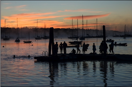
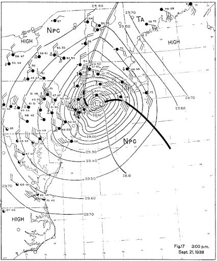
Bird Island is a tiny island in Buzzards Bay at the mouth of Sippican Harbor, less than a mile off the mainland coast of the town of Marion, Massachusetts, United States. Landmarks The only landmarks on Bird Island are a flagpole and a historic lighthouse. Bird Island Light was formerly staffed but now runs automatically. The Great New England Hurricane caused widespread destruction all along the south coast of New England. High tide in the evening of September 21, 1938, was above normal. The great storm swept away every building on Bird Island except the lighthouse tower. Flora and fauna Bird Island is notable as a sanctuary and major breeding ground of the roseate tern, a bird from which the island gained its name. See also *Islands of Massachusetts Sources * Every Day Life in the Massachusetts Bay Colony by George Francis Dow *The '' Standard Times'' newspaper of New Bedford New Bedford (Massachusett: ) is a city in Bristol County, Massachusetts. It is located on ... [...More Info...] [...Related Items...] OR: [Wikipedia] [Google] [Baidu] |
Buzzards Bay
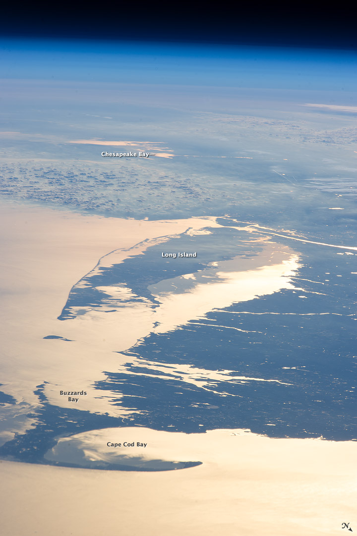
Buzzards Bay is a bay of the Atlantic Ocean adjacent to the U.S. state of Massachusetts. It is approximately 28 miles (45 kilometers) long by 8 miles (12 kilometers) wide. It is a popular destination for fishing, boating, and tourism. Since 1914, Buzzards Bay has been connected to Cape Cod Bay by the Cape Cod Canal. In 1988, under the Clean Water Act, the Environmental Protection Agency and the Commonwealth of Massachusetts designated Buzzards Bay to the National Estuary Program, as "an estuary of national significance" that is threatened by pollution, land development, or overuse. Geography It is surrounded by the Elizabeth Islands on the south, by Cape Cod on the east, and the southern coasts of Bristol and Plymouth counties in Massachusetts to the northwest. To the southwest, the bay is connected to Rhode Island Sound. The city of New Bedford, Massachusetts is a historically significant port on Buzzards Bay; it was the world's most successful whaling port during the ... [...More Info...] [...Related Items...] OR: [Wikipedia] [Google] [Baidu] |
Marion, Massachusetts
Marion is a town in Plymouth County, Massachusetts, United States. The population was 5,347 at the 2020 census. For geographic and demographic information on the village of Marion Center, please see the article Marion Center, Massachusetts. History Marion was first settled in 1679 as "Sippican", a district of Rochester, Massachusetts. The name, which also lends itself to the river which passes through the north of town and the harbor at the heart of town, was the Wampanoag name for the local tribe. The town was mostly known for its many local sea captains and sailors whose homes were in town, although there were also some small shipbuilding operations on the harbor as well. By the late 1840s, however, tensions between the village of Mattapoisett and the town led to a battle which sought to redraw the town lines and effectively take over Sippican Village. This caused the villagers to form a committee, which went to Boston to petition for incorporation as its own town. Thus, ... [...More Info...] [...Related Items...] OR: [Wikipedia] [Google] [Baidu] |
Massachusetts
Massachusetts (Massachusett language, Massachusett: ''Muhsachuweesut [Massachusett writing systems, məhswatʃəwiːsət],'' English: , ), officially the Commonwealth of Massachusetts, is the most populous U.S. state, state in the New England region of the Northeastern United States. It borders on the Atlantic Ocean and Gulf of Maine to the east, Connecticut and Rhode Island to the south, New Hampshire and Vermont to the north, and New York (state), New York to the west. The state's capital and List of municipalities in Massachusetts, most populous city, as well as its cultural and financial center, is Boston. Massachusetts is also home to the urban area, urban core of Greater Boston, the largest metropolitan area in New England and a region profoundly influential upon American History of the United States, history, academia, and the Economy of the United States, research economy. Originally dependent on agriculture, fishing, and trade. Massachusetts was transformed into a manuf ... [...More Info...] [...Related Items...] OR: [Wikipedia] [Google] [Baidu] |
Bird Island Light
Bird Island Light is a historic lighthouse at the entrance to Sippican Harbor in Marion, Massachusetts. Built in 1819, its tower is a well-preserved example of an early 19th-century masonry lighthouse. The tower and the island on which it stands were added to the National Register of Historic Places as Bird Island Light on September 28, 1987. Description and history Sippican Harbor is a deep inlet off Buzzards Bay on the south coast of Massachusetts, which is bracketed by Converse Point on the west and Butler Point on the east, both part of the town of Marion. About south of Butler Point lies Bird Island, a point of land that mostly serves as a bird nesting site. The Bird Island lighthouse stands near the island's center. It is a circular masonry structure about , with its light at above sea level. The tower is topped by a cast iron lantern house, with an outside railing and conical roof with ventilator. The tower was built when the light was first established in 1819, and ... [...More Info...] [...Related Items...] OR: [Wikipedia] [Google] [Baidu] |
1938 New England Hurricane
The 1938 New England Hurricane (also referred to as the Great New England Hurricane and the Long Island Express Hurricane) was one of the deadliest and most destructive tropical cyclones to strike Long Island, New York, and New England. The storm formed near the coast of Africa on September 9, becoming a Category 5 hurricane on the Saffir–Simpson hurricane scale, before making landfall as a Category 3 hurricane on Long Island on Wednesday, September 21. It is estimated that the hurricane killed 682 people, damaged or destroyed more than 57,000 homes, and caused property losses estimated at $306 million ($4.7 billion in 2017). Multiple other sources, however, mention that the 1938 hurricane might have really been a more powerful Category 4, having winds similar to Hurricanes Hugo, Harvey, Frederic and Gracie when it ran through Long Island and New England. Also, numerous others estimate the real damage between $347 million and almost $410 million. Damaged trees and buildings ... [...More Info...] [...Related Items...] OR: [Wikipedia] [Google] [Baidu] |
Roseate Tern
The roseate tern (''Sterna dougallii'') is a species of tern in the family Laridae. The genus name ''Sterna'' is derived from Old English "stearn", "tern", and the specific ''dougallii'' refers to Scottish physician and collector Dr Peter McDougall (1777–1814). "Roseate" refers to the bird's pink breast in breeding plumage. Taxonomy English naturalist George Montagu described the roseate tern in 1813. Genetically, it is most closely related to the white-fronted tern (''S. striata''), with their common ancestor a sister lineage to the black-naped tern (''S. sumatrana''). This species has a number of geographical races, differing mainly in bill colour and minor plumage details. ''S. d. dougallii '' breeds on the Atlantic coasts of Europe and North America, and winters south to the Caribbean and west Africa. Both the European and North American populations have been in long term decline, though active conservation measures have reversed the decline in the last few years at som ... [...More Info...] [...Related Items...] OR: [Wikipedia] [Google] [Baidu] |
Islands Of Massachusetts
The islands of Massachusetts range from barren, almost completely submerged rocks in Massachusetts Bay (e.g. Abbott Rock, first on the list below) to the large, famous and heavily visited Martha's Vineyard and Nantucket. The recent history of Massachusetts' islands includes creation by flooding, connection to the mainland and subsumption into new land. Several islands existed as hills in western Worcester County, Massachusetts, Worcester County and eastern Hampshire County, Massachusetts, Hampshire County until the 1930s, when the Swift River (Ware River), Swift River was dammed amid controversy to create the Quabbin Reservoir to meet demand for water in the Boston metropolitan area. Castle Island (Massachusetts), Castle Island, Deer Island (Massachusetts), Deer Island and Nut Island, all in Boston Harbor, have been attached to the mainland and remain islands in name only. Castle and Nut Islands now form the ends of peninsulas due to land reclamation, while Deer Island was attache ... [...More Info...] [...Related Items...] OR: [Wikipedia] [Google] [Baidu] |
The Standard-Times (New Bedford)
''The Standard-Times'' (and ''Sunday Standard-Times''), based in New Bedford, Massachusetts, is the largest of three daily newspapers covering the South Coast of Massachusetts, along with ''The Herald News'' of Fall River and ''Taunton Daily Gazette'' of Taunton, Massachusetts. Like the ''Cape Cod Times'', which is the only larger newspaper in Southeastern Massachusetts, ''The Standard-Times'' is owned by Gannett. Together with the weekly newspapers of Hathaway Publishing, which also cover Fall River and several other suburban towns, ''The Standard-Times'' is part of the South Coast Media Group. Coverage ''The Standard-Times''' coverage area includes Acushnet, Dartmouth, Fairhaven, Fall River, Freetown, Lakeville, Marion, Mattapoisett, New Bedford, Rochester, Wareham, and Westport, Massachusetts. ''The Standard-Times''' main daily competitor is ''The Herald News'' of Fall River. Other rivals include ''The Boston Globe'', the ''Taunton Daily Gazette'' and the ''Providenc ... [...More Info...] [...Related Items...] OR: [Wikipedia] [Google] [Baidu] |
New Bedford, Massachusetts
New Bedford (Massachusett language, Massachusett: ) is a city in Bristol County, Massachusetts, Bristol County, Massachusetts. It is located on the Acushnet River in what is known as the South Coast (Massachusetts), South Coast region. Up through the 17th century, the area was the territory of the Wampanoag Native American people. English colonists bought the land on which New Bedford would later be built from the Wampanoag in 1652, and the original colonial settlement that would later become the city was founded by English Quakers in the late 17th century. The town of New Bedford itself was officially incorporated in 1787. During the first half of the 19th century, New Bedford was one of the world's most important whaling ports. At its economic height during this period, New Bedford was the wealthiest city in the world per capita. New Bedford was also a Abolitionism in New Bedford, Massachusetts, center of abolitionism at this time. The city attracted many freed or escaped Afric ... [...More Info...] [...Related Items...] OR: [Wikipedia] [Google] [Baidu] |
Coastal Islands Of Massachusetts
The coast, also known as the coastline or seashore, is defined as the area where land meets the ocean, or as a line that forms the boundary between the land and the coastline. The Earth has around of coastline. Coasts are important zones in natural ecosystems, often home to a wide range of biodiversity. On land, they harbor important ecosystems such as freshwater or estuarine wetlands, which are important for bird populations and other terrestrial animals. In wave-protected areas they harbor saltmarshes, mangroves or seagrasses, all of which can provide nursery habitat for finfish, shellfish, and other aquatic species. Rocky shores are usually found along exposed coasts and provide habitat for a wide range of sessile animals (e.g. mussels, starfish, barnacles) and various kinds of seaweeds. Along tropical coasts with clear, nutrient-poor water, coral reefs can often be found between depths of . According to a United Nations atlas, 44% of all people live within 5 km (3.3mi) of ... [...More Info...] [...Related Items...] OR: [Wikipedia] [Google] [Baidu] |


