|
Bilopillya
Bilopillia (, ; , translit.: ''Belopol`ye'') is a city and the administrative center of Bilopillia Raion in Sumy Oblast of northeastern Ukraine. It is located close to Kursk Oblast of Russia. Population: The city's ancient name is Vyr. Geography Bilopillya railway station is situated in the south part of the city. Roads , , , and highway are present in the city. History Bilopillia was an important town in the Sumy Cossack regiment. It consisted of a town with 9 towers and a fort with 13 towers. In 1678 there were 53 Russian service people and 1,202 Cossacks. In 1681, the three villages of Krygu (in office), Vorozhba (2 kilometers from the city), and Pavlivka (5 km from the city) were assigned to Bilopillia. Later, Bilopillia became a settlement (since 1791 – a town) in Sumskoy Uyezd in the Kharkov Governorate of the Russian Empire. In 1933 Bilopillia Machine-Building Plant was built here. The settlement suffered as a result of the genocide of the Ukrainian people, ... [...More Info...] [...Related Items...] OR: [Wikipedia] [Google] [Baidu] |
Bilopillya Railway Station
Bilopillya (Ukrainian: Білопілля) is a railway station in Bilopillya, Ukraine. It is a major passenger station on the Bilopillya-Basy line of the Sumy Directorate of Southern Railways. The station is located between Vorozhba ( away) and ( away) in western Bilopillya on Vorozhbyanskyi Shlyakh. History On May 13, 1873, a project for the construction of the Merefa-Vorozhba railway line was approved. On January 8, 1878, passenger and freight traffic was opened in the direction of Sumy from Bilopillya station to Merefa Merefa () is a city in eastern Ukraine. It is located in Kharkiv Raion (district) of Kharkiv Oblast (province). Merefa hosts the administration of Merefa urban hromada, one of the hromadas of Ukraine. Population: History It was a village in ... station. On January 22, 1878, the movement of trains was opened on the Vorozhba - Bilopillya line. On February 8, 1878, trains were opened through the entire Sumy line from Merefa station to Vorozhba sta ... [...More Info...] [...Related Items...] OR: [Wikipedia] [Google] [Baidu] |
List Of Sovereign States
The following is a list providing an overview of sovereign states around the world with information on their status and recognition of their sovereignty. The 206 listed states can be divided into three categories based on membership within the United Nations System: 193 UN member states, 2 UN General Assembly non-member observer states, and 11 other states. The ''sovereignty dispute'' column indicates states having undisputed sovereignty (188 states, of which there are 187 UN member states and 1 UN General Assembly non-member observer state), states having disputed sovereignty (16 states, of which there are 6 UN member states, 1 UN General Assembly non-member observer state, and 9 de facto states), and states having a special political status (2 states, both in free association with New Zealand). Compiling a list such as this can be a complicated and controversial process, as there is no definition that is binding on all the members of the community of nations concerni ... [...More Info...] [...Related Items...] OR: [Wikipedia] [Google] [Baidu] |
Wehrmacht
The ''Wehrmacht'' (, ) were the unified armed forces of Nazi Germany from 1935 to 1945. It consisted of the ''Heer'' (army), the ''Kriegsmarine'' (navy) and the ''Luftwaffe'' (air force). The designation "''Wehrmacht''" replaced the previously used term and was the manifestation of the Nazi regime's efforts to rearm Germany to a greater extent than the Treaty of Versailles permitted. After the Nazi rise to power in 1933, one of Adolf Hitler's most overt and audacious moves was to establish the ''Wehrmacht'', a modern offensively-capable armed force, fulfilling the Nazi régime's long-term goals of regaining lost territory as well as gaining new territory and dominating its neighbours. This required the reinstatement of conscription and massive investment and defense spending on the arms industry. The ''Wehrmacht'' formed the heart of Germany's politico-military power. In the early part of the Second World War, the ''Wehrmacht'' employed combined arms tactics (close-cover ... [...More Info...] [...Related Items...] OR: [Wikipedia] [Google] [Baidu] |
World War II
World War II or the Second World War, often abbreviated as WWII or WW2, was a world war that lasted from 1939 to 1945. It involved the vast majority of the world's countries—including all of the great powers—forming two opposing military alliances: the Allies and the Axis powers. World War II was a total war that directly involved more than 100 million personnel from more than 30 countries. The major participants in the war threw their entire economic, industrial, and scientific capabilities behind the war effort, blurring the distinction between civilian and military resources. Aircraft played a major role in the conflict, enabling the strategic bombing of population centres and deploying the only two nuclear weapons ever used in war. World War II was by far the deadliest conflict in human history; it resulted in 70 to 85 million fatalities, mostly among civilians. Tens of millions died due to genocides (including the Holocaust), starvation, ma ... [...More Info...] [...Related Items...] OR: [Wikipedia] [Google] [Baidu] |
Holodomor
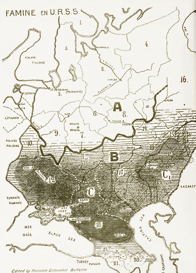
The Holodomor ( uk, Голодомо́р, Holodomor, ; derived from uk, морити голодом, lit=to kill by starvation, translit=moryty holodom, label=none), also known as the Terror-Famine or the Great Famine, was a man-made famine in Soviet Ukraine from 1932 to 1933 that killed millions of Ukrainians. The Holodomor was part of the wider Soviet famine of 1932–1933 which affected the major grain-producing areas of the Soviet Union. While scholars universally agree that the cause of the famine was man-made, whether the Holodomor constitutes a genocide remains in dispute. Some historians conclude that the famine was planned and exacerbated by Joseph Stalin in order to eliminate a Ukrainian independence movement. This conclusion is supported by Raphael Lemkin. Others suggest that the famine arose because of rapid Soviet industrialisation and collectivization of agriculture. Ukraine was one of the largest grain-producing states in the USSR and was subject to unre ... [...More Info...] [...Related Items...] OR: [Wikipedia] [Google] [Baidu] |
Russian Empire
The Russian Empire was an empire and the final period of the Russian monarchy from 1721 to 1917, ruling across large parts of Eurasia. It succeeded the Tsardom of Russia following the Treaty of Nystad, which ended the Great Northern War. The rise of the Russian Empire coincided with the decline of neighbouring rival powers: the Swedish Empire, the Polish–Lithuanian Commonwealth, Qajar Iran, the Ottoman Empire, and Qing China. It also held colonies in North America between 1799 and 1867. Covering an area of approximately , it remains the third-largest empire in history, surpassed only by the British Empire and the Mongol Empire; it ruled over a population of 125.6 million people per the 1897 Russian census, which was the only census carried out during the entire imperial period. Owing to its geographic extent across three continents at its peak, it featured great ethnic, linguistic, religious, and economic diversity. From the 10th–17th centuries, the land ... [...More Info...] [...Related Items...] OR: [Wikipedia] [Google] [Baidu] |
Kharkov Governorate
The Kharkov Governorate ( pre-reform Russian: , tr. ''Khárkovskaya gubérniya'', IPA: �xarʲkəfskəjə ɡʊˈbʲernʲɪjə ) was a governorate of the Russian Empire founded in 1835. It embraced the historical region of Sloboda Ukraine. From 1765 to 1780 and from 1796 to 1835 the governorate was called the Sloboda Ukraine Governorate. In 1780-1796 there existed the Kharkov Viceroyalty. From 1765 to 1780, the Sloboda–Ukraine Governorate existed. In 1780, the Kharkov Viceroyalty was established and lasted until 1796. In 1835, the Viceroyalty was again reorganized into the Sloboda-Ukrainian Governorate, and from 1835 onwards, the Kharkov Governorate was formed, which existed until 1925. With each reorganization, the boundaries and administrative structure change significantly. The main state tax implementation, processing, and publishing of statistical information for the Kharkov governorate were the Kharkov Governorate Statistical Committee. History Slobozhanshchyna, with ... [...More Info...] [...Related Items...] OR: [Wikipedia] [Google] [Baidu] |
Sumskoy Uyezd as their native language.Sumsky Uyezd () or Sumy Povit () was one of the subdivisions of the Kharkov Governorate of the Russian Empire. It was situated in the northwestern part of the governorate. Its administrative centre was Sumy. Demographics At the time of the Russian Empire Census of 1897, Sumsky Uyezd had a population of 228,094. Of these, 91.9% spoke Ukrainian, 7.0% Russian, 0.4% Yiddish, 0.2% German, 0.2% Polish, 0.1% Belarusian and 0.1% Tatar The Tatars ()Tatar in the Collins English Dictionary is an umbrella term for different Демоскоп Weekly - Приложение. Справочник статистических показателей
|
Vorozhba
Vorozhba (, ) is a city in Bilopillia Raion, Sumy Oblast, Ukraine Ukraine ( uk, Україна, Ukraïna, ) is a country in Eastern Europe. It is the second-largest European country after Russia, which it borders to the east and northeast. Ukraine covers approximately . Prior to the ongoing Russian inv .... Population: References Cities in Sumy Oblast Kharkov Governorate Cities of district significance in Ukraine {{Sumy-geo-stub ... [...More Info...] [...Related Items...] OR: [Wikipedia] [Google] [Baidu] |
Russia
Russia (, , ), or the Russian Federation, is a List of transcontinental countries, transcontinental country spanning Eastern Europe and North Asia, Northern Asia. It is the List of countries and dependencies by area, largest country in the world, with its internationally recognised territory covering , and encompassing one-eighth of Earth's inhabitable landmass. Russia extends across Time in Russia, eleven time zones and shares Borders of Russia, land boundaries with fourteen countries, more than List of countries and territories by land borders, any other country but China. It is the List of countries and dependencies by population, world's ninth-most populous country and List of European countries by population, Europe's most populous country, with a population of 146 million people. The country's capital and List of cities and towns in Russia by population, largest city is Moscow, the List of European cities by population within city limits, largest city entirely within E ... [...More Info...] [...Related Items...] OR: [Wikipedia] [Google] [Baidu] |
Oblasts Of Ukraine
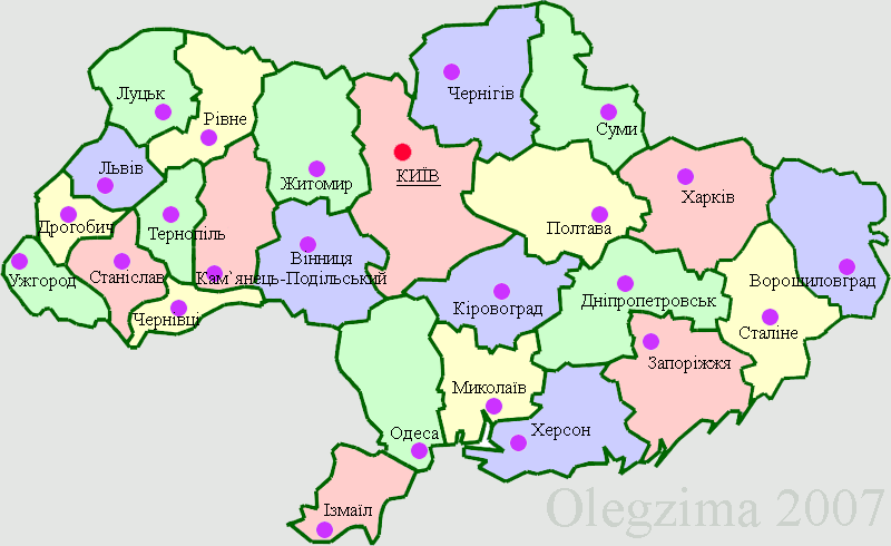
An oblast ( uk, о́бласть; ) in Ukraine, often called a region or province, is the main type of first-level administrative division of the country. Ukraine's territory is divided into 24 oblasts, as well as one autonomous republic, Crimea, and two cities with special status, Kyiv and Sevastopol. Ukraine is a unitary state, thus the oblasts do not have much legal scope of competence other than that which is established in the Ukrainian Constitution and by law. Articles 140–146 of Chapter XI of the constitution deal directly with local authorities and their competency. Oblasts are subdivided into raions (districts), each oblast having from 3 to 10 raions following the July 2020 reform. General characteristics In Ukraine, the term ''oblast'' denotes a primary administrative division. Under the Russian Empire and into the 1920s, Ukraine was divided between several governorates. The term ''oblast'' was introduced in 1932 by Soviet authorities when the Ukrainian SSR was ... [...More Info...] [...Related Items...] OR: [Wikipedia] [Google] [Baidu] |


