|
Bight (geography)
In geography, a bight is a concave bend or curvature in a coastline, river or other geographical feature (such as a cliff), or it may refer to a very open bay formed by such a feature. Such bays are typically broad, open, shallow and only slightly recessed. Description Bights are distinguished from sounds, in that sounds are much deeper. Traditionally, explorers defined a bight as a bay that could be sailed out of on a single tack in a square-rigged sailing vessel, regardless of the direction of the wind (typically meaning the apex of the bight is less than 25 degrees from the edges). The term is derived from Old English ''byht'' (“bend, angle, corner; bay, bight”) with German ''Bucht'' and Danish ''bugt'' as cognates, both meaning "bay". Bight is not etymologically related to " bite" (Old English ''bītan''). Notable examples * Bay of Campeche * Bay of Plenty * Bight of Benin * Bight of Biafra or Bight of Bonny * Canterbury Bight * German Bight or Heligoland Bight ... [...More Info...] [...Related Items...] OR: [Wikipedia] [Google] [Baidu] |
Great Australian Bight Marine Park
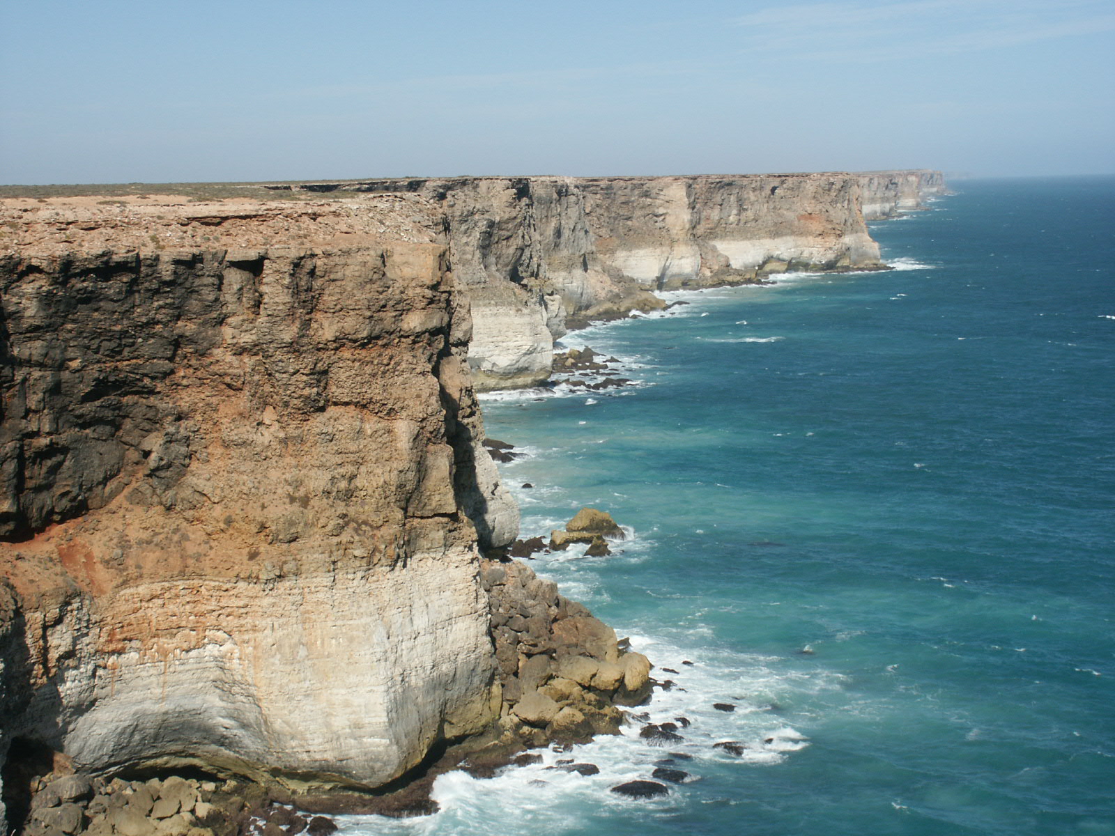
Great Australian Bight Marine Park is the name given to a group of marine protected areas which are located together within both Australian and South Australian jurisdictions in the Great Australian Bight and which has been in use as recently as 2005. The constituent protected areas are the Great Australian Bight Marine National Park and the Great Australian Bight Marine Park Whale Sanctuary within the coastal waters of South Australia, and the Great Australian Bight Commonwealth Marine Reserve in waters within the Australian Exclusive economic zone. It was listed on the now-defunct Register of the National Estate. See also * Great Australian Bight Marine Park (Commonwealth waters) Great Australian Bight Marine Park (Commonwealth Waters) is a former marine protected area located in the Great Australian Bight immediately south of South Australia and its immediate onshore waters. On 8 November 2012, it was replaced by a ne ... References External linksGreat Australia ... [...More Info...] [...Related Items...] OR: [Wikipedia] [Google] [Baidu] |
Canterbury Bight
The Canterbury Bight is a large bight on the eastern side of New Zealand's South Island. The bight runs for approximately from the southern end of Banks Peninsula to the settlement of Timaru and faces southeast, exposing it to high-energy storm waves originating in the Pacific Ocean. The bight is known for rough conditions as a result, with wave heights of over common. Much of the bight's geography is shaped by this high-energy environment interacting with multiple large rivers which enter the Pacific in the bight, such as the Rakaia, Ashburton / Hakatere, and Rangitata Rivers. Sediment from these rivers, predominantly Greywacke, is deposited along the coast and extends up to out to sea from the current shoreline. Multiple ''hapua'', or river-mouth lagoons, can be found along the length of the bight where waves have deposited sufficient sediment to form a barrier across a river mouth, including most notably Lake Ellesmere / Te Waihora and Washdyke Lagoon Zones of the Canter ... [...More Info...] [...Related Items...] OR: [Wikipedia] [Google] [Baidu] |
Southern California Bight
The Southern California Bight is a 692-kilometer-long (430 mi) stretch of curved coastline that runs along the west coast of the United States and Mexico, from Point Conception in California to Punta Colonet in Baja California, plus the area of the Pacific Ocean defined by that curve. This includes the Channel Islands of California and the Coronado Islands and Islas de Todo Santos of Baja California. The region is known for having a climate similar to that of the Mediterranean, consisting of rainy winters and dry summers. The Southern California Bight has a thriving ecosystem that is home to many species of plant life, fish, birds, and mammals. History Various Native American peoples occupied the lands in and around the Southern California Bight for tens of thousands of years before the arrival of Europeans. When Spanish explorers arrived in the 16th century the Chumash people occupied the northern coastal region of the bight, as well as the four Northern Channel Islands, ... [...More Info...] [...Related Items...] OR: [Wikipedia] [Google] [Baidu] |
Southern Bight
Southern Bight, also known as the Flanders Bight, and (in Dutch) the Hoofden, is the southern bight of the North Sea bounded by the coasts of the Netherlands, Belgium, France and Great Britain. The Southern Bight is south west of the German Bight and the Wadden Sea. The Southern Bight is roughly delimited in the north by a roughly straight line between The Wash and the West Frisian Islands going south of the Dogger Bank, a large shallow part in the North Sea, and the Outer Silver Pit, a deep water channel south of the Dogger Bank. It corresponds to sea area Thames and the northern part of sea area Dover. There are many sand banks in the Southern Bight. From the Strait of Dover to the Norfolk Banks, there is a deep water channel, which enters into wherein the water is about 30 metres deep or deeper. At the end of the English Channel, this depth increases to about 100 metres. The North Sea as a whole has characteristics which are similar to those of the Atlantic Ocean, whereas ... [...More Info...] [...Related Items...] OR: [Wikipedia] [Google] [Baidu] |
South Taranaki Bight
The South Taranaki Bight is a large bay on the west coast of New Zealand, south of Taranaki, west of the Manawatu, north and west of the western entrance of Cook Strait and north of the South Island. The name is sometimes used for a much smaller bay in South Taranaki, between the mouth of the Kaupokonui Stream directly south of Mount Taranaki and the mouth of the Pātea River. Approximately 18,000 years ago during the Last Glacial Maximum when sea levels were over 100 metres lower than present day levels, the South Taranaki Bight was a coastal plain which connected the North and South Islands, featuring rivers which drained into the Cook Strait (then a harbour) to the south-east. Sea levels began to rise 7,000 years ago, eventually separating the islands and connecting the Cook Strait to the Tasman Sea. The bight was once a calving ground for southern right whales in winter and spring and early Europeans in New Zealand called it Mothering Bay after the large number of cow-calf ... [...More Info...] [...Related Items...] OR: [Wikipedia] [Google] [Baidu] |
Santa Monica Bay
Santa Monica Bay is a bight of the Pacific Ocean in Southern California, United States. Its boundaries are slightly ambiguous, but it is generally considered to be the part of the Pacific within an imaginary line drawn between Point Dume, in Malibu, and the Palos Verdes Peninsula. Its eastern shore forms the western boundary of the Los Angeles Westside and South Bay regions. Although it was fed by the Los Angeles River until the river's catastrophic change of course in 1825, the only stream of any size now flowing into it is Ballona Creek. Smaller waterways draining into the bay include Malibu Creek, Topanga Creek, and Santa Monica Creek. The Santa Monica Bay is home to some of the most famous beaches in the world, including Malibu Lagoon State Beach (Surfrider), Will Rogers State Beach, Santa Monica State Beach, and Dockweiler State Beach. Several piers extend into the bay, including Malibu Pier, Santa Monica Pier, Venice Pier, Manhattan Beach pier, Hermosa Beach ... [...More Info...] [...Related Items...] OR: [Wikipedia] [Google] [Baidu] |
Robson Bight
Robson Bight is a small Vancouver Island bay at the west end of Johnstone Strait across from West Cracroft Island in British Columbia, Canada that includes a protected killer whale habitat famous for its whale-rubbing beaches. The bight is adjacent to Lower Tsitika River Provincial Park. The nearest access point is Telegraph Cove on the east coast of Northern Vancouver Island. Ecological Reserve Robson Bight (Michael Bigg) Ecological Reserve was established in 1982 as a sanctuary for killer whales. The area, 10 km south east of Telegraph Cove and 40 km from Port McNeill, British Columbia, is restricted. Access by boat or land is prohibited. The Robson Bight Warden Program is operated by Cetus Research and Conservation Society. This program educates visitors to the area about the Ecological Reserve and asks visitors to remain outside the Ecological Reserve boundaries. The Reserve extends 1 km offshore from markers at either end of the Reserve. The total area ... [...More Info...] [...Related Items...] OR: [Wikipedia] [Google] [Baidu] |
North Taranaki Bight
The North Taranaki Bight is a large bay that extends north and east from the north coast of Taranaki in New Zealand's North Island. The name is echoed by the South Taranaki Bight to the south of Cape Egmont. As with its southern counterpart, the size of the bight depends to a large extent on the source referring to it. Strict definitions refer to it stretching from the mouth of the Waitara River, 10 kilometres northeast of New Plymouth, to the mouth of the Mokau River. Looser descriptions refer to it extending as far north as Tirua Point, 50 kilometres southwest of Te Kuiti, or even to Albatross Point, close to the entrance to Kawhia Harbour Kawhia Harbour (Maori: ''Kāwhia'') is one of three large natural inlets in the Tasman Sea coast of the Waikato region of New Zealand's North Island. It is located to the south of Raglan Harbour, Ruapuke and Aotea Harbour, 40 kilometres sout .... See also * South Taranaki Bight References External links New Plymouth ... [...More Info...] [...Related Items...] OR: [Wikipedia] [Google] [Baidu] |
New York Bight
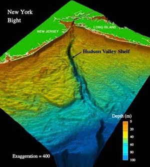
The New York Bight is the geological identification applied to a roughly triangular indentation, regarded as a bight, along the Atlantic coast of the United States that extends northeasterly from Cape May Inlet in New Jersey to Montauk Point on the eastern tip of Long Island. As the result of direct contact with the Gulf Stream along the coast of North America, the coastal climate of the bight area is temperate. Geography The bight is formed by the roughly right-angled intersection of the generally north-south Atlantic coast of New Jersey and the approximately east–west southern coast of Long Island at the mouth of the Hudson River. The New York Bight Apex is the area including and between the Hudson River estuary and the Raritan River estuary extending 6–7 km of the coast, and it includes Raritan Bay and the Lower New York Bay. Weather The geography of the bight has long been of major concern to meteorologists in the study of tropical storm patterns along the eas ... [...More Info...] [...Related Items...] OR: [Wikipedia] [Google] [Baidu] |
Mid-Atlantic Bight
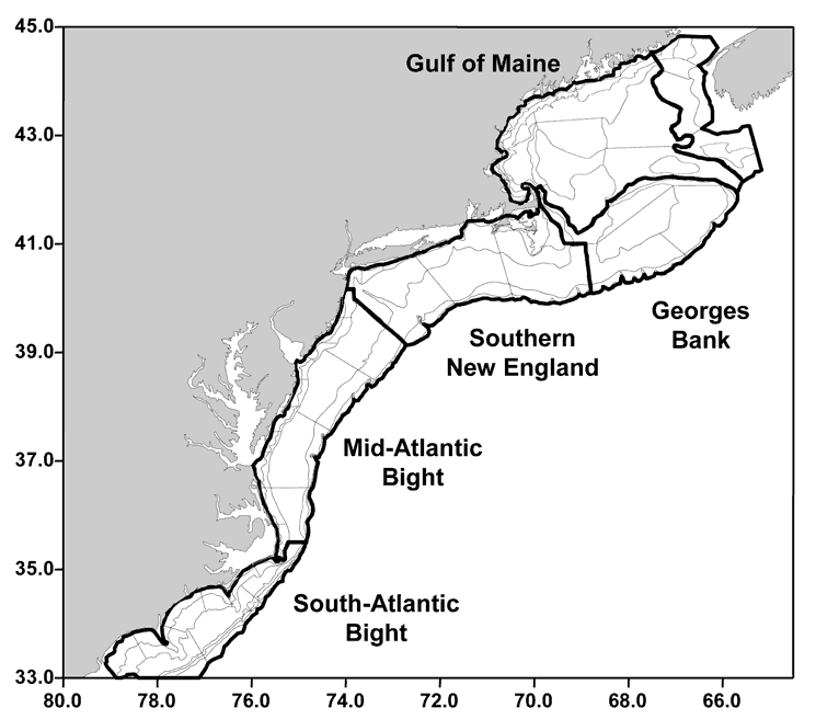
The Mid-Atlantic Bight is a coastal region running from Massachusetts to North Carolina. It contains the New York Bight. It is separated from the South Atlantic Bight by Cape Hatteras to the south and the Gulf of Maine to the north by Cape Cod Cape Cod is a peninsula extending into the Atlantic Ocean from the southeastern corner of mainland Massachusetts, in the northeastern United States. Its historic, maritime character and ample beaches attract heavy tourism during the summer mont .... References External linksThe Mid-Atlantic Bight (MAB) National Undersea Research Center Landforms of Massachusetts Landforms of New York (state) Landforms of New Jersey Landforms of North Carolina Landforms of the Atlantic Ocean Bights (geography) {{Marine-geo-stub ... [...More Info...] [...Related Items...] OR: [Wikipedia] [Google] [Baidu] |
Mecklenburg Bight
The Bay of Mecklenburg ( or ''Mecklenburgische Bucht''; ), also known as the Mecklenburg Bay or Mecklenburg Bight, is a long narrow basin making up the southwestern finger-like arm of the Baltic Sea, between the shores of Germany to the south and the Danish islands of Lolland, Falster, and Møn to the north, the shores of Jutland to the west, and joining the largest part of the Baltic to the east. The Bay of Mecklenburg, which includes the Bay of Wismar and the Bay of Lübeck, connects to the Bay of Kiel in the northwest. Notable ports in the bay are Lübeck, Rostock and Wismar. See also * List of lighthouses and lightvessels in Denmark * List of lighthouses and lightvessels in Germany External links Mecklenburg Mecklenburg Bays of Denmark Mecklenburg Mecklenburg (; nds, label= Low German, Mękel(n)borg ) is a historical region in northern Germany comprising the western and larger part of the federal-state Mecklenburg-Western Pomerania. The largest cities o ... [...More Info...] [...Related Items...] OR: [Wikipedia] [Google] [Baidu] |
McKenzie Bight
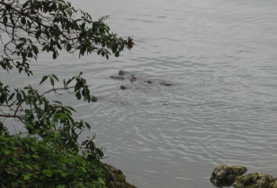
McKenzie Bight is a feature on the southeast side of Saanich Inlet in British Columbia, Canada. This bight is located in Gowlland Tod Provincial Park directly adjacent to the rural community of Willis Point. McKenzie Bight can be accessed by trail from the Mount Work parking area and trailhead on Ross-Durrance road, or via a short hike from the southern end of Mark Lane in Willis Point. Nearby is a reef which is a popular shore-dive location for scuba diving Scuba diving is a mode of underwater diving whereby divers use breathing equipment that is completely independent of a surface air supply. The name "scuba", an acronym for " Self-Contained Underwater Breathing Apparatus", was coined by Chr .... Occasionally river otters can be seen in the area. References External linksBC Parks Gowlland Tod Website*https://www.crd.bc.ca/parks-recreation-culture/parks-trails/find-park-trail/mount-work Strait of Georgia Bays of British Columbia Saanich Peninsula Bights (geo ... [...More Info...] [...Related Items...] OR: [Wikipedia] [Google] [Baidu] |


