|
Big Timbers
Big Timbers is a wooded riparian area in Colorado along both banks of the Arkansas River that is famous as a campsite for native American tribes and travelers on the Mountain Branch of the Santa Fe Trail. Description The Spanish knew this area as ''La Casa de Palo'' or the House of Wood, because wood was scarce along the banks of the Arkansas River except for that specific area. Cottonwood was the primary type of timber found there. It known by its Spanish name following Juan Bautista de Anza's defeat of Cuerno Verde and the parties signed a peace treaty there in 1785–1786. At its greatest extent, Big Timbers may have stretched from the mouth of the Purgatoire to the present-day Kansas-Colorado border, a distance of Winter camping ground Seasonally the Cheyenne that camped at Bent's Old Fort moved down the Arkansas River from their camp to Big Timbers. Alongside the Arkansas River for Big Timbers was a prime location for hunting buffalo, a major source of food for the ... [...More Info...] [...Related Items...] OR: [Wikipedia] [Google] [Baidu] |
Bent's New Fort
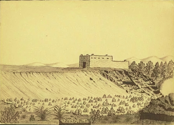
Bent's New Fort was a historic fort and trading post along the banks of the Arkansas River in what is now Bent County, Colorado, about nine miles west of Lamar, on the Mountain Route branch of the Santa Fe Trail. William Bent operated a trading post with limited success at the site and in 1860 leased the fort to the United States government, which operated it as a military outpost until 1867. In 1862, it was named Fort Lyon. The fort was abandoned after a flood of the Arkansas River in 1867. The ruins of the fort and a portion of the Santa Fe Trail were listed as Santa Fe Trail Mountain Route-Bent's New Fort on the U.S. National Register of Historic Places in 2016. Description In 1849, William Bent built a wooden stockade for a fort and trading post. It was a U-shaped structure of three connected log cabins. The open side faced the Arkansas River. He then built a rectangular limestone or sandstone trading post and fort in the summer and early fall of 1853. Built near the Che ... [...More Info...] [...Related Items...] OR: [Wikipedia] [Google] [Baidu] |
Native American History Of Colorado
Native may refer to: People * Jus soli, citizenship by right of birth * Indigenous peoples, peoples with a set of specific rights based on their historical ties to a particular territory ** Native Americans (other) In arts and entertainment * Native (band), a French R&B band * Native (comics), a character in the X-Men comics universe * ''Native'' (album), a 2013 album by OneRepublic * ''Native'' (2016 film), a British science fiction film * ''The Native'', a Nigerian music magazine In science * Native (computing), software or data formats supported by a certain system * Native language, the language(s) a person has learned from birth * Native metal, any metal that is found in its metallic form, either pure or as an alloy, in nature * Native species, a species whose presence in a region is the result of only natural processes Other uses * Northeast Arizona Technological Institute of Vocational Education (NATIVE), a technology school district in the Arizona portion o ... [...More Info...] [...Related Items...] OR: [Wikipedia] [Google] [Baidu] |
Geography Of Prowers County, Colorado
Geography (from Greek: , ''geographia''. Combination of Greek words ‘Geo’ (The Earth) and ‘Graphien’ (to describe), literally "earth description") is a field of science devoted to the study of the lands, features, inhabitants, and phenomena of Earth. The first recorded use of the word γεωγραφία was as a title of a book by Greek scholar Eratosthenes (276–194 BC). Geography is an all-encompassing discipline that seeks an understanding of Earth and its human and natural complexities—not merely where objects are, but also how they have changed and come to be. While geography is specific to Earth, many concepts can be applied more broadly to other celestial bodies in the field of planetary science. One such concept, the first law of geography, proposed by Waldo Tobler, is "everything is related to everything else, but near things are more related than distant things." Geography has been called "the world discipline" and "the bridge between the human and t ... [...More Info...] [...Related Items...] OR: [Wikipedia] [Google] [Baidu] |
Alexander Barclay (frontiersman)
Alexander Barclay (May 21, 1810 – December 1855) was an American frontiersman. After working in St. Louis as a bookkeeper and clerk, he worked at Bent's Old Fort. He then ventured westward where he was a trapper, hunter, and trader. Barclay entered into a common-law relationship with Teresita Sandoval, one of the founders of the settlement and trading post El Pueblo. He helped settle Hardscrabble, Colorado and built Fort Barclay in New Mexico. Early life Born May 21, 1810, Barclay was raised by his mother, since his father was proven improvident. He had a brother George and sister Mary, with whom he would correspond throughout his life. He was said to have been raised in "genteel poverty". Barclay worked in London, England as a corset maker as a young adult. He sold his business for 80 pounds and sought off for a new life by sailing for Canada in 1833, having been inspired by the actions of two friends. Arriving ill from his trip, he was quarantined in Quebec for a time and th ... [...More Info...] [...Related Items...] OR: [Wikipedia] [Google] [Baidu] |
Lamar, Colorado
Lamar is the home rule municipality that is the county seat and the most populous municipality of Prowers County, Colorado, United States. The city population was 7,804 at the 2010 United States Census. The city was named after Confederate slaveholder Lucius Quintus Cincinnatus Lamar II during the period that he was Secretary of the Interior in the futile hope that the town would be named as the land office. History Lamar was founded on May 24, 1886 by Issac Holmes. It was named after Lucius Lamar. At the time Lamar was the Secretary of the Interior, but previously he had written the Mississippi Ordinance of Secession, served the Confederacy as an officer and a diplomat. The first town elections were held in December, and C. M. Morrison became the town's first mayor. In 1889 Prowers County was established, and Lamar was elected to house the county's government. Throughout its history, Lamar has suffered from fires and floods. The town was also greatly affected by the Du ... [...More Info...] [...Related Items...] OR: [Wikipedia] [Google] [Baidu] |
Owl Woman
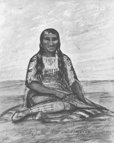
Owl Woman (Cheyenne name: ''Mis-stan-stur''; died 1847) was a Cheyenne woman.Varnell, p. 7., a daughter of White Thunder, a well-respected medicine man of the Cheyenne tribe. She was married to an Anglo-American trader named William Bent, with whom she had four children. Owl Woman was inducted into the Colorado Women's Hall of Fame for her role in managing relations between Native American tribes and the Anglo-American men. Background Native American tribes of the central plains In the 1820s, the central plains area in which several Native American tribes lived had been subject to political and economic turmoil resulting from the Mexican War of Independence. The Arkansas River delineated the border, with Mexico to the south and the United States northwards. There were many opportunities for trade alliances, in part to replace those that had involved the now-deposed Spanish governors, and there was also encroachment on the area by the United States as that nation pursued it ... [...More Info...] [...Related Items...] OR: [Wikipedia] [Google] [Baidu] |
William Bent
William Wells Bent (May 23, 1809 – May 19, 1869) was a frontier trader and rancher in the American West, with forts in Colorado. He also acted as a mediator among the Cheyenne Nation, other Native American tribes and the expanding United States. With his brothers, Bent established a trade business along the Santa Fe Trail. In the early 1830s Bent built an adobe fort, called Bent's Fort, along the Arkansas River in present-day Colorado. Furs, horses and other goods were traded for food and other household goods by travelers along the Santa Fe trail, fur-trappers, and local Mexican and Native American people. Bent negotiated a peace among the many Plains tribes north and south of the Arkansas River, as well as between the Native American and the United States government. In 1835 Bent married Owl Woman, the daughter of White Thunder, a Cheyenne chief and medicine man. Together they had four children. Bent was accepted into the Cheyenne tribe and became a sub-chief. In the 1 ... [...More Info...] [...Related Items...] OR: [Wikipedia] [Google] [Baidu] |
Cholera
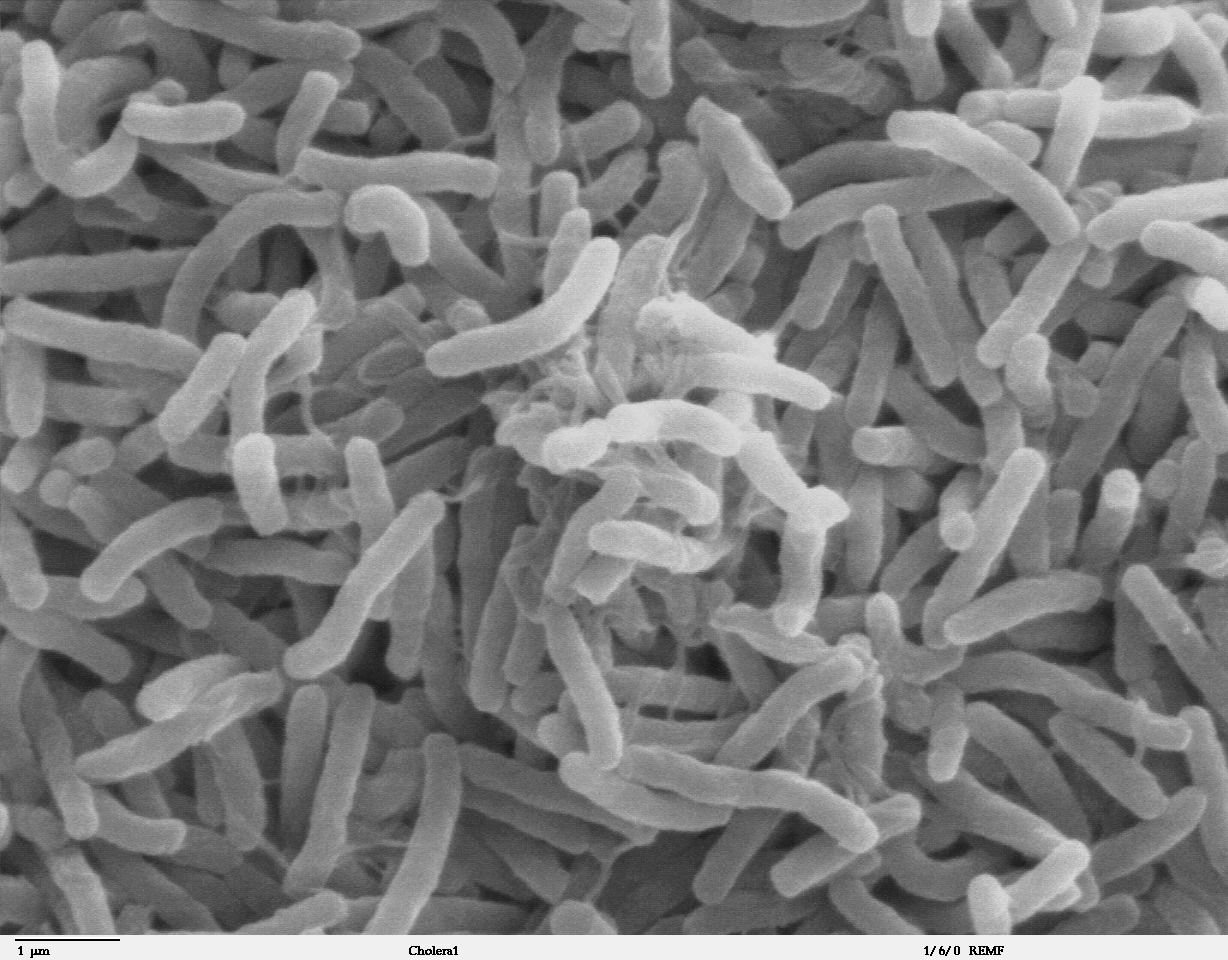
Cholera is an infection of the small intestine by some strains of the bacterium '' Vibrio cholerae''. Symptoms may range from none, to mild, to severe. The classic symptom is large amounts of watery diarrhea that lasts a few days. Vomiting and muscle cramps may also occur. Diarrhea can be so severe that it leads within hours to severe dehydration and electrolyte imbalance. This may result in sunken eyes, cold skin, decreased skin elasticity, and wrinkling of the hands and feet. Dehydration can cause the skin to turn bluish. Symptoms start two hours to five days after exposure. Cholera is caused by a number of types of ''Vibrio cholerae'', with some types producing more severe disease than others. It is spread mostly by unsafe water and unsafe food that has been contaminated with human feces containing the bacteria. Undercooked shellfish is a common source. Humans are the only known host for the bacteria. Risk factors for the disease include poor sanitation, not enou ... [...More Info...] [...Related Items...] OR: [Wikipedia] [Google] [Baidu] |
Riparian Zone
A riparian zone or riparian area is the interface between land and a river or stream. Riparian is also the proper nomenclature for one of the terrestrial biomes of the Earth. Plant habitats and communities along the river margins and banks are called riparian vegetation, characterized by hydrophilic plants. Riparian zones are important in ecology, environmental resource management, and civil engineering because of their role in soil conservation, their habitat biodiversity, and the influence they have on fauna and aquatic ecosystems, including grasslands, woodlands, wetlands, or even non-vegetative areas. In some regions, the terms riparian woodland, riparian forest, riparian buffer zone, riparian corridor, and riparian strip are used to characterize a riparian zone. The word ''riparian'' is derived from Latin '' ripa'', meaning "river bank". Characteristics Riparian zones may be natural or engineered for soil stabilization or restoration. These zones are important nat ... [...More Info...] [...Related Items...] OR: [Wikipedia] [Google] [Baidu] |


