|
Białystok County
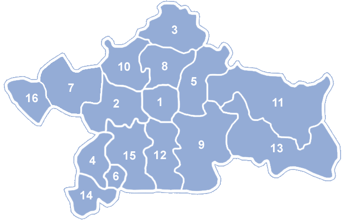
__NOTOC__ Białystok County ( pl, powiat białostocki) is a unit of territorial administration and local government (powiat) in Podlaskie Voivodeship, north-eastern Poland, on the border with Belarus. It was created on 1 January 1999 as a result of the Polish local government reforms passed in 1998. Its administrative seat is the city of Białystok, although the city is not part of the county (it constitutes a separate city county). The county contains nine towns: Łapy, south-west of Białystok, Czarna Białostocka, north of Białystok, Wasilków, north of Białystok, Choroszcz, west of Białystok, Supraśl, north-east of Białystok, Michałowo, east of Białystok, Zabłudów, south-east of Białystok, Tykocin, west of Białystok, and Suraż, south-west of Białystok. The county covers an area of , making it the largest county in Poland (ahead of Olsztyn County). As of 2019 its total population is 148,745, out of which the population of Łapy is 15,609, that of Cza ... [...More Info...] [...Related Items...] OR: [Wikipedia] [Google] [Baidu] |
Powiat
A ''powiat'' (pronounced ; Polish plural: ''powiaty'') is the second-level unit of local government and administration in Poland, equivalent to a county, district or prefecture ( LAU-1, formerly NUTS-4) in other countries. The term "''powiat''" is most often translated into English as "county" or "district" (sometimes "poviat"). In historical contexts this may be confusing because the Polish term ''hrabstwo'' (an administrative unit administered/owned by a ''hrabia'' (count) is also literally translated as "county". A ''powiat'' is part of a larger unit, the voivodeship ( Polish ''województwo'') or province. A ''powiat'' is usually subdivided into ''gmina''s (in English, often referred to as "communes" or "municipalities"). Major towns and cities, however, function as separate counties in their own right, without subdivision into ''gmina''s. They are termed " city counties" (''powiaty grodzkie'' or, more formally, ''miasta na prawach powiatu'') and have roughly the same s ... [...More Info...] [...Related Items...] OR: [Wikipedia] [Google] [Baidu] |
Gmina Wasilków
__NOTOC__ Gmina Wasilków is an urban-rural gmina (administrative district) in Białystok County, Podlaskie Voivodeship, in north-eastern Poland. Its seat is the town of Wasilków, which lies approximately north of the regional capital Białystok. The gmina covers an area of , and as of 2006 its total population is 12,790 (out of which the population of Wasilków amounts to 8,967, and the population of the rural part of the gmina is 3,823). The gmina contains part of the protected area called Knyszyń Forest Landscape Park. Villages Apart from the town of Wasilków, Gmina Wasilków contains the villages and settlements of Burczak, Gmina Wasilków, Burczak, Dąbrówki, Podlaskie Voivodeship, Dąbrówki, Horodnianka, Gmina Wasilków, Horodnianka, Horodnianka-Kolonia, Jurowce, Podlaskie Voivodeship, Jurowce, Jurowce-Kolonia, Katrynka, Katrynka-Leśniczówka, Mostek, Podlaskie Voivodeship, Mostek, Mostek-Gajówka, Nowodworce, Osowicze, Ożynnik, Podkrzemionka, Rybniki, Podlaskie Voiv ... [...More Info...] [...Related Items...] OR: [Wikipedia] [Google] [Baidu] |
Michałowo
Michałowo ( be, Міхалова) is a town in Białystok County, Podlaskie Voivodeship, in north-eastern Poland, close to the border with Belarus. It is the seat of the gmina (administrative district) called Gmina Michałowo. It lies approximately east of the regional capital Białystok. From 1975 to 1998 it was part of Białystok Voivodeship. The town has a population of 3,343. Michałowo received its town rights on 1 January 2009. In November 2021, several NGO A non-governmental organization (NGO) or non-governmental organisation (see spelling differences) is an organization that generally is formed independent from government. They are typically nonprofit entities, and many of them are active in h ...s came to Michałowo to provide humanitarian aid to migrants brought to the Belarusian border east of the town. References External links * Cities and towns in Podlaskie Voivodeship Grodno Governorate Białystok Voivodeship (1919–1939) Belastok ... [...More Info...] [...Related Items...] OR: [Wikipedia] [Google] [Baidu] |
Supraśl
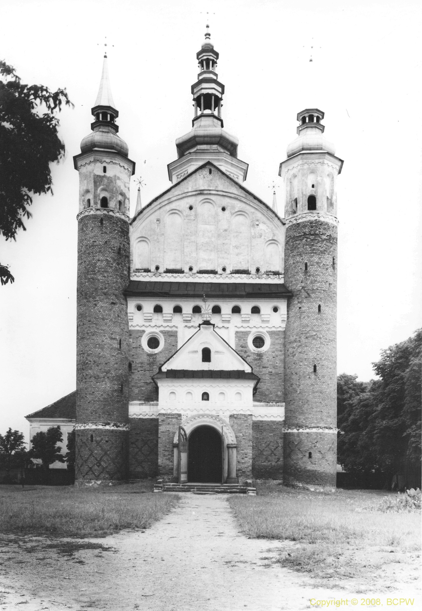
Supraśl (; be, Су́прасль; ) is a town and former episcopal see in north-eastern Poland. Supraśl is in Podlaskie Voivodeship (province) since 1999, previously in Białystok Voivodeship (1975-1998) (1975–1998), and is in Białystok County, about northeast of Białystok. It is the seat of the Gmina of Supraśl. Its population is 4,526 (2004). History The settlement was founded in the 16th century. After the Third Partition of Poland in 1795, it was annexed by Prussia. In 1807 it passed to the Russian Partition of Poland. In 1823, a 10th-century manuscript, the oldest Slavic literary work in Poland, named the ''Codex of Supraśl'' was discovered in the Supraśl Monastery by Michał Bobrowski. After 1831, the textile industry developed. In 1834 manufacturer Wilhelm Fryderyk Zachert came from Zgierz to Supraśl and significantly contributed to the development of the village into a town. Until the mid-19th century, it was the largest center of the textile industry in ... [...More Info...] [...Related Items...] OR: [Wikipedia] [Google] [Baidu] |
Choroszcz
Choroszcz () is a town in north-eastern Poland, located in Białystok County, Podlaskie Voivodeship, seat of Gmina Choroszcz. The Baroque palace in Choroszcz was the summer residence of the noble Branicki family, and is now part of the Museum of Polish Interiors. As of December 2021, the town has a population of 5,960. History Choroszcz was granted town rights by King Sigismund I the Old in 1507. It was a private town, administratively located in the Podlaskie Voivodeship in the Lesser Poland Province. Jan Klemens Branicki erected a Baroque palace, which served as the summer residence of the Branicki family. Following the Third Partition of Poland, in 1795, it was annexed by Prussia. In 1807, it passed to the Russian Partition of Poland. Choroszcz was one of the sites of Russian executions of Polish insurgents during the January Uprising. The execution sites are now marked by memorials.''Katalog miejsc pamięci powstania styczniowego w województwie podlaskim'', pp. 32–34 ... [...More Info...] [...Related Items...] OR: [Wikipedia] [Google] [Baidu] |
Wasilków
Wasilków ( be, Васількаў) is a city in north-eastern Poland Poland, officially the Republic of Poland, is a country in Central Europe. It is divided into 16 administrative provinces called voivodeships, covering an area of . Poland has a population of over 38 million and is the fifth-most populou ..., about 8 km north of Białystok, with 8,751 inhabitants (2004). It is situated in Białystok County, in Podlaskie Voivodeship (since 1999, having previously been in Białystok Voivodeship from 1975 to 1998). External links * * Cities and towns in Podlaskie Voivodeship Białystok County Trakai Voivodeship Sokolsky Uyezd Białystok Voivodeship (1919–1939) Belastok Region {{Białystok-geo-stub ... [...More Info...] [...Related Items...] OR: [Wikipedia] [Google] [Baidu] |
Czarna Białostocka
Czarna Białostocka is a town in north-eastern Poland. It is the seat of Gmina Czarna Białostocka, situated in Białystok County in the Podlaskie Voivodeship, having previously been in Białystok Voivodeship (1975-1998) Białystok Voivodeship may refer to the following administrative districts of Poland: *Białystok Voivodeship (1919–1939), as defined before World War II *Białystok Voivodeship (1945–1975), as defined after World War II *Białystok Voivodeship .... As of December 2021, the town has a population of 9,032. Notable people * Andrzej Jerzy Zglejszewski (born 1961) Catholic bishop in the United States. References Cities and towns in Podlaskie Voivodeship Białystok County Trakai Voivodeship Sokolsky Uyezd Białystok Voivodeship (1919–1939) Belastok Region {{Podlaskie-geo-stub ... [...More Info...] [...Related Items...] OR: [Wikipedia] [Google] [Baidu] |
Łapy
Łapy is a town in north-eastern Poland, in Białystok County (''powiat''), Podlaskie Voivodeship; the administrative centre of the urban-rural gmina Łapy. It is situated in the North Podlasie Lowland, on the river Narew. According to data from 31 December 2010, the town had 16,049 inhabitants. Situated here are the bankrupt Railway Fleet Repair Works, a dairy, and the sugar refinery closed in February 2008. Now, Łapy is a medical and educational centre for the region of the former Łapy county. Location The town of Łapy is located in north-eastern Poland. According to Kondracki's division of Poland into physico-geographical regions, the town of Łapy sits on North-Podlasie Plain, over the Upper Valley of Narew. The town of Łapy lies by the Narew river. The terrain is elevated here from 120 to 130 metres. Included in Białystok agglomeration, the town is situated in the buffer zone of Narew National Park. According to data from 1 January 2010, the town ... [...More Info...] [...Related Items...] OR: [Wikipedia] [Google] [Baidu] |
Polish Local Government Reforms
The administrative division of Poland since 1999 has been based on three levels of subdivision. The territory of Poland is divided into ''voivodeships'' (provinces); these are further divided into ''powiats'' (counties or districts), and these in turn are divided into ''gminas'' (communes or municipalities). Major cities normally have the status of both gmina and powiat. Poland currently has 16 voivodeships, 380 powiats (including 66 cities with powiat status), and 2,478 gminas. The current system was introduced pursuant to a series of acts passed by the Polish parliament in 1998, and came into effect on 1 January 1999. Between 1975 and 1998 there had been 49 smaller voivodeships and no powiats (see subdivisions of the Polish People's Republic). The reform created 16 larger voivodeships (largely based on and named after historical regions) and reintroduced powiats. The boundaries of the voivodeships do not always reflect the historical borders of Polish regions. Around half of ... [...More Info...] [...Related Items...] OR: [Wikipedia] [Google] [Baidu] |
Belarus
Belarus,, , ; alternatively and formerly known as Byelorussia (from Russian ). officially the Republic of Belarus,; rus, Республика Беларусь, Respublika Belarus. is a landlocked country in Eastern Europe. It is bordered by Russia to the east and northeast, Ukraine to the south, Poland to the west, and Lithuania and Latvia to the northwest. Covering an area of and with a population of 9.4 million, Belarus is the 13th-largest and the 20th-most populous country in Europe. The country has a hemiboreal climate and is administratively divided into seven regions. Minsk is the capital and largest city. Until the 20th century, different states at various times controlled the lands of modern-day Belarus, including Kievan Rus', the Principality of Polotsk, the Grand Duchy of Lithuania, the Polish–Lithuanian Commonwealth, and the Russian Empire. In the aftermath of the Russian Revolution in 1917, different states arose competing for legitimacy amid the ... [...More Info...] [...Related Items...] OR: [Wikipedia] [Google] [Baidu] |
Poland
Poland, officially the Republic of Poland, is a country in Central Europe. It is divided into 16 administrative provinces called voivodeships, covering an area of . Poland has a population of over 38 million and is the fifth-most populous member state of the European Union. Warsaw is the nation's capital and largest metropolis. Other major cities include Kraków, Wrocław, Łódź, Poznań, Gdańsk, and Szczecin. Poland has a temperate transitional climate and its territory traverses the Central European Plain, extending from Baltic Sea in the north to Sudeten and Carpathian Mountains in the south. The longest Polish river is the Vistula, and Poland's highest point is Mount Rysy, situated in the Tatra mountain range of the Carpathians. The country is bordered by Lithuania and Russia to the northeast, Belarus and Ukraine to the east, Slovakia and the Czech Republic to the south, and Germany to the west. It also shares maritime boundaries with Denmark a ... [...More Info...] [...Related Items...] OR: [Wikipedia] [Google] [Baidu] |
Powiat
A ''powiat'' (pronounced ; Polish plural: ''powiaty'') is the second-level unit of local government and administration in Poland, equivalent to a county, district or prefecture ( LAU-1, formerly NUTS-4) in other countries. The term "''powiat''" is most often translated into English as "county" or "district" (sometimes "poviat"). In historical contexts this may be confusing because the Polish term ''hrabstwo'' (an administrative unit administered/owned by a ''hrabia'' (count) is also literally translated as "county". A ''powiat'' is part of a larger unit, the voivodeship ( Polish ''województwo'') or province. A ''powiat'' is usually subdivided into ''gmina''s (in English, often referred to as "communes" or "municipalities"). Major towns and cities, however, function as separate counties in their own right, without subdivision into ''gmina''s. They are termed " city counties" (''powiaty grodzkie'' or, more formally, ''miasta na prawach powiatu'') and have roughly the same s ... [...More Info...] [...Related Items...] OR: [Wikipedia] [Google] [Baidu] |


