|
Bhutar
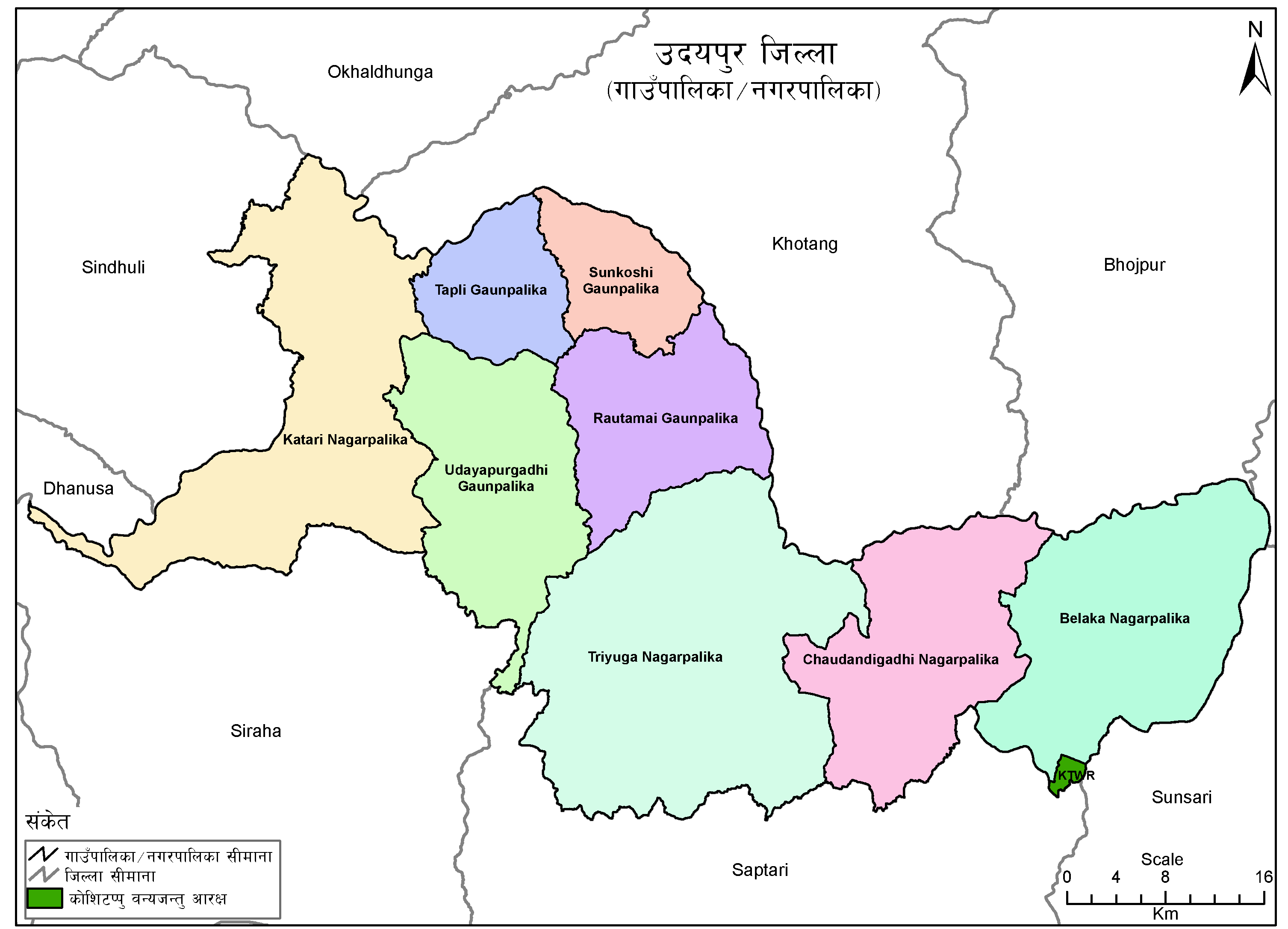
Bhuttar was a village development committee in Udayapur District in the Sagarmatha Zone of Eastern Development Region of Nepal. It became part of Rautamai Rural Municipality after reconstruction of administration in Nepal. It is now municipal headquarter of Rautamai rural municipality. Fulfilling the requirement of the new constitution of Nepal in 2015, all old municipalities and villages (which were more than 3900 in number) were restructured into 753 new units. At the time of the 1991 Nepal census The 1991 Nepal census was a widespread national census conducted by the Nepal Central Bureau of Statistics. Working with Nepal's Village Development Committees at a district level, they recorded data from all the main towns and villages of each ... it had a population of 3244 people living in 583 individual households. References External linksUN map of the municipalities of Udayapur District Populated places in Udayapur District Rautamai {{Udayapur-geo-stub ... [...More Info...] [...Related Items...] OR: [Wikipedia] [Google] [Baidu] |
Rautamai
Rautamai Rural Municipality ( ne, रौतामाई गाउँपालिका) is a rural municipality in Udayapur district of Province No. 1 in Nepal. There are 4 rural municipalities in Udayapur district. There are 8 wards in this municipality. According to 2011 census of Nepal, the total population of the municipality is 23,481 and total area is 204 km². The headquarter of the municipality is in Bhuttar The rural municipality was established on March 10, 2017 when Ministry of Federal Affairs and Local Development dissolved the existing village development committees and announced the establishment of this new local body. Nametar, Bhuttar Bhuttar was a village development committee in Udayapur District in the Sagarmatha Zone of Eastern Development Region of Nepal. It became part of Rautamai Rural Municipality after reconstruction of administration in Nepal. It is now municipal h ..., Laphagaun, Pokhari, Rauta and Aaptar VDCs were merged to form the ne ... [...More Info...] [...Related Items...] OR: [Wikipedia] [Google] [Baidu] |
Neighborhood
A neighbourhood (British English, Irish English, Australian English and Canadian English) or neighborhood (American English; see spelling differences) is a geographically localised community within a larger city, town, suburb or rural area, sometimes consisting of a single street and the buildings lining it. Neighbourhoods are often social communities with considerable face-to-face interaction among members. Researchers have not agreed on an exact definition, but the following may serve as a starting point: "Neighbourhood is generally defined spatially as a specific geographic area and functionally as a set of social networks. Neighbourhoods, then, are the spatial units in which face-to-face social interactions occur—the personal settings and situations where residents seek to realise common values, socialise youth, and maintain effective social control." Preindustrial cities In the words of the urban scholar Lewis Mumford, "Neighbourhoods, in some annoying, inchoate fashi ... [...More Info...] [...Related Items...] OR: [Wikipedia] [Google] [Baidu] |
Eastern Development Region, Nepal
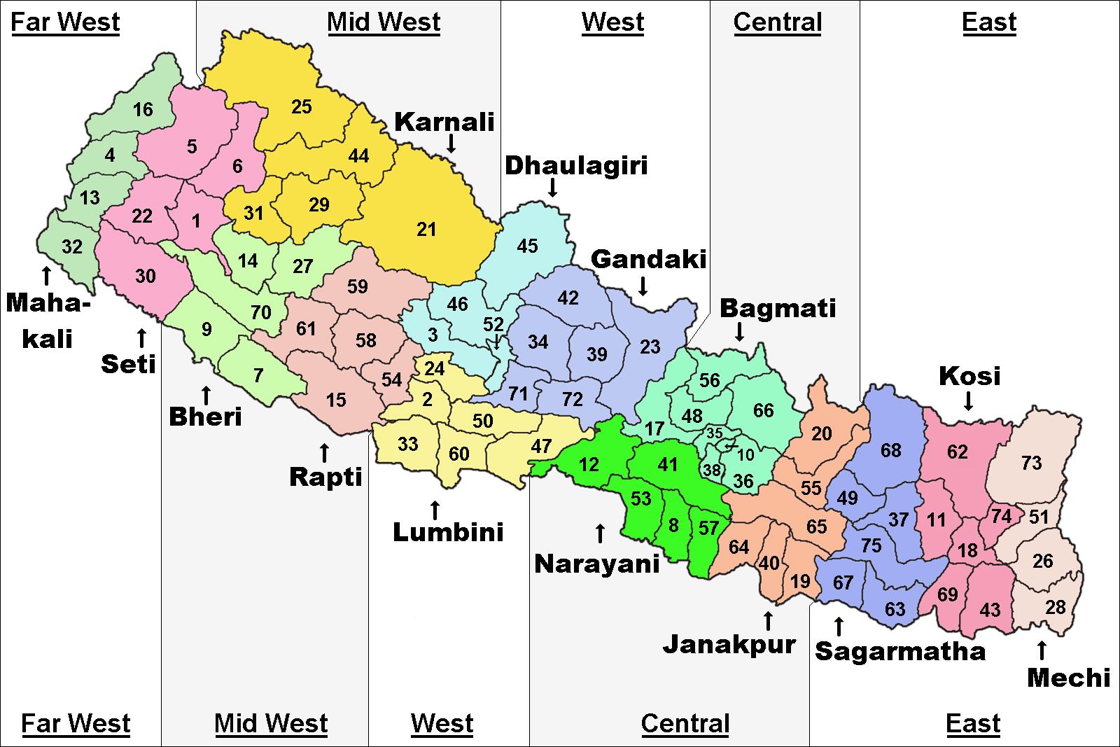
The Eastern Development Region ( Nepali: पुर्वाञ्चल विकास क्षेत्र, ''Purwānchal Bikās Kshetra'') was one of Nepal's five development regions. It is also known as Kirata region. It was located at the eastern end of the country with its headquarters at Dhankuta. The town of Dhankuta was the headquarter of the Eastern Region, as well as the headquarter of the Dhankuta District. History On April 13, 1961 Mahendra, the king of Nepal, divided the existing 35 districts into 75 districts and grouped them into 14 administrative zones. In 1972, the King of Nepal grouped 14 zones into total 4 development regions, thus Eastern Development Region came into existence. On 20 September 2015, Eastern Development Region including all other development regions of Nepal were abolished, when the new Constitution of Nepal-2015 was proclaimed. The total area of the region was 28,456 km². Administrative divisions The region administratively was ... [...More Info...] [...Related Items...] OR: [Wikipedia] [Google] [Baidu] |
Digital Himalaya
The Digital Himalaya project was established in December 2000 by Mark Turin, Alan Macfarlane, Sara Shneiderman, and Sarah Harrison. The project's principal goal is to collect and preserve historical multimedia materials relating to the Himalaya, such as photographs, recordings, and journals, and make those resources available over the internet and offline, on external storage media. The project team have digitized older ethnographic collections and data sets that were deteriorating in their analogue formats, so as to protect them from deterioration and make them available and accessible to originating communities in the Himalayan region and a global community of scholars. The project was founded at the Department of Anthropology of the University of Cambridge, moved to Cornell University in 2002 (when a collaboration with the University of Virginia was initiated), and then back to the University of Cambridge in 2005. From 2011 to 2014, the project was jointly hosted between the Uni ... [...More Info...] [...Related Items...] OR: [Wikipedia] [Google] [Baidu] |

