|
Berneuse
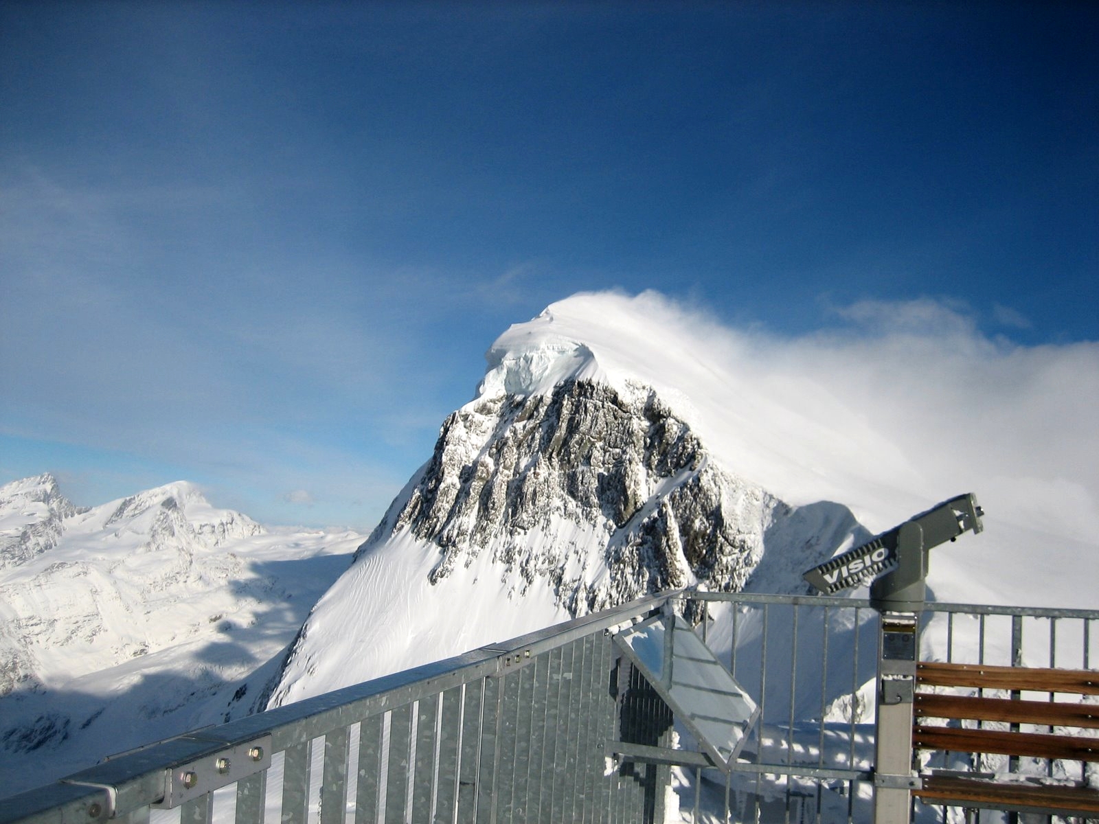
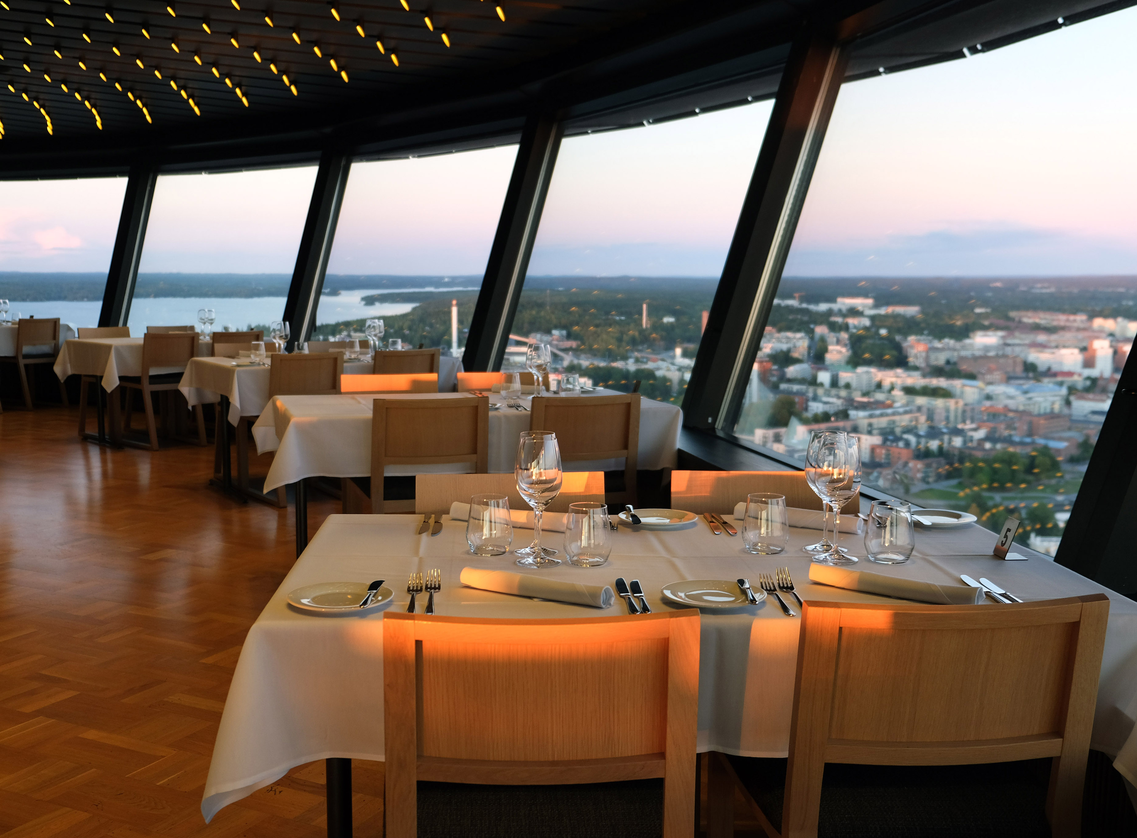
The Berneuse (or ''la Berneuse'') is a mountain of the western Bernese Alps, above Leysin in the canton of Vaud. It lies on the range east of the Rhone valley, culminating at the Tour d'Aï. Its summit (2,045 m) is a popular destination, hosting the ''Kuklos'', a revolving restaurant accessible by cable cabin from town. On a clear day, Lake Geneva is visible from this summit. See also *List of mountains of Switzerland accessible by public transport This is a list of mountains of Switzerland above 800 metres whose summits are accessible by public transport. This list includes mountains with a topographic prominence of at least 30 metres that have a station above the height of their key col a ... References External links Leysin Tourist Office official websiteBerneuse on HikrWebsite for hikers Cable cars in Switzerland Bernese Alps Mountains of the Alps Buildings and structures with revolving restaurants Mountains of the canton of Vaud Mountains of Switzerland { ... [...More Info...] [...Related Items...] OR: [Wikipedia] [Google] [Baidu] |
Tour D'Aï
The Tour d'Aï is a mountain in the western Bernese Alps, overlooking Leysin in the canton of Vaud. It is located near the Tour de Mayen, on the range lying between the Rhone and Col des Mosses, south of Lake Geneva, from where both summits can be easily seen. The summit can be accessed via a trail on its northern slopes, from the alp of Aï, near the Berneuse The Berneuse (or ''la Berneuse'') is a mountain of the western Bernese Alps, above Leysin in the canton of Vaud. It lies on the range east of the Rhone valley, culminating at the Tour d'Aï. Its summit (2,045 m) is a popular destination, host ..., above Leysin. References External links *Tour d'Aï on SummitPost Bernese Alps [...More Info...] [...Related Items...] OR: [Wikipedia] [Google] [Baidu] |
Leysin
Leysin is a municipality of the canton of Vaud in the Aigle district of Switzerland. It is first mentioned around 1231–32 as ''Leissins'', in 1352 as ''Leisins''. Located in the Vaud Alps, Leysin is a sunny alpine resort village at the eastern end of Lake Geneva in proximity to Montreux, Lausanne, and Geneva. In earlier years, Leysin was known for its TB sanatorias; today it is most famous for spectacular Alpine views across the Rhône Valley towards the Dents du Midi and year-round mountain sports and recreational facilities. The village of Leysin and hamlet of Veyges are a designated part of the Inventory of Swiss Heritage Sites. Geography Leysin has an area, , of . Of this area, or 34.9% is used for agricultural purposes, while or 37.2% is forested. Of the rest of the land, or 7.7% is settled (buildings or roads), or 0.2% is either rivers or lakes and or 19.8% is unproductive land. [...More Info...] [...Related Items...] OR: [Wikipedia] [Google] [Baidu] |
List Of Mountains Of Switzerland Accessible By Public Transport
This is a list of mountains of Switzerland above 800 metres whose summits are accessible by public transport. This list includes mountains with a topographic prominence of at least 30 metres that have a station above the height of their key col and within 120 metres (height difference) from the summit. The station can be reached by cable car, funicular, railway or bus. This list notably includes the Klein Matterhorn and the Säntis, respectively the highest and the most prominentInformation retrieved on 5 March 2014 froCore Europe 50 Most Prominent Peaks (peakbagger.com)an/ref> peaks of Europe with public transport access. It also includes the Chasseral, the most isolated summit of the country accessible to pedestrians. This list does not include ski lifts. For a list of ski areas, see List of ski areas and resorts in Switzerland. For a general list of mountains, see List of mountains of Switzerland. List See also *List of aerial tramways in Switzerland *List of funiculars ... [...More Info...] [...Related Items...] OR: [Wikipedia] [Google] [Baidu] |
Swisstopo
Swisstopo is the official name for the Swiss Federal Office of Topography (in German language, German: ''Bundesamt für Landestopografie''; French language, French: ''Office fédéral de topographie''; Italian language, Italian: ''Ufficio federale di topografia''; Romansh language, Romansh: ''Uffizi federal da topografia''), Switzerland's national mapping agency. The current name was made official in 2002. It had been in use as the domain name for the institute's homepage, swisstopo.ch, since 1997. Maps The main class of products produced by Swisstopo are topographical maps on seven different Scale (map), scales. Swiss maps have been praised for their accuracy and quality. Regular maps * 1:25.000. This is the most detailed map, useful for many purposes. Those are popular with tourists, especially for famous areas like Zermatt and St. Moritz. These maps cost CHF 13.50 each (2004). 208 maps on this scale are published at regular intervals. The first map published on this scale ... [...More Info...] [...Related Items...] OR: [Wikipedia] [Google] [Baidu] |
Revolving Restaurant
A revolving restaurant or rotating restaurant is usually a tower restaurant eating space designed to rest atop a broad circular revolving platform that operates as a large turntable. The building remains stationary and the diners are carried on the revolving floor. The revolving rate varies between one and three times per hour and enables patrons to enjoy a panoramic view without leaving their seats. Such restaurants are often located on upper stories of hotels, communication towers, and skyscrapers. Design and construction Revolving restaurants are designed as a circular structure, with a platform that rotates around a core in the center. The center core contains the building's elevators, kitchens, or other features. The restaurant itself rests on a thin steel platform, with the platform sitting on top of a series of wheels connected to the floor of the structure. Alternatively, some designs, like one in Memphis, Tennessee, have the platform mounted on tires. A motor rotate ... [...More Info...] [...Related Items...] OR: [Wikipedia] [Google] [Baidu] |
Buildings And Structures With Revolving Restaurants
A building, or edifice, is an enclosed structure with a roof and walls standing more or less permanently in one place, such as a house or factory (although there's also portable buildings). Buildings come in a variety of sizes, shapes, and functions, and have been adapted throughout history for a wide number of factors, from building materials available, to weather conditions, land prices, ground conditions, specific uses, prestige, and aesthetic reasons. To better understand the term ''building'' compare the list of nonbuilding structures. Buildings serve several societal needs – primarily as shelter from weather, security, living space, privacy, to store belongings, and to comfortably live and work. A building as a shelter represents a physical division of the human habitat (a place of comfort and safety) and the ''outside'' (a place that at times may be harsh and harmful). Ever since the first cave paintings, buildings have also become objects or canvasses of much artistic ... [...More Info...] [...Related Items...] OR: [Wikipedia] [Google] [Baidu] |
Mountains Of The Alps
This page tabulates only the most prominent mountains of the Alps, selected for having a topographic prominence of ''at least'' , and all of them exceeding in height. Although the list contains 537 summits, some significant alpine mountains are necessarily excluded for failing to meet the stringent prominence criterion. The list of these most prominent mountains is continued down to 2500 m elevation at List of prominent mountains of the Alps (2500–2999 m) and down to 2000 m elevation on List of prominent mountains of the Alps (2000–2499 m). All such mountains are located in either France, Italy, Switzerland, Liechtenstein, Austria, Germany or Slovenia, even in some lower regions. Together, these three lists include all 44 ultra-prominent peaks of the Alps, with 19 ultras over 3000m on this page. For a definitive list of all 82 the highest peaks of the Alps, as identified by the International Climbing and Mountaineering Federation (UIAA), and often referred to as the 'Alpi ... [...More Info...] [...Related Items...] OR: [Wikipedia] [Google] [Baidu] |
Cable Cars In Switzerland
Cable may refer to: Mechanical * Nautical cable, an assembly of three or more ropes woven against the weave of the ropes, rendering it virtually waterproof * Wire rope, a type of rope that consists of several strands of metal wire laid into a helix ** Arresting cable, part of a system used to rapidly decelerate an aircraft as it lands ** Bowden cable, a mechanical cable for transmitting forces * Rope generally, especially a thick, heavy ("cable laid") variety Transmission * Electrical cable, an assembly of one or more wires which may be insulated, used for transmission of electrical power or signals ** Coaxial cable, an electrical cable comprising an inner conductor surrounded by a flexible, tubular insulating layer, coated or surrounded by a tubular conducting shield ** Power cable, a cable used to transmit electrical power ** Submarine communications cable, a cable laid on the sea bed to carry telecommunication signals between land-based stations * Fiber-optic cable, a cable co ... [...More Info...] [...Related Items...] OR: [Wikipedia] [Google] [Baidu] |
Lake Geneva
, image = Lake Geneva by Sentinel-2.jpg , caption = Satellite image , image_bathymetry = , caption_bathymetry = , location = Switzerland, France , coords = , lake_type = Glacial lake , inflow = Rhône, Dranse , outflow = Rhône , catchment = , basin_countries = Switzerland, France , length = , width = , area = , depth = , max-depth = , volume = , residence_time = 11.4 years , shore = , elevation = , islands = Île de Peilz, Château de Chillon, Île de Salagnon, Île de la Harpe, Île Rousseau, Île de Choisi , cities = Geneva (CH), Lausanne (CH), Évian (F), Montreux (CH), Thonon (F), Vevey (CH) (''see list'') , pushpin_map=France Rhône-Alpes#Canton of Vaud#Canton of Valais#Switzerland#France#Alps , pushpin_label_position= bottom , e ... [...More Info...] [...Related Items...] OR: [Wikipedia] [Google] [Baidu] |
Bernese Alps
, topo_map= Swiss Federal Office of Topography swisstopo , photo=BerneseAlps.jpg , photo_caption=The Eiger, Mönch, and Jungfrau , country= Switzerland , subdivision1_type=Cantons , subdivision1= , parent= Western Alps , borders_on= , length_mi= , length_orientation= , width_mi= , width_orientation= , geology= , orogeny= , highest=Finsteraarhorn , elevation_m=4274 , range_coordinates= , coordinates= , map_image=Berner Alpen.png , map_caption=Map of Bernese Alps and their location in Switzerland (red) The Bernese Alps (german: Berner Alpen, french: Alpes bernoises, it, Alpi bernesi) are a mountain range of the Alps, located in western Switzerland. Although the name suggests that they are located in the Berner Oberland region of the canton of Bern, portions of the Bernese Alps are in the adjacent cantons of Valais, Fribourg and Vaud, the latter being usually named ''Fribourg Alps'' and ''Vaud Alps'' respectively. The highest mountain in the range, the Fins ... [...More Info...] [...Related Items...] OR: [Wikipedia] [Google] [Baidu] |
Mountain
A mountain is an elevated portion of the Earth's crust, generally with steep sides that show significant exposed bedrock. Although definitions vary, a mountain may differ from a plateau in having a limited Summit (topography), summit area, and is usually higher than a hill, typically rising at least 300 metres (1,000 feet) above the surrounding land. A few mountains are Monadnock, isolated summits, but most occur in mountain ranges. Mountain formation, Mountains are formed through Tectonic plate, tectonic forces, erosion, or volcanism, which act on time scales of up to tens of millions of years. Once mountain building ceases, mountains are slowly leveled through the action of weathering, through Slump (geology), slumping and other forms of mass wasting, as well as through erosion by rivers and glaciers. High elevations on mountains produce Alpine climate, colder climates than at sea level at similar latitude. These colder climates strongly affect the Montane ecosystems, ecosys ... [...More Info...] [...Related Items...] OR: [Wikipedia] [Google] [Baidu] |


