|
Bergstraße (route)
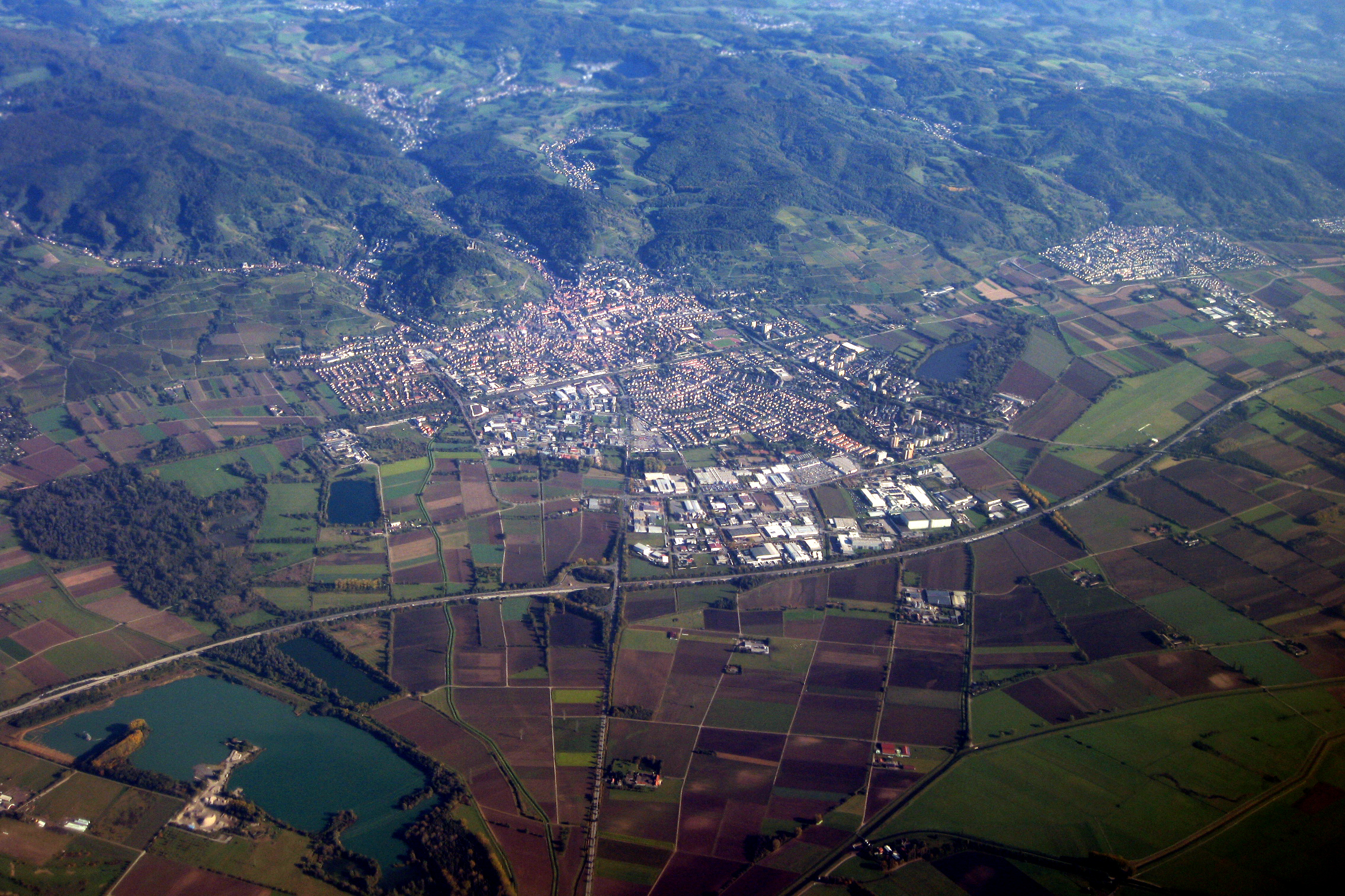
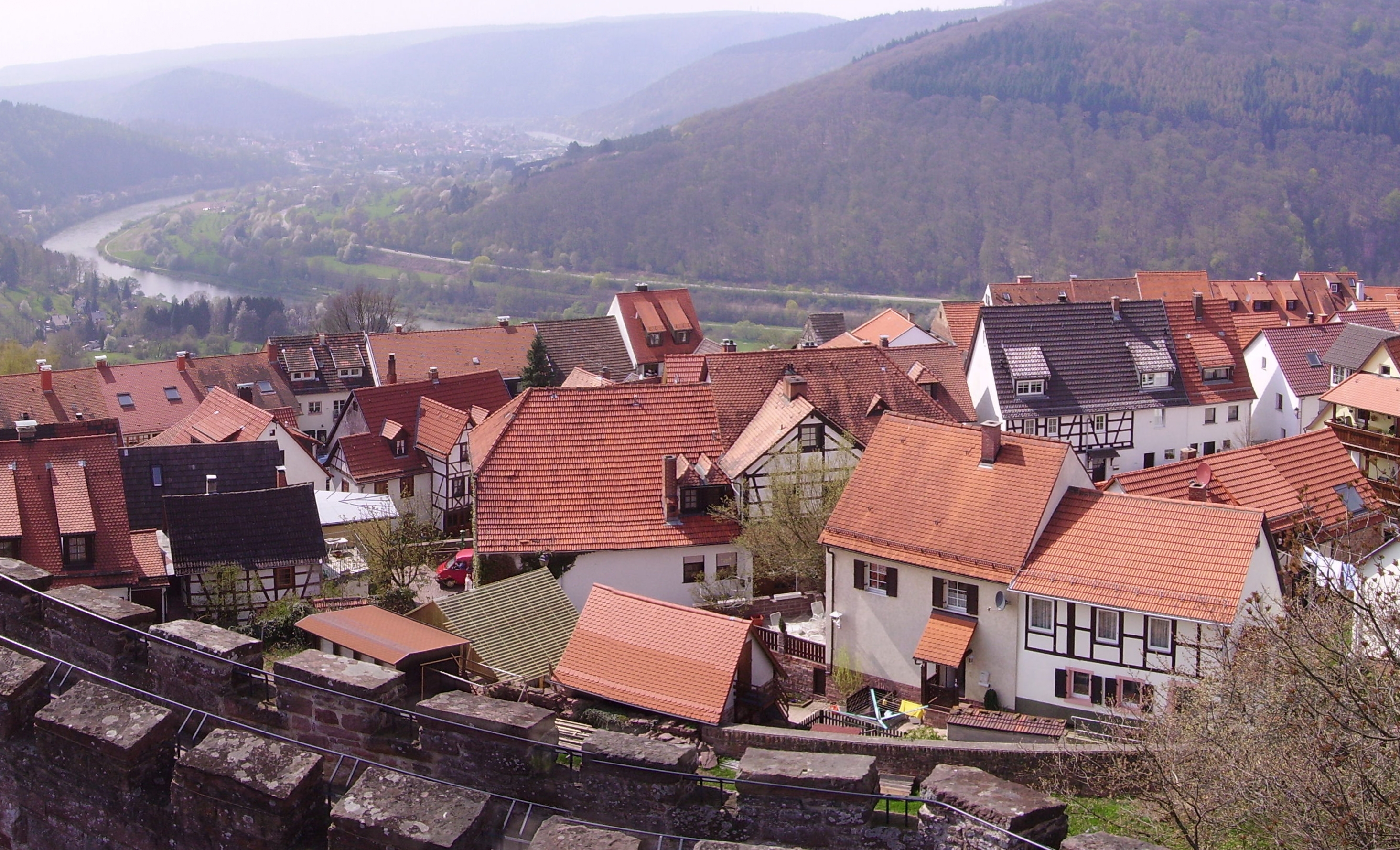
The Bergstraße ("Mountain Road") is ancient trade route in the south-west of Germany. The route and the area around it is a mountainous " theme route" running north–south along the western edge of the Odenwald forest in southern Hesse and northern Baden-Württemberg. The route passes through the Bergstraße administrative district, and independent viticultural regions of Hessische Bergstraße and Badische Bergstraße. Between the cities of Heidelberg and Weinheim the Upper Rhine Railway Company (OEG) tram route runs alongside. Route The route goes almost straight from north to south at the spot where the Rhine lowlands meet the western edge of the Odenwald. The name comes from the road's route along the foot of the mountains, the Rhine lowlands once being too damp to build a road there. The route mostly follows the modern B3 road. It begins in Darmstadt and, after passing through Eberstadt, splits into the "Old Bergstraße" and the "New Bergstraße", which goes somewhat ... [...More Info...] [...Related Items...] OR: [Wikipedia] [Google] [Baidu] |
Zwingenberg, Hesse
Zwingenberg lies in the Bergstraße district in southern Hessen, Germany, south of Frankfurt and Darmstadt, and with the granting of town rights coming in 1274 it is the oldest town on the Hessen Bergstraße. Geography Location Zwingenberg lies on the western edge of the Odenwald at the foot of the Melibokus, at 517.4 m above sea level the Bergstraße's highest mountain. The municipal area's elevation varies between roughly 90 m above sea level in the outlying centre of Rodau and just under 300 m on the slope of the Melibokus. Zwingenberg's highest elevation is no one single mountain. Rather, it runs along the Melibokus's slope into the area of Auerbach, an outlying centre of Bensheim. The 100-metre marker at Zwingenberg railway station is taken to be the standard. In the west, Zwingenberg abuts the ''Hessisches Ried'', and thereby the Rhine rift. In Zwingenberg's west, towards Rodau and in Rodau itself, cropraising and meadows prevail. Only a small patc ... [...More Info...] [...Related Items...] OR: [Wikipedia] [Google] [Baidu] |
Heppenheim
Heppenheim (Bergstraße) is the seat of Bergstraße district in Hesse, Germany, lying on the Bergstraße on the edge of the Odenwald. It is best known for being the birthplace of 4-time Formula One World Champion Sebastian Vettel. Geography Location The town is set on the vineyards below the mediaeval Starkenburg (castle). Defining for the townscape, besides the castle, is ''St. Peter'', the “Cathedral of the Bergstraße” as the big Catholic church is known locally; it was consecrated on 1 August 1904, and is not a bishop's seat. Heppenheim lies centrally on ''Bundesstraßen'' 3 and 460, and Autobahn A 5/ A 67, almost halfway between Heidelberg and Darmstadt, in southern Hesse on the boundary with Baden-Württemberg, and is Hesse's southernmost district seat. The town's official designation is “Heppenheim an der Bergstraße”. In the local Palatinate German dialect, the town is also called ''Hepprum''. “Bergstraße” is not only the name given t ... [...More Info...] [...Related Items...] OR: [Wikipedia] [Google] [Baidu] |
Baden
Baden (; ) is a historical territory in South Germany, in earlier times on both sides of the Upper Rhine but since the Napoleonic Wars only East of the Rhine. History The margraves of Baden originated from the House of Zähringen. Baden is named after the margraves' residence, in Baden-Baden. Hermann II of Baden first claimed the title of Margrave of Baden in 1112. A united Margraviate of Baden existed from this time until 1535, when it was split into the two Margraviates of Baden-Durlach and Baden-Baden. Following a devastating fire in Baden-Baden in 1689, the capital was moved to Rastatt. The two parts were reunited in 1771 under Margrave Charles Frederick. The restored Margraviate with its capital Karlsruhe was elevated to the status of electorate in 1803. In 1806, the Electorate of Baden, receiving territorial additions, became the Grand Duchy of Baden. The Grand Duchy of Baden was a state within the German Confederation until 1866 and the German Empire until 1918, ... [...More Info...] [...Related Items...] OR: [Wikipedia] [Google] [Baidu] |
Rhein-Neckar-Kreis
The Rhein-Neckar-Kreis is a district in the northwest of Baden-Württemberg, Germany. The administrative headquarters are based in the city Heidelberg, which is a district-free city. As of 2019, the district is the most populous in Baden-Württemberg. History The district was created in 1973 by merging the previous districts of Heidelberg, Mannheim and Sinsheim. Geography The district is named after the two main rivers which flow through the district, the Rhine and Neckar. The highest elevation is 580 m near the 584 m tall peak of the Odenwald mountain Stiefelhöhe, located near Heiligkreuzsteinach. The lowest elevation with 92 m is in Ilvesheim, located in the Neckar valley. Sights Government The district is governed by a district assembly (''Kreistag'') and a district executive (''Landrat''). The eligible voters of the district elect the Kreistag every 5 years. This body in turn elects the Landrat every 8 years. The Landrat is the legal representative of the district as wel ... [...More Info...] [...Related Items...] OR: [Wikipedia] [Google] [Baidu] |
Kreis Bergstraße
Kreis is the German word for circle. Kreis may also refer to: Places * , or circles, various subdivisions roughly equivalent to counties, districts or municipalities ** Districts of Germany (including and ) ** Former districts of Prussia, also known as ** ''Kreise'' of the former Electorate of Saxony *, or Imperial Circles, ceremonial associations of several regional monarchies () and/or imperial cities () in the Holy Roman Empire People * Harold Kreis (born 1959), Canadian-German ice hockey coach * Jason Kreis (born 1972), American soccer player * Melanie Kreis (born 1971), German businesswoman * Wilhelm Kreis (1873–1955), German architect Music and culture *''Der Kreis'', a Swiss gay magazine * ''Kreise'' (album), a 2017 album by Johannes Oerding See also * Krai, an administrative division in Russia * Kraj, an administrative division in Czechia and Slovakia * Okręg, an administrative division in Poland * Okres, an administrative division in Czechia and Slov ... [...More Info...] [...Related Items...] OR: [Wikipedia] [Google] [Baidu] |
Landkreis Darmstadt-Dieburg
Darmstadt-Dieburg is a Kreis (district) in the south of Hesse, Germany. Neighboring districts are Offenbach, Aschaffenburg, Miltenberg, Odenwaldkreis, Bergstraße, Groß-Gerau, and the district-free city of Darmstadt, which it surrounds. History The district was created in 1975 by merging the previous districts of Darmstadt and Dieburg. In 1963 the district was twinned with the district of North East Derbyshire, England, in 1990 with the district Zwickauer Land in Saxony, Germany, and in 1995 with the Mladá Boleslav region in the Czech Republic. Geography The district is located in the Odenwald mountains. Most famous in the district is the Messel Pit, where many fossils in the oil shale of a Tertiary lake were found. The site is listed in the UNESCO world heritage list since 1995. Coat of arms The coat of arms show a lion in the top part, taken from the coat of arms of the counts of Katzenelnbogen. The lion holds a Wheel of Mainz, the symbol of state of Mainz Mainz () ... [...More Info...] [...Related Items...] OR: [Wikipedia] [Google] [Baidu] |
List Of German Urban Districts ...
The sixteen constituent states of Germany are divided into a total of 401 administrative ''Kreis'' or ''Landkreis''; these consist of 294 rural districts (german: Landkreise or – the latter in the states of North Rhine-Westphalia and Schleswig-Holstein only), and 107 urban districts ( or, in Baden-Württemberg only, – cities that constitute districts in their own right). List Historical *Administrative divisions of East Germany *Administrative divisions of Nazi Germany See also *Districts of Germany * States of Germany * List of rural districts with populations and area * List of urban districts with populations and area References {{Reflist, 30em * Districts Districts A district is a type of administrative division that, in some countries, is managed by the local government. Across the world, areas known as "districts" vary greatly in size, spanning regions or counties, several municipalities, subdivisions o ... [...More Info...] [...Related Items...] OR: [Wikipedia] [Google] [Baidu] |
List Of German Rural Districts ...
The sixteen constituent states of Germany are divided into a total of 401 administrative ''Kreis'' or ''Landkreis''; these consist of 294 rural districts (german: Landkreise or – the latter in the states of North Rhine-Westphalia and Schleswig-Holstein only), and 107 urban districts ( or, in Baden-Württemberg only, – cities that constitute districts in their own right). List Historical *Administrative divisions of East Germany *Administrative divisions of Nazi Germany See also *Districts of Germany * States of Germany * List of rural districts with populations and area * List of urban districts with populations and area References {{Reflist, 30em * Districts Districts A district is a type of administrative division that, in some countries, is managed by the local government. Across the world, areas known as "districts" vary greatly in size, spanning regions or counties, several municipalities, subdivisions o ... [...More Info...] [...Related Items...] OR: [Wikipedia] [Google] [Baidu] |
Wiesloch
Wiesloch (, locally ; South Franconian: ''Wissloch''), is a town in northern Baden-Württemberg, Germany. It is situated 13 kilometres south of Heidelberg. After Weinheim, Sinsheim and Leimen it is the fourth largest town in the Rhein-Neckar-Kreis. It shares Wiesloch-Walldorf station with its neighbouring town Walldorf. Also in the vicinity of Wiesloch are Dielheim, Malsch (bei Wiesloch), Mühlhausen, Rauenberg and Sankt Leon-Rot. Wiesloch's population grew to more than 20,000 when the administration of the area was reorganised in the 1970s. Wiesloch became a ''Große Kreisstadt'' on 1 January 1973, when Altwiesloch, Baiertal, Frauenweiler and Schatthausen were amalgamated with Wiesloch to form the present municipality. History The settlement that is now Wiesloch town centre originated during the expansion of silver mining in the vicinity in the 10th century. Fossil site The fossil remains of the oldest hummingbird found to date, ''Eurotrochilus inexpectatus'', were found ... [...More Info...] [...Related Items...] OR: [Wikipedia] [Google] [Baidu] |


