|
Ben More (Crianlarich)
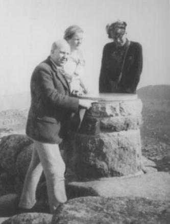
Ben More ( gd, Beinn Mhòr, "the great mountain") is a mountain in the Breadalbane region of the southern Scottish Highlands, near Crianlarich. Rising to , it is a Munro and is the highest of the so-called Crianlarich Hills to the south-east of the village. There is no higher land in the British Isles south of Ben More. It is separated from () by the ', " col between two mountains". It is the highest peak in the Loch Lomond and The Trossachs National Park. Ben More's north side contains a long-lasting snow patch, which – uniquely in the Southern Highlands – is named on a 1:25000 Ordnance Survey map, and is called the ' (crooked wreath), on account of the shape it forms in late spring/early summer. This patch frequently lasts until well into June and sometimes July. The similar name ' appears as a summit near Lochnagar. Climbing The simplest ascent starts from Benmore Farm on the A85. Initially, one should follow the path leading up Benmore Burn, before leaving this pa ... [...More Info...] [...Related Items...] OR: [Wikipedia] [Google] [Baidu] |
List Of Mountains Of The British Isles By Relative Height
This is a list of P600 mountains in Britain and Ireland by height. A P600 is defined as a mountain with a topographic prominence above , regardless of elevation or any other merits (e.g. topographic isolation); this is a similar approach to that of the Marilyn, Simms, HuMP and TuMP British Isle mountain and hill classifications. By definition, P600s have a height above , the requirement to be called a "mountain" in the British Isles. The "P" terminology is an international classification, along with P1500 Ultras. P600 and "Majors" are used interchangeably. , there were 120 P600s in the British Isles: 81 in Scotland, 25 in Ireland, 8 in Wales, 4 in England, 1 in Northern Ireland, and 1 in the Isle of Man. The 120 P600s contained 54 of the 282 Scottish Munros, and 10 of the 34 Non-Scottish Munros (or Furths), all of which have prominences above , and are sometimes called the "Super-Majors". The list also contained the highest mountains in Scotland, Wales, Ireland, and Eng ... [...More Info...] [...Related Items...] OR: [Wikipedia] [Google] [Baidu] |
Stob Binnein
Stob Binnein is a mountain in the southern Highlands of Scotland, near Crianlarich. It forms a twin-peak with Ben More 3,852 ft (1,174 m), from which it is separated by the Bealach-eadar-dha Beinn, meaning ''pass between two hills''. Stob Binnein is often climbed in conjunction with Ben More by means of the Bealach-eadar-dha Beinn. Descent may be made from the bealach direct to Benmore Burn. It may also be climbed from the south, starting near Inverlochlarig, some 8 km from Balquhidder. A route of about 5 km climbs from the glen, following the mountain's southern ridge over the intervening minor summits of Stob Invercarnaig and Stob Coire an Lochain. See also * Ben Nevis * List of Munro mountains * Mountains and hills of Scotland Scotland is the most mountainous country in the United Kingdom. Scotland's mountain ranges can be divided in a roughly north to south direction into: the Scottish Highlands, the Central Belt and the Southern Uplands, the latter two ... [...More Info...] [...Related Items...] OR: [Wikipedia] [Google] [Baidu] |
Air Accidents Investigation Branch
The Air Accidents Investigation Branch (AAIB) investigates civil aircraft accidents and serious incidents within the United Kingdom, its overseas territories and crown dependencies. It is also the Space Accident Investigation Authority (SAIA) for the United Kingdom. The AAIB is a branch of the Department for Transport and is based in the grounds of Farnborough Airport, Rushmoor, Hampshire. History Aviation accident investigation in the United Kingdom started in 1912, when the Royal Aero Club published a report into a fatal accident at Brooklands Aerodrome, Surrey. The AAIB was established in 1915 as the Accidents Investigation Branch (AIB) of the Royal Flying Corps (RFC). Captain G B Cockburn was appointed "Inspector of Accidents" for the RFC, reporting directly to the Director General of Military Aeronautics in the War Office. After the First World War, the Department of Civil Aviation was set up in the Air Ministry and the AIB became part of that department with a remit ... [...More Info...] [...Related Items...] OR: [Wikipedia] [Google] [Baidu] |
Glasgow International Airport
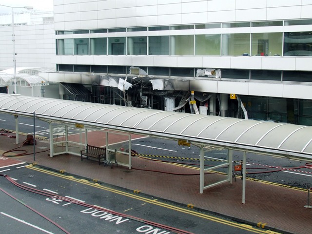
gd, Port-adhair Eadar-nàiseanta Ghlaschu , image = Glasgow Airport logo.svg , image-width = 200 , image2 = GlasgowAirportFromAir.jpg , image2-width = 250 , IATA = GLA , ICAO = EGPF , type = Public , owner = AGS Airports , hub = *easyJet *Loganair *TUI Airways , operator = Glasgow Airport Ltd. , city-served = Glasgow , elevation-f = 26 , pushpin_map = Scotland Renfrewshire , pushpin_map_caption = Location of airport in Renfrewshire , website = , r1-number = 05/23 , r1-length-m = 2,665 , stat-year = 2019 , stat1-header = Passengers , stat1-data = 8,843,214 , stat2-header = Passenger change 18–19 , stat2-data = 8.4% , stat3-header = Aircraft movements , stat3-data = 86,226 , stat4-header = Movements change 17–18 , stat4-data = 3.2% , footnotes = Sources: UK AIP at NATSStatistics from the UK Civil Aviation AuthorityLocation from Glasgow Airport Glasgow Airport, also known as Glasgow International Airport (), formerly ''Abbotsinch Airport'', is ... [...More Info...] [...Related Items...] OR: [Wikipedia] [Google] [Baidu] |
British European Airways
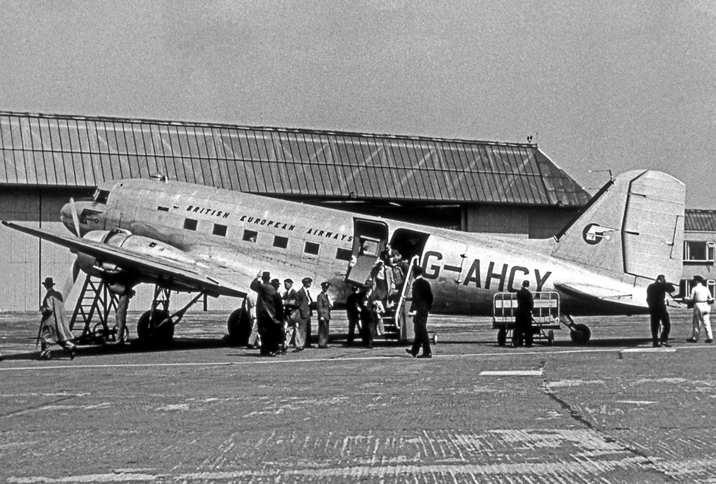
British European Airways (BEA), formally British European Airways Corporation, was a British airline which existed from 1946 until 1974. BEA operated to Europe, North Africa and the Middle East from airports around the United Kingdom. The airline was also the largest UK domestic operator, serving major British cities, including London, Manchester, Glasgow, Edinburgh and Belfast, as well as areas of the British Isles such as the Highlands and Islands of Scotland, the Channel Islands and the Isle of Man.''Classic Aircraft (Gone but not forgotten ... BEA: Highlands and Islands – Never on a Sunday)'', Vol. 45, No. 6, p. 46, Ian Allan Publishing, Hersham, June 2012 BEA also operated a network of internal German routes between West Berlin and West Germany as part of the Cold War agreements regulating air travel within Germany.''Classic Aircraft (Gone but not forgotten ... BEA: Internal German Services – Berlin-bound)'', Vol. 45, No. 6, p. 51, Ian Allan Publishing, Hersham, June ... [...More Info...] [...Related Items...] OR: [Wikipedia] [Google] [Baidu] |
Vickers Viscount
The Vickers Viscount is a British medium-range turboprop airliner first flown in 1948 by Vickers-Armstrongs. A design requirement from the Brabazon Committee, it entered service in 1953 and was the first turboprop-powered airliner. The Viscount was well received by the public for its cabin conditions, which included pressurisation, reductions in vibration and noise, and panoramic windows. It became one of the most successful and profitable of the first post-war transport aircraft; 445 Viscounts were built for a range of international customers, including in North America. Development Origins The Viscount was a response to the 1943 Brabazon Committee's proposed Type II design for a post-war small medium-range pressurised aircraft to fly less-travelled routes, carrying 24 passengers up to 1,750 mi (2,816 km) at 200 mph (320 km/h).Cacutt 1989, pp. 323–333. During discussions between the committee and Vickers' chief designer, Rex Pierson, Vickers adv ... [...More Info...] [...Related Items...] OR: [Wikipedia] [Google] [Baidu] |
Killin
Killin (; (Scottish Gaelic: ''Cill Fhinn'') is a village in Perthshire in the central highlands of Scotland. Situated at the western head of Loch Tay, it is administered by the Stirling Council area. Killin is a historic conservation village and sits within the Loch Lomond and The Trossachs National Park. It is the central settlement of the historic region of Breadalbane. Killin is notable as a historically important part of the Gaidhealtachd of Perthshire and a centre of wildlife and adventure tourism. A recent analysis (July 2021) by a leading mental health life insurance provider identified Killin as the second-best holiday destination for wellness in the United Kingdom Location and Etymology The west end of the village is magnificently sited around the scenic Falls of Dochart (Scottish Gaelic: ''Eas Dochard''). The falls are crossed by a narrow, multi-arched stone bridge carrying the main A827 road into Killin. The main street then leads down towards the Loch at the ... [...More Info...] [...Related Items...] OR: [Wikipedia] [Google] [Baidu] |
Forest
A forest is an area of land dominated by trees. Hundreds of definitions of forest are used throughout the world, incorporating factors such as tree density, tree height, land use, legal standing, and ecological function. The United Nations' Food and Agriculture Organization (FAO) defines a forest as, "Land spanning more than 0.5 hectares with trees higher than 5 meters and a canopy cover of more than 10 percent, or trees able to reach these thresholds ''in situ''. It does not include land that is predominantly under agricultural or urban use." Using this definition, '' Global Forest Resources Assessment 2020'' (FRA 2020) found that forests covered , or approximately 31 percent of the world's land area in 2020. Forests are the predominant terrestrial ecosystem of Earth, and are found around the globe. More than half of the world's forests are found in only five countries (Brazil, Canada, China, Russia, and the United States). The largest share of forests (45 percent) are in th ... [...More Info...] [...Related Items...] OR: [Wikipedia] [Google] [Baidu] |
Stream
A stream is a continuous body of water, body of surface water Current (stream), flowing within the stream bed, bed and bank (geography), banks of a channel (geography), channel. Depending on its location or certain characteristics, a stream may be referred to by a variety of local or regional names. Long large streams are usually called rivers, while smaller, less voluminous and more intermittent river, intermittent streams are known as streamlets, brooks or creeks. The flow of a stream is controlled by three inputs – surface runoff (from precipitation or meltwater), daylighting (streams), daylighted subterranean river, subterranean water, and surfaced groundwater (Spring (hydrology), spring water). The surface and subterranean water are highly variable between periods of rainfall. Groundwater, on the other hand, has a relatively constant input and is controlled more by long-term patterns of precipitation. The stream encompasses surface, subsurface and groundwater fluxes th ... [...More Info...] [...Related Items...] OR: [Wikipedia] [Google] [Baidu] |
A85 Road
The A85 is a major road in Scotland. It runs east from Oban along the south bank of Loch Etive, through Lochawe and Tyndrum, Crianlarich, Lochearnhead, St Fillans and Crieff before passing through Perth, where it crosses the River Tay via Perth Bridge to Bridgend. Its name between Crieff and Perth is the Crieff Road. It then multiplexes with the A90 to the Swallow Roundabout before diverging to follow the Invergowrie Bypass, Riverside Avenue and Riverside Drive before terminating in Dundee city centre. The A90 road from Perth to Dundee was previously numbered A85; on opening of an upgraded A94 to Aberdeen the A90 number was continued across the Friarton Bridge (previously M85) and on to the A85 route, then from Swallow Roundabout to Aberdeen. The Perth-Dundee stretch was formerly part of the Euroroute system, of route E120 which ran in a circular route between Inverness, Aberdeen, Dundee and Perth. Between Tyndrum and Crianlarich Crianlarich (; gd, A' Chrìon Làraich) ... [...More Info...] [...Related Items...] OR: [Wikipedia] [Google] [Baidu] |
Lochnagar
Lochnagar or is a mountain in the Mounth, in the Grampians of Scotland. It is about south of the River Dee near Balmoral. It is a popular hill with hillwalkers, and is a noted venue for summer and winter climbing. Names The English name refers to a mountain lake in the northeast corrie, , the 'little loch of the noisy sound'. or , 'mountain of breasts' or ' breast-shaped mountain', is probably the original Gaelic name for the mountain. The summit itself is , meaning 'small cairn of faeces' in Gaelic, or less euphemistically, 'little pile of shit'. Peter Drummond, former chairman of the Architectural Heritage Society of Scotland, has also suggested that is a corruption of ('slope'), which would lend a translation of 'little cairn of the slope'. Geography Lochnagar is located on the Royal Estate of Balmoral. Its principal feature is a north-facing corrie, around which most of the subsidiary tops, as well as the main peak, sit. The corrie is the location of many c ... [...More Info...] [...Related Items...] OR: [Wikipedia] [Google] [Baidu] |


_nahe_dem_Weiherdamm_in_Wildbergerhütte.jpg)

