|
Belbina (Argolis)
Belbina ( grc, Βέλβινα) was a town on a small island of the same name (now known as St. George). The island was very lofty and difficult to access, situated at the entrance of the Saronic Gulf, about 10 miles (16 km) from the promontory of Sunium. Although nearer to Attica than the Peloponnesus, it was reckoned to belong to the latter, in particular to ancient Argolis. Therefore, it was inhabited by the Dorians, and was probably a colony from Belemina (also written Belmina and Belbina), a town on the confines of Laconia and Arcadia. Themistocles Themistocles (; grc-gre, Θεμιστοκλῆς; c. 524–459 BC) was an Athenian politician and general. He was one of a new breed of non-aristocratic politicians who rose to prominence in the early years of the Athenian democracy. A ... quotes the island as one of the most insignificant spots in ancient Greece. Although the island is now uninhabited, it was inhabited in antiquity. On the slopes of its hills ther ... [...More Info...] [...Related Items...] OR: [Wikipedia] [Google] [Baidu] |
Belbina (island)
Agios Georgios ( el, Άγιος Γεώργιος) or San Giorgio is a Greek unpopulated and uninhabited island in the entry of Saronic Gulf. It’s the largest uninhabited island of the Saronic Islands with an area of 4.3 km2. History In antiquity the island was named Belbina ( grc, Βέλβινα) and it is mentioned by Herodotus in a dialogue between Themistocles and his political opponent Timodemos from Afidnes. There was also a town of the same name on the island. Though some scholars have proposed that Agios Georgios should be identified as the ancient Psyttaleia which was involved in the Battle of Salamis, the consensus remains with the island that has long been known as Lipsokoutali, now renamed Psyttaleia. Modern times In 2016 a 73 MW wind farm was built on the island by Terna Energy, and delivers about 250 GWh electricity per year to Athens. Administratively, the island has belonged to the municipality of Hydra since 1834. In recent years, the municipality of Lavreo ... [...More Info...] [...Related Items...] OR: [Wikipedia] [Google] [Baidu] |
Saronic Gulf
The Saronic Gulf (Greek: Σαρωνικός κόλπος, ''Saronikós kólpos'') or Gulf of Aegina in Greece is formed between the peninsulas of Attica and Argolis and forms part of the Aegean Sea. It defines the eastern side of the isthmus of Corinth, being the eastern terminus of the Corinth Canal, which cuts across the isthmus. The Saronic Islands in the gulf have played a pivotal role in the history of Greece, with the largest, Salamis, naming a significant naval battle in the Greco-Persian wars. The Megara Gulf makes up the northern end of the Saronic Gulf. The capital of Greece, Athens, lies on the north coast of the Saronic Gulf. Etymology The origin of the gulf's name comes from the mythological king Saron who drowned at the Psifaei lake (modern Psifta). The Saronic Gulf was a string of six entrances to the Underworld, each guarded by a chthonic enemy in the shape of a thief or bandit. History The Battle of Salamis, just to the west of modern-day Piraeus, took ... [...More Info...] [...Related Items...] OR: [Wikipedia] [Google] [Baidu] |
Cape Sounion
Cape Sounion (Modern Greek: Aκρωτήριο Σούνιο ''Akrotírio Soúnio'' ; grc, Ἄκρον Σούνιον ''Άkron Soúnion'', latinized ''Sunium''; Venetian: ''Capo Colonne'' "Cape of Columns") is the promontory at the southernmost tip of the Attic peninsula, south of the town of Lavrio (ancient Thoricus), and 69.5 km (43.1 miles) southeast of Athens. It is part of Lavreotiki municipality, East Attica, Greece. Cape Sounion is noted for its Temple of Poseidon, one of the major monuments of the Golden Age of Athens. Its remains are perched on the headland, surrounded on three sides by the Aegean sea. Climate Cape Sounio has a hot semi-arid climate (Köppen climate classification: ''BSh''). Cape Sounio experiences hot, dry summers and mild, wetter winters. Current Weather (2021) Weather records for 2021 in Ilioupoli (as of 31 October 2021) are given below: History The earliest literary reference to Sounion is in Homer's ''Odyssey'' (III. 278–285) ... [...More Info...] [...Related Items...] OR: [Wikipedia] [Google] [Baidu] |
Peloponnesus
The Peloponnese (), Peloponnesus (; el, Πελοπόννησος, Pelopónnēsos,(), or Morea is a peninsula and geographic region in southern Greece. It is connected to the central part of the country by the Isthmus of Corinth land bridge which separates the Gulf of Corinth from the Saronic Gulf. From the late Middle Ages until the 19th century the peninsula was known as the Morea ( grc-x-byzant, Μωρέας), (Morèas) a name still in colloquial use in its demotic form ( el, Μωριάς, links=no), (Moriàs). The peninsula is divided among three administrative regions: most belongs to the Peloponnese region, with smaller parts belonging to the West Greece and Attica regions. Geography The Peloponnese is a peninsula located at the southern tip of the mainland, in area, and constitutes the southernmost part of mainland Greece. It is connected to the mainland by the Isthmus of Corinth, where the Corinth Canal was constructed in 1893. However, it is also connected to the ma ... [...More Info...] [...Related Items...] OR: [Wikipedia] [Google] [Baidu] |
Dorians
The Dorians (; el, Δωριεῖς, ''Dōrieîs'', singular , ''Dōrieús'') were one of the four major ethnic groups into which the Hellenes (or Greeks) of Classical Greece divided themselves (along with the Aeolians, Achaeans, and Ionians). They are almost always referred to as just "the Dorians", as they are called in the earliest literary mention of them in the ''Odyssey'', where they already can be found inhabiting the island of Crete. They were diverse in way of life and social organization, varying from the populous trade center of the city of Corinth, known for its ornate style in art and architecture, to the isolationist, military state of Sparta. And yet, all Hellenes knew which localities were Dorian, and which were not. Dorian states at war could more likely, but not always, count on the assistance of other Dorian states. Dorians were distinguished by the Doric Greek dialect and by characteristic social and historical traditions. In the 5th century BC, Dorians an ... [...More Info...] [...Related Items...] OR: [Wikipedia] [Google] [Baidu] |
Belemina
Belemina ( grc, Βελεμίνα), or Belmina (Βέλμινα), or Belbina (Βελβίνα), or Blenina (Βλένινα), was a town of ancient Laconia and ancient Arcadia, at the northwest frontier of the former, the territory of which was called Belminatis (Βελμινᾶτις). It was originally an Arcadian town, but was conquered by the Lacedaemonians at an early period, and annexed to their territory; although Pausanias does not believe this statement. After the Battle of Leuctra, Belemina was restored to Arcadia, reckoned to be part of Aegytis; most of its inhabitants were removed to the newly founded city of Megalopolis; and the place continued to be a dependency of the latter city. In the wars of the Achaean League, the Belminatis was a constant source of contention between the Spartans and Achaeans. Under Machanidas or Nabis, the tyrants of Sparta, the Belminatis was again annexed to Laconia; but upon the subjugation of Sparta by Philopoemen in 188 BCE, the Belminatis ... [...More Info...] [...Related Items...] OR: [Wikipedia] [Google] [Baidu] |
Ancient Laconia
Laconia or Lakonia ( el, Λακωνία, , ) is a historical and administrative region of Greece located on the southeastern part of the Peloponnese peninsula. Its administrative capital is Sparta. The word ''laconic''—to speak in a blunt, concise way—is derived from the name of this region, a reference to the ancient Spartans who were renowned for their verbal austerity and blunt, often pithy remarks. Geography Laconia is bordered by Messenia to the west and Arcadia to the north and is surrounded by the Myrtoan Sea to the east and by the Laconian Gulf and the Mediterranean Sea to the south. It encompasses Cape Malea and Cape Tainaron and a large part of the Mani Peninsula. The Mani Peninsula is in the west region of Laconia. The islands of Kythira and Antikythera lie to the south, but they administratively belong to the Attica regional unit of islands. The island, Elafonisos, situated between the Laconian mainland and Kythira, is part of Laconia. The Eurotas is the longe ... [...More Info...] [...Related Items...] OR: [Wikipedia] [Google] [Baidu] |
Ancient Arcadia
Arcadia ( el, Ἀρκαδία) is a region in the central Peloponnese. It takes its name from the mythological character Arcas, and in Greek mythology it was the home of the gods Hermes and Pan. In European Renaissance arts, Arcadia was celebrated as an unspoiled, harmonious wilderness; as such, it was referenced in popular culture. The modern regional unit of the same name more or less overlaps with the historical region, but is slightly larger. History Arcadia was gradually linked in a loose confederation that included all the Arcadian towns and was named League of the Arcadians. In the 7th century BC, it successfully faced the threat of Sparta and the Arcadians managed to maintain their independence. They participated in the Persian Wars alongside other Greeks by sending forces to Thermopylae and Plataea. During the Peloponnesian War, Arcadia allied with Sparta and Corinth. In the following years, during the period of the Hegemony of Thebes, the Theban general Epaminond ... [...More Info...] [...Related Items...] OR: [Wikipedia] [Google] [Baidu] |
Themistocles
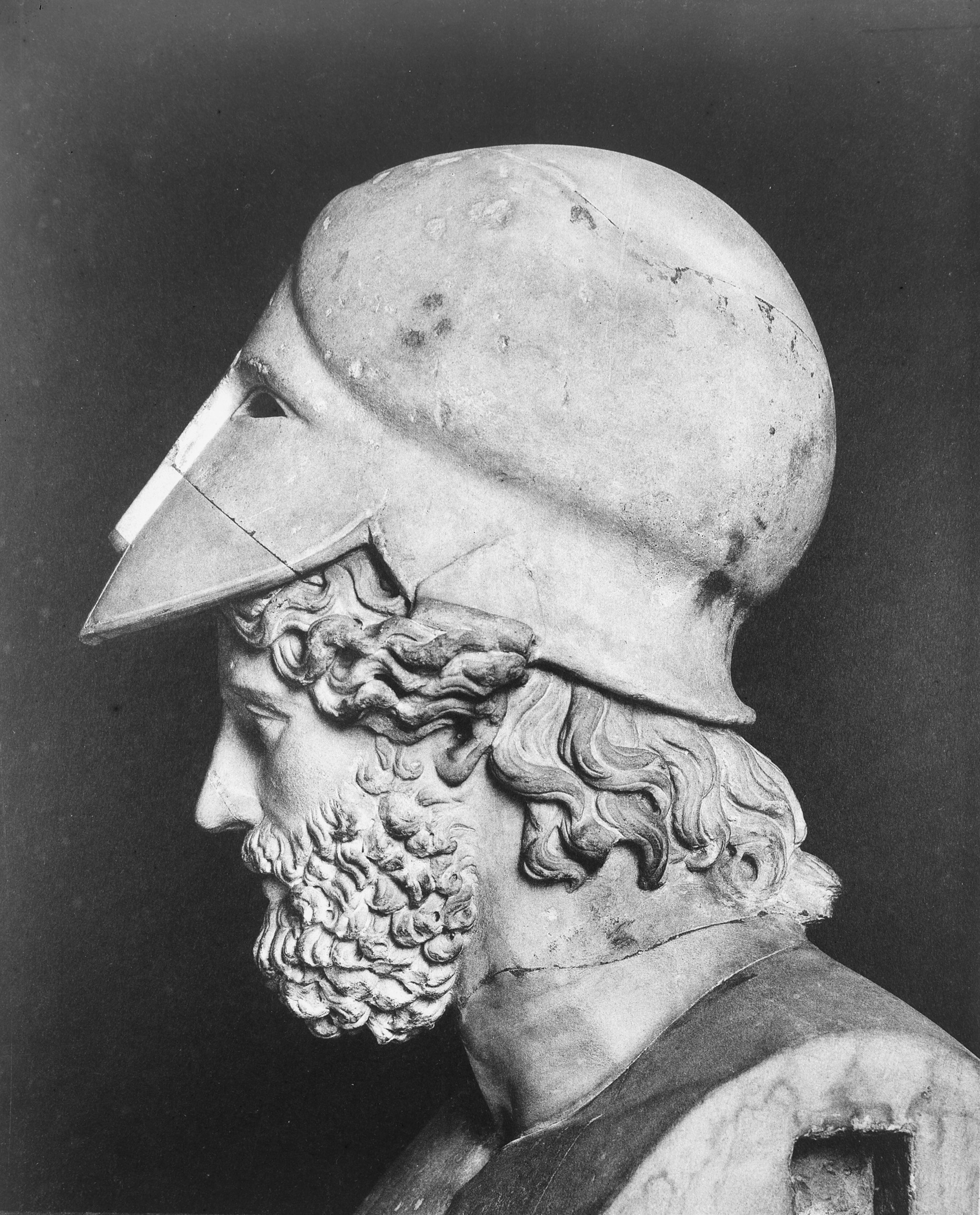
Themistocles (; grc-gre, Θεμιστοκλῆς; c. 524–459 BC) was an Athenian politician and general. He was one of a new breed of non-aristocratic politicians who rose to prominence in the early years of the Athenian democracy. As a politician, Themistocles was a populist, having the support of lower-class Athenians, and generally being at odds with the Athenian nobility. Elected archon in 493 BC, he convinced the polis to increase the naval power of Athens, a recurring theme in his political career. During the first Persian invasion of Greece he fought at the Battle of Marathon (490 BC) and was possibly one of the ten Athenian ''strategoi'' (generals) in that battle. In the years after Marathon, and in the run-up to the second Persian invasion of 480–479 BC, Themistocles became the most prominent politician in Athens. He continued to advocate for a strong Athenian Navy, and in 483 BC he persuaded the Athenians to build a fleet of 200 triremes; these prove ... [...More Info...] [...Related Items...] OR: [Wikipedia] [Google] [Baidu] |
Periplus Of Pseudo-Scylax
The ''Periplus of Pseudo-Scylax'' is an ancient Greek periplus (περίπλους ''períplous'', 'circumnavigation') describing the sea route around the Mediterranean and Black Sea. It probably dates from the mid-4th century BC, specifically the 330s, and was probably written at or near Athens. Its author is often included among the ranks of 'minor' Greek geographers. There is only one manuscript available, which postdates the original work by over 1500 years. The author's name is written Pseudo-Scylax or Pseudo-Skylax, often abbreviated as Ps.-Scylax or Ps.-Skylax. Author The only extant, medieval manuscript names the author as "Scylax"' (or "Skylax"), but scholars have proven that this attribution is to be treated as a so-called "pseudepigraphy, pseudepigraphical appeal to authority": Herodotus mentions a Scylax of Caryanda, a Greek navigator who in the late sixth century BC explored the coast of the Indian Ocean on behalf of the Achaemenid Persia, Persians.Herodotus. ''His ... [...More Info...] [...Related Items...] OR: [Wikipedia] [Google] [Baidu] |


