|
Beenleigh Historical Village
The Beenleigh Historical Village and Museum is an open-air museum at Main Street, Beenleigh, City of Logan, Queensland, Australia. It preserves twenty buildings from Beenleigh's past which contain many collections related to the history of this district. History in July 2019 the Heck family homestead "‘Friedensheim" (House of Peace), then at 129 Mill Road, Woongoolba, opposite the Rocky Point Sugar Mill (), was divided into three pieces and relocated to the museum. Following work to reconstruct and restore the building, it was officially reopened in November 2021 at the museum. The homestead was built in 1914 for the Heck family who operated the sugar mill but had not been used as a home since the 1970s. Buildings The buildings preserved on the site include: * the heritage-listed former St George's Anglican Church * the council chambers of the former Shire of Beenleigh * the Loganholme School building * the original 1885 Beenleigh railway station building *the Heck family ho ... [...More Info...] [...Related Items...] OR: [Wikipedia] [Google] [Baidu] |
St George's Anglican Church, Beenleigh
St George's Anglican Church is a heritage-listed former church in the Beenleigh Historical Village, Main Street, Beenleigh, City of Logan, Queensland, Australia. It was designed by Francis Drummond Greville Stanley and built in 1875 by Wohlsen and Ehlers. It was added to the Queensland Heritage Register on 21 October 1992. History The Reverend Dubois was appointed as the Church of England minister for Beenleigh in March 1871, preaching his services in the local court house. By August 1871, the congregation were planning to build a church. However, by March 1873, plans for the church slowed when Dubois left the district and the Bishop of Brisbane failed to appoint a replacement minister. In January 1874, the Reverend James Gilbertson was appointed to the district and planning resumed, calling for tenders in May 1874. The church was built in 1875 by Wohlsen and Ehlers to a design by prominent Brisbane architect FDG Stanley. It was built on land donated by local pioneer Micha ... [...More Info...] [...Related Items...] OR: [Wikipedia] [Google] [Baidu] |
Open-air Museum
An open-air museum (or open air museum) is a museum that exhibits collections of buildings and artifacts out-of-doors. It is also frequently known as a museum of buildings or a folk museum. Definition Open air is “the unconfined atmosphere…outside buildings...” In the loosest sense, an open-air museum is any institution that includes one or more buildings in its collections, including farm museums, historic house museums, and archaeological open-air museums. Mostly, 'open-air museum is applied to a museum that specializes in the collection and re-erection of multiple old buildings at large outdoor sites, usually in settings of recreated landscapes of the past, and often include living history. They may, therefore, be described as building museums. European open-air museums tended to be sited originally in regions where wooden architecture prevailed, as wooden structures may be translocated without substantial loss of authenticity. Common to all open-air museums, including ... [...More Info...] [...Related Items...] OR: [Wikipedia] [Google] [Baidu] |
Beenleigh
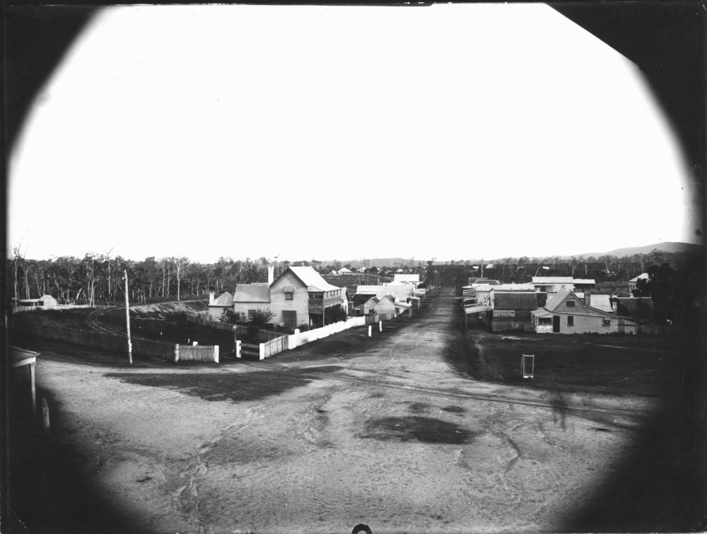
Beenleigh is a town and suburb in the City of Logan, Queensland, Australia. In the , the suburb of Beenleigh had a population of 8,252 people. A government survey for the new town was conducted in 1866. The town is the terminus for the Beenleigh railway line, which first opened in 1885 and a stop on the South Coast railway line, which reached Southport in 1889. Beenleigh was the administrative centre of the former Shire of Albert. It is known for the heritage-listed tourist attraction called the Beenleigh Artisan Distillery. In recent years it has seen many high rise developments. Geography Beenleigh and adjoining suburbs are located near the confluence of the Logan and Albert Rivers. The urban centre lies southwest of the Pacific Motorway after it crosses the Logan River and is crossed by the Gold Coast railway line. Logan River Parklands contain a boat ramp, barbeques, and a picnic area. Whilst it was once a stand-alone town built on sugar and home to Australia's olde ... [...More Info...] [...Related Items...] OR: [Wikipedia] [Google] [Baidu] |
City Of Logan
Logan City is a local government area situated within the south of the Brisbane metropolitan area in South East Queensland, Australia. Situated between the City of Brisbane to the north and the City of Gold Coast to the south, the City also borders the Scenic Rim Region, the City of Ipswich, and Redland City LGAs. Logan City is divided into 70 suburbs and 12 divisions; a councillor is elected to each of the latter. The area had a population of 326,615 in June 2018. Gaining significant area in 2008 from the amalgamation of parts of the Albert and Beaudesert Shires, Logan City extends north to Priestdale, south to Mundoolun near the Albert River, east to Carbrook at the Logan River, and west to Lyons. Logan City is located across parts of the sub-basin of Oxley Creek, and the Logan and Albert Rivers. The Daisy Hill Koala Centre serves as an example of Logan's prominent bushland, reminiscent of Karawatha Forest, and the Tamborine and Venman Bushland National Parks, that bo ... [...More Info...] [...Related Items...] OR: [Wikipedia] [Google] [Baidu] |
Queensland
) , nickname = Sunshine State , image_map = Queensland in Australia.svg , map_caption = Location of Queensland in Australia , subdivision_type = Country , subdivision_name = Australia , established_title = Before federation , established_date = Colony of Queensland , established_title2 = Separation from New South Wales , established_date2 = 6 June 1859 , established_title3 = Federation , established_date3 = 1 January 1901 , named_for = Queen Victoria , demonym = , capital = Brisbane , largest_city = capital , coordinates = , admin_center_type = Administration , admin_center = 77 local government areas , leader_title1 = Monarch , leader_name1 = Charles III , leader_title2 = Governor , leader_name2 = Jeannette Young , leader_title3 = Premier , leader_name3 = Annastacia Palaszczuk ( ALP) , legislature = Parliament of Queensland , judiciary = Supreme Court of Queensland , national_representation = Parliament of Australia , national_representation_type ... [...More Info...] [...Related Items...] OR: [Wikipedia] [Google] [Baidu] |
Logan City Council
Logan City is a local government area situated within the south of the Brisbane metropolitan area in South East Queensland, Australia. Situated between the City of Brisbane to the north and the City of Gold Coast to the south, the City also borders the Scenic Rim Region, the City of Ipswich, and Redland City LGAs. Logan City is divided into 70 suburbs and 12 divisions; a councillor is elected to each of the latter. The area had a population of 326,615 in June 2018. Gaining significant area in 2008 from the amalgamation of parts of the Albert and Beaudesert Shires, Logan City extends north to Priestdale, south to Mundoolun near the Albert River, east to Carbrook at the Logan River, and west to Lyons. Logan City is located across parts of the sub-basin of Oxley Creek, and the Logan and Albert Rivers. The Daisy Hill Koala Centre serves as an example of Logan's prominent bushland, reminiscent of Karawatha Forest, and the Tamborine and Venman Bushland National Parks, that bo ... [...More Info...] [...Related Items...] OR: [Wikipedia] [Google] [Baidu] |
Woongoolba, Queensland
Woongoolba is a coastal rural locality in the northern part of City of Gold Coast, Queensland, Australia. In the , Woongoolba had a population of 280 people. Geography The locality is bounded to the north by the Logan River () and to the north-east by Moreton Bay. Little Rocky Point is a headland jutting into Moreton Bay (). The land is low-lying (less than 10 metres above sea level) with only three places higher than this in the locality: * Marks Hill () rising to in the north-east of the locality, close to the mouth of the Logan River * immediately inland of Little Rocky Point * Cecil Zipf Park along the coast The land is predominantly used for growing sugarcane except for the north-east of the locality which is used for aquaculture, mostly prawns. Parts of the north-east of the locality are marshland and undeveloped. History In the late 1800s, the farming district located between the Pimpama River and the Logan River called Pimpama Island and encompasses the modern local ... [...More Info...] [...Related Items...] OR: [Wikipedia] [Google] [Baidu] |
Rocky Point Sugar Mill
''Rocky'' is a 1976 American sports drama film directed by John G. Avildsen and written by and starring Sylvester Stallone. It is the first installment in the ''Rocky'' franchise and stars Talia Shire, Burt Young, Carl Weathers, and Burgess Meredith. In the film, Rocky Balboa (Stallone), an uneducated, small-time club fighter and debt collector gets an unlikely shot at the world heavyweight championship held by Apollo Creed (Weathers). ''Rocky'' entered development in March 1975, after Stallone wrote the screenplay in three days. It entered a complicated production process after Stallone refused to allow the film to be made without him in the lead role; United Artists eventually agreed to cast Stallone after he rejected a six figure deal for the film rights. Principal photography began in January 1976, with filming primarily held in Philadelphia; several locations featured in the film, such as the Rocky Steps, are now considered cultural landmarks. With an estimated production ... [...More Info...] [...Related Items...] OR: [Wikipedia] [Google] [Baidu] |
The RHSQ Bulletin
''The'' () is a grammatical article in English, denoting persons or things that are already or about to be mentioned, under discussion, implied or otherwise presumed familiar to listeners, readers, or speakers. It is the definite article in English. ''The'' is the most frequently used word in the English language; studies and analyses of texts have found it to account for seven percent of all printed English-language words. It is derived from gendered articles in Old English which combined in Middle English and now has a single form used with nouns of any gender. The word can be used with both singular and plural nouns, and with a noun that starts with any letter. This is different from many other languages, which have different forms of the definite article for different genders or numbers. Pronunciation In most dialects, "the" is pronounced as (with the voiced dental fricative followed by a schwa) when followed by a consonant sound, and as (homophone of the archaic pron ... [...More Info...] [...Related Items...] OR: [Wikipedia] [Google] [Baidu] |
Quest Newspapers
Quest Community Newspapers is a newspaper company in Bowen Hills, Queensland, Australia. It is a subsidiary of News Corp Australia. It publishes weekly tabloids and one bi-weekly, providing news coverage primarily for the greater Brisbane area. In total, there are 20 free suburban newspapers, one news magazine (''City News'') and one gloss lifestyle magazine based on the Sunshine Coast, ''The Weekender'', distributed to households and businesses throughout South East Queensland. Mastheads Collectively, Quest Community Newspapers cover an area stretching from Caboolture in the north to Logan in the south, providing coverage of key suburbs in Brisbane for more than 1,000,000 readers in print and online weekly. The full list of titles are: *''Albert & Logan News'', online-only since June 2020 *''Bribie Weekly'', ceased publication in June 2020 *''Caboolture Herald'' (formerly ''Caboolture Shire Herald'') *''City North News'' ( – present) *''City South News'' *''Nort ... [...More Info...] [...Related Items...] OR: [Wikipedia] [Google] [Baidu] |
Shire Of Beenleigh
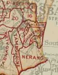
The Shire of Beenleigh is a former Local government in Australia, local government area in the south-east of Queensland, Australia, centred on the town of Beenleigh, Queensland, Beenleigh. It existed from 1879 to 1949. History On 11 November 1879, the Beenleigh Division was created as one of 74 divisions within Queensland under the ''Divisional Boards Act 1879'' with a population of 1578. With the passage of the ''Local Authorities Act 1902'', it became a Shire on 31 March 1903. Amalgamations in 1948 On 9 December 1948, as part of a major reorganisation of local government in South East Queensland, an Order in Council replacing ten former local government areas between the City of Brisbane and the New South Wales border with only four. The former ten were: * Shire of Beaudesert, Beaudesert * Beenleigh * Shire of Cleveland, Cleveland * Town of Coolangatta, Coolangatta * Shire of Coomera, Coomera * Shire of Nerang, Nerang * Town of Southport, Southport * Shire of Tamborine, Tambo ... [...More Info...] [...Related Items...] OR: [Wikipedia] [Google] [Baidu] |
Loganholme
Loganholme is a suburb in the City of Logan, Queensland, Australia. In the , Loganholme had a population of 6,303 people. The majority of the land is used for houses while it has range of other uses. Geography The suburb is bisected by the Pacific Motorway and the Logan Motorway which aligns with a small section of the northern boundary. The southern and western boundaries of the suburb follow the Logan River. Tudor Park on Clarks Road features sports facilities. The Beenleigh–Redland Bay Road exits to the north-east. A small pocket of land by the Logan River is known as Alexander Clark Park. The park is well-facilitated and available for large groups and events such as weddings. East of the motorway is a large commercial and industrial area, adjacent to vacant flood plains. Here the largest wastewater treatment plant in the City of Logan began an upgrade process in 2014. The upgrade was needed to meet population growth in the area. In the northern tip of Loganholme, ... [...More Info...] [...Related Items...] OR: [Wikipedia] [Google] [Baidu] |


.png)

