|
Bee-Line Bus System
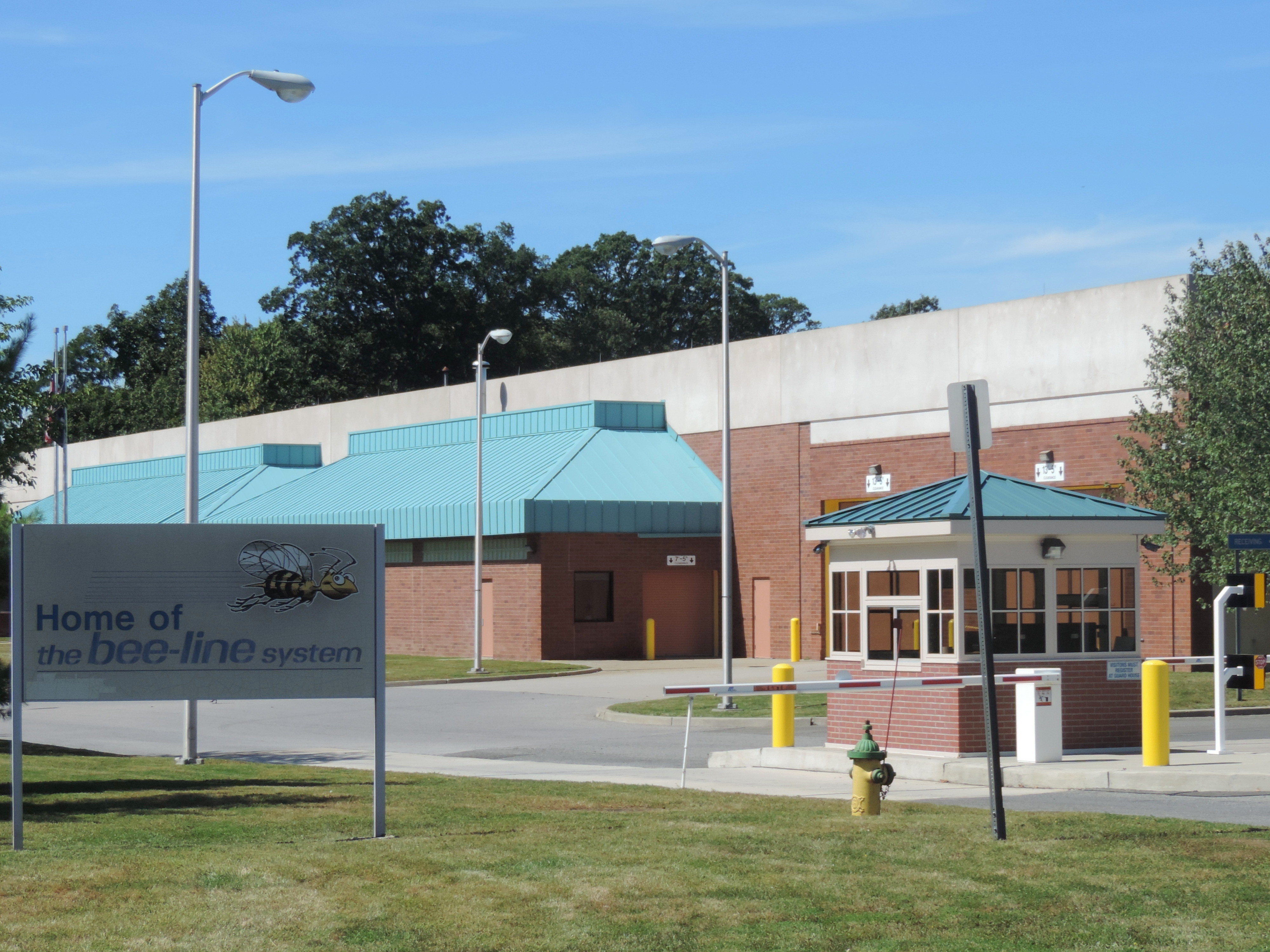
The Westchester County Bee-Line System, branded on the buses in lowercase as ''the bee-line system'', is a bus system serving Westchester County, New York. The system is owned by the county's Department of Public Works and Transportation. History The system was founded on May 1, 1978, by the then Westchester County Department of Transportation to consolidate the bus system with thirteen private bus companies and has been given control over the buses, fare structure, routes, and services. By the 1980s, the bus system had an identity problem in who was providing the service. On May 19, 1987, WCDOT officially named the bus service "The Bee-Line System" with a 'bee-in-flight' mascot drawn by cartoonist Jack Davis (cartoonist), Jack Davis. The Westchester County Department of Public Works and Transportation currently contracts out to two private bus companies to provide service in Westchester County and the surrounding counties: Yonkers, New York, Yonkers-based Liberty Lines Transit, ... [...More Info...] [...Related Items...] OR: [Wikipedia] [Google] [Baidu] |
Mount Vernon, New York
Mount Vernon is a city in Westchester County, New York, United States. It is an inner suburb of New York City, immediately to the north of the Borough (New York City), borough of the Bronx. As of the 2020 United States census, 2020 census, Mount Vernon had a population of 73,893, making it the 24th-largest municipality in the state and List of U.S. communities with African-American majority populations in 2020#New York, largest African-American majority city in the state. Mount Vernon has 12,898 Jamaicans with Afro-Jamaicans, African and Indo-Jamaicans, Indian descent that had immigrated from their homeland of Jamaica after the country gained its independence from United Kingdom of Great Britain and Northern Ireland, Britain on August 6, 1962. Mount Vernon has two major sections. South-side Mount Vernon is more urban, while north-side Mount Vernon is more residential. Mount Vernon's downtown business district is on the city's south side, which includes City Hall, Mount Vernon's ... [...More Info...] [...Related Items...] OR: [Wikipedia] [Google] [Baidu] |
Thanksgiving (United States)
Thanksgiving is a Federal holidays in the United States, federal holiday in the United States celebrated on the fourth Thursday of November (which became the uniform date country-wide in 1941). Outside the United States, it is sometimes called American Thanksgiving to distinguish it from Thanksgiving (Canada), the Canadian holiday of the same name and Thanksgiving, related celebrations in other regions. The modern national celebration dates to 1863 and has been linked to the Pilgrim Fathers, Pilgrims' 1621 harvest festival since the late 19th century. As the name implies, the theme of the holiday generally revolves around giving thanks and the centerpiece of most celebrations is a Thanksgiving dinner with family Friendsgiving, and friends. The dinner often consists of foods associated with New England harvest celebrations: Turkey meat, turkey, potatoes (usually Mashed potato, mashed and Sweet potato, sweet), Winter squash, squash, maize, corn (maize), green beans, Cranberry, cra ... [...More Info...] [...Related Items...] OR: [Wikipedia] [Google] [Baidu] |
MTA New York City Transit
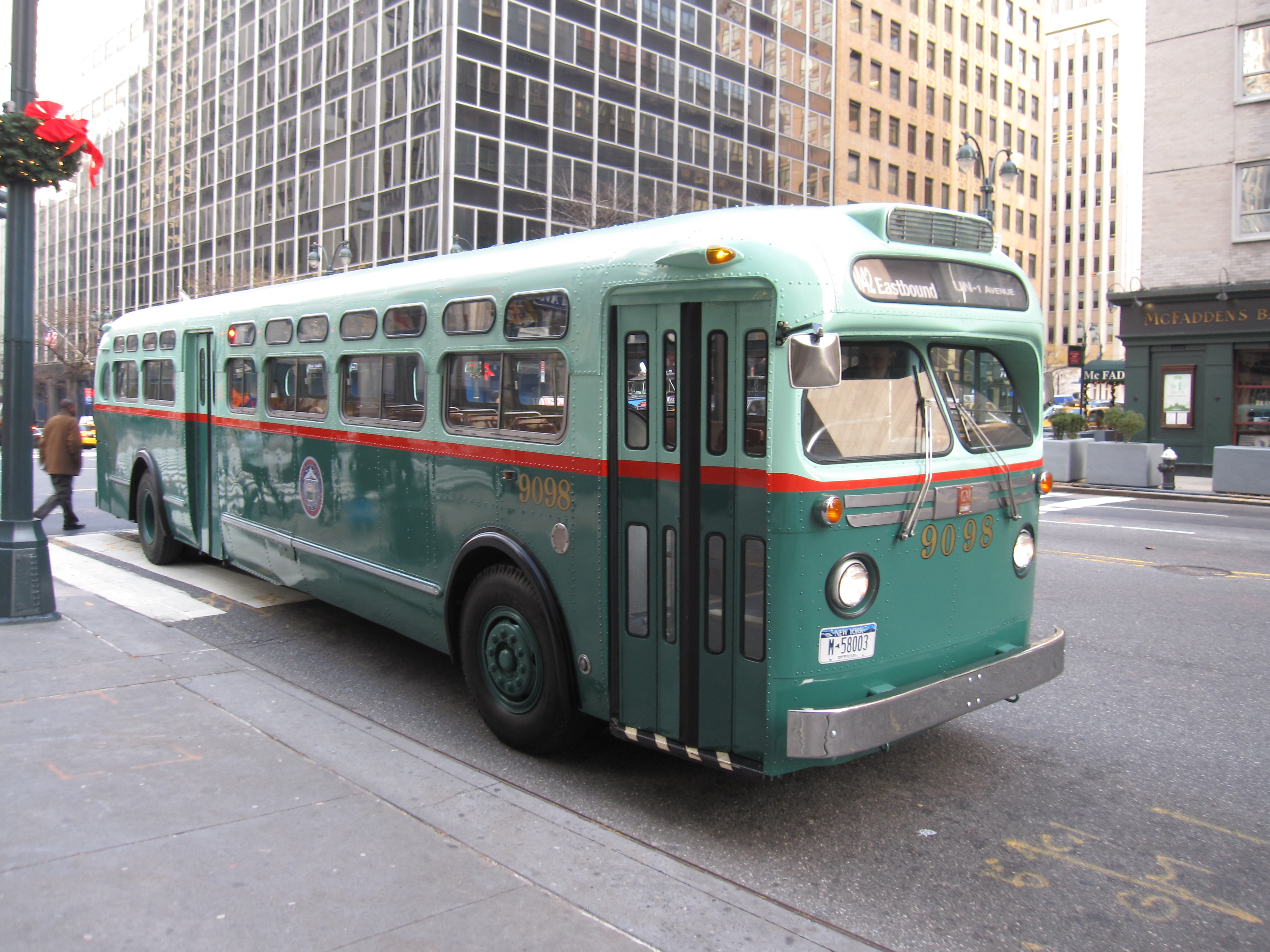
The New York City Transit Authority (also known as NYCTA, the TA, or simply Transit, and branded as MTA New York City Transit) is a New York state public-benefit corporations, public-benefit corporation in the U.S. state of New York (state), New York that operates public transportation in New York City. Part of the Metropolitan Transportation Authority, the busiest and largest transit system in North America, the NYCTA has a daily ridership of 8million trips (over 2.5billion annually). The NYCTA operates the following systems: * New York City Subway, a rapid transit system serving Manhattan, the Bronx, Brooklyn, and Queens * Staten Island Railway, a rapid transit line on Staten Island (operated by the subsidiary Staten Island Rapid Transit Operating Authority) * New York City Bus, an extensive bus network serving all five boroughs (operated by the subsidiary MTA Regional Bus Operations) Name As part of establishing a common corporate identity, the Metropolitan Transportation Aut ... [...More Info...] [...Related Items...] OR: [Wikipedia] [Google] [Baidu] |
The Bronx
The Bronx ( ) is the northernmost of the five Boroughs of New York City, boroughs of New York City, coextensive with Bronx County, in the U.S. state of New York (state), New York. It shares a land border with Westchester County, New York, Westchester County to its north; to its south and west, the New York City borough of Manhattan is across the Harlem River; and to its south and east is the borough of Queens, across the East River. The Bronx, the only New York City borough not primarily located on an island, has a land area of and a population of 1,472,654 at the 2020 United States census, 2020 census. It has the fourth-largest area, fourth-highest population, and third-highest population density of the boroughs.New York State Department of Health''Population, Land Area, and Population Density by County, New York State – 2010'' retrieved on August 8, 2015. The Bronx is divided by the Bronx River into a hillier section in the West Bronx, west, and a flatter East Bronx, easte ... [...More Info...] [...Related Items...] OR: [Wikipedia] [Google] [Baidu] |
Borough (New York City)
The boroughs of New York City are the five major governmental districts that comprise New York City. They are the Bronx, Brooklyn, Manhattan, Queens, and Staten Island. Each borough is coextensive with a respective Administrative divisions of New York (state)#County, county of the New York (state), State of New York: The Bronx is Bronx County, Brooklyn is Kings County, Manhattan is New York County, Queens is Queens County, and Staten Island is Richmond County. All five boroughs of New York came into existence with the creation of City of Greater New York, modern New York City in 1898, when New York County (then including the Bronx), Kings County, Richmond County, and part of Queens County were consolidated within one municipal government under a New York City Charter, new city charter. All former municipalities within the newly consolidated city were dissolved. New York City was originally confined to Manhattan Island and the smaller surrounding islands that formed New York C ... [...More Info...] [...Related Items...] OR: [Wikipedia] [Google] [Baidu] |
Rush Hour
A rush hour (American English, British English) or peak hour (Australian English, Indian English) is a part of the day during which traffic congestion on roads and crowding on public transport is at its highest. Normally, this happens twice every weekday: once in the morning and once in the afternoon or evening, the times during which most people commuting, commute. The term is often used for a period of peak congestion that may last for more than one hour. The term is very broad, but often refers specifically to private automobile transportation traffic, even when there is a large volume of cars on a road but not many people, or if the volume is normal but there is some disruption of speed. By analogy to vehicular traffic, the term Internet rush hour has been used to describe periods of peak data network usage, resulting in delays and slower delivery of data packets. Definition The name is sometimes a misnomer, as the peak period often lasts more than one hour and the "rush ... [...More Info...] [...Related Items...] OR: [Wikipedia] [Google] [Baidu] |
Pound Ridge, New York
Pound Ridge is a town in Westchester County, New York, United States. The population was 5,082 at the 2020 census. The town is located toward the eastern end of the county, bordered to the north and east by the town of Lewisboro, by Stamford, Connecticut, and New Canaan, Connecticut, to the south, Bedford, New York, and North Castle to the west. History Native Americans In the early 17th century, Pound Ridge was inhabited by Native Americans who spoke the Munsee language and were members of the Wappinger Confederacy. The geographical boundaries of the tribes within the Confederacy are unclear. Pound Ridge has been variously listed as within the territory of the Kitchawong, Siwanoy, and Tankiteke bands. The Siwanoy are generally agreed to have lived along the north Long Island Sound Coast with a maximum range extending from Hell Gate to the Five Mile River separating today's Darien, Connecticut, from Rowayton to its east. The Tankiteke appear to have occupied easternmos ... [...More Info...] [...Related Items...] OR: [Wikipedia] [Google] [Baidu] |
North Salem, New York
North Salem is a Administrative divisions of New York#Town, town in the northeastern section of Westchester County, New York, Westchester County, New York (state), New York, United States. The town, incorporated in 1788, is a suburb of New York City, located approximately 50 miles north of Manhattan, Midtown Manhattan. As of the 2020 census, North Salem was recorded as possessing a population of 5,243 people living on a land area of 21.37 square miles. Founded prior to the American Revolution, North Salem contains an amalgamation of urban and rural features, including parks, forests, lakes, and horse trails alongside commuter train service and an interstate highway. The town has been referred to as "Billionaires' Dirt Road" due to a number of wealthy residents, although local median household income is not exceptionally high. History Revolutionary Era Prior to the end of the American Colonial Era, Colonial Era, what would become North Salem and its neighboring town of South S ... [...More Info...] [...Related Items...] OR: [Wikipedia] [Google] [Baidu] |
Lewisboro, New York
Lewisboro is a town in Westchester County, New York, United States. The population was 12,265 at the 2020 census. The town is named after John Lewis, an early settler. Lewisboro is a suburb of New York City. History After purchasing land from the local natives, the first settlers established themselves around South Salem. The town was formed as "Salem" in 1747. By 1790 the town assumed its current dimensions as lands were removed for other towns. The name changed to South Salem in 1806. John Lewis, a financier, requested that the town be given his name and established a fund for the town, though he did not follow through on his promise of a railroad link. An abundance of natural open space, Dry-stone walls and elegant Colonial mansions are dominant features. Lewisboro has had two noteworthy historical characters. Sarah Bishop was the hermit of West Mountain. Apparently mistreated by British soldiers at the time of the Revolutionary War, she retreated to a solitary life in t ... [...More Info...] [...Related Items...] OR: [Wikipedia] [Google] [Baidu] |
Peekskill
Peekskill is a city in northwestern Westchester County, New York, United States, north of New York City. Established as a village in 1816, it was incorporated as a city in 1940. It lies on a bay along the east side of the Hudson River, across from Jones Point in Rockland County. The population was 25,431 at the 2020 U.S. census, up from 23,583 at the 2010 census. It is the third-largest municipality in northern Westchester County, after Cortlandt and Yorktown. The area was an early American industrial center, primarily for iron plow and stove products. The Binney & Smith Company, now named Crayola LLC and makers of Crayola products, is linked to the Peekskill Chemical Company founded by Joseph Binney at Annsville in 1864, and succeeded by a partnership by his son Edwin and nephew Harold Smith in 1885. The well-publicized Peekskill Riots of 1949 involved attacks and a lynching-in-effigy occasioned by Paul Robeson's benefit concerts for the Civil Rights Congress, al ... [...More Info...] [...Related Items...] OR: [Wikipedia] [Google] [Baidu] |
Ossining (village), New York
Ossining ( ) is a Political subdivisions of New York State#Village, village in Westchester County, New York, Westchester County, New York (state), New York, United States. The population at the 2020 United States census was 27,551, an increase from 25,060 at the 2010 United States census, 2010 census. As a village, it is located in the political subdivisions of New York State#Town, town of Ossining (town), New York, Ossining. Geography Ossining borders the eastern shores of the widest part of the Hudson River, the Tappan Zee. According to the United States Census Bureau, the village has a total area of , of which is land and (49.37%) is water. Demographics As of the 2010 United States Census, there were 25,060 people living in the village. The racial makeup of the village was 61.8% White, 15.6% Black, 0.1% Native American, 4.2% Asian, <0.1% Pacific Islander, 0.4% from some other race and 1.3% from two or more races. 41.4% were Hispanic or Latino of any race. According to ... [...More Info...] [...Related Items...] OR: [Wikipedia] [Google] [Baidu] |
Mount Kisco
Mount Kisco is a village and town in Westchester County, New York, United States. The town of Mount Kisco is coterminous with the village. The population was 10,959 at the 2020 United States census. It serves as a significant historic site along the Washington-Rochambeau Revolutionary Route. History The name ''Kisco'' may be connected to the Munsee word ''asiiskuw'' ("mud"), and the name of the settlement "first appeared in colonial records as Cisqua, the name of a meadow and river mentioned in the September 6, 1700 Indian deed to land in the area."Robert S. Grumet, ''Manhattan to Minisink: American Indian Place Names of Greater New York and Vicinity'' (University of Oklahoma Press, 2013), p. 62. The spelling ''Mount Kisko'' was used by the local postmaster when a post office was opened in the village sometime after 1850. The current spelling of the name was adopted in 1875, with the settlement's incorporation as a village. The town shares its name with the Kisco River, wh ... [...More Info...] [...Related Items...] OR: [Wikipedia] [Google] [Baidu] |


