|
Beberibe Cliffs Natural Monument
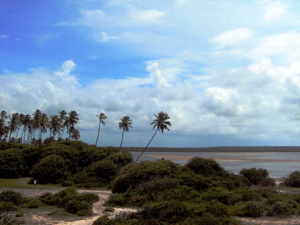
Beberibe Cliffs Natural Monument ( pt, Monumento Natural das Falésias de Beberibe is a natural monument in the state of Ceará, Brazil. Foundation The Beberibe Cliffs Natural Monument was instituted on 3 June 2004 by Ceará governor Lúcio Alcântara. At the same ceremony he signed the decree creating the Mata Fresca Private Ecological Reserve. The natural monument, of major environmental and tourist interest, is visited by about 400 people per day. The decree turned it into a fully protected area so that only eco-tourism and research would be allowed, and that only with permission from the responsible agency. Local youth were to be employed as guides, and explanatory signs installed. Location The natural monument is in the municipality of Beberibe on the east coast of the state of Ceará, between the Morro Branco and Fontes beaches. It has an area of and a perimeter of . The objective of the reserve is to protect the cliffs against the environmental impacts that had occurre ... [...More Info...] [...Related Items...] OR: [Wikipedia] [Google] [Baidu] |
Beberibe
Beberibe is a municipality in the state of Ceará in Brazil. Its estimated population in 2020 is 53,949. The municipality was created on June 5, 1892, and incorporated July 18, 1892. The name 'Beberibe' means "where the sugar cane grows". Geography The headquarters of the municipality are located in the town of Beberibe, which is situated about 80 km SE of Fortaleza, the state capital of Ceará. Near the town of Beberibe, and extending south-east along the coastline, are many magnificent beaches, popular with tourists. Sports such as kitesurfing are also popular at many of these beaches. The Beberibe Cliffs Natural Monument was instituted in 2004 to protect the sea cliffs of Beberibe, which at that time were being visited by 400 people per day. The designation protects the cliffs from damage, and allows visitors to access them only with authorized guides. The municipality contains the Prainha do Canto Verde Extractive Reserve, created in 2009 to protect a fishing communi ... [...More Info...] [...Related Items...] OR: [Wikipedia] [Google] [Baidu] |
Natural Monument (Brazil)
A Natural Monument ( pt, Monumento natural) in Brazil is a type of protected area of Brazil defined by law. The purpose of a natural monument A natural monument is a natural or natural/cultural feature of outstanding or unique value because of its inherent rarity, representative of aesthetic qualities or cultural significance. Under World Commission on Protected Areas guidelines, na ... to conserve unique or very beautiful natural sites. Definition The Natural Monument class of conservation unit was defined by the law 19/93 of 23 January 1993.Decreto-Lei n.º 19/93 de 23-01-1993 Versão: 1 -Artigo 8.º This basic objective of this type of unit is to preserve natural sites that are unique and/or have great scenic beauty. They may be private property as long as the owner's use is compatible with the objectives. If not, the area is expropriated. The public may visit the natural monuments, and research may be conducted with permission of the responsible agency. Selected list ... [...More Info...] [...Related Items...] OR: [Wikipedia] [Google] [Baidu] |
Ceará
Ceará (, pronounced locally as or ) is one of the 26 states of Brazil, located in the northeastern part of the country, on the Atlantic coast. It is the eighth-largest Brazilian State by population and the 17th by area. It is also one of the main tourist destinations in Brazil. The state capital is the city of Fortaleza, the country's fourth most populous city. The state has 4.3% of the Brazilian population and produces 2.1% of the Brazilian GDP. Literally, the name ''Ceará'' means "sings the jandaia". According to José de Alencar, one of the most important writers of Brazil and an authority in Tupi Guaraní, ''Ceará'' means turquoise or green waters. The state is best known for its extensive coastline, with of sand. There are also mountains and valleys producing tropical fruits. To the south, on the border of Paraíba, Pernambuco and Piauí, is the National Forest of Araripe. Geography Ceará has an area of . It is bounded on the north by the Atlantic Ocean, ... [...More Info...] [...Related Items...] OR: [Wikipedia] [Google] [Baidu] |
Lúcio Alcântara
Lucimar Ferreira da Silva (born 8 May 1978), commonly known as Lúcio, is a Brazilian former professional footballer who played as a centre-back. A tall and physically strong defender who excelled in the air, Lúcio was known for his long, surging, galloping runs on the ball, which earned him the nickname ''O Cavalo'' ("The Horse"). Lúcio began his professional career in 1998 with Internacional. After three years in the club, he moved to Bayer Leverkusen, where he reached the 2002 Champions League final against Real Madrid of Spain. He scored a header in the final, which Real Madrid won with the score of 2–1. In 2004, he arrived at Bayern Munich, where he won three cups and three Bundesliga titles. Since coach Louis van Gaal did not have a place for him at Bayern, he decided to search for a new team. He moved to Inter Milan in the summer of 2009. He won the treble with Inter in 2010, helped them win the 2010 Champions League against his former club Bayern Munich. With Bra ... [...More Info...] [...Related Items...] OR: [Wikipedia] [Google] [Baidu] |
Tertiary
Tertiary ( ) is a widely used but obsolete term for the geologic period from 66 million to 2.6 million years ago. The period began with the demise of the non-avian dinosaurs in the Cretaceous–Paleogene extinction event, at the start of the Cenozoic Era, and extended to the beginning of the Quaternary glaciation at the end of the Pliocene Epoch. The time span covered by the Tertiary has no exact equivalent in the current geologic time system, but it is essentially the merged Paleogene and Neogene periods, which are informally called the Early Tertiary and the Late Tertiary, respectively. The Tertiary established the Antarctic as an icy island continent. Historical use of the term The term Tertiary was first used by Giovanni Arduino during the mid-18th century. He classified geologic time into primitive (or primary), secondary, and tertiary periods based on observations of geology in Northern Italy. Later a fourth period, the Quaternary, was applied. In the early d ... [...More Info...] [...Related Items...] OR: [Wikipedia] [Google] [Baidu] |
Quaternary
The Quaternary ( ) is the current and most recent of the three periods of the Cenozoic Era in the geologic time scale of the International Commission on Stratigraphy (ICS). It follows the Neogene Period and spans from 2.58 million years ago to the present. The Quaternary Period is divided into two epochs: the Pleistocene (2.58 million years ago to 11.7 thousand years ago) and the Holocene (11.7 thousand years ago to today, although a third epoch, the Anthropocene, has been proposed but is not yet officially recognised by the ICS). The Quaternary Period is typically defined by the cyclic growth and decay of continental ice sheets related to the Milankovitch cycles and the associated climate and environmental changes that they caused. Research history In 1759 Giovanni Arduino proposed that the geological strata of northern Italy could be divided into four successive formations or "orders" ( it, quattro ordini). The term "quaternary" was introduced by Jules Desnoye ... [...More Info...] [...Related Items...] OR: [Wikipedia] [Google] [Baidu] |
Environmental Protection Area (Brazil)
An environmental protection area ( pt, Área de proteção ambiental: APA) is a type of protected area in Brazil that has some degree of human occupation, but where the primary intent is environmental protection. Human occupation is monitored and controlled. An environmental protection area often contains other types of conservation units, which may be more strictly protected. Definition Environmental protection areas (APAs) are defined as part of the National System of Conservation Units regulated by Law 9985 of 18 July 2000. They are one of the types of sustainable use units, which try to reconcile conservation of nature with sustainable use of some natural resources. Other types of sustainable use unit are significant ecological interest area, national forest, extractive reserve, fauna reserve, sustainable development reserve, and natural heritage particular reserve. As of 1993 APAs were defined as areas where wildlife, genetic diversity and other natural resources were to be ... [...More Info...] [...Related Items...] OR: [Wikipedia] [Google] [Baidu] |
Protected Areas Of Ceará
Protection is any measure taken to guard a thing against damage caused by outside forces. Protection can be provided to physical objects, including organisms, to systems, and to intangible things like civil and political rights. Although the mechanisms for providing protection vary widely, the basic meaning of the term remains the same. This is illustrated by an explanation found in a manual on electrical wiring: Some kind of protection is a characteristic of all life, as living things have evolved at least some protective mechanisms to counter damaging environmental phenomena, such as ultraviolet light. Biological membranes such as bark on trees and skin on animals offer protection from various threats, with skin playing a key role in protecting organisms against pathogens and excessive water loss. Additional structures like scales and hair offer further protection from the elements and from predators, with some animals having features such as spines or camouflage serving ... [...More Info...] [...Related Items...] OR: [Wikipedia] [Google] [Baidu] |

.jpg)


