|
Beaver Dam Lake (Wisconsin)
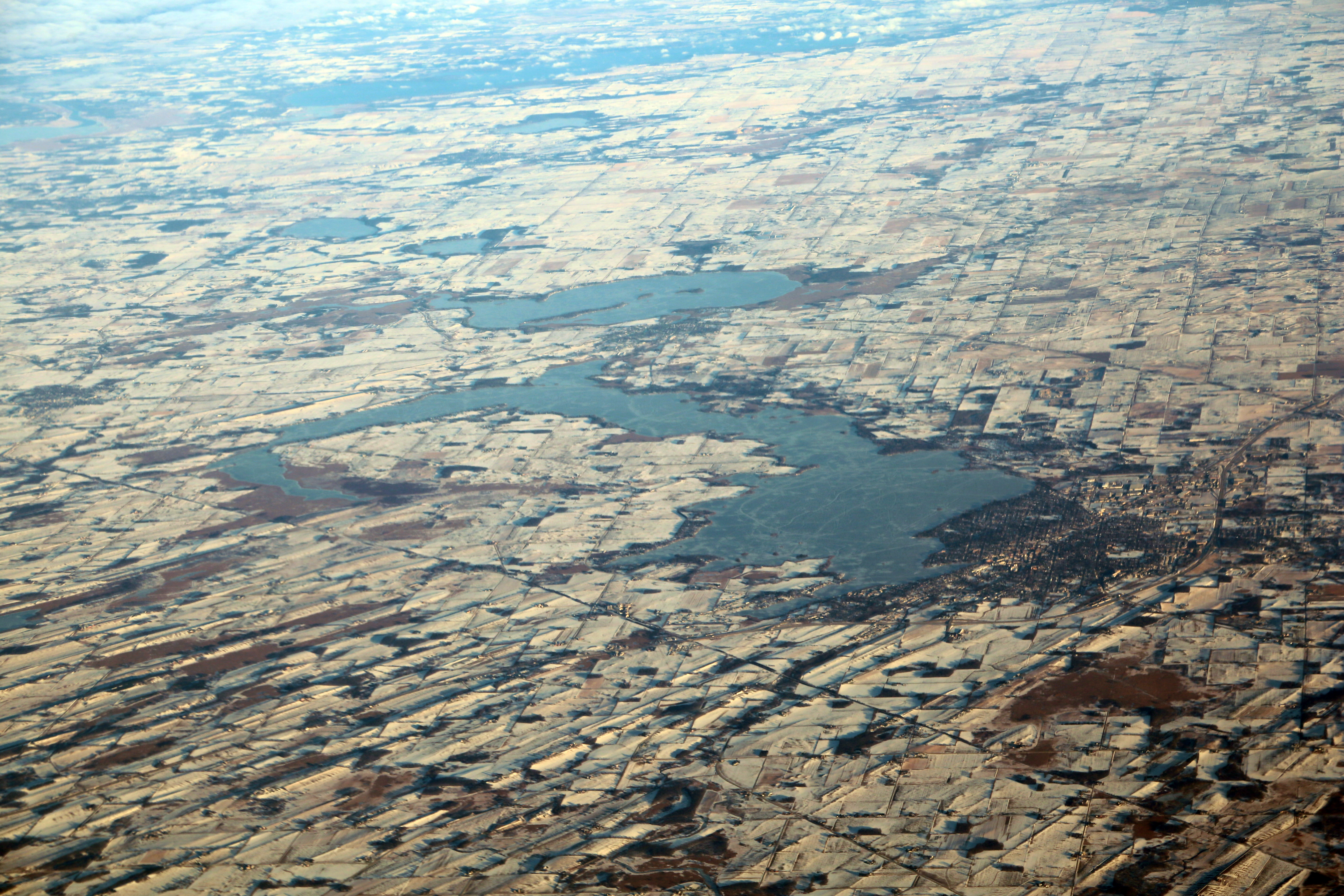
Beaver Dam Lake is a 6,718 acre lake in Dodge County, Wisconsin. The communities of Beaver Dam, South Beaver Dam, Sunset Beach, Beaver Edge, Fox Lake Junction border the lake. The fish present in the lake are Panfish, Largemouth Bass, Northern Pike, and Walleye. The lake is created by a dam located in the City of Beaver Dam at Haskell Street and flows into the Beaver Dam River. There are seven public boat landings and numerous parks along the lake shore. Water from Fox Lake flows through the Mill Creek into Beaver Dam Lake. Islands There are 26 islands in Beaver Dam Lake ranging from 0.1 to 2.8 acres. All of the islands are privately owned. See also * List of lakes in Wisconsin There are 15,074 documented lakes in Wisconsin.Wisconsin Dept. of Natural Resources, Wisconsin Lakes'. 2009. Of these, about 40 percent have been named. They range in size from small one-and two-acre () ponds to Lake Winnebago. They range in dept ... References {{authority control Lakes o ... [...More Info...] [...Related Items...] OR: [Wikipedia] [Google] [Baidu] |
Dodge County, Wisconsin
Dodge County is a county located in the U.S. state of Wisconsin. As of the 2020 census, the population was 89,396. Its county seat is Juneau. The county was created from the Wisconsin Territory in 1836 and organized in 1844. Dodge County comprises the Beaver Dam, WI Micropolitan Statistical Area, which is included in the Milwaukee- Racine- Waukesha, WI Combined Statistical Area. Geography According to the U.S. Census Bureau, the county has a total area of , of which is land and (3.5%) is water. The 6,718 acre Beaver Dam Lake and the 2,713 acre Fox Lake are found within the county. Adjacent counties * Fond du Lac County – northeast * Washington County – east * Waukesha County – southeast * Jefferson County – south * Dane County – southwest * Columbia County – west * Green Lake County – northwest National protected area * Horicon National Wildlife Refuge (part) Climate Demographics 2020 census As of the census of 2020, the population was 89,396 ... [...More Info...] [...Related Items...] OR: [Wikipedia] [Google] [Baidu] |
Wisconsin
Wisconsin () is a state in the upper Midwestern United States. Wisconsin is the 25th-largest state by total area and the 20th-most populous. It is bordered by Minnesota to the west, Iowa to the southwest, Illinois to the south, Lake Michigan to the east, Michigan to the northeast, and Lake Superior to the north. The bulk of Wisconsin's population live in areas situated along the shores of Lake Michigan. The largest city, Milwaukee, anchors its largest metropolitan area, followed by Green Bay and Kenosha, the third- and fourth-most-populated Wisconsin cities respectively. The state capital, Madison, is currently the second-most-populated and fastest-growing city in the state. Wisconsin is divided into 72 counties and as of the 2020 census had a population of nearly 5.9 million. Wisconsin's geography is diverse, having been greatly impacted by glaciers during the Ice Age with the exception of the Driftless Area. The Northern Highland and Western Upland along wi ... [...More Info...] [...Related Items...] OR: [Wikipedia] [Google] [Baidu] |
Beaver Dam River
The Beaver Dam River is a U.S. Geological Survey. National Hydrography Dataset high-resolution flowline dataThe National Map, accessed May 13, 2011 tributary of the Crawfish River in south-central Wisconsin in the United States. Via the Crawfish and Rock rivers, it is part of the Mississippi River watershed. Course The river's entire length is in Dodge County. It flows from Beaver Dam Lake at the city of Beaver Dam and follows a generally southward course, passing the village of Lowell before joining the Crawfish River at Mud Lake in the town of Shields. See also *List of Wisconsin rivers This is a list of rivers in the U.S. state of Wisconsin. By drainage basin This list is arranged by drainage basin, with respective tributaries indented under each larger stream's name. Great Lakes Drainage Lake Michigan *Menominee River * ... References Rivers of Dodge County, Wisconsin Rivers of Wisconsin Tributaries of the Mississippi River {{Wisconsin-river-st ... [...More Info...] [...Related Items...] OR: [Wikipedia] [Google] [Baidu] |
Beaver Dam, Wisconsin
Beaver Dam is a city in Dodge County, Wisconsin, United States, along Beaver Dam Lake and the Beaver Dam River. The population was 16,708 at the 2020 census, making it the largest city primarily located in Dodge County. It is the principal city of the Beaver Dam Micropolitan Statistical area. The city is adjacent to the Town of Beaver Dam. History Beaver Dam was first settled by Thomas Mackie and Joseph Goetschius in 1841, and by 1843 had a population of almost 100. The city was named for an old beaver dam located in a stream flowing into Beaver Dam River. The area had also been known as ''Okwaanim'', Chippewa for beaver dam. The community was incorporated as a city on March 18, 1856. That same year the Milwaukee Railroad reached the area, encouraging further growth. Beaver Dam hosted a World War II prisoner of war camp called Camp Beaver Dam in the summer of 1944. The camp held 300 German prisoners in a tent city encampment where the Wayland Academy field house now stands ... [...More Info...] [...Related Items...] OR: [Wikipedia] [Google] [Baidu] |
South Beaver Dam, Wisconsin
South Beaver Dam is an unincorporated community in Dodge County, Wisconsin, United States, in the town of Calamus. The community is located just south of the city of Beaver Dam. The ZIP code is 53916. It is part of the Beaver Dam Micropolitan Statistical Area. The community lies on the southern shore of Beaver Dam Lake. Education The South Beaver Dam Elementary School, which is part of the Beaver Dam Unified School District Beaver Dam Unified School District is a public school district in the city of Beaver Dam, Wisconsin Beaver Dam is a city in Dodge County, Wisconsin, United States, along Beaver Dam Lake and the Beaver Dam River. The population was 16,708 at ..., is located in South Beaver Dam. References Unincorporated communities in Dodge County, Wisconsin Unincorporated communities in Wisconsin {{DodgeCountyWI-geo-stub ... [...More Info...] [...Related Items...] OR: [Wikipedia] [Google] [Baidu] |
Sunset Beach, Wisconsin
Beaver Dam is a town in Dodge County, Wisconsin, United States. The population was 3,440 at the 2000 census. The City of Beaver Dam is encircled by the town. The unincorporated communities of Beaver Edge, Leipsig and Sunset Beach are located in the town. The ghost town of Clason Prairie was also located in the town. Geography According to the United States Census Bureau, the town has a total area of , of which, is land and (7.46%) is water. The community is at the southeast end of Beaver Dam Lake. Transportation US Route 151 passes through Beaver Dam. Demographics At the 2000 census, there were 3,440 people, 1,301 households and 978 families residing in the town. The population density was . There were 1,375 housing units at an average density of . The racial make-up of the town was 96.51% White, 0.06% Black or African American, 0.41% Native American, 0.38% Asian, 1.95% from other races and 0.70% from two or more races. 3.90% of the population were Hispanic or Latin ... [...More Info...] [...Related Items...] OR: [Wikipedia] [Google] [Baidu] |
Beaver Edge, Wisconsin
Beaver Edge is an unincorporated community in the town of Beaver Dam, Dodge County, Wisconsin Wisconsin () is a state in the upper Midwestern United States. Wisconsin is the 25th-largest state by total area and the 20th-most populous. It is bordered by Minnesota to the west, Iowa to the southwest, Illinois to the south, Lake M ..., United States. The community lies on the east shore of Beaver Dam Lake. Notes Unincorporated communities in Dodge County, Wisconsin Unincorporated communities in Wisconsin {{DodgeCountyWI-geo-stub ... [...More Info...] [...Related Items...] OR: [Wikipedia] [Google] [Baidu] |
Fox Lake Junction, Wisconsin
Fox Lake is a city in Dodge County, Wisconsin, United States. The population was 1,519 at the 2010 census. The city is located within the Town of Fox Lake. History Established in 1838, Fox Lake was the first settlement in Dodge County. The first inhabitants were Winnebago Indians who had named the area "Hosh-a-rac-ah-tah", meaning "good land". The area was later named Fox Lake, either in honor of a Winnebago Indian named Big Fox who saved a lost trapper or for the English translation of the Indian name of the town. Geography Fox Lake is located at 43°33'45" North, 88°54'35" West (43.56265, -88.90994). According to the United States Census Bureau, the city has a total area of , of which, is land and is water. The 2,713 acre lake also known as Fox Lake is found north of the city. Demographics 2010 census As of the census of 2010, there were 1,519 people, 663 households, and 400 families living in the city. The population density was . There were 801 housing units at an ... [...More Info...] [...Related Items...] OR: [Wikipedia] [Google] [Baidu] |
Glacial Features Near Beaver Dam Lake, Wisconsin
A glacial period (alternatively glacial or glaciation) is an interval of time (thousands of years) within an ice age that is marked by colder temperatures and glacier advances. Interglacials, on the other hand, are periods of warmer climate between glacial periods. The Last Glacial Period ended about 15,000 years ago. The Holocene is the current interglacial. A time with no glaciers on Earth is considered a greenhouse climate state. Quaternary Period Within the Quaternary, which started about 2.6 million years before present, there have been a number of glacials and interglacials. At least eight glacial cycles have occurred in the last 740,000 years alone. Penultimate Glacial Period The Penultimate Glacial Period (PGP) is the glacial period that occurred before the Last Glacial Period. It began about 194,000 years ago and ended 135,000 years ago, with the beginning of the Eemian interglacial. Last Glacial Period The last glacial period was the most recent glacial period wi ... [...More Info...] [...Related Items...] OR: [Wikipedia] [Google] [Baidu] |
Largemouth Bass
The largemouth bass (''Micropterus salmoides'') is a carnivorous freshwater gamefish in the Centrarchidae ( sunfish) family, a species of black bass native to the eastern and central United States, southeastern Canada and northern Mexico, but widely introduced elsewhere. It is known by a variety of regional names, such as the widemouth bass, bigmouth bass, black bass, bucketmouth, largies, Potter's fish, Florida bass, Florida largemouth, green bass, bucketmouth bass, Green trout, gilsdorf bass, Oswego bass, LMB, and southern largemouth and northern largemouth. The largemouth bass is the state fish of Georgia and Mississippi, and the state freshwater fish of Florida and Alabama. Taxonomy The largemouth bass was first formally described as ''Labrus salmoides'' in 1802 by the French naturalist Bernard Germain de Lacépède with the type locality given as the Carolinas. Lacépède based his description on an illustration of a specimen collected by Louis Bosc near Charleston, S ... [...More Info...] [...Related Items...] OR: [Wikipedia] [Google] [Baidu] |
Northern Pike
The northern pike (''Esox lucius'') is a species of carnivorous fish of the genus '' Esox'' (the pikes). They are typical of brackish and fresh waters of the Northern Hemisphere (''i.e.'' holarctic in distribution). They are known simply as a pike in Britain, Ireland, and most of Eastern Europe, Canada and the United States. Pike can grow to a relatively large size: the average length is about , with maximum recorded lengths of up to and published weights of . The IGFA currently recognizes a pike caught by Lothar Louis on Greffern Lake, Germany, on 16 October 1986, as the all-tackle world-record northern pike. Northern pike grow to larger sizes in Eurasia than in North America, and typically grow to larger sizes in coastal than inland regions of Eurasia. Etymology The northern pike gets its common name from its resemblance to the pole-weapon known as the pike (from the Middle English for 'pointed'). Various other unofficial trivial names are common pike, Lakes pike, great n ... [...More Info...] [...Related Items...] OR: [Wikipedia] [Google] [Baidu] |
Walleye
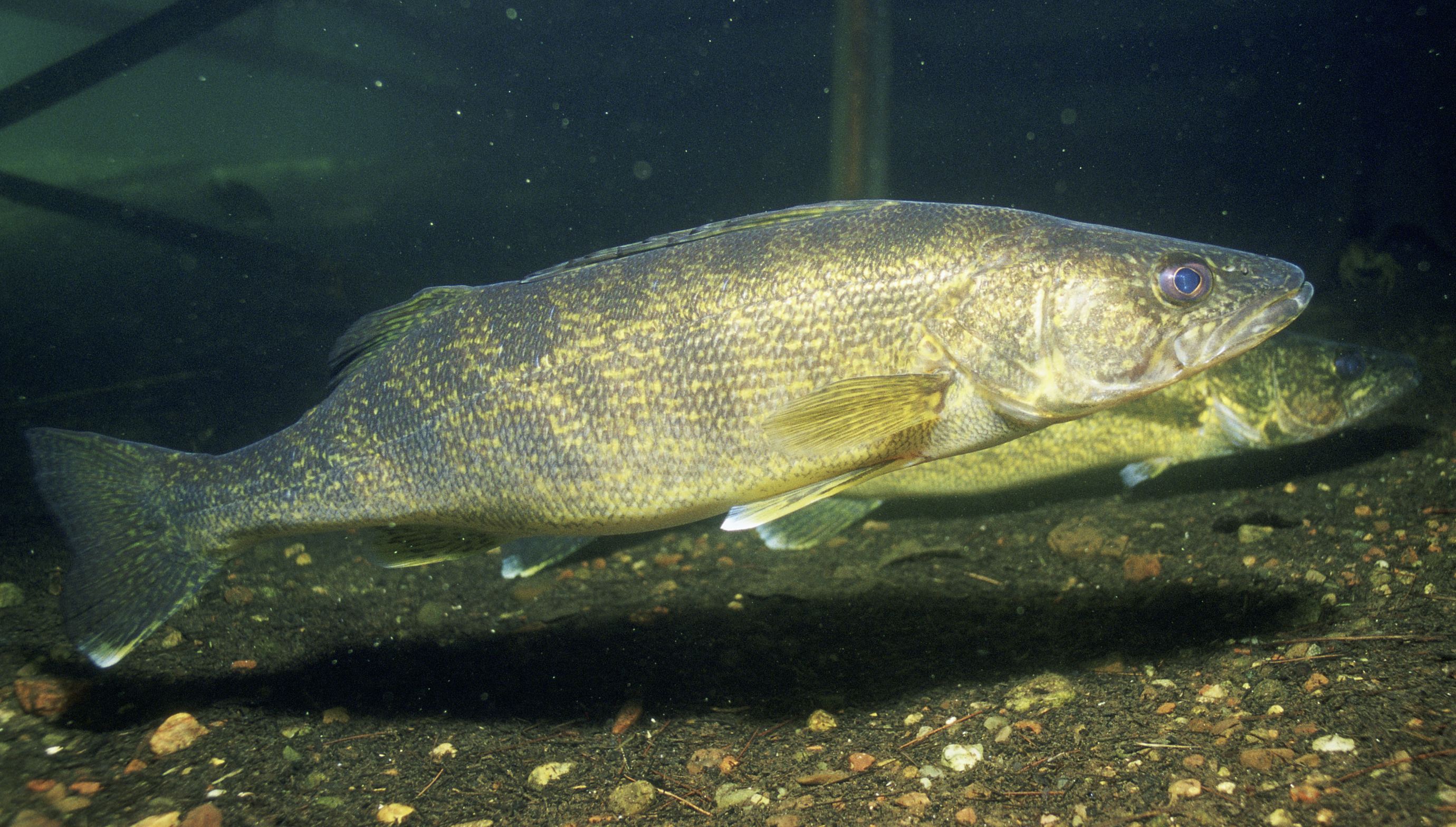
The walleye (''Sander vitreus'', synonym ''Stizostedion vitreum''), also called the yellow pike or yellow pickerel, is a freshwater perciform fish native to most of Canada and to the Northern United States. It is a North American close relative of the European zander, also known as the pikeperch. The walleye is sometimes called the yellow walleye to distinguish it from the blue walleye, which is a color morph that was once found in the southern Ontario and Quebec regions, but is now presumed extinct. However, recent genetic analysis of a preserved (frozen) 'blue walleye' sample suggests that the blue and yellow walleye were simply phenotypes within the same species and do not merit separate taxonomic classification. In parts of its range in English-speaking Canada, the walleye is known as a pickerel, though the fish is not related to the true pickerels, which are members of the family ''Esocidae''. Walleyes show a fair amount of variation across watersheds. In general, fis ... [...More Info...] [...Related Items...] OR: [Wikipedia] [Google] [Baidu] |


