|
Battle Of Galudoghson
In December 1742, at a site near present-day Glasgow, Virginia, the Augusta County militia engaged in combat with a group of Onondaga and Oneida Indians who had traveled to Virginia from Shamokin in Pennsylvania, under the command of an Iroquois chief named Jonnhaty, to participate in a campaign against the Catawba. The battle was the first armed conflict between settlers in Western Virginia and Native Americans. Three distinct accounts of the battle exist, with contradictory details. The Iroquois regarded the battle as an unprovoked act of aggression, while the Virginia colonists claimed that the Iroquois had raided Virginia settlements and killed livestock. Etymology The altercation remained without any formal title until the 1995 posthumous publication of a collection of papers and analysis compiled by historian Lyman Draper, in which it was designated "the Battle of Galudoghson," using the Iroquois name for the James River. Background At a series of conferences in Penn ... [...More Info...] [...Related Items...] OR: [Wikipedia] [Google] [Baidu] |
Glasgow, Virginia
Glasgow is a town in Rockbridge County, Virginia, United States, at the confluence of the James and Maury Rivers. The population was 1,133 at the 2010 census. Glasgow has had issues with flooding, notably during Hurricane Camille in 1969. As a result of flooding concerns, the Balcony Falls Dam (just east of the confluence of the James and Maury rivers) was removed in 1973. From 2001 to 2007, the town was known for having at least a dozen fiberglass dinosaur figures along the roadside. History German explorer John Peter Salling and his brother Adam were the first Europeans to settle in what is known today as Glasgow around 1741. In December 1742, the Battle of Galudoghson between Iroquois warriors and a company of Virginia militia took place near the confluence of the James River and the Maury River. The militia captain, John McDowell, was killed, along with eight militia soldiers. Between 1760 and 1768, John Paxton II acquired most of the Salling property. Robert, Joseph, and ... [...More Info...] [...Related Items...] OR: [Wikipedia] [Google] [Baidu] |
Virginia Council
The Governor's Council (also known as the "Council of State" or simply "the Council") was the upper house of the colonial legislature (the House of Burgesses was the other house) in the Colony of Virginia from 1607 until the American Revolution in 1776. Consisting of 12 men who, after the 1630s were appointed by the British Sovereign, the Governor's Council also served as an advisory body to the Virginia Royal Governor and as the highest judicial body in the colony. Organization The Council consisted of no more than 12 men who served lifetime appointments to advise the governor and were, together with the governor, the highest court in the colony. Thus this body served as a legislative, executive, and judicial body. Modeled after the British House of Lords, the Governor's Council went through a definite evolution as the Virginia colony grew. During much of the colonial period, the governor was absentee and the lieutenant governor was the beneficiary of the council's advice. When ... [...More Info...] [...Related Items...] OR: [Wikipedia] [Google] [Baidu] |
Fairfield, Rockbridge County, Virginia
Fairfield is an unincorporated community and census-designated place (CDP) in Rockbridge County, Virginia, United States. As of the 2020 census, it had a population of 257. The CDP is in the northeast part of the county, along U.S. Route 11 (North Lee Highway), which leads northeast to Greenville and southwest to Lexington. Interstate 81/ 64 forms the northwest edge of the community, with access from Exit 200 (Sterrett Road). The Interstate highway runs parallel to US 11 and leads northeast to Staunton and southwest to where the highways split near Lexington. Geography Fairfield is drained by Marlbrook Creek, which flows southeast to the South River, a southwest-flowing tributary of the Maury River and part of the James River The James River is a river in the U.S. state of Virginia that begins in the Appalachian Mountains and flows U.S. Geological Survey. National Hydrography Dataset high-resolution flowline dataThe National Map , accessed April 1, 2011 to Chesapea ... [...More Info...] [...Related Items...] OR: [Wikipedia] [Google] [Baidu] |
Appletons' Swatane
{{Media set index ...
Appleton's or Appletons may refer to several publications published by D. Appleton & Company, New York, including: *''Appletons' Journal'' (1869–1881) *''Appletons' Cyclopædia of American Biography'' (1887–1889) *''Appleton's Magazine'' (1905–1909) * Appletons' travel guides See also *Appleton (surname) Appleton is an Anglo-Saxon locational surname. * Alistair Appleton, British television presenter * Charles Appleton (academic) (1841–1879), Oxford don and scholarly entrepreneur * Charles Appleton (cricketer) (1844–1925), English amateur cri ... [...More Info...] [...Related Items...] OR: [Wikipedia] [Google] [Baidu] |
Lock Haven, Pennsylvania
Lock Haven is the county seat of Clinton County, in the U.S. state of Pennsylvania. Located near the confluence of the West Branch Susquehanna River and Bald Eagle Creek, it is the principal city of the Lock Haven Micropolitan Statistical Area, itself part of the Williamsport–Lock Haven combined statistical area. At the 2010 census, Lock Haven's population was 9,772. Built on a site long favored by pre-Columbian peoples, Lock Haven began in 1833 as a timber town and a haven for loggers, boatmen, and other travelers on the river or the West Branch Canal. Resource extraction and efficient transportation financed much of the city's growth through the end of the 19th century. In the 20th century, a light-aircraft factory, a college, and a paper mill, along with many smaller enterprises, drove the economy. Frequent floods, especially in 1972, damaged local industry and led to a high rate of unemployment in the 1980s. The city has three sites on the National Register o ... [...More Info...] [...Related Items...] OR: [Wikipedia] [Google] [Baidu] |
Potomac River
The Potomac River () drains the Mid-Atlantic United States, flowing from the Potomac Highlands into Chesapeake Bay. It is long,U.S. Geological Survey. National Hydrography Dataset high-resolution flowline dataThe National Map. Retrieved August 15, 2011 with a drainage area of 14,700 square miles (38,000 km2), and is the fourth-largest river along the East Coast of the United States and the 21st-largest in the United States. Over 5 million people live within its watershed. The river forms part of the borders between Maryland and Washington, D.C. on the left descending bank and between West Virginia and Virginia on the right descending bank. Except for a small portion of its headwaters in West Virginia, the North Branch Potomac River is considered part of Maryland to the low-water mark on the opposite bank. The South Branch Potomac River lies completely within the state of West Virginia except for its headwaters, which lie in Virginia. Course The Potomac River runs ... [...More Info...] [...Related Items...] OR: [Wikipedia] [Google] [Baidu] |
Shikellamy
Shikellamy (1680 - December 6, 1748), also spelled Shickellamy and also known as Swatana, was an Oneida chief and overseer for the Iroquois confederacy. In his position as chief and overseer, Shikellamy served as a supervisor for the Six Nations, overseeing the Shawnee and Lenape tribes in central Pennsylvania along the Susquehanna River and protecting the southern border of the Iroquois Confederacy. While his birth date is not known, his first recorded historical appearance was in Philadelphia in 1728. In 1728 he was living in a Shawnee village in Pennsylvania near modern Milton, and moved in 1742 to the village of Shamokin, modern day Sunbury, at the confluence of the West and North Branches of the Susquehanna. Shikellamy was an important figure in the early history of the Province of Pennsylvania and served as a go-between for the colonial government in Philadelphia and the Iroquois chiefs in Onondaga. He welcomed Conrad Weiser to Shamokin and served as Weiser's guide on his j ... [...More Info...] [...Related Items...] OR: [Wikipedia] [Google] [Baidu] |
Conrad Weiser
Conrad Weiser (November 2, 1696 – July 13, 1760), born Johann Conrad Weiser, Jr., was a Pennsylvania Dutch (German) pioneer who served as an interpreter and diplomat between the Pennsylvania Colony and Native American nations. Primarily a farmer, he also worked as a tanner, and later served as a soldier and judge. He lived part of the time for six years at Ephrata Cloister, a Protestant monastic community in Lancaster County. As an emissary in councils between Native Americans and the colonies, especially Pennsylvania, during the late 18th century's tensions of the French and Indian War (Seven Years' War), he contributed to alliances that supported the British effort. Early years Conrad Weiser was born in 1696 in the small village of Affstätt in Herrenberg, in the Duchy of Württemberg (now in Baden-Württemberg, Germany), where his father ( Johann Conrad Weiser Sr.) was stationed as a member of the Württemberg Blue Dragoons. Soon after Conrad's birth, his father was dis ... [...More Info...] [...Related Items...] OR: [Wikipedia] [Google] [Baidu] |
Sir William Gooch, 1st Baronet
Sir William Gooch, 1st Baronet (21 October 1681 – 17 December 1751) was a British Army officer and colonial administrator who served as the governor of Virginia from 1727 to 1749. Technically, Gooch only held the title of Royal Lieutenant Governor, but the nominal governors, Lord Orkney and Lord Albemarle, were in England and did not exercise much authority. Gooch's tenure as governor was characterized by his unusual political effectiveness. One of his greatest successes was the passage of the Tobacco Inspection Act of 1730. The Act called for the inspection and regulation of Virginia's tobacco, the most important crop of the colony. Tobacco planters were required to transport their crop to public warehouses where it was inspected and stored. The Act raised the quality of Virginia's tobacco and reduced fraud; this greatly increased the demand for Virginia tobacco in Europe. Gooch's military policy focused on protecting the western territory from Native Americans and Fre ... [...More Info...] [...Related Items...] OR: [Wikipedia] [Google] [Baidu] |
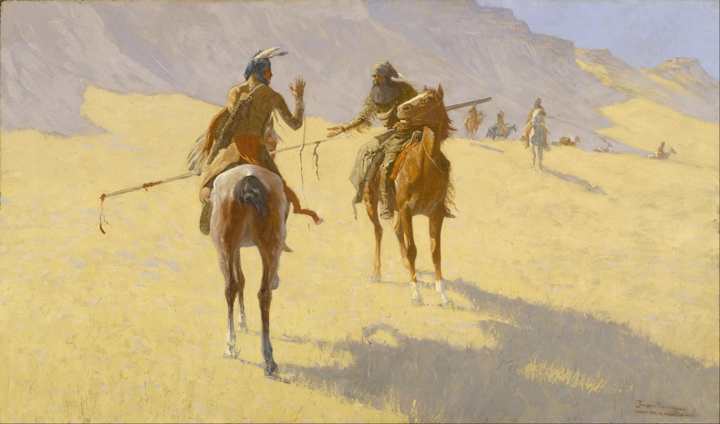
Parley
A parley (from french: link=no, parler – "to speak") refers to a discussion or conference, especially one designed to end an argument or hostilities between two groups of people. The term can be used in both past and present tense; in present tense the term is referred to as parleying. In some cases, opposing parties would signal their intent to invoke parley by using a white flag, however the use of a white flag to invoke or request parley is not considered mandatory. The term ''parley'' has been used to refer to numerous high-profile meetings of the 20th century, including the London and Paris Conferences held in 1954 to determine the status of West Germany. In popular culture Below are some examples where a parley is a significant element of the plot. * The Last of the Mohicans features a scene depicting a parley at the end the siege of Fort William Henry. * In the ''Pirates of the Caribbean'' series, parley is a plot device introduced in the first film, '' Pirates of ... [...More Info...] [...Related Items...] OR: [Wikipedia] [Google] [Baidu] |
John Peter Salling
John Peter Salling, (died 1755) born Johan Peter Saling and sometimes referred to as John Peter Salley, Sayling, Sallings, and Sallee, was a German explorer known for being among the first Europeans to visit parts of what is now Virginia, West Virginia and Kentucky. He was imprisoned by the French in New Orleans on charges of spying and escaped together with another prisoner, taking eight months to finally reach his home in Virginia. His detailed journal describing his journeys of exploration was lost twice, and each time Salling was able to reconstruct it from memory. Salling's journal was used as a source in the creation of early maps of Virginia and eastern North America. Biography Salling was born in the Palatinate region of the Holy Roman Empire to Niclaus Sallin and Salome Johanna, Huguenots from Kaiserslautern, Germany. Different sources give his year of birth as 1697, 1706 or 1719. He arrived in Philadelphia with his wife Anna Marie and his two daughters (Catherine and ... [...More Info...] [...Related Items...] OR: [Wikipedia] [Google] [Baidu] |


