|
Barsinghausen
Barsinghausen is a town in the district of Hanover, in Lower Saxony, Germany. It is situated at the Deister chain of hills approx. 20 km west of Hanover. Barsinghausen belongs to the historic landscape Calenberg Land and was first mentioned in 1193. Geography Neighbouring places Barsinghausen adjoins Wunstorf, Seelze, Gehrden, Springe, Bad Nenndorf and Wennigsen. Division of the town Barsinghausen consists of 18 districts: Bantorf, Barrigsen, Barsinghausen, Eckerde, Egestorf, Göxe, Großgoltern, Nordgoltern, Groß Munzel, Hohenbostel, Holtensen, Kirchdorf, Landringhausen, Langreder, Ostermunzel, Stemmen, Wichtringhausen, Winninghausen History Barsinghausen is the site of an old double monastery (“Kloster Barsinghausen”) that was established during the High Middle Ages. At that time, fertile loess soil and a number of influent streams to river Südaue constituted a central fundament for farming and numerous windmills in Calenberg Land. Barsinghausen became a co ... [...More Info...] [...Related Items...] OR: [Wikipedia] [Google] [Baidu] |
Colossus Of Ostermunzel
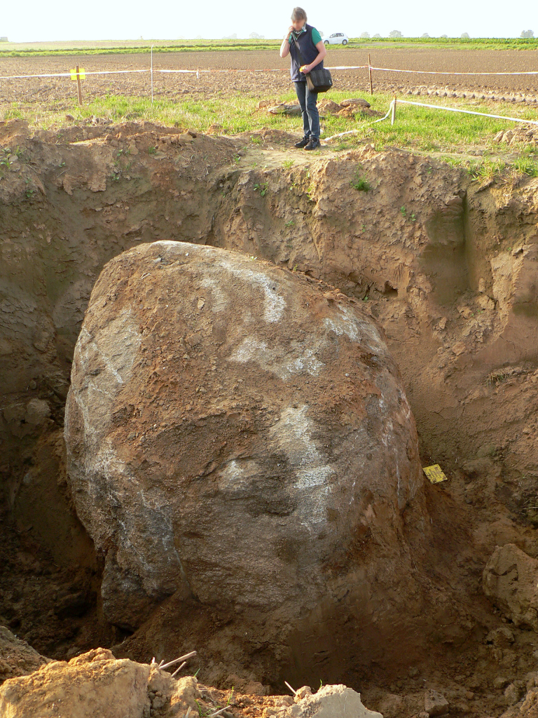
The Colossus of Ostermunzel is a 27.5-tonne glacial erratic stone found in a farmer's field east of Ostermunzel in Lower Saxony, Germany, in 2013.''Erfolgreiche Bergung des Findlings von Ostermunzel'' on hannover.de of 17 April 2015. It was excavated and moved to a new location a kilometre away. Location, discovery and excavation This glacial erratic, a piece of rock that differs from the size and type of rock native to the area in which it rests, was found by a farmer who was ploughing his land in 2013. The field in which it was discovered lies on a small hill near the district road K 253 between Ostermunzel and < ...[...More Info...] [...Related Items...] OR: [Wikipedia] [Google] [Baidu] |
Hanover (district)
Hanover Region (german: Region Hannover) is a district in Lower Saxony, Germany. It is bounded by (from the north and clockwise) the districts of Heidekreis, Celle, Gifhorn, Peine, Hildesheim, Hamelin-Pyrmont, Schaumburg and Nienburg. The Hanover Region district has a unique legal status among the districts of Lower Saxony. It includes the city of Hanover (the state capital) which has the same privileges as a city that is not part of a district. As a consequence, the district is much larger in population than any other district of the state. Its administrative body is the regional parliament (german: Regionsparlament, label=none), headed by the regional president (german: Regionspräsident, label=none), which since 2021 is Steffen Krach ( SPD). The members of the regional parliament are elected once every five years and the regional president is elected once every eight years in local elections. History The city of Hanover was not part of the district until 2001, when the ... [...More Info...] [...Related Items...] OR: [Wikipedia] [Google] [Baidu] |
Calenberg Land
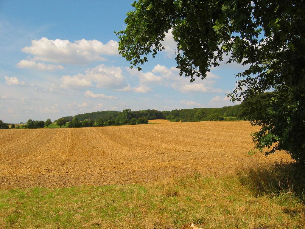
The Calenberg Land (german: Calenberger Land) is a historic landscape southwest of Hanover in Germany, roughly formed by the countryside between the Leine and the Deister hills. The name of this region comes from the Principality of Calenberg ruled the area during the Middle Ages with its seat at Calenberg Castle near Pattensen. Geography Today Calenberg Land covers a geographical area of about 20 x 30 km. It lies on the left bank of the river Leine and is bordered to the west by the hills of the Deister, Kleiner Deister and Osterwald. Its northern boundary is Hanover and the line of the A 2 motorway towards Wunstorf. Its name is not derived from the hill known as the Kalenberg on the Deister. The region includes the Calenberg Loess Börde (''Calenburger Lössbörde'') which was formed during and after the Weichselian glaciation. Strong north winds deposited the loess soil in layers between 0.2 –2 m thick, the upper layers of which became loam. The area is heavily do ... [...More Info...] [...Related Items...] OR: [Wikipedia] [Google] [Baidu] |
Wurzen
Wurzen () is a town in the Leipzig district, in Saxony, Germany. It is situated on the river Mulde, here crossed by two bridges, 25 km east of Leipzig, by rail N.E. of Leipzig on the main line via Riesa to Dresden. It has a cathedral dating from the twelfth century, a castle, at one time a residence of the bishops of Meissen and later utilized as law courts, several schools, an agricultural college and as a police station including a prison. History Founded after 600 by Slavs, Wurzen is first mentioned in the act of donation from Otto I in 961 as a "Burgward" civitas vurcine. Situated in the "anderen Gau Neletici", it was a town early in the twelfth century when Herwig, bishop of Meissen, founded a Collegiate church here. In 1581 it passed to the elector of Saxony. During the Thirty Years' War (1637) it was sacked by the Swedish army and burned almost completely down. In 1768 Goethe travelled from Leipzig to Dresden and back through Wurzen. The long wait for the ferry l ... [...More Info...] [...Related Items...] OR: [Wikipedia] [Google] [Baidu] |
Mont-Saint-Aignan
Mont-Saint-Aignan () is a commune in the Seine-Maritime department in the region of Normandy, northwestern France. The inhabitants of the town of Mont-Saint-Aignan are called ''Mont-Saint-Aignanais'' in French. Due to the presence of higher education institutions (notably the University of Rouen and the NEOMA Business School) and the city's relatively small population, Mont-Saint-Aignan is considered the French city that has the largest proportion of students relative to its population (students represented in 2014 25,61% of the total population). Geography The town is the fifth-largest suburb of the city of Rouen and lies directly adjacent to the north side of Rouen at the junction of the D121 and D43. In addition to its population of 21,265, there are also around 20,000 students at the University and the various ''Grandes Écoles''. History The town is ultimately named for the ancient Saint Aignan of Orleans. The parishes of Saint-Aignan ( la, Sanctus Anianus) and Mont-aux- ... [...More Info...] [...Related Items...] OR: [Wikipedia] [Google] [Baidu] |
Deister
The Deister is a chain of hills in the German state of Lower Saxony, about 15 mi (25 km) southwest of the city of Hanover. It runs in a north-westerly direction from Springe in the south to Rodenberg in the north. The next in the chain of hills to the south is the Kleiner Deister ("Little Deister") from which it is separated by the flat pass of the Deister Gate. It is surrounded by Springe, Wennigsen, Barsinghausen, Bad Nenndorf, Rodenberg and Bad Münder (counter-clockwise, starting in the south). It has a total length of 21 km (14 mi), and rises in the Hofeler to a height of 395 m (1,250 ft). The highest point is the Bröhn at 405 m (1,312 ft). The chain is well-wooded and abounds in game. From the 17th century on there were several coal mines; the last were abandoned in the 1950s. Sandstone from quarries in eastern Deister was used in several important buildings all over Europe, including the opera house in Hanover and the Reichst ... [...More Info...] [...Related Items...] OR: [Wikipedia] [Google] [Baidu] |
Kovel
Kovel (, ; pl, Kowel; yi, קאוולע / קאוולי ) is a city in Volyn Oblast (province), in northwestern Ukraine. It serves as the administrative center of Kovel Raion (district). Population: Kovel gives its name to one of the oldest runic inscriptions which were lost during World War II. The Kovel spearhead, unearthed near the town in 1858, contained text in Gothic. History The name Kovel comes from a Slavonic word for blacksmith hence the horseshoe on the town's coat of arms. The rune-inscribed Spearhead of Kovel was found near Kovel in 1858. It dates to the early 3rd century, when Gothic tribes lived in the area. Kovel (Kowel) was first mentioned in 1310. It received its town charter from the Polish King Sigismund I the Old in 1518. In 1547 the owner of Kowel became Bona Sforza, Polish queen. In 1564 starost of Kowel became Kurbski (d. 1584). From 1566 to 1795 it was part of the Volhynian Voivodeship. Kowel was a royal city of Poland. After the late 18th centu ... [...More Info...] [...Related Items...] OR: [Wikipedia] [Google] [Baidu] |
Gmina Brzeg Dolny
__NOTOC__ Gmina Brzeg Dolny is an urban-rural gmina (administrative district) in Wołów County, Lower Silesian Voivodeship, in south-western Poland. Its seat is the town of Brzeg Dolny, which lies approximately south-east of Wołów, and north-west of the regional capital Wrocław. It is part of the Wrocław metropolitan area. The gmina covers an area of , and as of 2019 its total population is 16,155. Neighbouring gminas Gmina Brzeg Dolny is bordered by the gminas of Miękinia, Oborniki Śląskie, Środa Śląska and Wołów. Villages Apart from the town of Brzeg Dolny, the gmina contains the villages of Bukowice, Godzięcin, Grodzanów, Jodłowice, Naborów, Pogalewo Małe, Pogalewo Wielkie, Pysząca, Radecz, Stary Dwór, Wały, Żerków and Żerkówek. Twin towns – sister cities Gmina Brzeg Dolny is twinned with: * Barsinghausen, Germany * Chernyakhovsk, Russia * Kovel, Ukraine * Mont-Saint-Aignan, France References {{Wołów County Brzeg Doln ... [...More Info...] [...Related Items...] OR: [Wikipedia] [Google] [Baidu] |
Südaue
Südaue (in its upper course: Levester Bach) is a river of Lower Saxony, Germany. It flows into the Westaue west of Wunstorf. See also *List of rivers of Lower Saxony All rivers in the German state of Lower Saxony flow directly or indirectly into the North Sea. A–Z A B D E F G H I J K L M N O P * Purrmühlenbach R S T * Tiefenbeek * Trillkebach * Trutenbeek * Twiste U * Uffe * Ulrich ... References Rivers of Lower Saxony Rivers of Germany {{LowerSaxony-river-stub ... [...More Info...] [...Related Items...] OR: [Wikipedia] [Google] [Baidu] |
Wennigsen
Wennigsen is a municipality in the district of Hanover, in Lower Saxony, Germany. It is situated near the Deister hills, approx. 15 km southwest of Hanover. Geography Wennigsen borders on (from north and clockwise) Gehrden, Ronnenberg, Springe and Barsinghausen. The highest elevation is the Bröhn, the highest hill of the Deister with 405 meters. History The founding date of Wennigsen is unknown. It possibly dates back to 5th to 8th century. The first dated occurrence (1199 to 1206) is a copy of a certificate from bishop Hartbert of Hildesheim. At this time there was a settlement of Bernhard, earl of Poppenburg, in Wennigsen. He had three roses each with five leaves in his coat of arms. Today Wennigsen bears one of them in its coat of arms. During the Thirty Years' War Wennigsen was near to be completely destroyed. Duke George William of Hanover (later of Brunswick-Lüneburg) split the Großvogtei Calenberg and founded a new Amt Calenberg in which Wennigsen became court ... [...More Info...] [...Related Items...] OR: [Wikipedia] [Google] [Baidu] |
World War II
World War II or the Second World War, often abbreviated as WWII or WW2, was a world war that lasted from 1939 to 1945. It involved the World War II by country, vast majority of the world's countries—including all of the great powers—forming two opposing military alliances: the Allies of World War II, Allies and the Axis powers. World War II was a total war that directly involved more than 100 million Military personnel, personnel from more than 30 countries. The major participants in the war threw their entire economic, industrial, and scientific capabilities behind the war effort, blurring the distinction between civilian and military resources. Air warfare of World War II, Aircraft played a major role in the conflict, enabling the strategic bombing of population centres and deploying the Atomic bombings of Hiroshima and Nagasaki, only two nuclear weapons ever used in war. World War II was by far the List of wars by death toll, deadliest conflict in hu ... [...More Info...] [...Related Items...] OR: [Wikipedia] [Google] [Baidu] |
Stift
The term (; nl, sticht) is derived from the verb (to donate) and originally meant 'a donation'. Such donations usually comprised earning assets, originally landed estates with serfs defraying dues (originally often in kind) or with vassal tenants of noble rank providing military services and forwarding dues collected from serfs. In modern times the earning assets could also be financial assets donated to form a fund to maintain an endowment, especially a charitable foundation. When landed estates, donated as a to maintain the college of a monastery, the chapter of a collegiate church or the cathedral chapter of a diocese, formed a territory enjoying the status of an imperial state within the Holy Roman Empire then the term often also denotes the territory itself. In order to specify this territorial meaning the term is then composed with as the compound ''Hochstift'', denoting a prince-bishopric, or for a prince-archbishopric. Endowment lural (literally, the 'donation' ... [...More Info...] [...Related Items...] OR: [Wikipedia] [Google] [Baidu] |


.jpg)
