|
Baron Tornado Index
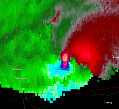
The Baron Tornado Index (BTI), also called Vipir Tornado Index (VTI) is a meteorological computer model. Its main usage is to determine the probabilities of a tornado inside a Tornadic Vortex Signature on the rear flank of a storm, to better alert potential high-risk areas for tornadoes and to easily track them. With the help of NEXRAD weather radar data, mesoscale models and algorithms, the index is measured on a scale of 0 to 10. The higher the BTI value is, the more likely a tornado is on the ground. Shear markers from different colors are used depending on the scale above 2. Yellow markers are used for values between 2 and 3.9, Orange markers are used for values between 4 and 6.9 and red markers are used for values over 7. The product was developed and is marketed by Baron Services of Huntsville, Alabama, and is a part of the company's VIPIR radar analysis product. The system is primarily used by television stations. The BTI first saw public usage in early 2008. WMC-TV, the ... [...More Info...] [...Related Items...] OR: [Wikipedia] [Google] [Baidu] |
Tornadic Vortex Signature
A tornadic vortex signature, abbreviated TVS, is a Pulse-Doppler radar weather radar detected rotation algorithm that indicates the likely presence of a strong mesocyclone that is in some stage of tornadogenesis. It may give meteorologists the ability to pinpoint and track the location of tornadic rotation within a larger storm, but it is not an important feature in the National Weather Service's warning operations. The tornadic vortex signature was first identified by Donald W. Burgess, Leslie R. Lemon, and Rodger A. Brown in the 1970s using experimental Doppler radar at the National Severe Storms Laboratory (NSSL) in Norman, Oklahoma. The National Weather Service (NWS) now uses an updated algorithm developed by NSSL, the ''tornado detection algorithm'' (TDA) based on data from its WSR-88D system of radars. NSSL also developed the ''mesocyclone detection algorithm'' (MDA). Display The conditions causing a TVS are often visible on the Doppler weather radar storm relative velocit ... [...More Info...] [...Related Items...] OR: [Wikipedia] [Google] [Baidu] |
WMC-TV
WMC-TV (channel 5) is a television station in Memphis, Tennessee, United States, affiliated with NBC and owned by Gray Television. Its studios are located on Union Avenue in midtown Memphis, and its transmitter is located in northeast Memphis, near the suburb of Bartlett, Tennessee. History The station first signed on the air on November 13, 1948, as WMCT, initially transmitting on VHF channel 4. WMCT was also the first television station in the state of Tennessee. This first transmission coincided with being the first football game telecast in Tennessee—the tenth meeting at Crump Stadium between Tennessee and Ole Miss. Daily programming for WMCT began on December 11, 1948. The station originally broadcast from studios located inside the Goodwyn Institute Building in Downtown Memphis. It was owned by the E. W. Scripps Company, along with the city's morning newspaper, ''The Commercial Appeal'', the afternoon ''Memphis Press-Scimitar'', WMC radio ( 790 AM), and WMCF (99.7 FM) ... [...More Info...] [...Related Items...] OR: [Wikipedia] [Google] [Baidu] |
Tornado
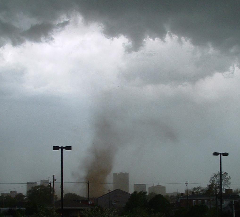
A tornado is a violently rotating column of air that is in contact with both the surface of the Earth and a cumulonimbus cloud or, in rare cases, the base of a cumulus cloud. It is often referred to as a twister, whirlwind or cyclone, although the word cyclone is used in meteorology to name a weather system with a low-pressure area in the center around which, from an observer looking down toward the surface of the Earth, winds blow counterclockwise in the Northern Hemisphere and clockwise in the Southern. Tornadoes come in many shapes and sizes, and they are often visible in the form of a condensation funnel originating from the base of a cumulonimbus cloud, with a cloud of rotating debris and dust beneath it. Most tornadoes have wind speeds less than , are about across, and travel several kilometers (a few miles) before dissipating. The most extreme tornadoes can attain wind speeds of more than , are more than in diameter, and stay on the ground for more than 100 k ... [...More Info...] [...Related Items...] OR: [Wikipedia] [Google] [Baidu] |
Radar Meteorology
Weather radar, also called weather surveillance radar (WSR) and Doppler weather radar, is a type of radar used to locate precipitation, calculate its motion, and estimate its type (rain, snow, hail etc.). Modern weather radars are mostly pulse-Doppler radars, capable of detecting the motion of rain droplets in addition to the intensity of the precipitation. Both types of data can be analyzed to determine the structure of storms and their potential to cause severe weather. During World War II, radar operators discovered that weather was causing echoes on their screen, masking potential enemy targets. Techniques were developed to filter them, but scientists began to study the phenomenon. Soon after the war, surplus radars were used to detect precipitation. Since then, weather radar has evolved on its own and is now used by national weather services, research departments in universities, and in television stations' weather departments. Raw images are routinely used and specialize ... [...More Info...] [...Related Items...] OR: [Wikipedia] [Google] [Baidu] |
List Of BTI Operating Stations
A ''list'' is any set of items in a row. List or lists may also refer to: People * List (surname) Organizations * List College, an undergraduate division of the Jewish Theological Seminary of America * SC Germania List, German rugby union club Other uses * Angle of list, the leaning to either port or starboard of a ship * List (information), an ordered collection of pieces of information ** List (abstract data type), a method to organize data in computer science * List on Sylt, previously called List, the northernmost village in Germany, on the island of Sylt * ''List'', an alternative term for ''roll'' in flight dynamics * To ''list'' a building, etc., in the UK it means to designate it a listed building that may not be altered without permission * Lists (jousting), the barriers used to designate the tournament area where medieval knights jousted * ''The Book of Lists'', an American series of books with unusual lists See also * The List (other) * Listing (di ... [...More Info...] [...Related Items...] OR: [Wikipedia] [Google] [Baidu] |
Jackson, Tennessee
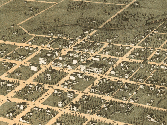
Jackson is a city in and the county seat of Madison County, Tennessee, United States. Located east of Memphis, Tennessee, Memphis, it is a regional center of trade for West Tennessee. Its total population was 68,205 as of the 2020 United States census. Jackson is the primary city of the Jackson metropolitan area, Tennessee, Jackson, Tennessee metropolitan area, which is included in the Jackson-Humboldt, Tennessee combined statistical area. Jackson is Madison County, Tennessee, Madison County's largest city, and the second-largest city in West Tennessee next to Memphis. It is home to the Tennessee Supreme Court's courthouse for West Tennessee, as Jackson was the major city in the west when the court was established in 1834. In the antebellum era, Jackson was the market city for an agricultural area based on cultivation of cotton, the major commodity crop. Beginning in 1851, the city became a hub of railroad systems ultimately connecting to major markets in the north and south, a ... [...More Info...] [...Related Items...] OR: [Wikipedia] [Google] [Baidu] |
2008 Super Tuesday Tornado Outbreak
The 2008 Super Tuesday tornado outbreak was a deadly tornado outbreak which affected the Southern United States and the lower Ohio Valley on February 5 and 6, 2008. The event began on Super Tuesday, while 24 states in the United States were holding primary elections and caucuses to select the presidential candidates for the upcoming presidential election. Missouri, Illinois, Arkansas, Alabama, and Tennessee were among the affected regions in which primaries were being held. Some voting locations were forced to close early due to the approaching severe weather. The outbreak generated 87 tornadoes over 15 hours from the afternoon of February 5 until the early morning of February 6. The storm system produced several destructive tornadoes in heavily populated areas, most notably in the Memphis metropolitan area, in Jackson, Tennessee, and the northeastern end of the Nashville metropolitan area. A total of 57 people were killed across four states and 18 counties, with hun ... [...More Info...] [...Related Items...] OR: [Wikipedia] [Google] [Baidu] |
Memphis, Tennessee
Memphis is a city in the U.S. state of Tennessee. It is the seat of Shelby County in the southwest part of the state; it is situated along the Mississippi River. With a population of 633,104 at the 2020 U.S. census, Memphis is the second-most populous city in Tennessee, after Nashville. Memphis is the fifth-most populous city in the Southeast, the nation's 28th-largest overall, as well as the largest city bordering the Mississippi River. The Memphis metropolitan area includes West Tennessee and the greater Mid-South region, which includes portions of neighboring Arkansas, Mississippi and the Missouri Bootheel. One of the more historic and culturally significant cities of the Southern United States, Memphis has a wide variety of landscapes and distinct neighborhoods. The first European explorer to visit the area of present-day Memphis was Spanish conquistador Hernando de Soto in 1541. The high Chickasaw Bluffs protecting the location from the waters of the Mississipp ... [...More Info...] [...Related Items...] OR: [Wikipedia] [Google] [Baidu] |
Volumetric Imaging And Processing Of Integrated Radar
Volumetric Imaging and Processing of Integrated Radar, known by the acronym VIPIR, is an analysis and display program for Doppler weather radar, created and sold by Baron Services. This software allows improved analysis of radar data for private users, in particular television stations, similar to the ''Weather Decision Support System'' program used by the National Weather Service. Technique WSR-88D, or NEXRAD, Doppler radars scan at various elevations, creating a volume scan. This data can be manipulated in a three-dimensional view by VIPIR. The result of this process is a three-dimensional image of the storm, which may be rotated and viewed from any angle. If imagery is zoomed in at an adequate range, actual weather satellite data can be superimposed. VIPIR images can be constructed from multiple sources, including Doppler weather radar and NEXRAD. It is used by television meteorologists to give a comprehensive view of weather, in particular severe weather events. Algorithms I ... [...More Info...] [...Related Items...] OR: [Wikipedia] [Google] [Baidu] |
Tornado
A tornado is a violently rotating column of air that is in contact with both the surface of the Earth and a cumulonimbus cloud or, in rare cases, the base of a cumulus cloud. It is often referred to as a twister, whirlwind or cyclone, although the word cyclone is used in meteorology to name a weather system with a low-pressure area in the center around which, from an observer looking down toward the surface of the Earth, winds blow counterclockwise in the Northern Hemisphere and clockwise in the Southern. Tornadoes come in many shapes and sizes, and they are often visible in the form of a condensation funnel originating from the base of a cumulonimbus cloud, with a cloud of rotating debris and dust beneath it. Most tornadoes have wind speeds less than , are about across, and travel several kilometers (a few miles) before dissipating. The most extreme tornadoes can attain wind speeds of more than , are more than in diameter, and stay on the ground for more than 100 k ... [...More Info...] [...Related Items...] OR: [Wikipedia] [Google] [Baidu] |
Huntsville, Alabama
Huntsville is a city in Madison County, Limestone County, and Morgan County, Alabama, United States. It is the county seat of Madison County. Located in the Appalachian region of northern Alabama, Huntsville is the most populous city in the state. Huntsville was founded within the Mississippi Territory in 1805 and became an incorporated town in 1811. When Alabama was admitted as a state in 1819, Huntsville was designated for a year as the first capital, before that was moved to more central settlements. The city developed across nearby hills north of the Tennessee River, adding textile mills in the late nineteenth century. Its major growth has taken place since World War II. During the war, the Army established Redstone Arsenal near here with a chemical weapons plant, and nearby related facilities. After the war, additional research was conducted at Redstone Arsenal on rockets, followed by adaptations for space exploration. NASA's Marshall Space Flight Center, the Unit ... [...More Info...] [...Related Items...] OR: [Wikipedia] [Google] [Baidu] |
Baron Services
Baron Services is a weather technology company based in Huntsville, Alabama, United States. The company develops weather systems that aid in the detection and dissemination of weather information to customers in the broadcast, government, aviation, marine and automotive industries. These technologies include weather tracking software, Doppler weather radar, systems integration, and personal alerting services, among others. The company holds numerous U.S. patents for weather technology. The OmniWxTrac system developed in 1992 was the first street-level storm tracking system for broadcast television. The corporation has developed storm-tracking technologies like shear markers and SCITS, as well as the Baron Tornado Index (BTI), which ranks a storm’s tornadic potential on a scale between 0-10. OmniWxTrac was followed by many additional weather tools including the FasTrac storm tracking system, the 3D VIPIR storm tracking system and the Omni system. In the mid 2010s Baron introduc ... [...More Info...] [...Related Items...] OR: [Wikipedia] [Google] [Baidu] |


