|
Barkhale Camp
Barkhale Camp is a Neolithic British Isles, Neolithic causewayed enclosure, an archaeological site on Bignor Hill, on the South Downs in West Sussex, England. Causewayed enclosures were built in England from shortly before 3700 BC until at least 3500 BC; they are characterized by the full or partial enclosure of an area with ditches that are interrupted by gaps, or causeways. Their purpose is not known; they may have been settlements, meeting places, or ritual sites. The Barkhale Camp enclosure was first identified in 1929, by John Ryle (physician), John Ryle, and was surveyed the following year by E. Cecil Curwen, who listed it as a possible Neolithic site in a 1930 paper which was the first attempt to list all the causewayed enclosures in England. A small trench was dug in 1930 by Ryle, and a more extensive excavation was undertaken by Veronica Seton-Williams between 1958 and 1961, which confirmed Curwen's survey and found a characteristically Neolithic assemblage of flints ... [...More Info...] [...Related Items...] OR: [Wikipedia] [Google] [Baidu] |
Arundel
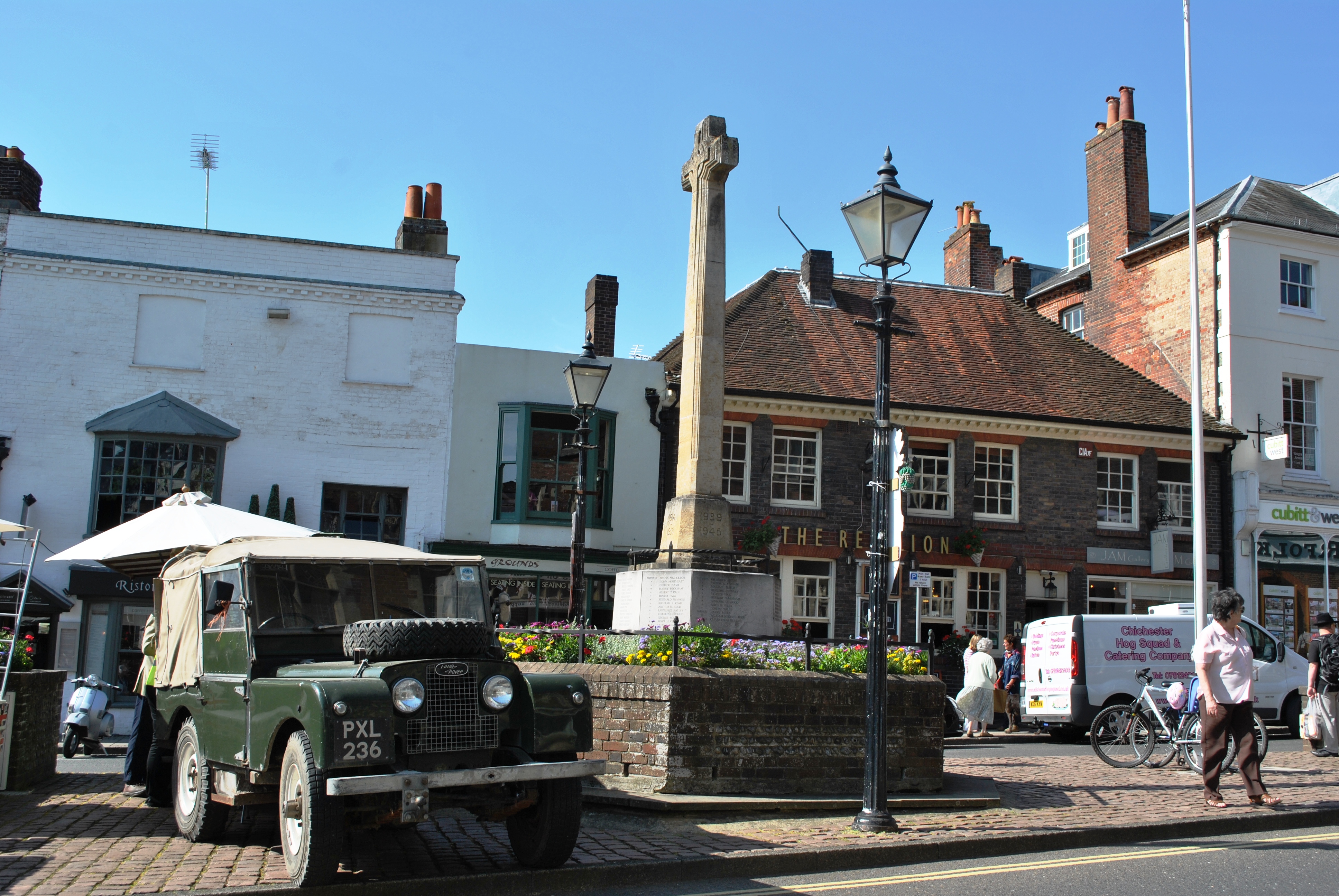
Arundel ( ) is a market town and civil parish in the Arun District of the South Downs, West Sussex, England. The much-conserved town has a medieval castle and Roman Catholic cathedral. Arundel has a museum and comes second behind much larger Chichester in its number of listed buildings in West Sussex. The River Arun runs through the eastern side of the town. Arundel was one of the boroughs reformed by the Municipal Reform Act 1835. From 1836 to 1889 the town had its own Borough police force with a strength of three. In 1974 it became part of the Arun district, and is now a civil parish with a town council. Name The name comes from the Old English ''Harhunedell'', meaning "valley of horehound", and was first recorded in the Domesday Book. Folk etymology, however, connects the name with the Old French word ''arondelle'', meaning "swallow", and swallows appear on the town's arms. Governance An electoral ward of the same name exists. This ward stretches north to Houghton ... [...More Info...] [...Related Items...] OR: [Wikipedia] [Google] [Baidu] |
English Heritage
English Heritage (officially the English Heritage Trust) is a charity that manages over 400 historic monuments, buildings and places. These include prehistoric sites, medieval castles, Roman forts and country houses. The charity states that it uses these properties to "bring the story of England to life for over 10 million people each year". Within its portfolio are Stonehenge, Dover Castle, Tintagel Castle and the best preserved parts of Hadrian's Wall. English Heritage also manages the London Blue Plaque scheme, which links influential historical figures to particular buildings. When originally formed in 1983, English Heritage was the operating name of an executive non-departmental public body of the British Government, officially titled the Historic Buildings and Monuments Commission for England, that ran the national system of heritage protection and managed a range of historic properties. It was created to combine the roles of existing bodies that had emerged from a long ... [...More Info...] [...Related Items...] OR: [Wikipedia] [Google] [Baidu] |
Royal Commission On The Historical Monuments Of England
The Royal Commission on the Historical Monuments of England (RCHME) was a government advisory body responsible for documenting buildings and monuments of archaeological, architectural and historical importance in England. It was established in 1908 (shortly after the parallel commissions for Scotland and Wales); and was merged with English Heritage in 1999. The research section and the archive are now part of Historic England. History The Royal Commission was established in 1908, twenty-six years after the passage of the Ancient Monuments Protection Act 1882, which provided the first state protection for ancient monuments in the United Kingdom, and eight years after the passage of the wider-ranging Ancient Monuments Protection Act 1900. Critics, including David Murray in his ''Archaeological Survey of the United Kingdom'' (1896) and Gerard Baldwin Brown in his ''Care of Ancient Monuments'' (1905), had argued that, for the legislation to be effective, a detailed list of significant ... [...More Info...] [...Related Items...] OR: [Wikipedia] [Google] [Baidu] |
Terra Sigillata
Terra sigillata is a term with at least three distinct meanings: as a description of medieval medicinal earth; in archaeology, as a general term for some of the fine red Ancient Roman pottery with glossy surface slips made in specific areas of the Roman Empire; and more recently, as a description of a contemporary studio pottery technique supposedly inspired by ancient pottery. Usually roughly translated as 'sealed earth', the meaning of 'terra sigillata' is 'clay bearing little images' (Latin ''sigilla''), not 'clay with a sealed (impervious) surface'. The archaeological term is applied, however, to plain-surfaced pots as well as those decorated with figures in relief. Terra sigillata as an archaeological term refers chiefly to a specific type of plain and decorated tableware made in Italy and in Gaul (France and the Rhineland) during the Roman Empire. These vessels have glossy surface slips ranging from a soft lustre to a brilliant glaze-like shine, in a characteristic colou ... [...More Info...] [...Related Items...] OR: [Wikipedia] [Google] [Baidu] |
Lithic Flake
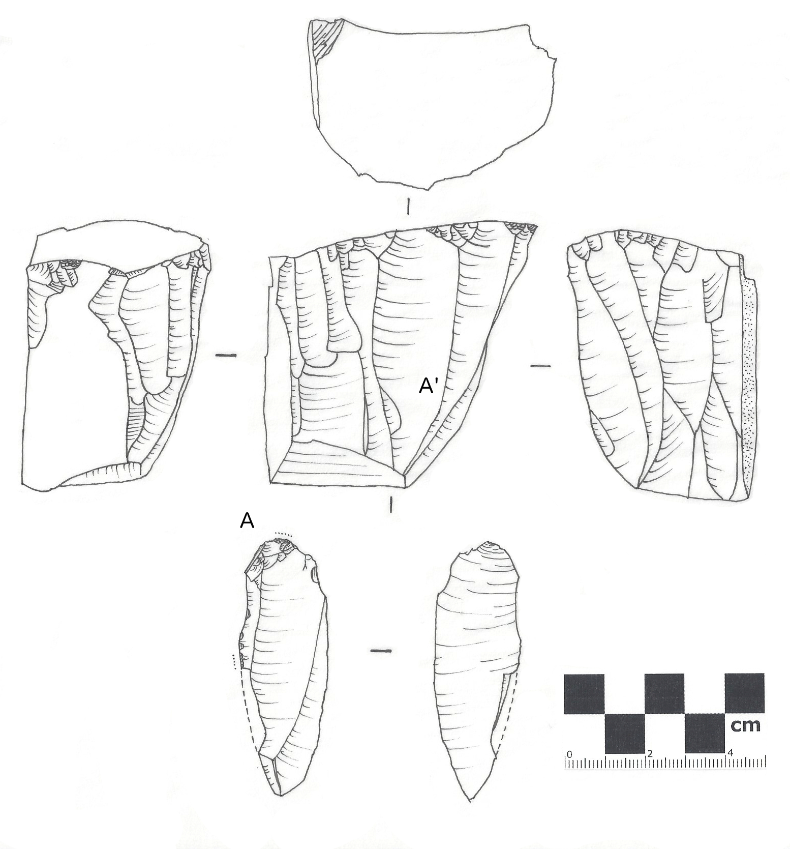
In archaeology, a lithic flake is a "portion of rock removed from an objective piece by percussion or pressure,"Andrefsky, W. (2005) ''Lithics: Macroscopic Approaches to Analysis''. 2d Ed. Cambridge, Cambridge University Press and may also be referred to as simply a ''flake'', or collectively as debitage. The objective piece, or the rock being reduced by the removal of flakes, is known as a core.Andrefsky, W. (2005) ''Lithics: Macroscopic Approaches to Analysis''. 2d Ed. Cambridge, Cambridge University Press Once the proper tool stone has been selected, a percussor or pressure flaker (e.g., an antler tine) is used to direct a sharp blow, or apply sufficient force, respectively, to the surface of the stone, often on the edge of the piece. The energy of this blow propagates through the material, often ( but not always) producing a Hertzian cone of force which causes the rock to fracture in a controllable fashion. Since cores are often struck on an edge with a suitable angle (<90°) ... [...More Info...] [...Related Items...] OR: [Wikipedia] [Google] [Baidu] |
Lithic Core
In archaeology, a lithic core is a distinctive artifact that results from the practice of lithic reduction. In this sense, a core is the scarred nucleus resulting from the detachment of one or more flakes from a lump of source material or tool stone, usually by using a hard hammer precursor such as a hammerstone. The core is marked with the positive scars of these flakes. The surface area of the core which received the blows necessary for detaching the flakes is referred to as the striking platform. The core may be discarded or shaped further into a core tool, such as can be seen in some types of handaxe. The purpose of core reduction may be to rough out a blank for later refinement into a projectile point, knife, or other stone tool, or it may be performed in order to obtain sharp flakes, from which a variety of simple tools can be made. Generally, the presence of a core is indicative of the latter process, since the former process usually leaves no core. Because the morpholo ... [...More Info...] [...Related Items...] OR: [Wikipedia] [Google] [Baidu] |
Scraper (archaeology)
In prehistoric archaeology, scrapers are unifacial tools thought to have been used for hideworking and woodworking. Many lithic analysts maintain that the only true scrapers are defined on the base of use-wear, and usually are those that were worked on the distal ends of blades—i.e., "end scrapers" (french: grattoir, link=no). Other scrapers include the so-called "side scrapers" or racloirs, which are made on the longest side of a flake, and notched scrapers, which have a cleft on either side that may have been used to attach them to something else. Scrapers are typically formed by chipping the end of a flake of stone in order to create one sharp side and to keep the rest of the sides dull to facilitate grasping it. Most scrapers are either circle or blade-like in shape. The working edges of scrapers tend to be convex, and many have trimmed and dulled lateral edges to facilitate hafting. One important variety of scraper is the thumbnail scraper, a scraper shaped much like ... [...More Info...] [...Related Items...] OR: [Wikipedia] [Google] [Baidu] |
Whitehawk Camp
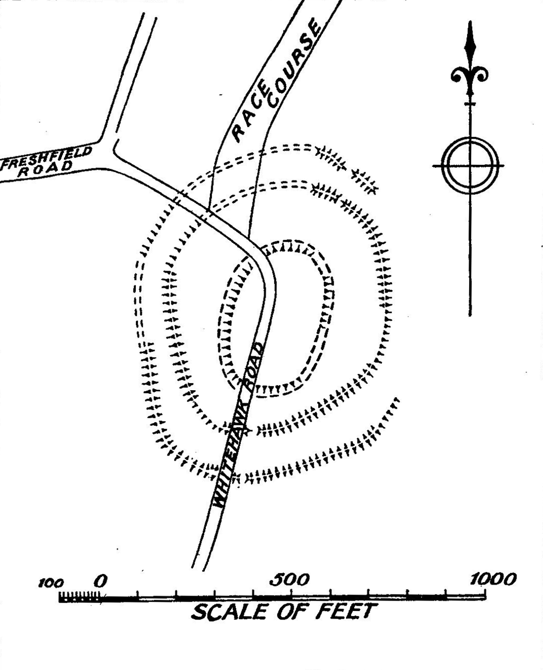
Whitehawk Camp is the remains of a causewayed enclosure on Whitehawk Hill near Brighton and Hove, Brighton, East Sussex, England. Causewayed enclosures are a form of Neolithic British Isles#Early and Middle Neolithic: 4000–2900 BCE, early Neolithic Earthworks (archaeology), earthwork that were built in England from shortly before 3700 BC until at least 3500 BC, characterized by the full or partial enclosure of an area with ditches that are interrupted by gaps, or causeways. Their purpose is not known; they may have been settlements, or meeting places, or ritual sites. The Whitehawk site consists of four roughly concentric circular ditches, with banks of earth along the interior of the ditches evident in some places. There may have been a timber palisade on top of the banks. Outside the outermost circuit there are at least two more ditches, one of which is thought from radiocarbon dating, radiocarbon evidence to date to the Bronze Age Britain, Bronze Age, about two thousand years a ... [...More Info...] [...Related Items...] OR: [Wikipedia] [Google] [Baidu] |
London University
The University of London (UoL; abbreviated as Lond or more rarely Londin in post-nominals) is a federal public research university located in London, England, United Kingdom. The university was established by royal charter in 1836 as a degree-awarding examination board for students holding certificates from University College London and King's College London and "other such other Institutions, corporate or unincorporated, as shall be established for the purpose of Education, whether within the Metropolis or elsewhere within our United Kingdom". This fact allows it to be one of three institutions to claim the title of the third-oldest university in England, and moved to a federal structure in 1900. It is now incorporated by its fourth (1863) royal charter and governed by the University of London Act 2018. It was the first university in the United Kingdom to introduce examinations for women in 1869 and, a decade later, the first to admit women to degrees. In 1913, it appointed ... [...More Info...] [...Related Items...] OR: [Wikipedia] [Google] [Baidu] |
Bosing (archaeology)
Bosing is an unsophisticated method for the discovery of buried archaeological features such as pits and ditches dug into a thin substratum of rock, such as limestone or chalk. The technique involves hitting a block of wood laid over the ground surface with a weighty hammer and assessing the sound given out. For example, if the wood gave out a heavy thudding sound, then this would indicate that the underlying bedrock In geology, bedrock is solid Rock (geology), rock that lies under loose material (regolith) within the crust (geology), crust of Earth or another terrestrial planet. Definition Bedrock is the solid rock that underlies looser surface mater ... had been disturbed while undisturbed bedrock would emit a thinner and sharper tone. Methodically repeating the process across an area and noting the sound pattern will reveal the extent of the underground features.The concise Oxford dictionary of archaeology p.57 References Sources * {{archaeology-stub Geologica ... [...More Info...] [...Related Items...] OR: [Wikipedia] [Google] [Baidu] |
Earth Auger
An earth auger, earth drill, or post-hole auger is a drilling tool or machine used for making holes in the ground. It typically consists of a rotating vertical metal rod or pipe with one or more blades attached at the lower end, that cut or scrape the soil. History Metal augers have been in use since the Middle Ages to drill holes in wood. In the 19th century, the hand-operated earth auger became a common farm and construction tool in the US, and several inventors submitted patents for them.US Patent Office (1881): ''Annual Report of the Commissioner of Patents'', page 251. The page lists several patents for "earth auger" or "post hole auger", including: 225,508 (A. J. Collins, 1880-03016), 226,444 (D. P. Cudd, 1880-04-13), 228,044 (A. J. Dine, 1880-05-25), 230,830 (E. A. Smith, 1880-08-03), 231,775 (J. S. Dunning, 1880-08-31), 232,041 (B. Knopp, 1880-09-07), and 233,931 (M. M. Hubby, 1880-11-02). An example is the design of a certain M. Hubby of Maysfield, Texas, consistin ... [...More Info...] [...Related Items...] OR: [Wikipedia] [Google] [Baidu] |


.jpg)


