|
Bargoed Interchange
Bargoed Interchange ( cy, Cyfnewidfa Bargod) is a bus station located in the town centre of Bargoed, South Wales. It is situated near the High Street. Background The new station building was funded through the European Regional Development Fund, European Union Regional Development Fund, and through the Welsh Government's Targeted Match Funding, Transport Grant programme, and the A465 road, Heads of the Valleys Programme. Layout The toilet facilities closed in April 2019 due to the increasing financial difficulties faced by Caerphilly Council. Caerphilly Town Centre public toilets re-opened in July 2019 but the fate of facilities in Blackwood remain uncertain. The station was covered by Caerphilly Council's Public Space Protection Orders issued in 2015, which introduced Community Safety Wardens empowered to issue fixed penalty notices of £100 for any incidents of anti-social activities at the station, including any "disorderly, indecent or offensive" behaviour includi ... [...More Info...] [...Related Items...] OR: [Wikipedia] [Google] [Baidu] |
Bus Station
A bus station or a bus interchange is a structure where city or intercity buses stop to pick up and drop off passengers. While the term bus depot can also be used to refer to a bus station, it generally refers to a bus garage. A bus station is larger than a bus stop, which is usually simply a place on the roadside, where buses can stop. It may be intended as a terminal station for a number of routes, or as a transfer station where the routes continue. Bus station platforms may be assigned to fixed bus lines, or variable in combination with a dynamic passenger information system. The latter requires fewer platforms, but does not supply the passenger the comfort of knowing the platform well in advance and waiting there. Accessible station An accessible station is a public transportation passenger station which provides ready access, is usable and does not have physical barriers that prohibit and/or restrict access by people with disabilities, including those who use wheelchairs. ... [...More Info...] [...Related Items...] OR: [Wikipedia] [Google] [Baidu] |
A465 Road
The A465 is a trunk road that runs from Bromyard in Herefordshire, England to Llandarcy near Swansea in South Wales. The western half is known officially as the Neath to Abergavenny Trunk Road, but the section from Abergavenny to the Vale of Neath is more commonly referred to as the Heads of the Valleys Road because it links the northern heads of the South Wales Valleys. Approximately following the southern boundary of the Brecon Beacons National Park, the Ordnance Survey ''Pathfinder'' guide describes it as the unofficial border between rural and industrial South Wales. The A465 provides an alternative route between England and the counties in South West Wales and to the Ferry, ferries to Republic of Ireland, Ireland. Route The A465 runs south-west from Bromyard towards the River Lugg, from where it runs Concurrency (road), concurrently with the A4103 road, A4103 for a short distance before entering Hereford. After a short distance on the A49 road, A49, it crosses the River Wye, ... [...More Info...] [...Related Items...] OR: [Wikipedia] [Google] [Baidu] |
Buildings And Structures Completed In 2011
A building, or edifice, is an enclosed structure with a roof and walls standing more or less permanently in one place, such as a house or factory (although there's also portable buildings). Buildings come in a variety of sizes, shapes, and functions, and have been adapted throughout history for a wide number of factors, from building materials available, to weather conditions, land prices, ground conditions, specific uses, prestige, and aesthetic reasons. To better understand the term ''building'' compare the list of nonbuilding structures. Buildings serve several societal needs – primarily as shelter from weather, security, living space, privacy, to store belongings, and to comfortably live and work. A building as a shelter represents a physical division of the human habitat (a place of comfort and safety) and the ''outside'' (a place that at times may be harsh and harmful). Ever since the first cave paintings, buildings have also become objects or canvasses of much artis ... [...More Info...] [...Related Items...] OR: [Wikipedia] [Google] [Baidu] |
Bus Stations In Wales
A bus (contracted from omnibus, with variants multibus, motorbus, autobus, etc.) is a road vehicle that carries significantly more passengers than an average car or van. It is most commonly used in public transport, but is also in use for charter purposes, or through private ownership. Although the average bus carries between 30 and 100 passengers, some buses have a capacity of up to 300 passengers. The most common type is the single-deck rigid bus, with double-decker and articulated buses carrying larger loads, and midibuses and minibuses carrying smaller loads. Coaches are used for longer-distance services. Many types of buses, such as city transit buses and inter-city coaches, charge a fare. Other types, such as elementary or secondary school buses or shuttle buses within a post-secondary education campus, are free. In many jurisdictions, bus drivers require a special large vehicle licence above and beyond a regular driving licence. Buses may be used for scheduled bus ... [...More Info...] [...Related Items...] OR: [Wikipedia] [Google] [Baidu] |
Buildings And Structures In Caerphilly County Borough
A building, or edifice, is an enclosed structure with a roof and walls standing more or less permanently in one place, such as a house or factory (although there's also portable buildings). Buildings come in a variety of sizes, shapes, and functions, and have been adapted throughout history for a wide number of factors, from building materials available, to weather conditions, land prices, ground conditions, specific uses, prestige, and aesthetic reasons. To better understand the term ''building'' compare the list of nonbuilding structures. Buildings serve several societal needs – primarily as shelter from weather, security, living space, privacy, to store belongings, and to comfortably live and work. A building as a shelter represents a physical division of the human habitat (a place of comfort and safety) and the ''outside'' (a place that at times may be harsh and harmful). Ever since the first cave paintings, buildings have also become objects or canvasses of much artistic ... [...More Info...] [...Related Items...] OR: [Wikipedia] [Google] [Baidu] |
Penarth Railway Station
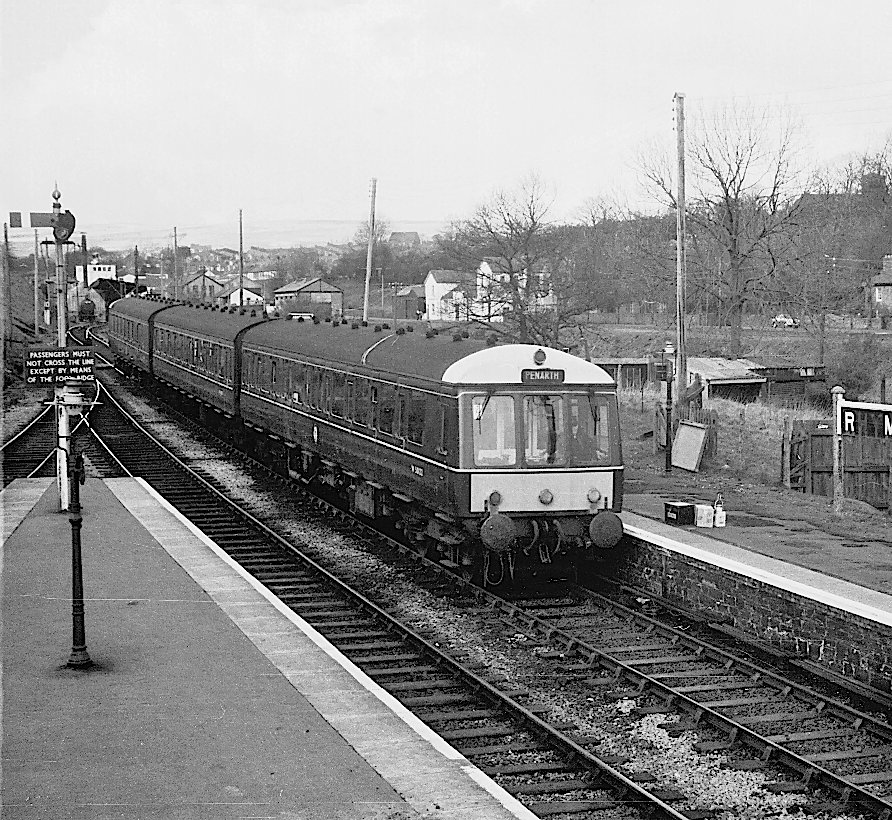
Penarth railway station is the railway station serving the town of Penarth in the Vale of Glamorgan, South Wales. It is the terminus of Network Rail's Penarth branch running from Cogan Junction to Penarth station, from the junction and south of station. The Penarth branch ran from Cogan Junction to Biglis Junction, a rail mileage of and was officially closed beyond Penarth after the last passenger train ran on Saturday 4 May 1968. Station history Heyday Penarth Station (or Penarth Town as it was originally known) was built for the Cardiff, Penarth and Barry Junction Railway, and opened in 1878 as part of that company's new line to Lavernock. This was a continuation of the Taff Vale Railway's ''Penarth Extension Railway'', which had been completed in February 1878 and gave the town its first rail link to Cardiff. The Taff Vale took over the CP&BJR in 1889 and had the line completed from Lavernock to Biglis Junction (east of ) on the Barry Railway in 1890. The extension att ... [...More Info...] [...Related Items...] OR: [Wikipedia] [Google] [Baidu] |
Cardiff Central Railway Station
, symbol_location = gb , symbol = rail , image = Cardiff Central station (26526139271).jpg , caption = 1930s frontage of Cardiff Central station (northern entrance) , borough = Cardiff, City and County of Cardiff , country = Wales , coordinates = , grid_name = Grid reference , grid_position = , owned = Network Rail , manager = Transport for Wales Rail , platforms = 8 , code = CDF , classification = DfT category A , years = 19 June 1850 , events = Opened as ''Cardiff'' , years1 = 1896 , events1 = Enlarged , years2 = 1924 , events2 = Renamed ''Cardiff General'' , years3 = 1931–34 , events3 = Rebuilt , years4 = 1940 , events4 = Merged with Cardiff Riverside station , years5 = 1964 , events5 = Riverside platforms closed , years6 = 1973 , events6 = Renamed ''Cardiff Central'' , years7 = 2015-17 , events7 = Enlarged , mpassengers = , footnotes = Passenger statistics from the Office of Rail and Road , mapframe=yes , mapframe-zoom = 13 Cardiff Cen ... [...More Info...] [...Related Items...] OR: [Wikipedia] [Google] [Baidu] |
Cardiff Queen Street Railway Station
, symbol_location = gb , symbol = rail , image = Cardiff Queen St. (19366639218).jpg , caption = Cardiff Queen Street seen from the north. , borough = Cardiff, City and County of Cardiff , country = Wales , coordinates = , grid_name = Grid reference , grid_position = , manager = Transport for Wales , platforms = 5 , code = CDQ , classification = DfT category C1 , years1 = 9 October 1840 , events1 = Opened as ''Cardiff Taff Vale'' , years2 = 1887 , events2 = Rebuilt and renamed ''Cardiff Queen Street'' , years3 = 1928 , events3 = Enlarged , years4 = 1973 , events4 = Rebuilt , years5 = 2014 , events5 = Redeveloped , mpassengers = , footnotes = Passenger statistics from the Office of Rail and Road Cardiff Queen Street railway station ( cy, Caerdydd Heol y Frenhines) is a railway station serving the north and east of Central Cardiff, Wales. It is the fourth busiest railway station in Wales. Being located near Queen Street, it is one of 20 stations i ... [...More Info...] [...Related Items...] OR: [Wikipedia] [Google] [Baidu] |
Caerphilly Railway Station
, symbol_location = gb , symbol = rail , image = Caerphilly railway station, The Rhymney Line, South Wales. View towards Bargoed.jpg , caption = Caerphilly railway station in 2019 , borough = Caerphilly, Caerphilly , country = Wales , coordinates = , grid_name = Grid reference , grid_position = , manager = Transport for Wales , platforms = 3 , code = CPH , classification = DfT category D , original = Rhymney Railway , pregroup = Rhymney Railway , postgroup = Great Western Railway , years1 = 31 March 1858 , events1 = Opened , years2 = 1 April 1871 , events2 = Re-sited , mpassengers = , footnotes = Passenger statistics from the Office of Rail and Road , mapframe=yes , mapframe-zoom = 13 Caerphilly railway station ( cy, Gorsaf re ... [...More Info...] [...Related Items...] OR: [Wikipedia] [Google] [Baidu] |
Rhymney Railway Station
, symbol_location = gb , symbol = rail , image = Stone building on Rhymney railway station (geograph 5999380).jpg , caption = Rhymney Station in December 2018 , borough = Rhymney, Caerphilly , country = Wales , coordinates = , grid_name = Grid reference , grid_position = , manager = Transport for Wales , platforms = 1 , code = RHY , classification = DfT category F1 , opened = 31 March 1858 , mpassengers = , footnotes = Passenger statistics from the Office of Rail and Road , mapframe=yes , mapframe-zoom = 13 Rhymney railway station serves the town of Rhymney in Wales. Situated on the Valley Lines network north of Cardiff Central, it is the terminus of the Rhymney Line. The station has sidings to the west of its single platform which are used for the overnight stabling of the diesel multiple unit t ... [...More Info...] [...Related Items...] OR: [Wikipedia] [Google] [Baidu] |
Bargoed Railway Station
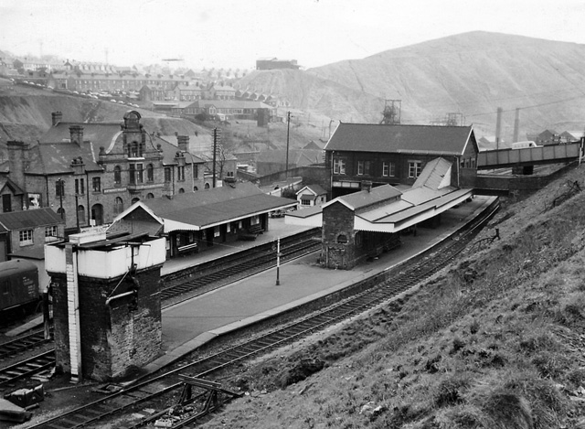
, symbol_location = gb , symbol = rail , image = Bargoed Railway Station (geograph 4776805).jpg , borough = Bargoed, Caerphilly , country = Wales , coordinates = , grid_name = Grid reference , grid_position = , manager = Transport for Wales , platforms = 2 , code = BGD , classification = DfT category E , opened = 1858 , mpassengers = , footnotes = Passenger statistics from the Office of Rail and Road , mapframe=yes , mapframe-zoom = 13 Bargoed railway station serves the town of Bargoed in the county borough of Caerphilly, South Wales. It is a stop on the Rhymney branch of the Valley Lines network. It is located close to the Bargoed Interchange bus station. History The station was opened on 31 March 1858 by the Rhymney Railway and was once a busy junction, serving lines to (via Bedwas) and Brecon (the Brecon and ... [...More Info...] [...Related Items...] OR: [Wikipedia] [Google] [Baidu] |


