|
Barauni–Katihar Section
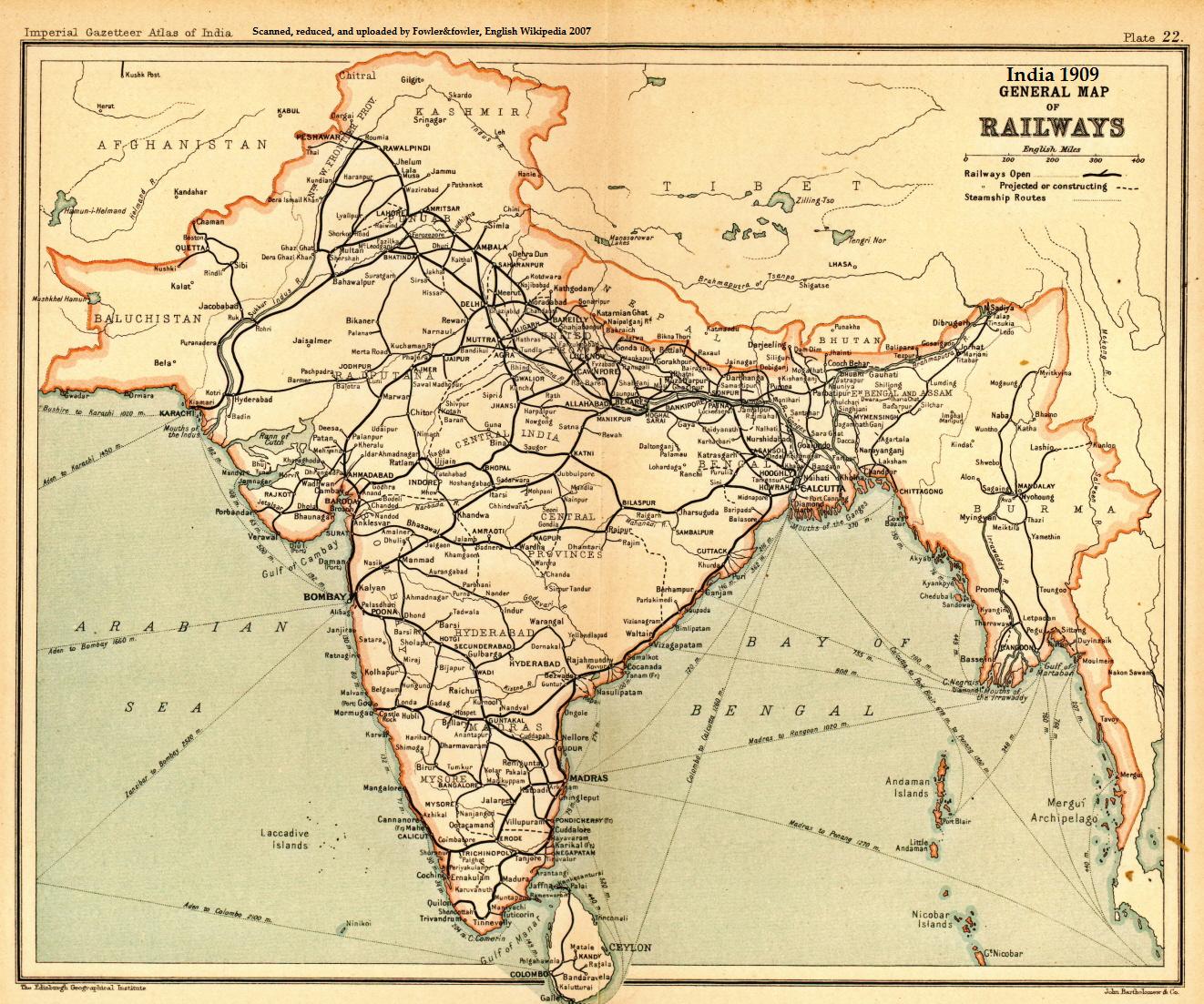
The Barauni–Katihar, Saharsa and Purnia sections of the Barauni–Guwahati line connects Barauni, Saharsa, Purnia and Katihar in the Indian state of Bihar . History Early developments Railway development on the northern side of the Ganges in Bihar came up soon after the opening of the Howrah–Delhi main line on the southern side of the Ganges in 1866. Several railway companies were involvedEast Indian Railway, Assam Behar State Railway, and Tirhut State Railway. In his book ''The Indian Empire, Its People, History and Products'' (first published in 1886) W.W.Hunter, says "The Tirhut State Railway with its various branches intersects Northern Behar and is intended to extend to the Nepal frontier on one side and to Assam on the other." However, early developments appear to be scattered. EIR built the Katihar– Kasba and Katihar–Manihari lines in 1887. Assam Behar State Railway built the Parbatipur–Katihar line (see Barsoi–Parbatipur line) in 1889, thereby linking A ... [...More Info...] [...Related Items...] OR: [Wikipedia] [Google] [Baidu] |
Bihar
Bihar (; ) is a state in eastern India. It is the 2nd largest state by population in 2019, 12th largest by area of , and 14th largest by GDP in 2021. Bihar borders Uttar Pradesh to its west, Nepal to the north, the northern part of West Bengal to the east, and with Jharkhand to the south. The Bihar plain is split by the river Ganges, which flows from west to east. On 15 November 2000, southern Bihar was ceded to form the new state of Jharkhand. Only 20% of the population of Bihar lives in urban areas as of 2021. Additionally, almost 58% of Biharis are below the age of 25, giving Bihar the highest proportion of young people of any Indian state. The official languages are Hindi and Urdu, although other languages are common, including Maithili, Magahi, Bhojpuri and other Languages of Bihar. In Ancient and Classical India, the area that is now Bihar was considered the centre of political and cultural power and as a haven of learning. From Magadha arose India's first ... [...More Info...] [...Related Items...] OR: [Wikipedia] [Google] [Baidu] |
Radhikapur
Radhikapur is a village and a gram panchayat in Kaliaganj CD block in Raiganj subdivision of Uttar Dinajpur district in the state of West Bengal, India. It is a border checkpoint on the Bangladesh-India border. Geography Location Radhikapur is located at . Radhikapur-Biral transit point The Radhikapur-Birol rail link was put back in operation in April 2017. It was a defunct rail transit point on the India-Bangladesh border for a long time. The corresponding station on the Bangladesh side is Biral in Dinajpur District. The transit facility in the Radhikapur-Birol sector had remained suspended since 1 April 2005. The railway track on the Indian side had been converted to broad gauge while that on the Bangladesh side it continued to remain metre gauge. As per the Memorandum of Understanding entered into by Bangladesh and India on 15 August 1978 it was agreed to facilitate overland transit traffic between Bangladesh and Nepal. An addendum was made on 6 September 2011, to add ... [...More Info...] [...Related Items...] OR: [Wikipedia] [Google] [Baidu] |
Kosi River
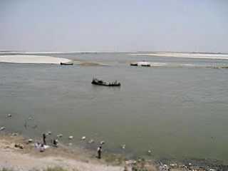
The Kosi or Koshi ( ne, कोशी, , hi, कोसी, ) is a transboundary river which flows through China, Nepal and India. It drains the northern slopes of the Himalayas in Tibet and the southern slopes in Nepal. From a major confluence of tributaries north of the Chatra Gorge onwards, the Kosi River is also known as Saptakoshi ( ne, सप्तकोशी, ) for its seven upper tributaries. These include the Tamor River originating from the Kanchenjunga area in the east and Arun River and Sun Kosi from Tibet. The Sun Koshi's tributaries from east to west are Dudh Koshi, Bhote Koshi, Tamakoshi River, Likhu Khola and Indravati. The Saptakoshi crosses into northern Bihar, India where it branches into distributaries before joining the Ganges near Kursela in Katihar district. The Kosi River is long and drains an area of about in Tibet, Nepal and Bihar.Nayak, J. (1996). ''Sediment management of the Kosi River basin in Nepal''. In: Walling, D. E. and B. W. We ... [...More Info...] [...Related Items...] OR: [Wikipedia] [Google] [Baidu] |
North Eastern Railway Zone
The North Eastern Railway (abbreviated NER) is one of the 19 railway zones of Indian Railways in India. It is headquartered at Gorakhpur. Zonal Rail Training Institute (ZRTI) is established in district Ghazipur, Uttar Pradesh. North Eastern Railway is one of the most important transit zones, that is, it is used to take in loaded wagons, especially food grains, from Northern Railway divisions like Firozpur, and move it towards Eastern belt and the Northern Frontier region (Seven Sister States). Thus, it acts as an essential cog in the food security of the country. Apart from being an important transit zone, it is also at the center-stage for much inward traffic from the neighboring zones. The inward traffic comprises food grains, fertiliser, stone chips, cement, petroleum, coal, etc. As North Eastern Railway caters to a large area spread from the western part of Uttar Pradesh towards eastern Uttar Pradesh and area comprising western Bihar, it runs many passenger trains for the ... [...More Info...] [...Related Items...] OR: [Wikipedia] [Google] [Baidu] |
Assam Bengal Railway
The Assam Bengal Railway (ABR) was one of the pioneering railway companies in British India. Headquartered in Chittagong, it functioned from 1892 to 1942. History Assam Bengal Railway was incorporated in 1892 to serve British-owned tea plantations in Assam. Assam Bengal Railway started construction of a railway track on the eastern side of Bengal in 1891. A track between Chittagong and Comilla was opened to traffic in 1895. The Comilla-Akhaura-Kulaura-Badarpur section was opened in 1896–1898 and finally extended to Lumding in 1903. The Assam Bengal Railway constructed a branch line to Guwahati, connecting the city to the eastern line in 1900. The line was extended to Tinsukia in 1902 and it was also connected to Dibru-Sadiya Railway in 1903. In 1936, the company owned 205 locomotives, 588 coaches and 5922 goods wagons. On 1 January 1942 the Assam Bengal Railway combined with the Eastern Bengal Railway to form the Bengal and Assam Railway. [...More Info...] [...Related Items...] OR: [Wikipedia] [Google] [Baidu] |
Eastern Bengal Railway
The Eastern Bengal Railway (full name: "Eastern Bengal Railway Company"; shortened EBR) was one of the pioneering railway companies that operated from 1857 to 1942, in Bengal and Assam provinces of British India. History Formation The Eastern Bengal Railway Company was incorporated by the Eastern Bengal Railway Act 1857 (20 & 21 Vict. c.159) of the Parliament of the United Kingdom, with the objective of introduction of railway transport in eastern Bengal and even to move into Burma. The operational area of Eastern Bengal Railway was to be the east bank of the Hooghly River, while East Indian Railway Company operated on the west bank of the river. Rolling stock By the end of 1877 the company owned 43 steam locomotives, 180 coaches and 691 goods wagons. By 1936, the rolling stock had increased to 327 locomotives, 3 steam railcars, 1560 coaches and 13.781 freight wagons. Classification It was labeled as a Class I railway according to Indian Railway Classification System of 1926 ... [...More Info...] [...Related Items...] OR: [Wikipedia] [Google] [Baidu] |
Sahibganj Loop
The Sahibganj loop is a railway line connecting Khana Junction and Kiul Junction. Originally a part of the Howrah–Delhi main line, it was opened to traffic in 1866. With the construction of a shorter railway line for a part of the route, the stretch was assigned a separate identity. History Railway transportation was introduced in India within 30 years of its maiden run in England. The East Indian Railway Company which was formed on 1 June 1845, completed its survey for a railway line from Kolkata, then called Calcutta, to Delhi via Mirzapur in 1846. The company initially became defunct on refusal of government guarantee, which was given in 1849. Thereafter, an agreement was signed between East Indian Railway Company and the East India Company, for the construction and operation of an "experimental" line between Kolkata and Rajmahal, which would later be extended to Delhi via Mirzapur. Construction began in 1851. On 15 August 1854, the first passenger train in the eastern ... [...More Info...] [...Related Items...] OR: [Wikipedia] [Google] [Baidu] |
Jamalpur, Munger
Jamalpur is a city in the Indian state of Bihar. It is situated 8 km from the Munger city centre. Jamalpur is a part of Munger-Jamalpur twin cities.It is main railhead for reaching Munger city. The name Jamalpur means ''Jamal'' (beautiful) ''pur'' (town). Jamalpur is best known for the Jamalpur Locomotive Workshop, which employs more than 25,000 people at its training institution, The Indian Railways Institute of Mechanical and Electrical Engineering. Annual turnover is Rs. 10.56 billion with 111,485 employees. This is Asia's largest and oldest locomotive railway workshop. The city was established in 1862 during the British Raj, with the Railways Institute forming its cultural hub. Etymology Jamalpur is named after 16th century Sufi saint Jamal Baba, whose ''dargah'' (shrine) is still present at East Colony Hospital Road, Jamalpur. History The city was established in 1862 during the British Raj, with the Railways Institute forming its cultural hub. The paleolithic s ... [...More Info...] [...Related Items...] OR: [Wikipedia] [Google] [Baidu] |
Munger
Munger, formerly spelt as Monghyr, is a twin city and a Municipal Corporation situated in the Indian state of Bihar. It is the administrative headquarters of Munger district and Munger Division. Munger was one of the major cities in Eastern India and undivided Bengal during Mughal period and British Raj. It is one of the major political,cultural,educational and commercial center of Bihar and Eastern India. Munger is situated about 180km from east of capital city Patna, about 480km west of Eastern India's largest city kolkata and 1200km from country's capital New Delhi. Historically, Munger is known for being an ancient seat of rule. The twin city comprises Munger and Jamalpur situated on the southern bank of the river Ganges. It is situated 08 km from Jamalpur Junction,180 km east of capital city Patna and 430 Km from Kolkata the capital of West Bengal. Munger is said to have been founded by the Guptas (4th century CE) and contains a fort that houses the ... [...More Info...] [...Related Items...] OR: [Wikipedia] [Google] [Baidu] |
Rajendra Setu
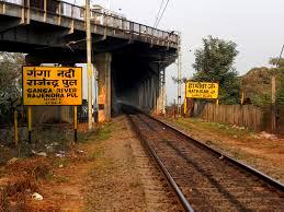
Rajendra Setu, or Simaria Bridge, is a bridge across the Ganges that was the first to link the northern and southern portions of the state of Bihar. The location of the bridge was based on the work of M. Visvesvaraya, who was more than 90 years old at the time. In a wheelchair, he visited the bridge site on the special request of Bihar's chief minister, Shri Krishna Sinha. It was the first bridge over the Ganges to be built in independent India (after 1947). The road-cum-rail bridge near Hathidah in Patna district and Simaria in Begusarai district was inaugurated in 1959 by Jawaharlal Nehru, prime minister of India, and Shri Krishna Sinha. The bridge was constructed by Braithwaite, Burn & Jessop Construction Company. It is about long and carries a two-lane road and a single-line railway track. A new bridge, carrying the four-lane NH 31 and double-track rail, 25 metres upstream from the existing rail and road bridge, was planned in 2011. The construction of the new parall ... [...More Info...] [...Related Items...] OR: [Wikipedia] [Google] [Baidu] |
Bihpur
Bihpur is a block in Bhagalpur district of Bihar, India. It is one of sixteen blocks under Bhagalpur district Bhagalpur district is one of the thirty-eight districts of Bihar state, India, and Bhagalpur town is the administrative headquarters of this district. Majority of Bhagalpur district lies in South Bihar. Geography Bhagalpur district occupies an a .... References {{Bhagalpur district Bhagalpur district ... [...More Info...] [...Related Items...] OR: [Wikipedia] [Google] [Baidu] |
Barauni
Barauni is an Industrial City situated on the bank of the river Ganges in Begusarai district in the state of Bihar, India. Transport Railways Barauni Junction is one of the important stations in Bihar and has strategic location. It is a junction and is connected to India's main cities of New Delhi, Kolkata, Mumbai and Chennai via broad gauge routes. Barauni has three railway stations – * Barauni Junction - where trains from Patna side enter and reverse to proceed towards North East (exception is for trains coming from Samastipur and Hajipur side where reversal is not needed), * New Barauni Junction - at some distance in order to avoid reversal at the former. it is a bypass station of Barauni Junction which is directly connected to Patna and Katihar side. * Barauni Flag - A small station on Barauni–Gorakhpur, Raxaul and Jainagar lines. Roads starts from Barauni and leads to Lucknow via Muzaffarpur. passes through the town and leads to Purnia and Guwahati in Eas ... [...More Info...] [...Related Items...] OR: [Wikipedia] [Google] [Baidu] |
_1_by_N._A._Naseer.jpg)


.jpg)


