|
Bandundu Province
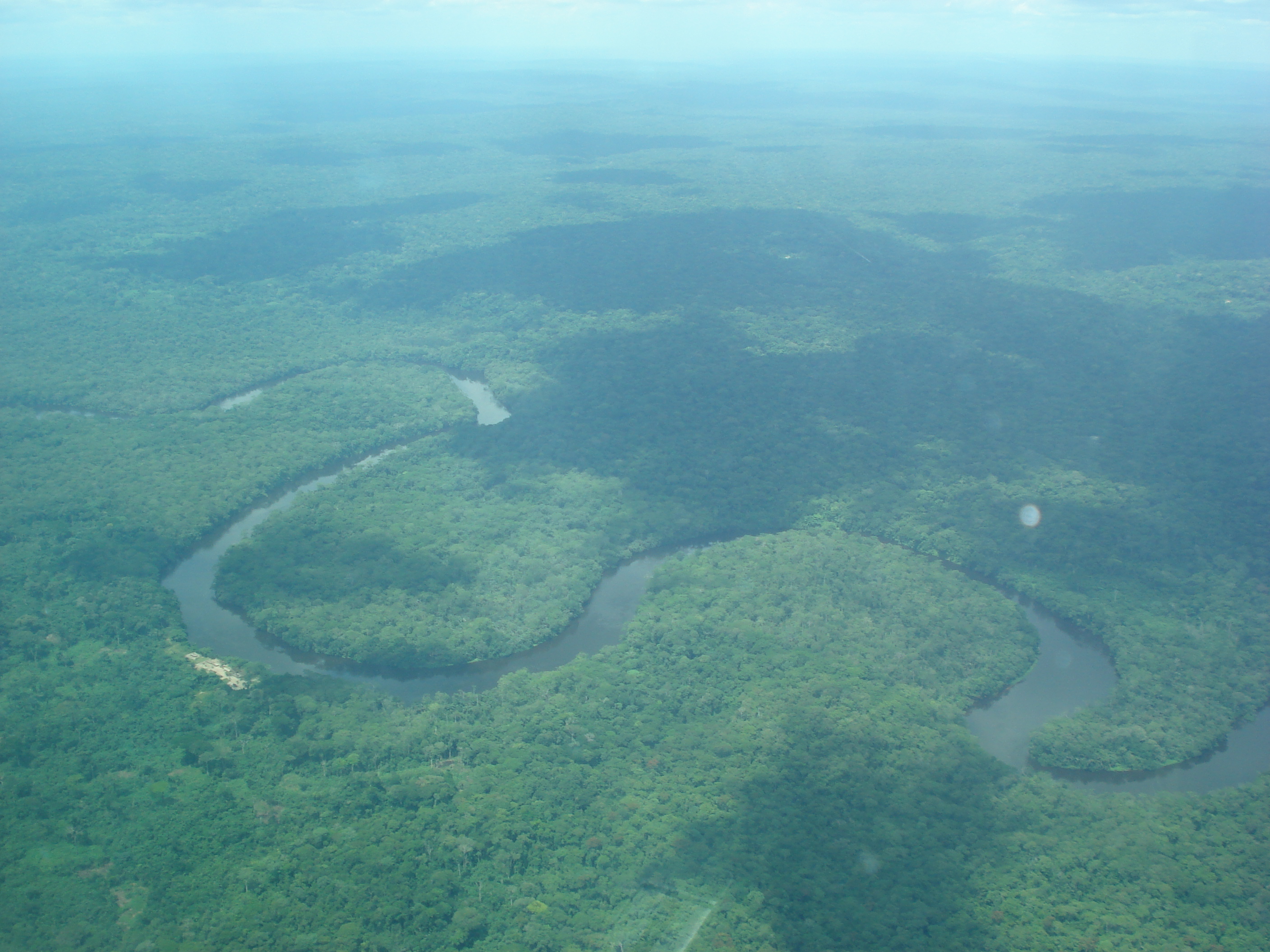
Bandundu is one of eleven former provinces of the Democratic Republic of the Congo. It bordered the provinces of Kinshasa and Bas-Congo to the west, Équateur to the north, and Kasai-Occidental to the east. The provincial capital is also called Bandundu (formerly Banningstad/Banningville). History Bandundu was formed in 1966 by merging the three post-colonial political regions: Kwilu, Kwango, and Mai-Ndombe. Under the 2006 constitution, Bandundu was to be broken up again into the aforementioned political regions. This finally took place in the 2015 repartitioning. Kwilu province was formed by combining the Kwilu district and the cites of Bandundu and Kikwit, Kwango province from the Kwango district, and Mai-Ndombe province by combining the Plateaux and Mai-Ndombe districts. Geography The landscape of Bandundu province consisted primarily of plateaus covered in savanna, cut by rivers and streams that are often bordered by thick forest. The province was bisected ... [...More Info...] [...Related Items...] OR: [Wikipedia] [Google] [Baidu] |
Provinces Of The Democratic Republic Of The Congo
Article 2 of the Constitution of the Democratic Republic of the Congo divides the country into the capital city of Kinshasa and 25 named provinces. It also gives the capital the status of a province. Therefore, in many contexts Kinshasa is regarded as the 26th province. List History When Belgium annexed the Belgian Congo as a colony in November 1908, it was initially organised into 22 districts. Ten western districts were administered directly by the main colonial government, while the eastern part of the colony was administered under two vice-governments: eight northeastern districts formed Orientale Province, and four southeastern districts formed Katanga. In 1919, the colony was organised into four provinces: * Congo-Kasaï (five southwestern districts), * Équateur (five northwestern districts), * Orientale Province and Katanga (previous vice-governments). [...More Info...] [...Related Items...] OR: [Wikipedia] [Google] [Baidu] |
Kwango
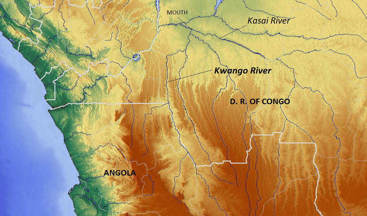
Kwango is a province of the Democratic Republic of the Congo. It's one of the 21 provinces created in the 2015 repartitioning. Kwango, Kwilu, and Mai-Ndombe provinces are the result of the dismemberment of the former Bandundu province. Kwango was formed from the Kwango district whose town of Kenge was elevated to capital city of the province. The province takes its name from the Kwango River, a tributary of the Kasai River that defines part of the international boundary between the DRC and Angola. Towns/territories The capital of Kwango district is Kenge. Other towns include Popokabaka, Feshi, Kasongo Lunda, Lusanga and Kahemba. The province is in the southwest of the DRC, bordering Angola to the south. Territories are: * Feshi * Kahemba * Kasongo Lunda * Kenge * Popokabaka History Kwango previously existed as a province from 1962 to 1966. Presidents (from 1965, governors) *23 September 1962 – 11 November 1962 Albert Delvaux (fl. 1918) * November 1962 Em ... [...More Info...] [...Related Items...] OR: [Wikipedia] [Google] [Baidu] |
Lake Mai-Ndombe
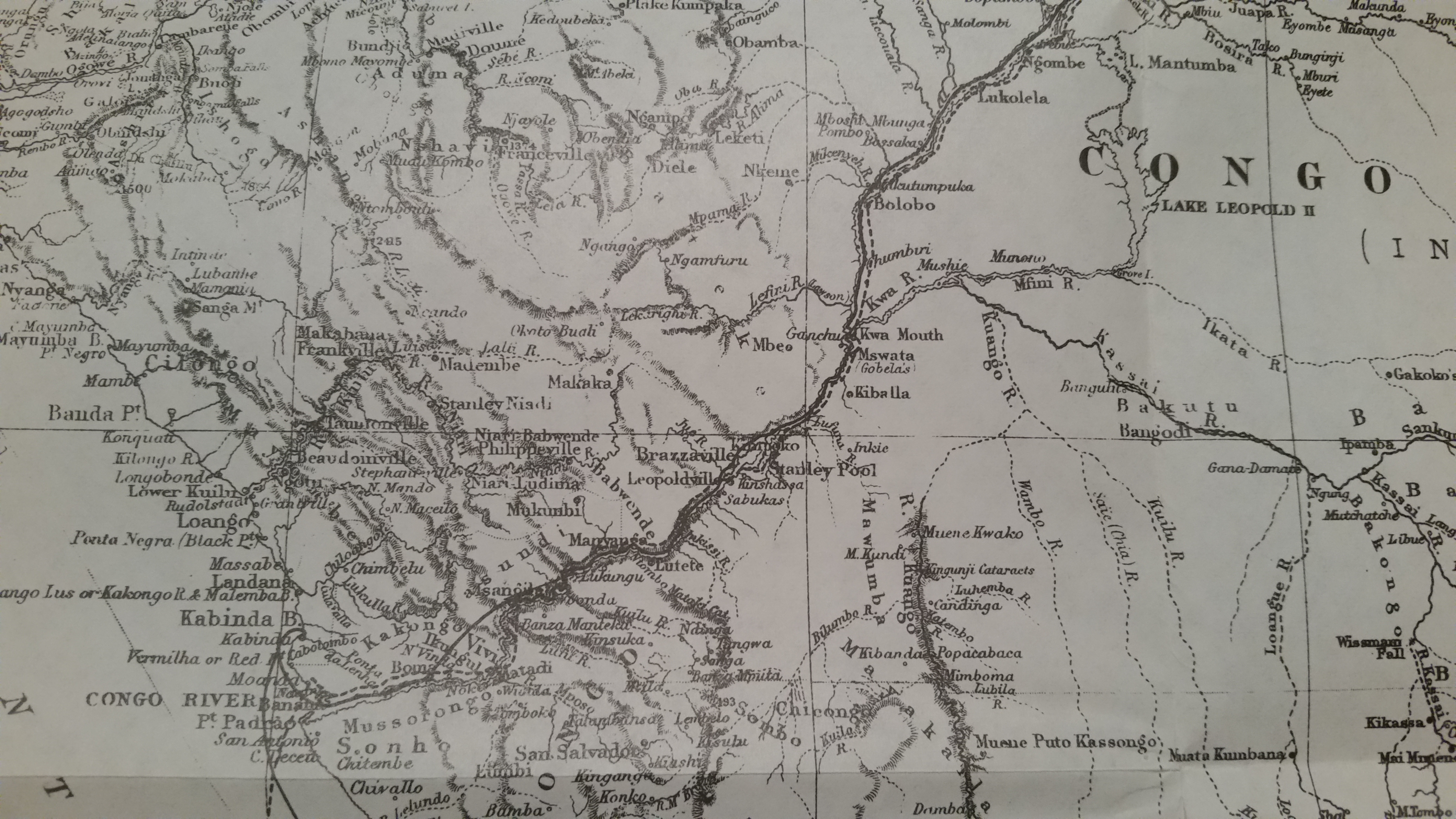
Lake Mai-Ndombe (french: Lac Mai-Ndombe) is a large freshwater lake in Mai-Ndombe province in western Democratic Republic of the Congo. The lake is within the Tumba-Ngiri-Maindombe area, the largest Wetland of International Importance recognized by the Ramsar Convention in the world. Location The lake drains to the south through the Fimi River into the Kwah and Congo Rivers. Known until 1972 as Lake Leopold II (''Lac Léopold II'') after Leopold II, King of the Belgians. ''Mai-Ndombe'' means "black water" in Kikongo. The lake is of irregular shape and ranges in depth from only 5 meters (mean) to 10 meters (maximum). Covering approximately 890 square miles (2,300 square km), it is known to double or triple in size during the rainy season. Its waters are oxygenated throughout their depth and the pH ranges from 4.2 to 5.5. Low, forested shores surround it with dense, humid equatorial rainforest prevailing to the north and a mosaic of forest and savanna to the south. Biodiversity S ... [...More Info...] [...Related Items...] OR: [Wikipedia] [Google] [Baidu] |
Lukenie River
The Lukenie River is a river in the central Congo basin of the Democratic Republic of the Congo (DRC). River barges from Kinshasa journey up the Congo, Kwah ( Kasai), and Fimi Rivers to the Lukenie as far as the landing at Kole, a journey of 6 to 12 weeks. This is not done during the low water season (June–August), however, for fear of stranding for long periods. The Lukenie is not navigable by barges above Kole. During the early Belgian colonial era, the river was sometimes used to transport rubber from posts such as Kole and Lodja down to Lake Leopold II. However, most supplies were brought overland from Bene Dibele, to the south on the right bank of the Sankuru River just below the point where it is joined by the Lubefu River, a more reliable route. Some of the main logging concession areas of Sodefor are on both sides of the Lukenie River, centered on Oshwe. In September 2010 hundreds of people in Oshwe, a community in Mai-Ndombe Province Mai-Ndombe is one o ... [...More Info...] [...Related Items...] OR: [Wikipedia] [Google] [Baidu] |
Kwilu River
The Kwilu River is a major river in the Kwilu Province formerly known as Bandundu province in the Democratic Republic of the Congo (DRC) to the city of Bandundu, where it joins the Kwango River just before this stream enters the Kasai River. In the DRC the river flows past the towns of Gungu, Kikwit, Bulungu, Bagata, Rutherfordia and Bandundu. Lusanga, formerly Leverville, lies at the location where the Kwenge River joins the Kwilu, between Kikwit and Bulungu. Characteristics It is a meandering river. Near its mouth it is 950 meter wide. The bed material is sand. The river is about long. In the wet season the flooded area covers . The headwaters of the river rise at elevations between and in the Angolan highlands. They drop steeply to the flat central Congo Basin The Congo Basin (french: Bassin du Congo) is the sedimentary basin of the Congo River. The Congo Basin is located in Central Africa, in a region known as west equatorial Africa. The Congo Basin region ... [...More Info...] [...Related Items...] OR: [Wikipedia] [Google] [Baidu] |
Kwenge River
The Kwenge River is a stream in the Bandundu Province of the Democratic Republic of the Congo. The river begins in Angola and then for about it forms a short part of the Angola–DRC border. It flows north from the Angola border through the Kwango and Kwilu districts, joining the Kwilu River below Kikwit. Lusanga, formerly Leverville, is at the confluence of the Kwenge and Kwilu rivers. The land between the Kwilu and the Kwenge was first occupied be the Pende people. The Suku people, who came to the region from the Kwango River The Cuango or Kwango ( pt, Rio Cuango) is a transboundary river of Angola and Democratic Republic of Congo. It is the largest left bank tributary of the Kasai River in the Congo River basin. It flows through Malanje in Angola. The Kwango River ... valley in the 1800s, live in the savanna region between the upper Bakali and Kwenge rivers. The lowest part of the river valley contains strips of periodically or permanently flooded land. References ... [...More Info...] [...Related Items...] OR: [Wikipedia] [Google] [Baidu] |
Kwango River
The Cuango or Kwango ( pt, Rio Cuango) is a transboundary river of Angola and Democratic Republic of Congo. It is the largest left bank tributary of the Kasai River in the Congo River basin. It flows through Malanje in Angola. The Kwango River basin has large resources of diamonds in the Chitamba-Lulo Kimberlite Cluster in Lunda Norte Province, discovered in the main river channel and on flats and terraces in its flood plains. History The Rund Kingdom, which expanded to become the Lunda Empire, encompassed territory stretching from Kwango River to the Luapula River. Its rulers partook in the slave trade. Lunda's expansion in the valley promoted a common political and cultural heritage while also promoting slave trading, accounting for the low population densities between the Kwango and Kwilu rivers.Ogot, p.607 The Portuguese colonized the Kwango River valley and usurped the Kingdom of Kasanje. The Kwango River was subject to a Portuguese treaty signing in Lisbon on May 25 ... [...More Info...] [...Related Items...] OR: [Wikipedia] [Google] [Baidu] |
Congo River
The Congo River ( kg, Nzâdi Kôngo, french: Fleuve Congo, pt, Rio Congo), formerly also known as the Zaire River, is the second longest river in Africa, shorter only than the Nile, as well as the second largest river in the world by discharge volume, following only the Amazon. It is also the world's deepest recorded river, with measured depths around . The Congo- Lualaba- Chambeshi River system has an overall length of , which makes it the world's ninth-longest river. The Chambeshi is a tributary of the Lualaba River, and ''Lualaba'' is the name of the Congo River upstream of Boyoma Falls, extending for . Measured along with the Lualaba, the main tributary, the Congo River has a total length of . It is the only major river to cross the Equator twice. The Congo Basin has a total area of about , or 13% of the entire African landmass. Name The name ''Congo/Kongo'' originates from the Kingdom of Kongo once located on the southern bank of the river. The kingdom in turn was nam ... [...More Info...] [...Related Items...] OR: [Wikipedia] [Google] [Baidu] |
Kasai River
The Kasai River ( ; called Cassai in Angola) is a tributary (left side) of the Congo River, located in Central Africa. The river begins in central Angola and flows to the east until it reaches the border between Angola and the Democratic Republic of the Congo, where it turns north and serves as the border until it flows into the DRC. From Ilebo, between the confluences with Lulua river and Sankuru river, the Kasai river turns to a westerly direction. The lower stretch of the river from the confluence with Fimi river, is known as the Kwa(h) River, before it joins the Congo at Kwamouth northeast of Kinshasa. The Kasai basin consists mainly of equatorial rainforest areas, which provide an agricultural land in a region noted for its infertile, sandy soil. It is a tributary of Congo river and diamonds are found in it. Around 60% of diamonds in Belgium go from Kasai river for cutting and shaping. Exploration Henry Morton Stanley reached the confluence on 9 March 1877, calling the ri ... [...More Info...] [...Related Items...] OR: [Wikipedia] [Google] [Baidu] |
Savanna
A savanna or savannah is a mixed woodland-grassland (i.e. grassy woodland) ecosystem characterised by the trees being sufficiently widely spaced so that the canopy does not close. The open canopy allows sufficient light to reach the ground to support an unbroken herbaceous layer consisting primarily of grasses. According to '' Britannica'', there exists four savanna forms; ''savanna woodland'' where trees and shrubs form a light canopy, ''tree savanna'' with scattered trees and shrubs, ''shrub savanna'' with distributed shrubs, and ''grass savanna'' where trees and shrubs are mostly nonexistent.Smith, Jeremy M.B.. "savanna". Encyclopedia Britannica, 5 Sep. 2016, https://www.britannica.com/science/savanna/Environment. Accessed 17 September 2022. Savannas maintain an open canopy despite a high tree density. It is often believed that savannas feature widely spaced, scattered trees. However, in many savannas, tree densities are higher and trees are more regularly spaced than in for ... [...More Info...] [...Related Items...] OR: [Wikipedia] [Google] [Baidu] |
Au Bord De La Rivère Kwilu à Bandundu
Au, AU, au or a.u. may refer to: Science and technology Computing * .au, the internet country code for Australia * Au file format, Sun Microsystems' audio format * Audio Units, a system level plug-in architecture from Apple Computer * Adobe Audition, a sound editor program * Windows Update or Automatic Updates, in Microsoft Windows * Windows 10 Anniversary Update, of August 2016a * Gold, symbol Au (from Latin ), a chemical element * Absorbance unit, a reporting unit in spectroscopy * Atomic units, a system of units convenient for atomic physics and other fields * Ångström unit, a unit of length equal to 10−10 m or 0.1 nanometre. * Astronomical unit, a unit of length often used in Solar System astronomy, an approximation for the average distance between the Earth and the Sun * Arbitrary unit, a relative placeholder unit for when the actual value of a measurement is unknown or unimportant ("a.u." is deprecated, use "arb. unit" instead) Arts and entertainment Music * AU (ba ... [...More Info...] [...Related Items...] OR: [Wikipedia] [Google] [Baidu] |
Mai-Ndombe District
Mai-Ndombe District was a district of pre-2015 Bandundu Province in the Democratic Republic of the Congo. It covered roughly the same area as the colonial-era Lac Léopold II District. In 2015, it was merged with Plateaux District, all in pre-2015 Bandundu Province, to form the new Mai-Ndombe Province. Location Mai-Ndombe extends north from the Kasai River and is separated from the Congo River to the east by the Plateaux District. The district takes its name from the large but shallow Lake Mai-Ndombe, which covers but expands to double or triple that size in the rainy season. The Lukenie River flows from the east and runs through the southern part of the district. The Lukenie joins with the Fimi River, which drains Lake Mai-Ndombe and continues westward to join the Kasai at Mushie. The district includes the Mai Ndombe Conservation Concession, an area of on the western shore of Lake Mai Ndombe in the Inongo Territory. The concession extends over the Ntomba, Baselenge, and ... [...More Info...] [...Related Items...] OR: [Wikipedia] [Google] [Baidu] |


