|
Balsam Creek, Ontario
Balsam Creek is a community located on Highway 63 in the district of Nipissing in Northern Ontario. The village is part of the unincorporated township of Phelps. It is located about 25 km north-east of the city of North Bay. Communities in Nipissing District {{NorthernOntario-geo-stub ... [...More Info...] [...Related Items...] OR: [Wikipedia] [Google] [Baidu] |
Highway 63 (Ontario)
King's Highway 63, commonly referred to as Highway 63, is a Ontario Provincial Highway Network, provincially maintained highway in the Canada, Canadian province of Ontario. The route travels from Ontario Highway 11, Highway 11 and Ontario Highway 17, Highway 17 (the Trans-Canada Highway) in North Bay, Ontario, North Bay northeast to the Ontario-Quebec provincial boundary, where it continues as Quebec Route 101, Route 101 into Témiscaming, Quebec, Témiscaming. The route was assumed in 1937, following the merger of the Department of Northern Development (DND) into the Department of Highways, Ontario, Department of Highways (DHO), predecessor to the modern Ministry of Transportation of Ontario (MTO). It travelled from what was then Highway 11 (Main Street) in downtown North Bay northeast to its present terminus. The highway follows the same route today, with the exception of the westernmost , which were transferred to the City of North Bay in 1998. Route descr ... [...More Info...] [...Related Items...] OR: [Wikipedia] [Google] [Baidu] |
Nipissing, Ontario
Nipissing is an incorporated (political) township in Parry Sound District in Central Ontario, Canada. It is on Lake Nipissing and is part of the Almaguin Highlands region. Nipissing was surveyed between 1874 and 1881, and was incorporated in 1888. Among the first settlers in the area were the Chapman and Beatty families. Nipissing Township annexed Gurd Township in 1970. The township also contains a community named Nipissing, which is located on the South River near Chapman's Landing, on the South Bay of Lake Nipissing. The township administrative offices are located in Nipissing. The township includes the communities of Alsace, Christian Valley, Commanda, Hotham, Nipissing and Wade's Landing. History The founder of Nipissing, John Beattie (John Beatty) arrived by canoe from Eganville in 1862. He was looking for land suitable for settlement. To lay claim to the property, he made brush piles, and was granted free land by the Government of Ontario. Around 1869 James Chapman and ... [...More Info...] [...Related Items...] OR: [Wikipedia] [Google] [Baidu] |
Northern Ontario
Northern Ontario is a primary geographic and quasi-administrative region of the Canadian province of Ontario, the other primary region being Southern Ontario. Most of the core geographic region is located on part of the Superior Geological Province of the Canadian Shield, a vast rocky plateau located mainly north of Lake Huron (including Georgian Bay), the French River, Lake Nipissing, and the Mattawa River. The statistical region extends south of the Mattawa River to include all of the District of Nipissing. The southern section of this district lies on part of the Grenville Geological Province of the Shield which occupies the transitional area between Northern and Southern Ontario. The extended federal and provincial quasi-administrative regions of Northern Ontario have their own boundaries even further south in the transitional area that vary according to their respective government policies and requirements. Ontario government departments and agencies such as the Growth Pl ... [...More Info...] [...Related Items...] OR: [Wikipedia] [Google] [Baidu] |
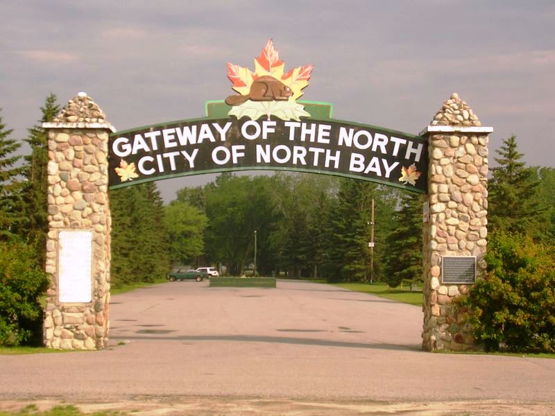
North Bay, Ontario
North Bay is a city in Northeastern Ontario, Canada. It is the seat of Nipissing District, and takes its name from its position on the shore of Lake Nipissing. North Bay developed as a railroad centre, and its airport was an important military location during the Cold War. History The site of North Bay is part of a historic canoe route where Samuel de Champlain took a party up the Ottawa River, through present-day Mattawa, on to Trout Lake and via the La Vase Creek to Lake Nipissing. Apart from Indigenous people, voyageurs and surveyors, there was little activity in the Lake Nipissing area until the arrival of the Canadian Pacific Railway (CPR) in 1882. That was the point where the Canada Central Railway (CCR) extension ended. The CCR was owned by Duncan McIntyre who amalgamated it with the CPR and became one of the handful of officers of the newly formed CPR. The CCR started in Brockville and extended to Pembroke. It then followed a westward route along the Ottawa Ri ... [...More Info...] [...Related Items...] OR: [Wikipedia] [Google] [Baidu] |

