|
Balkanabat
, other_name = Neftedag Nebit-Dag , image_skyline = , image_flag = , image_seal = , image_map = , map_caption = , pushpin_map = Turkmenistan , pushpin_label_position = bottom , pushpin_mapsize = 300 , pushpin_map_caption = Location in Turkmenistan , subdivision_type = Country , subdivision_type1 = Province , subdivision_name = Turkmenistan , subdivision_name1 = Balkan Province , subdivision_type2 = , subdivision_name2 = , established_title = , established_date = 1933 , leader_title = Mayor , leader_name = Balkan Gulmamedov , area_total_km2 = , area_land_km2 = , population_as_of = 2011 , population_footnotes = , population_total = 120,800 , population_urban = , registration_plate = BN , populati ... [...More Info...] [...Related Items...] OR: [Wikipedia] [Google] [Baidu] |
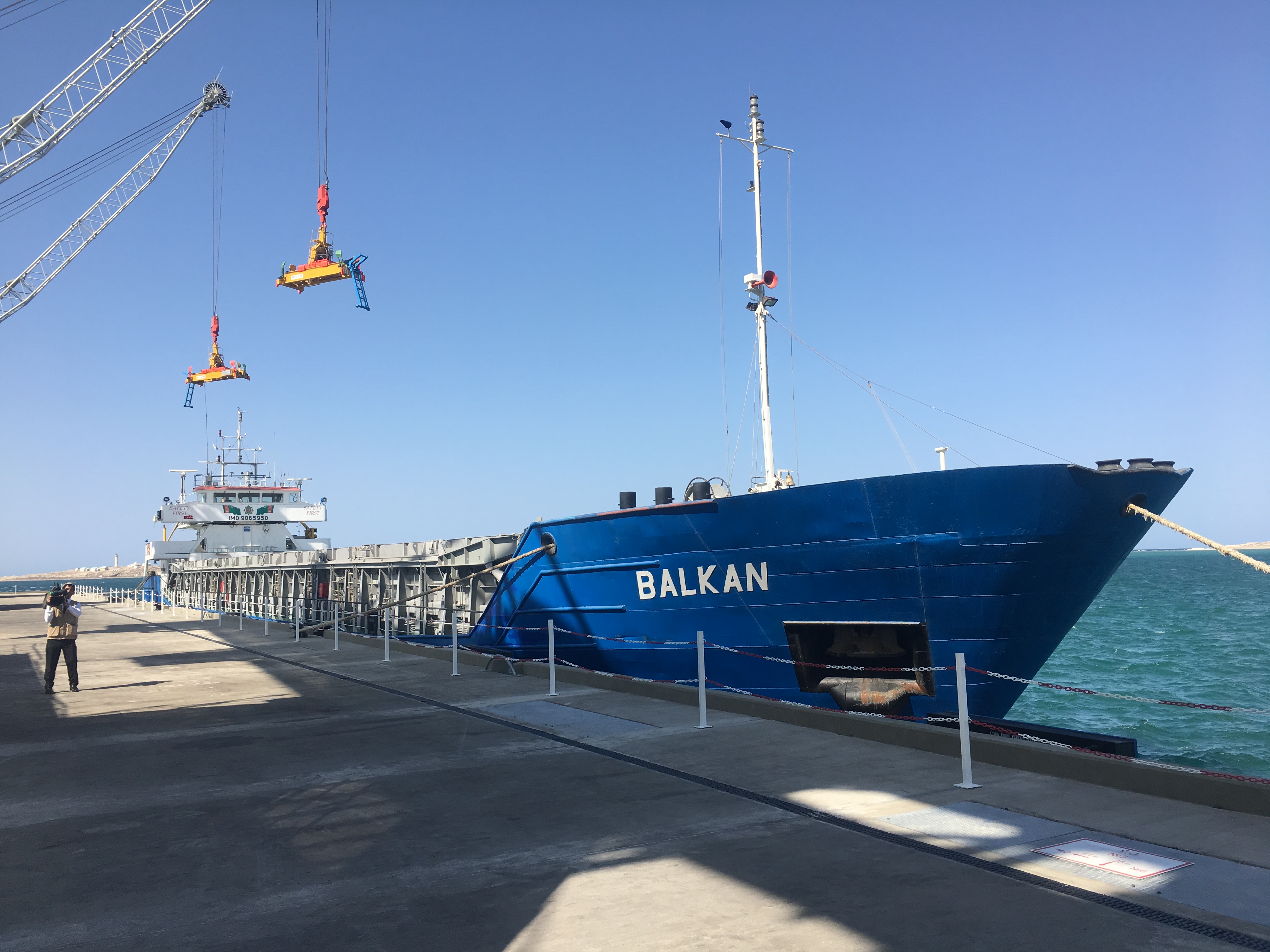
Balkanabat (35634838822)
, other_name = Neftedag Nebit-Dag , image_skyline = , image_flag = , image_seal = , image_map = , map_caption = , pushpin_map = Turkmenistan , pushpin_label_position = bottom , pushpin_mapsize = 300 , pushpin_map_caption = Location in Turkmenistan , subdivision_type = Country , subdivision_type1 = Province , subdivision_name = Turkmenistan , subdivision_name1 = Balkan Province , subdivision_type2 = , subdivision_name2 = , established_title = , established_date = 1933 , leader_title = Mayor , leader_name = Balkan Gulmamedov , area_total_km2 = , area_land_km2 = , population_as_of = 2011 , population_footnotes = , population_total = 120,800 , population_urban = , registration_plate = BN , populat ... [...More Info...] [...Related Items...] OR: [Wikipedia] [Google] [Baidu] |
Balkanabat (35672059311)
Balkanabat (), formerly Nebit-Dag and Neftedag, is the capital city of Balkan Province, the largest province in Turkmenistan. It lies at the foot of the Balkan Daglary mountain range. Balkanabat is about 450 km west of Ashgabat and 160 km east of the seaport city of Türkmenbaşy, Turkmenistan, Turkmenbashy. The city layout is a grid of apartment blocks called ''kvartal'' (quarters). The main streets are Magtymguly, Pervomayskiy and Gurbansoltan eje şaýoly. Etymology The town was founded in 1933 as Neftedag, meaning "Oil Mountain" (Russian ''neft'', "oil", and Turkmen language, Turkmen ''dag'', "mountain"), as a settlement along one of the stations of the Trans-Caspian Railway. In 1946, when it was transformed into a city, it was renamed "Nebit-Dag", also meaning "Oil Mountain", but this time using the Turkmen word ''nebit''. Nebit Dag was renamed Balkanabat (''Balkan'' from the name of Uly Balkan, the Balkan mountains (not to be confused with Balkan Mountains, the Bal ... [...More Info...] [...Related Items...] OR: [Wikipedia] [Google] [Baidu] |
Turkmenistan
Turkmenistan ( or ; tk, Türkmenistan / Түркменистан, ) is a country located in Central Asia, bordered by Kazakhstan to the northwest, Uzbekistan to the north, east and northeast, Afghanistan to the southeast, Iran to the south and southwest and the Caspian Sea to the west. Ashgabat is the capital and largest city. The population is about 6 million, the lowest of the Central Asian republics, and Turkmenistan is one of the most sparsely populated nations in Asia. Turkmenistan has long served as a thoroughfare for other nations and cultures. Merv is one of the oldest oasis-cities in Central Asia, and was once the biggest city in the world. It was also one of the great cities of the Islamic world and an important stop on the Silk Road. Annexed by the Russian Empire in 1881, Turkmenistan figured prominently in the anti-Bolshevik movement in Central Asia. In 1925, Turkmenistan became a constituent republic of the Soviet Union, the Turkmen Soviet Socialist Repu ... [...More Info...] [...Related Items...] OR: [Wikipedia] [Google] [Baidu] |
Balkan Province
Balkan Region ( tk, Balkan welaýaty, Балкан велаяты) is the westernmost of the five regions of Turkmenistan. Clockwise from north it borders Kazakhstan, Uzbekistan (north); two provinces of Turkmenistan (east), Iran (south), and the Caspian Sea (west). The capital city is Balkanabat, formerly known as Nebit Dag. The region's boundaries are identical to those of the former ''Krasnovodsk Oblast' '', a Soviet-era province of the Turkmen Soviet Socialist Republic. This oblast was liquidated and restored repeatedly in the 20th century, concluding with its abolition in 1988. However, the administrative boundaries of the region were restored in 1991 when Balkan Region was established. The province covers 139,270 square kilometers and counts 553,500 residents (2005 estimate). A large minority of these are nomadic herding families.''Statistical Yearbook of Turkmenistan 2000-2004'', National Institute of State Statistics and Information of Turkmenistan, Ashgabat, 2005. I ... [...More Info...] [...Related Items...] OR: [Wikipedia] [Google] [Baidu] |
Ashgabat
Ashgabat or Asgabat ( tk, Aşgabat, ; fa, عشقآباد, translit='Ešqābād, formerly named Poltoratsk ( rus, Полтора́цк, p=pəltɐˈratsk) between 1919 and 1927), is the capital and the largest city of Turkmenistan. It lies between the Karakum Desert and the Kopetdag mountain range in Central Asia, near the Iran-Turkmenistan border. The city was founded in 1881 on the basis of an Ahal Teke tribal village, and made the capital of the Turkmen Soviet Socialist Republic in 1924. Much of the city was destroyed by the 1948 Ashgabat earthquake, but has since been extensively rebuilt under the rule of Saparmurat Niyazov's "White City" urban renewal project, resulting in monumental projects sheathed in costly white marble. The Soviet-era Karakum Canal runs through the city, carrying waters from the Amu Darya from east to west. Since 2019, the city has been recognized as having one of the highest costs of living in the world largely due to Turkmenistan's inflation ... [...More Info...] [...Related Items...] OR: [Wikipedia] [Google] [Baidu] |
Türkmenbaşy, Turkmenistan
Türkmenbaşy ( Turkmen Cyrillic: Түркменбашы, Turkmen Arabic; توركمنباشی, also spelled Turkmenbashi, a back-formation of the Cyrillic Түркменбаши), formerly known as Krasnovodsk (russian: Красноводск), Kyzyl-Su, and Shagadam ( tk, Şagadam), is a city in Balkan Province in Turkmenistan, on the Türkmenbaşy Gulf of the Caspian Sea. It sits at an elevation of . The population (est 2004) was 86,800, mostly ethnic Turkmens but also Russian, Armenian and Azeri minorities. As the terminus of the Trans-Caspian Railway and site of a major seaport on the Caspian, it is an important transportation center. The city is also the site of Turkmenistan's largest oil refining complex. This city should not be confused with the similarly named town of Türkmenbaşy ( tk, Türkmenbaşy şäherçesi), formerly called Janga (russian: Джанга, Cyrillic tk, Җанга), also in Balkan Province, or the city of Saparmyrat Türkmenbaşy adyndaky in Daş ... [...More Info...] [...Related Items...] OR: [Wikipedia] [Google] [Baidu] |
Provinces Of Turkmenistan
Turkmenistan is divided into five regions or ''welaýatlar'' (singular '' welaýat'') and one capital city (''şäher'') with provincial legal status. They are Ahal, Balkan, Dashoguz, Lebap and Mary, plus the capital city of Ashgabat. Each province is divided into districts. As of 20 December 2022 there were 37 districts ( tk, etraplar, singular etrap), 49 cities ( tk, şäherler, singular şäher), including 7 cities with district status ( tk, etrap hukukly), 68 towns ( tk, şäherçeler, singular şäherçe), 469 rural councils (rural municipal units, tk, geňeşlikler, singular geňeşlik) and 1690 villages (rural settlements tk, oba ilatly ýerler) in Turkmenistan. Capital city The capital city of Turkmenistan is Ashgabat, which is an administrative and territorial unit with provincial authorities. ''See also'Map of the Boroughs of Ashgabat As of January 5, 2018, Ashgabat includes four boroughs (''uly etraplar''), each with a presidentially appointed mayor ( tk, häkim) ... [...More Info...] [...Related Items...] OR: [Wikipedia] [Google] [Baidu] |
Yomud
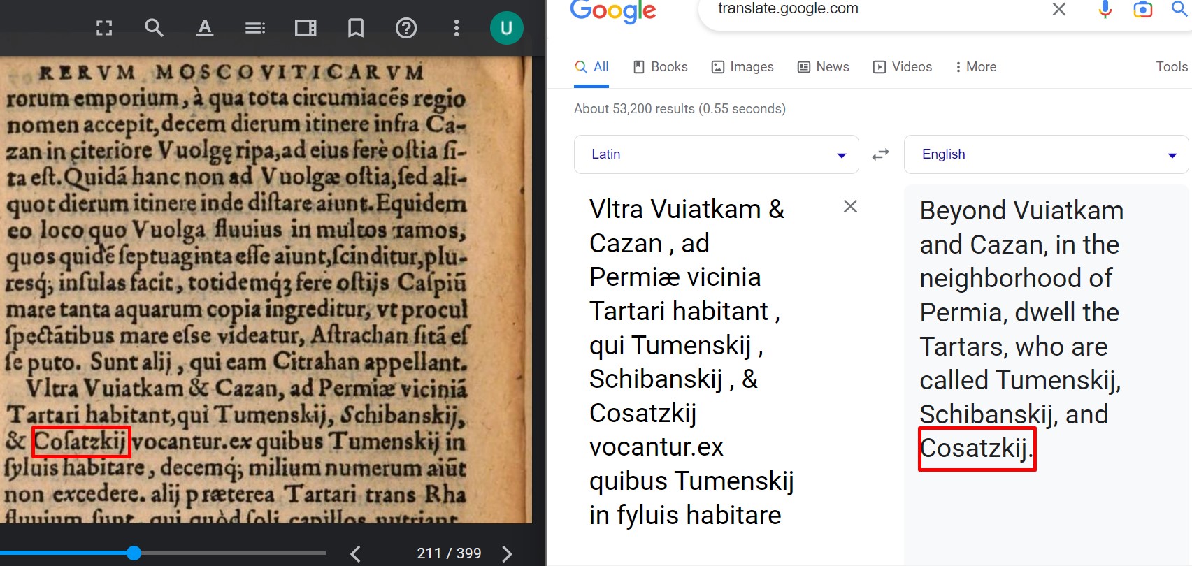
The Yomut or Yomud is a Turkmen tribe that lives in Western and Central Asia, including Gorgan, Iran; Turkmenbashi, Turkmenistan; the eastern Caspian shores; Khiva, Uzbekistan; and Dashoguz, Turkmenistan. The Yomut carpet is a type of rug traditionally handwoven by the Yomut. History Nadir Shah in 1740 sent a letter to the ruler of Khiva, Ilbars Khan, asking him to come to ask for forgiveness. The envoys of Nadir Shah with a letter arrived at the Ilbars camp, which was headed by 20 thousand horsemen, consisting of Yomuts, (other) Turkmens, Kazakhs and Uzbeks. The letter said: "Several times with the predatory tribe of Yomuts for the purpose of robbery, you raided the vicinity of sacred Mashhad and each time experienced misfortune and, having suffered defeat, defeated, went (back) to Khiva. Despite my peacefulness, three thousand people from the Yomut tribes, with the aim of making a night raid, arrived in Chardjuy. Upon learning of this, the troops of (Nadir Shah) dest ... [...More Info...] [...Related Items...] OR: [Wikipedia] [Google] [Baidu] |
Kazakhs
The Kazakhs (also spelled Qazaqs; Kazakh: , , , , , ; the English name is transliterated from Russian; russian: казахи) are a Turkic-speaking ethnic group native to northern parts of Central Asia, chiefly Kazakhstan, but also parts of northern Uzbekistan and the border regions of Russia, as well as Northwestern China (specifically Ili Kazakh Autonomous Prefecture) and Mongolia ( Bayan-Ölgii Province). The Kazakhs are descendants of the ancient Turkic Kipchak tribes and the medieval Mongolic tribes, and generally classified as Turco-Mongol cultural group. Kazakh identity is of medieval origin and was strongly shaped by the foundation of the Kazakh Khanate between 1456 and 1465, when following disintegration of the Golden Horde, several tribes under the rule of the sultans Janibek and Kerei departed from the Khanate of Abu'l-Khayr Khan in hopes of forming a powerful khanate of their own. ''Kazakh'' is used to refer to ethnic Kazakhs, while the term ''Kazakhstani'' ... [...More Info...] [...Related Items...] OR: [Wikipedia] [Google] [Baidu] |
Azerbaijan
Azerbaijan (, ; az, Azərbaycan ), officially the Republic of Azerbaijan, , also sometimes officially called the Azerbaijan Republic is a transcontinental country located at the boundary of Eastern Europe and Western Asia. It is a part of the South Caucasus region and is bounded by the Caspian Sea to the east, Russia (Republic of Dagestan) to the north, Georgia to the northwest, Armenia and Turkey to the west, and Iran to the south. Baku is the capital and largest city. The Azerbaijan Democratic Republic proclaimed its independence from the Transcaucasian Democratic Federative Republic in 1918 and became the first secular democratic Muslim-majority state. In 1920, the country was incorporated into the Soviet Union as the Azerbaijan SSR. The modern Republic of Azerbaijan proclaimed its independence on 30 August 1991, shortly before the dissolution of the Soviet Union in the same year. In September 1991, the ethnic Armenian majority of the Nagorno-Karabakh region formed the ... [...More Info...] [...Related Items...] OR: [Wikipedia] [Google] [Baidu] |
Turkmen Flag
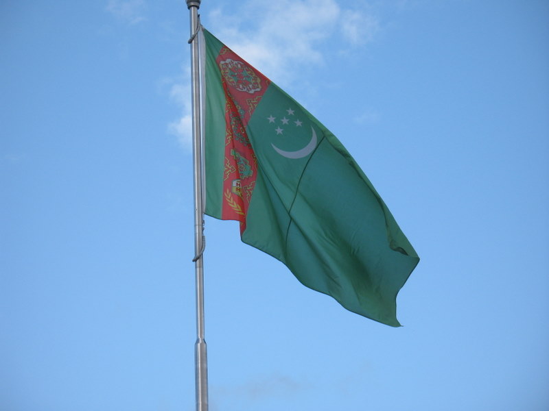
The flag of Turkmenistan ( tk, Türkmenistanyň baýdagy) features a white crescent (symbol of Islam) and five stars representing the five regions of the country and the Five Pillars of Islam. Placed upon a green field is a symbolic representation of the country's famous carpet industry. It was introduced as the flag of Turkmenistan on 27 September 1992 to replace the Soviet-era flag which consisted of a red background with two light blue bars in the middle. The modified version with a 2:3 ratio was adopted on 23 January 2001. State Flag and Constitution Day is celebrated on 18 May. Description It features a green field with a vertical red stripe near the hoist side, containing five carpet guls (designs used in producing rugs) stacked above two crossed olive branches similar to those on the flag of the United Nations; a white waxing crescent moon, typical of Turkic and Islamic symbology, and five white five-pointed stars appear in the upper corner of the field just to the ... [...More Info...] [...Related Items...] OR: [Wikipedia] [Google] [Baidu] |
Countries Of The World
The following is a list providing an overview of sovereign states around the world with information on their status and recognition of their sovereignty. The 206 listed states can be divided into three categories based on membership within the United Nations System: 193 member states of the United Nations, UN member states, 2 United Nations General Assembly observers#Present non-member observers, UN General Assembly non-member observer states, and 11 other states. The ''sovereignty dispute'' column indicates states having undisputed sovereignty (188 states, of which there are 187 UN member states and 1 UN General Assembly non-member observer state), states having disputed sovereignty (16 states, of which there are 6 UN member states, 1 UN General Assembly non-member observer state, and 9 de facto states), and states having a political status of the Cook Islands and Niue, special political status (2 states, both in associated state, free association with New Zealand). Compi ... [...More Info...] [...Related Items...] OR: [Wikipedia] [Google] [Baidu] |

.jpg)

.jpg)


