|
Baierbrunn
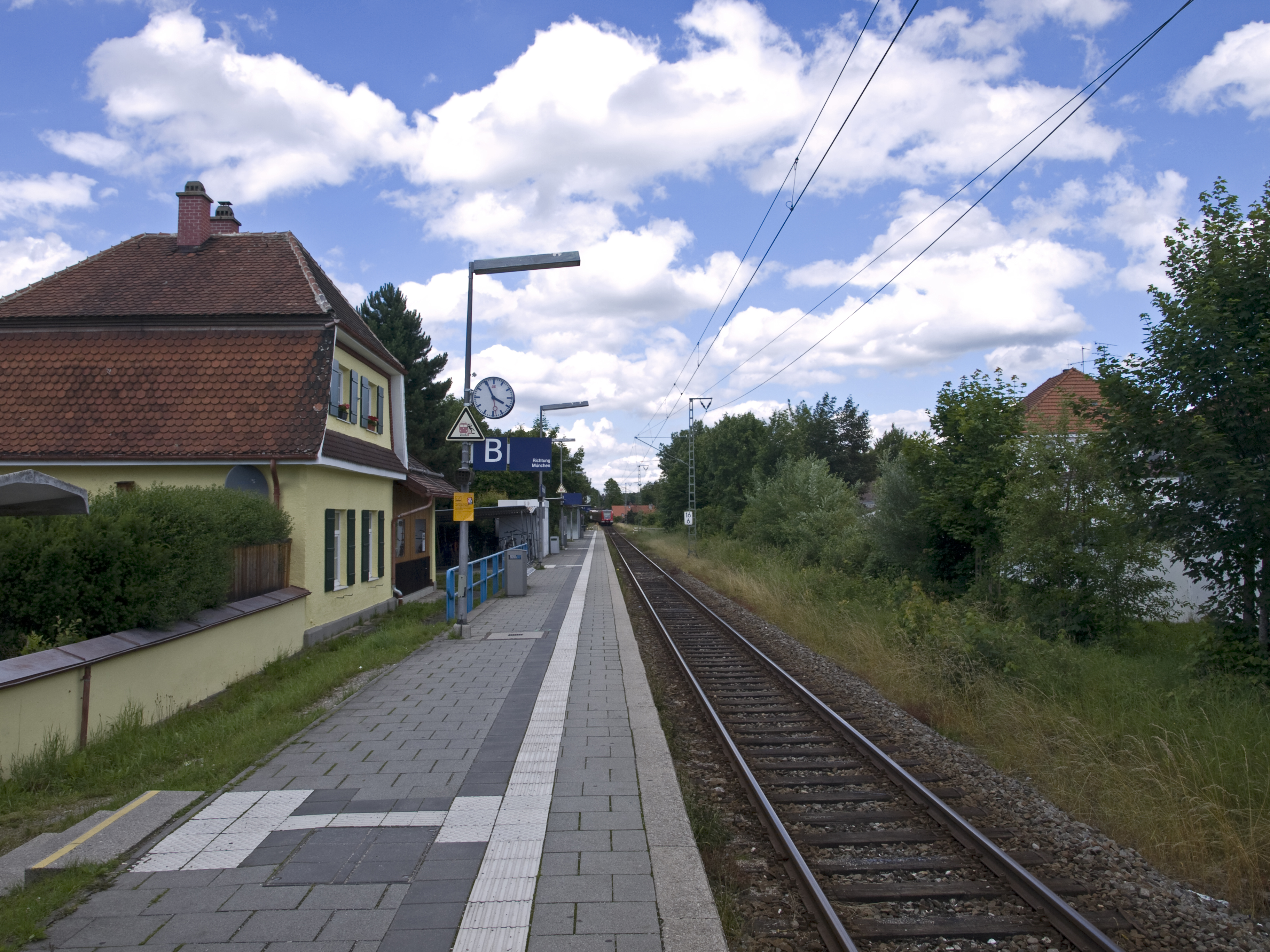
Baierbrunn is a municipality in the district of Munich in the south-German state Bavaria. It is located between Schäftlarn and Pullach on the Bundesstraße 11 and consists of the two villages Baierbrunn and Buchenhain. Baierbrunn has a stop on the S7 of the Munich S-Bahn. History Some remains of a hillfort from the Early Middle Ages, called Birg, can be found on the area of the municipality of Baierbrunn. The earliest known mentioning of Baierbrunn was in 776 on a deed of gift from Kloster Schäftlarn. It became an independent municipality in 1818. The village of Buchenhain started 1900 with an inn called "Waldgasthof". There used to be a ski slope until late 1930's, which remains are still visible today in the south of Baierbrunn.Joachim Lauchs: ''Baierbrunn. Eine Chronik'', Verlag Wort & Bild Becker, Baierbrunn 1988, ISBN 3-927216-00-3 The municipality was part of the men's individual road race at the summer Olympics of Munich in 1972 Transport The municipality has two ... [...More Info...] [...Related Items...] OR: [Wikipedia] [Google] [Baidu] |
Pullach
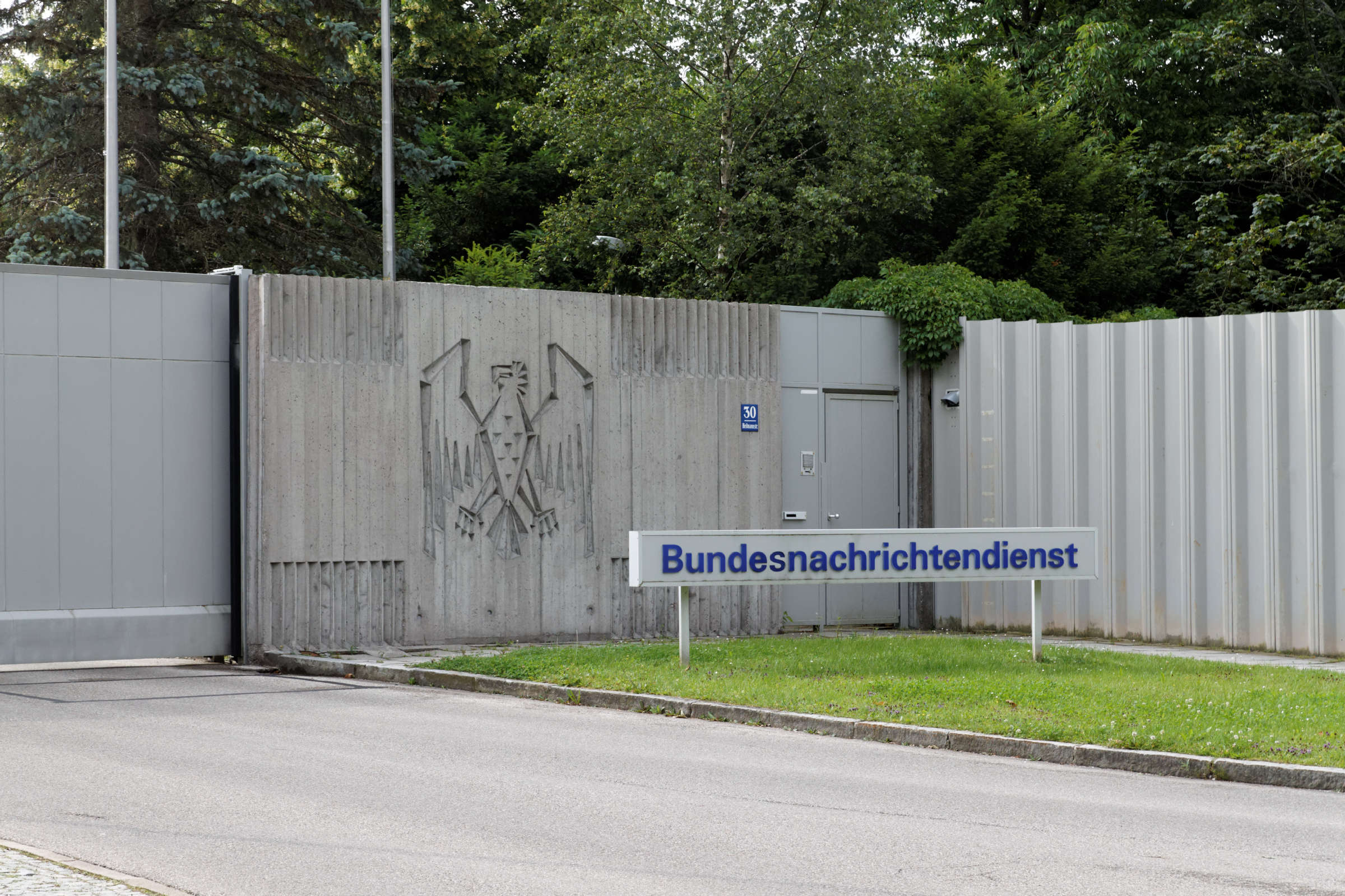
Pullach, officially Pullach i. Isartal, is a municipality in the district of Munich in Bavaria in Germany. It lies on the Isar Valley Railway and is served by the S 7 line of the Munich S-Bahn, at the Großhesselohe Isartalbahnhof, Pullach and Höllriegelskreuth railway stations. The headquarters of the intelligence agency of the German government, the Bundesnachrichtendienst (BND), was located in Pullach before the agency moved to Berlin. The new headquarters was completed in 2017 and opened officially in February 2019. Until the move to Berlin, ‘Pullach’ was a metonym for ‘the BND’ just as ‘ Langley’ is for ‘the CIA’. Geography Pullach sits on the western bank of the Isar river, just south of Munich. Neighbouring municipalities On the opposite bank of the Isar, lies the municipality of Grünwald, Bavaria, with the municipality of Baierbrunn further south. The municipality is bordered to the north by Munich, specifically the suburbs of Solln and Harlachin ... [...More Info...] [...Related Items...] OR: [Wikipedia] [Google] [Baidu] |
Isar Valley Railway
The Isar River Valley Railway (german: Isartalbahn) is a standard gauge and electrified railway in the German state of Bavaria. Originally it was 51.1 km long, running from Munich South station to and was built from 1891 to 1898 in sections by the Lokalbahn AG company (LAG). The section from Munich South to Wolfratshausen was classified as a main line, while the section from Wolfratshausen to Bichl was classified as a branch line. In 1900, the LAG electrified the section from the ''Isartalbahnhof'' (the station for the Isar River Valley Railway in Munich) to Höllriegelskreuth for suburban services at 580 volts DC. In 1938, the LAG and, with it, the Isar Valley Railway were nationalised. After the Second World War, Deutsche Bundesbahn converted the electrification to 15 kV AC (16 ⅔ Hz); this was completed in 1955 and extended to Wolfratshausen in 1960. The northern section from Munich South to Grosshesselohe Isartal station and the southern section from Wolfratshausen to ... [...More Info...] [...Related Items...] OR: [Wikipedia] [Google] [Baidu] |
Bundesstraße 11
The Bundesstraße 11 (abbr. B11) is a German federal highway. It is the first regional federal highway in the German federal highway numbering system and leads from the Czech border near Bayerisch Eisenstein past Deggendorf, Landshut and Munich to Krün near Garmisch-Partenkirchen, where it connects to the Bundesstraße 2. Between Deggendorf and Ergolding, the Bundesstraße 11 has been replaced by the Bundesautobahn 92. Northward, the road originally went over the ''Ruselabsatz'', a mountain pass. This strip of road was characterized by steep ascents and in winter the road was often impassable, especially for trucks. Due to this, the road has been rerouted to the west, where it is passable all year round. See also Wolfratshauser Straße 011 The following is a list of different international call prefixes that need to be dialled when placing an international telephone call from different countries. Countries by international prefix Countries using optional ca ... [...More Info...] [...Related Items...] OR: [Wikipedia] [Google] [Baidu] |
Munich (district)
Munich (german: Landkreis München) is a ''Landkreis'' (district) in Bavaria, Germany. It borders (from the north and clockwise) the districts of Dachau, Freising, Erding, Ebersberg, Rosenheim, Miesbach, Bad Tölz-Wolfratshausen, Starnberg, Fürstenfeldbruck, and almost encircles (except for the west and northwest sides) district-free city Munich itself, which is the district seat. History The history of the region is connected to the city of Munich. The district was established in 1852 and underwent several changes due to the ongoing incorporation of municipalities into the city of Munich. In 1972 the constant shrinking of the district was compensated by adding nine municipalities from the former district of Wolfratshausen. Geography The district is located in the east and the south of the city Munich, mostly covering the moraine plain around Munich. In the south of the district the foothills of the Alps start, which also contain the highest elevation of the district, two hills ... [...More Info...] [...Related Items...] OR: [Wikipedia] [Google] [Baidu] |
Munich S-Bahn
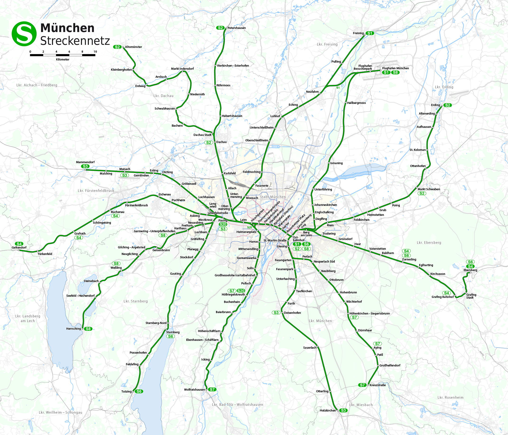
The Munich S-Bahn (german: S-Bahn München) is an electric rail transit system in Munich, Germany. "S-Bahn" is the German abbreviation for ''Stadtschnellbahn'' (literally, "urban rapid rail"), and the Munich S-Bahn exhibits characteristics of both rapid transit and commuter rail systems. The Munich S-Bahn network is operated by S-Bahn München, a subsidiary of DB Regio Bayern, which is itself a subsidiary of the German national railway company, Deutsche Bahn. It is integrated into the Munich Transport and Tariff Association (''Münchner Verkehrs- und Tarifverbund'', MVV) and interconnected throughout the city with the locally owned Munich U-Bahn. Today, the S-Bahn covers most of the populated area of the Munich metropolitan area of about 2.7 million inhabitants. The Munich S-Bahn was established on 28 May 1972. It was intended as part of the scheme to provide an adequate transport system during the 1972 Summer Olympics held in Munich by connecting the pre-existing suburban rail s ... [...More Info...] [...Related Items...] OR: [Wikipedia] [Google] [Baidu] |
Birg (Hillfort)
{{disambiguation ...
Birg refers to: * Birg (Bernese Alps), a mountain in Switzerland *the Austrian EDV-Handler BIRG * Birg (Hillfort), hillfort in Baierbrunn See also * Barg (other) *Berg (other) *Borg (other) *Burg (other) The German word Burg means castle. Burg or Bürg may refer to: Places Placename element * ''-burg'', a combining form in Dutch, German and English placenames * Burg, a variant of burh, the fortified towns of Saxon England Settlements * Burg, Aa ... [...More Info...] [...Related Items...] OR: [Wikipedia] [Google] [Baidu] |
Bayerisches Landesamt Für Statistik
The statistical offices of the German states ( German: ''Statistische Landesämter'') carry out the task of collecting official statistics in Germany together and in cooperation with the Federal Statistical Office. The implementation of statistics according to Article 83 of the constitution is executed at state level. The federal government A federation (also known as a federal state) is a political entity characterized by a union of partially self-governing provinces, states, or other regions under a central federal government (federalism). In a federation, the self-governin ... has, under Article 73 (1) 11. of the constitution, the exclusive legislation for the "statistics for federal purposes." There are 14 statistical offices for the 16 states: See also * Federal Statistical Office of Germany References {{Reflist Germany Statistical offices Germany ... [...More Info...] [...Related Items...] OR: [Wikipedia] [Google] [Baidu] |
Municipalities Of Germany
MunicipalitiesCountry Compendium. A companion to the English Style Guide European Commission, May 2021, pages 58–59. (german: Gemeinden, singular ) are the lowest level of official territorial division in . This can be the second, third, fourth or fifth level of territorial division, depending on the status of the municipality and the '' Land'' (federal state) it is part of. The city-states Berlin and Hamburg are second-l ... [...More Info...] [...Related Items...] OR: [Wikipedia] [Google] [Baidu] |
Germany
Germany, officially the Federal Republic of Germany (FRG),, is a country in Central Europe. It is the most populous member state of the European Union. Germany lies between the Baltic and North Sea to the north and the Alps to the south. Its 16 constituent states have a total population of over 84 million in an area of . It borders Denmark to the north, Poland and Czechia to the east, Austria and Switzerland to the south, and France, Luxembourg, Belgium, and the Netherlands to the west. The nation's capital and most populous city is Berlin and its main financial centre is Frankfurt; the largest urban area is the Ruhr. Settlement in what is now Germany began in the Lower Paleolithic, with various tribes inhabiting it from the Neolithic onward, chiefly the Celts. Various Germanic tribes have inhabited the northern parts of modern Germany since classical antiquity. A region named Germania was documented before AD 100. In 962, the Kingdom of Germany formed the ... [...More Info...] [...Related Items...] OR: [Wikipedia] [Google] [Baidu] |
Bavaria
Bavaria ( ; ), officially the Free State of Bavaria (german: Freistaat Bayern, link=no ), is a state in the south-east of Germany. With an area of , Bavaria is the largest German state by land area, comprising roughly a fifth of the total land area of Germany. With over 13 million inhabitants, it is second in population only to North Rhine-Westphalia, but due to its large size its population density is below the German average. Bavaria's main cities are Munich (its capital and largest city and also the third largest city in Germany), Nuremberg, and Augsburg. The history of Bavaria includes its earliest settlement by Iron Age Celtic tribes, followed by the conquests of the Roman Empire in the 1st century BC, when the territory was incorporated into the provinces of Raetia and Noricum. It became the Duchy of Bavaria (a stem duchy) in the 6th century AD following the collapse of the Western Roman Empire. It was later incorporated into the Holy Roman Empire, ... [...More Info...] [...Related Items...] OR: [Wikipedia] [Google] [Baidu] |
Schäftlarn
Schäftlarn is a municipality in the district of Munich in Bavaria in Germany. It consists of the villages Ebenhausen, Hohenschäftlarn, Kloster Schäftlarn, Neufahrn and Zell. The river Isar runs through it. A human settlement with the name "Schäftlarn" does not exist. The most famous building complex is Schäftlarn Abbey (Kloster). History The name Schäftlarn was officially recorded as a municipality in 1873. But the roots of the place go back much farther. Schäftlarn Abbey was founded in the year 762 as a monastery for Benedictine monks. The village of Hohenschäftlarn is first mentioned in documents 778 and belonged to the abbey. The monastery was rebuilt between 1702 and 1760, and the church of St. Georg in the village of Hohenschäftlarn in 1729/30. During the secularisation of Bavaria in 1803 the monastery was dissolved. In 1818 the municipality of Schäftlarn was first established as an independent political entity. In 1866 Ludwig I of Bavaria re-established the monas ... [...More Info...] [...Related Items...] OR: [Wikipedia] [Google] [Baidu] |
Hillfort
A hillfort is a type of earthwork used as a fortified refuge or defended settlement, located to exploit a rise in elevation for defensive advantage. They are typically European and of the Bronze Age or Iron Age. Some were used in the post- Roman period. The fortification usually follows the contours of a hill and consists of one or more lines of earthworks, with stockades or defensive walls, and external ditches. Hillforts developed in the Late Bronze and Early Iron Age, roughly the start of the first millennium BC, and were used in many Celtic areas of central and western Europe until the Roman conquest. Nomenclature The spellings "hill fort", "hill-fort" and "hillfort" are all used in the archaeological literature. The ''Monument Type Thesaurus'' published by the Forum on Information Standards in Heritage lists ''hillfort'' as the preferred term. They all refer to an elevated site with one or more ramparts made of earth, stone and/or wood, with an external ditch ... [...More Info...] [...Related Items...] OR: [Wikipedia] [Google] [Baidu] |


