|
Baglung
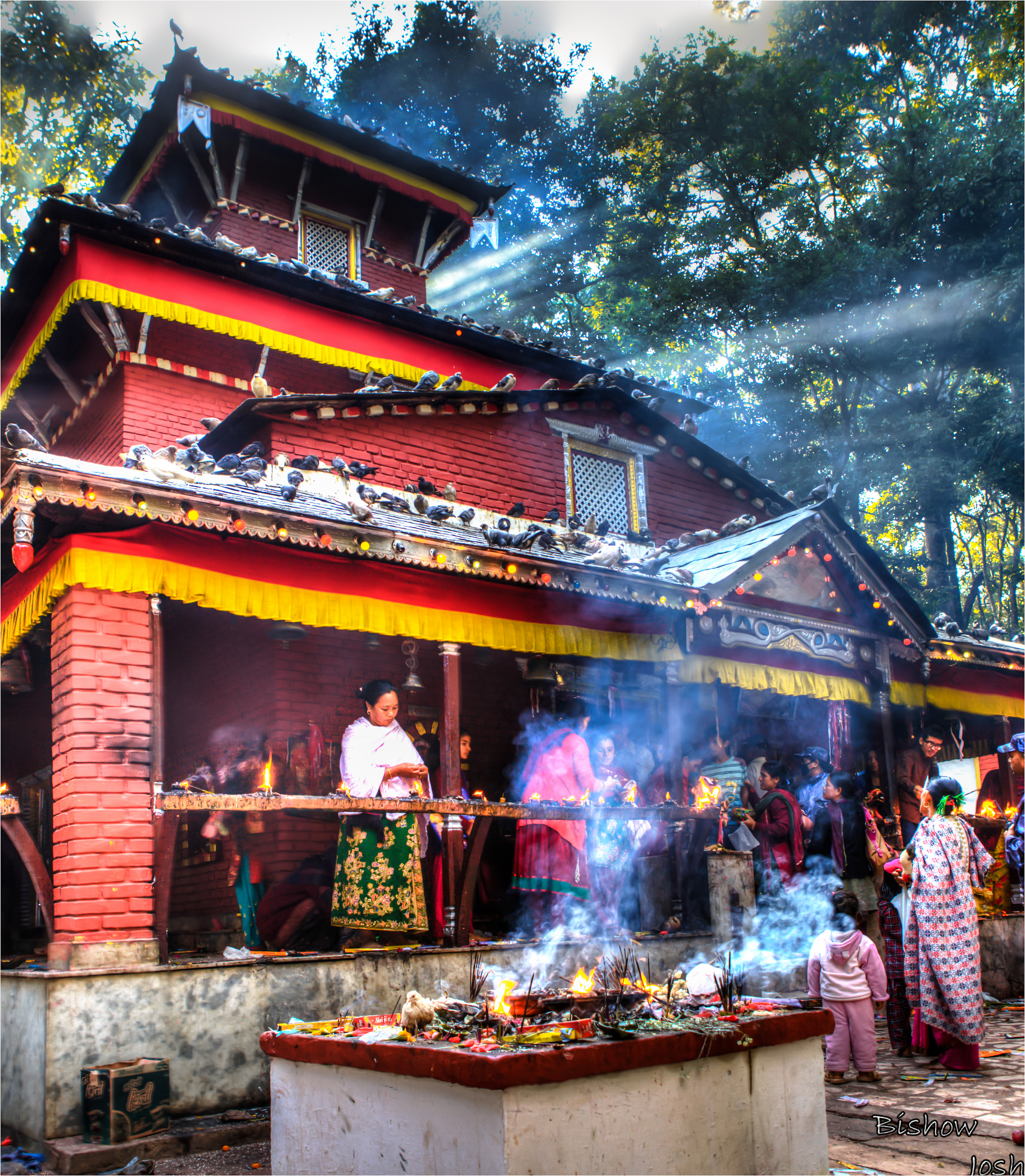
Baglung is a municipality in western Nepal, west of Kathmandu. It is the administrative headquarters of Baglung District and Dhaulagiri Zone. Baglung serves as the major center for business, finance, education, service and healthcare for the people of mid-Kali Gandaki valley that encompass Beni, Jaljala, Baglung, Kushma, Kathekhola, Galkot, Phalewas and Jaimuni local bodies. The city is located at the cross-section of Kaligandaki corridor highway and midhill highway that transverse Nepal in north–south and east–west directions respectively. Geography and climate Baglung Bazar is situated on a plateau overlooking the Kali Gandaki gorge directly south of the Dhaulagiri Himalayan range. Steep cliffs rising from the valley flank the plateau on three sides. City limits are roughly determined by the Theule Khola to the south, Kali Gandaki river to the east and Dhodeni Khola to the north. Baglung enjoys warm summers and mild winters. Annual average temperatures range from a maximum ... [...More Info...] [...Related Items...] OR: [Wikipedia] [Google] [Baidu] |
Baglung Bazar
Baglung is a municipality in western Nepal, west of Kathmandu. It is the administrative headquarters of Baglung District and Dhawalagiri Zone, Dhaulagiri Zone. Baglung serves as the major center for business, finance, education, service and healthcare for the people of mid-Kali Gandaki valley that encompass Beni, Dhaulagiri, Beni, Jaljala, Baglung, Kushma, Kathekhola, Galkot, Phalewas and Jaimuni local bodies. The city is located at the cross-section of Kaligandaki corridor highway and midhill highway that transverse Nepal in north–south and east–west directions respectively. Geography and climate Baglung Bazar is situated on a plateau overlooking the Kali Gandaki gorge directly south of the Dhaulagiri Himalayan range. Steep cliffs rising from the valley flank the plateau on three sides. City limits are roughly determined by the Theule Khola to the south, Kali Gandaki river to the east and Dhodeni Khola to the north. Baglung enjoys warm summers and mild winters. Annual avera ... [...More Info...] [...Related Items...] OR: [Wikipedia] [Google] [Baidu] |
Baglung District
Baglung District ( ne, बागलुङ जिल्ला ), a part of Gandaki Province, is one of the seventy-seven districts of Nepal. The district, with Baglung as its district headquarters, covers an area of and has a population (2011) of 268,613. Introduction Baglung is surrounded by Parbat, Myagdi, Rukum, Rolpa, Pyuthan and Gulmi districts. It has 59 Village Development Committees and one Municipality. Baglung has a moniker of "District of suspension bridges" as there are numerous suspension bridges. It is a hilly district, most of the population settled in the sides of the rivers. Fertile plains situated in the either sides of the rivers are used for farming. Headquarters of Baglung District is Baglung Municipality which is located on a plateau overlooking the holy Kali Gandaki. Like Nepal, Baglung is also diverse in religion, culture, ethnicity, altitude, temperature etc. Hinduism and Buddhism are the major religions. Baglung is rich in herbal medicinal plants. Ric ... [...More Info...] [...Related Items...] OR: [Wikipedia] [Google] [Baidu] |
Gandaki Province
Gandaki Province ( ne, गण्डकी प्रदेश ) ), is one of the seven federal provinces established by the current constitution of Nepal which was promulgated on 20 September 2015. Pokhara is the province's capital city. It borders the Tibet Autonomous Region of China to the north, Bagmati Province to the east, Karnali Province to the west, and Lumbini Province and Bihar of India to the south. The total area of the province is 21,504 km2 - about 14.57% of the country's total area. According to the latest census, the population of the province was 2,403,757. The newly elected Provincial Assembly adopted Gandaki Province as the permanent name by replacing its initial name Province no. 4 in July 2018. Krishna Chandra Nepali is the present chief minister of Gandaki Province Etymology Gandaki Province was named after the river Gandaki. Gandaki is a major river in the province. This river has Important links with historical Hindu civilization. The Gandaki river ... [...More Info...] [...Related Items...] OR: [Wikipedia] [Google] [Baidu] |
Pokhara Baglung Highway
The Pokhara Baglung highway is a stretch of road that begins at ''Zero Kilometer'', Pokhara, and ends in the municipality of Baglung in Gandaki Province, Nepal Nepal (; ne, :ne:नेपाल, नेपाल ), formerly the Federal Democratic Republic of Nepal ( ne, सङ्घीय लोकतान्त्रिक गणतन्त्र नेपाल ), is a landlocked country in S .... It is part of the Government of Nepal's 1095 km Midhill Highway Project. References Roads in Nepal {{Nepal-road-stub ... [...More Info...] [...Related Items...] OR: [Wikipedia] [Google] [Baidu] |
Dhawalagiri Zone
Dhaulagiri ( ne, धौलागिरी अञ्चल ) was one of the fourteen zones which Nepal was divided into for administrative purposes, prior to the September 10, 2015 adoption of a new Constitution, which divided the nation instead into 7 provinces. It is in the Western Development Region of Nepal and its headquarters are Baglung. Famous trekking areas like Mustang, Muktinath, Kali Gandaki valley and Mt Dhaulagiri fall in this zone. Dhorpatan Hunting Reserve, the only hunting reserve in Nepal is spread over Baglung and Myagdi Districts of this zone. Administrative subdivisions Dhaulagiri was divided into four districts; since 2015 these districts have been redesignated as part of Gandaki Province. See also * Development Regions of Nepal (Former) * List of zones of Nepal (Former) * List of districts of Nepal Districts in Nepal are second level of administrative divisions after provinces. Districts are subdivided in municipalities and rural municipalitie ... [...More Info...] [...Related Items...] OR: [Wikipedia] [Google] [Baidu] |
Kushma
Kushma is a small village and the headquarter of Parbat District in Nepal. Kushma municipality was formed by merging thirteen village development committees Pang, Khurkot, Durlung, Shivalaya, Chuwa, Katuwa Chaupari, Pipaltari and Pakuwa on 18 May 2014. This city lies in the western part of Nepal just about 57 km from Pokhara and 12 km from Baglung. Kushma falls under Western Development Region and Dhaulagiri Zone of Nepal. It is located at 28°13'06N 83°40'45E at an altitude of 1294 meters. Kusma Bazaar straddling a narrow and high strip of land between the banks of Kaligandaki and Modi is the main market centre of the municipality. A bridge joins Kushma with Gyadichour located on the other side of the deep Modi river canyon. History From early times Kusma has been an important stop for travellers from Baglung on their way to Pokhara, Palpa and Butwal. Businesses catering to these travelers started to spring up leading to the establishment of a small mark ... [...More Info...] [...Related Items...] OR: [Wikipedia] [Google] [Baidu] |
Hill Station
A hill station is a town located at a higher elevation than the nearby plain or valley. The term was used mostly in colonial Asia (particularly in India), but also in Africa (albeit rarely), for towns founded by European colonialists as refuges from the summer heat and, as Dale Kennedy observes about the Indian context, "the hill station ... was seen as an exclusive British preserve: here it was possible to render the Indian into an outsider".Kennedy, Dane. The Magic Mountains: Hill Stations and the British Raj. Berkeley: University of California Press, c1996 1996. , http://ark.cdlib.org/ark:/13030/ft396nb1sf/ In India, which has the largest number of hill stations, most are situated at an altitude of approximately . History Nandi Hills is a hill station in Karnataka, India which was developed by Ganga Dynasty in 11th century. It was also used by Tipu Sultan (1751 - 1799) as a summer retreat. Hill stations in British India were established for a variety of reasons. One ... [...More Info...] [...Related Items...] OR: [Wikipedia] [Google] [Baidu] |
Beni, Dhaulagiri
Beni is a municipality and the district headquarters of Myagdi District in Dhaulagiri Zone, Nepal. Municipality was announced by merging the then Ratnechaur, Jyamrukot, Arthunge, Ghatan, Pulachaur, Singa village development committees since 18 May 2014. Beni is located at the confluence of the Kali Gandaki River and Myagdi River at an altitude of 899 meters. Being the northernmost of the Tri-cities area of Nepal, it is located 12 km to the north of Zonal headquarters Baglung. It is mainly divided into two parts by the Kali Gandaki River. The Western Part lies in Myagdi District and the main offices lie there. The other part lies in Parbat District and is relatively small. History Beni meaning the place where two rivers meet was the winter headquarters of Parvat Rajya. It was on the Tibet-Nepal trading route before the invasion of Parvat Rajya. Education Beni municipality has many private, community as well as government schools. Some of them are as follows. * Beni Co ... [...More Info...] [...Related Items...] OR: [Wikipedia] [Google] [Baidu] |
Hari Bahadur Khadka
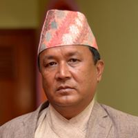
Hari Bahadur Khadka ( ne, हरि बहादुर खड्का) is a member of 2nd Nepalese Constituent Assembly. He won Baglung–1 seat in CA assembly, 2013 from Nepali Congress The Nepali Congress ( ne, नेपाली कांग्रेस ; abbr. NC) is the largest social democratic political party in Nepal. As per the results of recent local election, ''Nepali Congress'' stands as the single largest party of .... References Nepali Congress politicians from Gandaki Province Living people 1963 births Members of the 2nd Nepalese Constituent Assembly {{Gandaki-politician-stub ... [...More Info...] [...Related Items...] OR: [Wikipedia] [Google] [Baidu] |
Balewa Airport
Sir Abubakar Tafawa Balewa (December 1912 – 15 January 1966) was a Nigerian politician who served as the first and only Prime Minister of Nigeria upon independence. Early life Abubakar Tafawa Balewa was born in December 1912 in modern-day Bauchi State, in the Northern Nigeria Protectorate. Balewa's father, Yakubu Dan Zala, was of Gere ethnicity, and his mother Fatima Inna was of Gere and Fulani descent. His father worked in the house of the district head of Lere, a district within the Bauchi Emirate. Education Balewa began his education at a Qur'anic School in Bauchi; when southern colonial administrators began to push for western education in the Northern region, Balewa was among the children sent to Tafawa Balewa Elementary School, after the Qur'anic school. Thereafter, he proceeded to Bauchi Provincial School. Like many of his contemporaries, he studied at Barewa College, then known as Katsina College, where he was student number 145. Ahmadu Rabah, later known as Ahmad ... [...More Info...] [...Related Items...] OR: [Wikipedia] [Google] [Baidu] |


.jpg)