|
Baetov
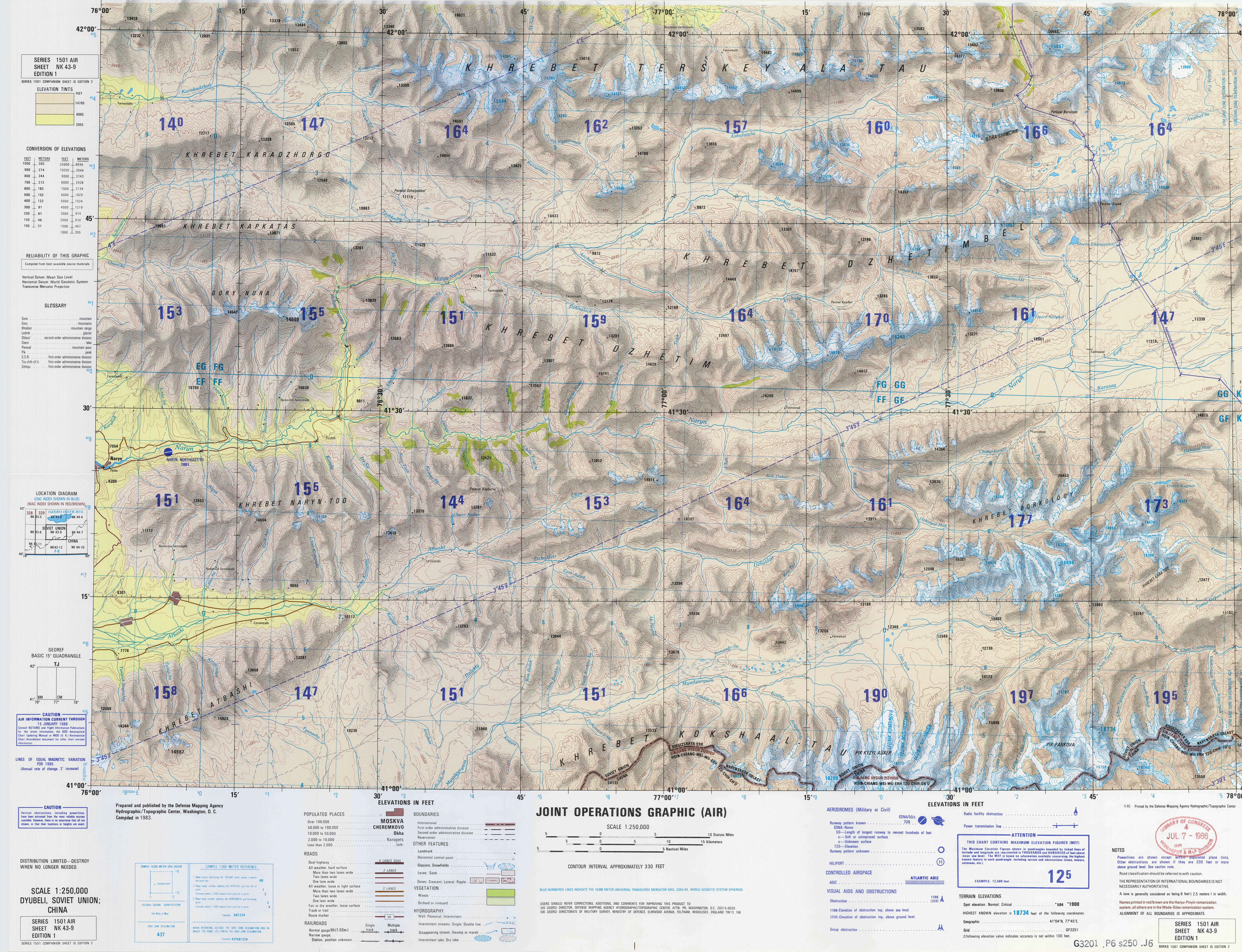
Baetov ( ky, Баетов; russian: Баетово, until 1980 ''Dyurbeldzhin'') is a village and a center of Ak-Talaa District in Naryn Region of Kyrgyzstan. Its population was 10,682 in 2021. It lies on the Naryn valley road about half-way from Naryn to Kazarman. At this point, a road branches south to Baetov on an outwash plain in the mountains. A jeep road goes south over a 3,268m pass to the At-Bashy valley and A365 to the Torugart Pass Torugart Pass (; ; ) is a mountain pass in the Tian Shan mountain range near the border between the Naryn Region of Kyrgyzstan and the Xinjiang Autonomous Region of China. It is one of two border crossings between Kyrgyzstan and China, the other .... Population References Populated places in Naryn Region {{Naryn-geo-stub ... [...More Info...] [...Related Items...] OR: [Wikipedia] [Google] [Baidu] |
Ak-Talaa District
Ak-Talaa ( ky, Ак-Талаа району, romanised: Ak-Talaa rayonu) is a district of Naryn Region in Kyrgyzstan. The administrative seat lies at Baetov. Its area is , and its resident population was 33,007 in 2021. Geography The district is located in the western part of Naryn Region and it is confined by Moldo Too from north and north-east, Baybiche Too from south and south-east, and Fergana Range from west. The mountains are characterized by severely dissected topography and high gravitational energy of slopes. The differences in absolute mean sea levels ranges from 2600 to 4737 m in mountains, and from 1500 to 2600 - in valleys. Approximately 87.5% of the district is occupied by mountains, and 12.5% - by valleys. The hydrological conditions are dominated by Naryn, Ala-Buga and their tributaries Terek, Jaman-Davan, Komorchok, Kurtka, Korgon, etc. Lake Song-Köl is at the northern border of the district. Climate Minimum temperatures in winter can be as low as -25°C in v ... [...More Info...] [...Related Items...] OR: [Wikipedia] [Google] [Baidu] |
Naryn Region
Naryn Region ( ky, Нарын облусу, Naryn oblusu; russian: Нарынская область, Narynskaya oblast) is the largest region ('' oblus'') of Kyrgyzstan. It is located in the east of the country and borders with Chüy Region in the north, Issyk-Kul Region in the northeast, Xinjiang Uyghur Autonomous Region of China in the southeast, Osh Region in the southwest, and Jalal-Abad Region in the west. Its capital is Naryn. Its total area is . The resident population of the region was 292,140 as of January 2021. The main highway runs from the Chinese border at Torugart Pass north to Balykchy on Issyk-Kul Lake. It is known as the location of Song Köl Lake and Chatyr-Kul Lake and Tash Rabat. The population of Naryn oblast is 99% Kyrgyz. The economy is dominated by animal herding (sheep, horses, yaks), with wool and meat as the main products. Mining of various minerals developed during the Soviet era has largely been abandoned as uneconomical. Today the oblast is co ... [...More Info...] [...Related Items...] OR: [Wikipedia] [Google] [Baidu] |
Kazarman
Kazarman is the village and capital of Toguz-Toro District, Jalal-Abad Region, Kyrgyzstan on the river Naryn. Its population was 11,191 in 2021. One sourceLaurence Mitchell, Kyrgyzstan, Bradt Travel Guides 2008 says that "this poor dust-blown settlement in northern Jalal-Abad Region has something of the sinister reputation of a tough mining town down on its luck". The Makmal open-pit gold mine just to the south no longer provides employment opportunities. The town is largely cut off in winter when the roads are closed by snow. There is a small airport Kazarman Airport, but it currently (2012) is served by no flights. The road southwest to Jalal-Abad city normally requires a 4x4 as far as the Kaldama Pass over the Ferghana range. Once over the pass the country opens out to the Ferghana Valley. The road east through Baetov and Dostuk to Naryn is somewhat better. The village is a base for visiting Saimaluu Tash Saymaluu-Tash ( ky, Саймалуу-Таш, meaning 'embroidered' or ... [...More Info...] [...Related Items...] OR: [Wikipedia] [Google] [Baidu] |
Kyrgyzstan
Kyrgyzstan,, pronounced or the Kyrgyz Republic, is a landlocked country in Central Asia. Kyrgyzstan is bordered by Kazakhstan to the north, Uzbekistan to the west, Tajikistan to the south, and the People's Republic of China to the east. Its capital and largest city is Bishkek. Ethnic Kyrgyz make up the majority of the country's seven million people, followed by significant minorities of Uzbeks and Russians. The Kyrgyz language is closely related to other Turkic languages. Kyrgyzstan's history spans a variety of cultures and empires. Although geographically isolated by its highly mountainous terrain, Kyrgyzstan has been at the crossroads of several great civilizations as part of the Silk Road along with other commercial routes. Inhabited by a succession of tribes and clans, Kyrgyzstan has periodically fallen under larger domination. Turkic nomads, who trace their ancestry to many Turkic states. It was first established as the Yenisei Kyrgyz Khaganate later in the ... [...More Info...] [...Related Items...] OR: [Wikipedia] [Google] [Baidu] |
Naryn
Naryn ( ky, Нарын, translit=Naryn, Mongolian : Нарийн, Nariin, Traditional Mongolian ᠨᠠᠷᠢᠨ) is the regional administrative center of Naryn Region in central Kyrgyzstan. Its area is , and its estimated population was 41,178 as of January 2021. The town was established as a fortress on the caravan route in 1868. It is situated on both banks of the river Naryn (one of the main head waters of the Syr Darya), which cuts a picturesque gorge through the town. The city has two regional museums and some hotels, but is otherwise residential. History Naryn was established as a fortress on the important caravan route between Kashgar and Zhetysu (Semirechye) at the direction of the first Governor-General of Russian Turkestan Konstantin Petrovich von Kaufmann in 1868. Overview From Naryn, the main road (one of the branches of the ancient Silk Road) runs south through the sparsely settled central Kyrgyz highlands to the Torugart Pass and China. At present, this is the ... [...More Info...] [...Related Items...] OR: [Wikipedia] [Google] [Baidu] |
Jeep
Jeep is an American automobile marque, now owned by multi-national corporation Stellantis. Jeep has been part of Chrysler since 1987, when Chrysler acquired the Jeep brand, along with remaining assets, from its previous owner American Motors Corporation (AMC). Jeep's current product range consists solely of sport utility vehicles – both crossovers and fully off-road worthy SUVs and models, including one pickup truck. Previously, Jeep's range included other pick-ups, as well as small vans, and a few roadsters. Some of Jeep's vehicles—such as the Grand Cherokee—reach into the luxury SUV segment, a market segment the 1963 Wagoneer is considered to have started. Jeep sold 1.4 million SUVs globally in 2016, up from 500,000 in 2008, two-thirds of which in North America, and was Fiat-Chrysler's best selling brand in the U.S. during the first half of 2017. In the U.S. alone, over 2400 dealerships hold franchise rights to sell Jeep-branded vehicles, and if Jeep were spun off ... [...More Info...] [...Related Items...] OR: [Wikipedia] [Google] [Baidu] |
At-Bashy
At-Bashy ( Kyrgyz: Ат-Башы) is a village in the Naryn Region of Kyrgyzstan, about 35km southwest of Naryn on the main highway to the Torugart Pass. It is the seat of At-Bashy District. The At-Bashy Range to the south extends to Lake Chatyr-Kul. The river At-Bashy comes in from the east and then runs northwest through a gorge in the Baybiche-Too range to join the Naryn near Dostuk Dostuk ( ky, Достук) is a village in Naryn District of Naryn Region of Kyrgyzstan on the river Naryn and highway A361 about 35 km west of Naryn. Its population was 750 in 2021. Until 2012 it was an urban-type settlement Urban-type .... It is the last considerable settlement before the Chinese border. The highway, built in 1906, runs southwest between the Baybiche-Too and At-Bashy ranges before turning south and then east to reach the pass. Its population was 14,655 in 2021. Population References Populated places in Naryn Region {{Naryn-geo-stub ... [...More Info...] [...Related Items...] OR: [Wikipedia] [Google] [Baidu] |
Torugart Pass
Torugart Pass (; ; ) is a mountain pass in the Tian Shan mountain range near the border between the Naryn Region of Kyrgyzstan and the Xinjiang Autonomous Region of China. It is one of two border crossings between Kyrgyzstan and China, the other being Erkeshtam, some 165 km (103 mi) to the southwest. The scenic lake Chatyr-Köl lies near the pass on the Kyrgyz side. The road to Naryn and then to Balykchy and Bishkek—stretching for some —is narrow and in winter often impassable due to heavy snowfall and frequent avalanches. On the Chinese side, the Torugart Port of Entry (吐尔尕特口岸), where travelers must clear for customs, is located about from the pass itself in Ulugqat County of the Kizilsu Kirghiz Autonomous Prefecture. Distances from the pass to major cities are: to Ulugqat, to Kashgar, to Artux and some to Ürümqi. The pass is also terminus of European route E125 and, under the new National Highway plans, the China National Highway ... [...More Info...] [...Related Items...] OR: [Wikipedia] [Google] [Baidu] |


