|
Bacoachi
Bacoachi is a small town in Bacoachi Municipality in the north of the Mexican state of Sonora. The area of the municipality is 487 square miles (1,260.65 km²) and the population (rural and urban) was 1,456 in 2005, with 924 inhabitants residing in the municipal seatThe elevation of the municipal seat is 4,429 feet (1,350 meters) above sea level. Bacoachi is located southeast of Cananea and has boundaries in the north with Naco, in the east with Fronteras, in the southeast with Nacozari, in the southwest with Arizpe and in the east with Cananea. See maps ao The territory was originally inhabited by the Opata Teguima Indians, who called their settlement "Cuchibaciachi". In 1649, Captain Simón Lazo de la Vega founded a Spanish town in the same spot. The name means "water snake" in the indigenous language. Most of the land is mountainous and is part of the Sierra de Sonora. There are still pine forests and a rich variety of fauna, including coyotes, jaguars, deer, raccoons ... [...More Info...] [...Related Items...] OR: [Wikipedia] [Google] [Baidu] |
Bacoachi Municipality
Bacoachi (municipality) is a municipality in Sonora in north-western Mexico Mexico (Spanish: México), officially the United Mexican States, is a country in the southern portion of North America. It is bordered to the north by the United States; to the south and west by the Pacific Ocean; to the southeast by Guatema .... References {{coord, 30.6532, N, 109.9790, W, source:wikidata, display=title Municipalities of Sonora ... [...More Info...] [...Related Items...] OR: [Wikipedia] [Google] [Baidu] |
Sonora
Sonora (), officially Estado Libre y Soberano de Sonora ( en, Free and Sovereign State of Sonora), is one of the 31 states which, along with Mexico City, comprise the Administrative divisions of Mexico, Federal Entities of Mexico. The state is divided into Municipalities of Sonora, 72 municipalities; the capital (and largest) city of which being Hermosillo, located in the center of the state. Other large cities include Ciudad Obregón, Nogales, Sonora, Nogales (on the Mexico–United States border, Mexico-United States border), San Luis Río Colorado, and Navojoa. Sonora is bordered by the states of Chihuahua (state), Chihuahua to the east, Baja California to the northwest and Sinaloa to the south. To the north, it shares the Mexico–United States border, U.S.–Mexico border primarily with the state of Arizona with a small length with New Mexico, and on the west has a significant share of the coastline of the Gulf of California. Sonora's natural geography is divided into three ... [...More Info...] [...Related Items...] OR: [Wikipedia] [Google] [Baidu] |
Fronteras
Fronteras is the seat of Fronteras Municipality in the northeastern part of the Mexican state of Sonora. Frontera translates as Border. The elevation is 1,120 meters and neighboring municipalities are Agua Prieta, Nacozari and Bacoachi. The area is 2839.62 km2, which represents 1.53% of the state total. Fronteras was founded by the Jesuits as a mission in 1645. Geography Fronteras is located in a mountainous area on the west side of the Sierra Madre Occidental. The average annual temperature is 16.9 °C. The rainy season is from July to August and the average annual rainfall is 427.5 millimeters. Demographics and industry The municipal population was 7,081 (2.34 /km2) in 2000, although in a second counting in 2005 this had increased to 7,470. The most important settlement and the municipal seat had 874 inhabitants in 2000. Industry is the most important economic activity together with agriculture and cattle raising. There was one ''maquiladora'' in 2000. The main ag ... [...More Info...] [...Related Items...] OR: [Wikipedia] [Google] [Baidu] |
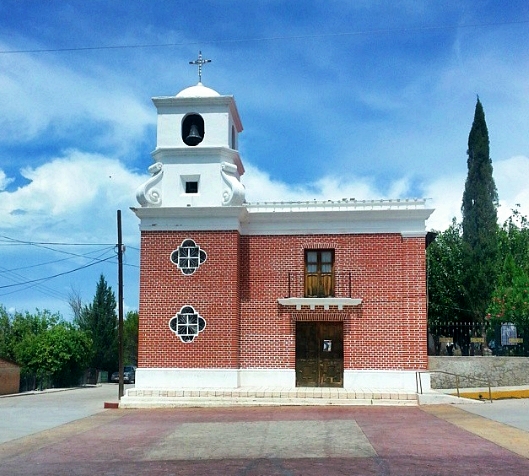
Iglesia San Miguel Arcángel, Bacoachi
Iglesia may refer to: * Iglesia Department * Iglesia ni Cristo * Iglesia Filipina Independiente , native_name_lang = fil , icon = Logo of the Philippine Independent Church (Aglipayan Church).svg , icon_width = 80px , icon_alt = Coat of arms of the Philippine Independent Church , image ... * Iglesia (Metro Madrid), a station on Line 1 {{disambiguation ... [...More Info...] [...Related Items...] OR: [Wikipedia] [Google] [Baidu] |
Mexican State
The states of Mexico are first-level administrative territorial entities of the country of Mexico, which is officially named Mexico, United Mexican States. There are 32 federal entities in Mexico (31 states and the capital, Mexico City, as a separate entity that is not formally a state). States are further divided into municipalities of Mexico, municipalities. Mexico City is divided in boroughs of Mexico City, boroughs, officially designated as or , similar to other state's municipalities but with different administrative powers. List ''Mexico's post agency, Correos de México, does not offer an official list of state name abbreviations, and as such, they are not included below. A list of Mexican states and several versions of their abbreviations can be found Template:Mexico State-Abbreviation Codes, here.'' } , style="text-align: center;" , ''Coahuila de Zaragoza'' , , style="text-align: center;" colspan=2 , Saltillo , style="text-align: right;" , , style="text-align ... [...More Info...] [...Related Items...] OR: [Wikipedia] [Google] [Baidu] |
Cananea
Cananea is a city in the Mexican state of Sonora, Northwestern Mexico. It is the seat of the Municipality of Cananea, in the vicinity of the U.S−Mexico border. The population of the city was 31,560 as recorded by the 2010 census. The population of the municipality, which includes rural areas, was 32,936. The total area of the municipality is approximately . History The first non-indigenous inhabitants of the present day Cananea, arrived in 1760 from other parts of the Spanish Viceroyalty of New Spain (colonial México). In the 19th century General Ignacio Pesqueira, from nearby Arizpe, retired to Cananea. He fought against the Apache who raided the area. One time, while following them into the mountains, he discovered the abandoned Spanish mines and by 1868 he had renewed the extraction of minerals in the Cananea mines. General Pesqueira's wife, Elena Pesqueira Pesqueira, "discovered" a nearby mountain range (''sierra'') and the General named the highest peak ''La Elen ... [...More Info...] [...Related Items...] OR: [Wikipedia] [Google] [Baidu] |
Naco, Sonora
Naco is a Mexican town in Naco Municipality located in the northeast part of Sonora state on the border with the United States. It is directly across from the unincorporated town of Naco, Arizona. The name Naco comes from the Opata language and means prickly pear cactus. The town saw fighting during the Mexican Revolution and during a rebellion led by General José Gonzalo Escobar in 1929. During the second conflict, an American pilot by the name of Patrick Murphy volunteered to bomb federal forces for the rebels, but mistakenly bombed Naco, Arizona, instead. Today, the town has been strongly affected by the smuggling of drugs, people and weapons across the international border. History Before the arrival of Europeans, the area was dominated by the Opata peoples. Naco, Sonora, along with Naco, Arizona, came into being in 1897 as a border crossing to connect copper mines on both sides. Naco, Sonora, was officially founded in 1900 with the construction of the Naco-Cananea rail li ... [...More Info...] [...Related Items...] OR: [Wikipedia] [Google] [Baidu] |
Arizpe
Arizpe (or Arispe) is a small town and the municipal seat of the Arizpe Municipality in the north of the Mexican state of Sonora. It is located at 30°20'"N 110°09'"W. The area of the municipality is 2,806.78 sq.km. The population in 2005 was 2,959 of which 1,743 lived in the municipal seat as of the 2000 census. History The region of Arizpe was occupied by the Opata people. The name ''Arizpe'' is a Basque word "Aritzpe"(''(H)Aritz'' meaning Oak and ''Pe'' meaning under) and translates to "Under the Oaks". Arizpe was founded in 1646 by the Jesuit missionary Jerónimo de la Canal, with one of the Spanish missions in the Sonoran Desert. Provincias Internas In 1776 Arizpe was made the capital of the Spanish colonial Comandancia y Capitanía General de las Provincias Internas. As the capital, Arizpe became a city by the end of the eighteenth century, the first in the Sonora region. The Provincias Internas had jurisdiction over the provinces of: Sonora and Sinaloa (present day ... [...More Info...] [...Related Items...] OR: [Wikipedia] [Google] [Baidu] |
Opata
The Opata (written Ópata in Spanish, pronounced with stress on the first syllable: /ˈopata/) are three indigenous peoples of Mexico. Opata territory, the “Opatería” in Spanish, encompasses the mountainous northeast and central part of the state of Sonora, extending to near the border with the United States. Most Opatan towns were situated in river valleys and had an economy based on irrigated agriculture. In the 16th century, when they first met the Spanish explorers, the Opata were the most numerous people in Sonora. Today, some people continue to identify as Opatas and are working to restore aspects of pre-contact Opata culture, and revitalize Opata identity. Some sources indicate that as an identifiable ethnic group, the Opata and their language are now extinct, or nearly extinct. Subgroups At the time of the first contact with the Spanish in the 16th century there were multiple sub-groups of Opata people. However, by the mid 17th century the Spanish identified only th ... [...More Info...] [...Related Items...] OR: [Wikipedia] [Google] [Baidu] |
Simón Lazo De La Vega
Simon may refer to: People * Simon (given name), including a list of people and fictional characters with the given name Simon * Simon (surname), including a list of people with the surname Simon * Eugène Simon, French naturalist and the genus authority ''Simon'' * Tribe of Simeon, one of the twelve tribes of Israel Places * Şimon ( hu, links=no, Simon), a village in Bran Commune, Braşov County, Romania * Șimon, a right tributary of the river Turcu in Romania Arts, entertainment, and media Films * ''Simon'' (1980 film), starring Alan Arkin * ''Simon'' (2004 film), Dutch drama directed by Eddy Terstall Games * ''Simon'' (game), a popular computer game * Simon Says, children's game Literature * ''Simon'' (Sutcliff novel), a children's historical novel written by Rosemary Sutcliff * Simon (Sand novel), an 1835 novel by George Sand * ''Simon Necronomicon'' (1977), a purported grimoire written by an unknown author, with an introduction by a man identified only as "Simon" ... [...More Info...] [...Related Items...] OR: [Wikipedia] [Google] [Baidu] |
United States
The United States of America (U.S.A. or USA), commonly known as the United States (U.S. or US) or America, is a country primarily located in North America. It consists of 50 states, a federal district, five major unincorporated territories, nine Minor Outlying Islands, and 326 Indian reservations. The United States is also in free association with three Pacific Island sovereign states: the Federated States of Micronesia, the Marshall Islands, and the Republic of Palau. It is the world's third-largest country by both land and total area. It shares land borders with Canada to its north and with Mexico to its south and has maritime borders with the Bahamas, Cuba, Russia, and other nations. With a population of over 333 million, it is the most populous country in the Americas and the third most populous in the world. The national capital of the United States is Washington, D.C. and its most populous city and principal financial center is New York City. Paleo-Americ ... [...More Info...] [...Related Items...] OR: [Wikipedia] [Google] [Baidu] |


