|
BDI Bridge
The Elm Park Bridge, sometimes locally referred to as the BDI Bridge or the Ice Cream Bridge, is a steel truss bridge over the Red River in Winnipeg, Manitoba. It links Kingston Crescent in the neighbourhood of St. Vital with Jubilee Avenue in the neighbourhood of Fort Rouge. Built in 1912 and opened in 1914, it is the fourth-oldest bridge in Winnipeg after the Redwood, Louise, and Arlington. The bridge has a deck measuring wide; though initially open to two-way vehicular traffic, it was closed to vehicles in 1974, remaining accessible to only pedestrians and cyclists ever since. The nickname "BDI Bridge" is derived from the popular ice-cream vendor, Bridge Drive-In (BDI), that sits adjacent to the bridge. In turn, BDI itself is so-named because of its proximity to the Elm Park Bridge. History Elm Park (now Kingston Crescent and Kingston Row), the former trolley park beside which the bridge was built, was created in 1890 by the Elm Park Company, whose parent company, ... [...More Info...] [...Related Items...] OR: [Wikipedia] [Google] [Baidu] |
Red River Of The North
The Red River (french: rivière Rouge or ) is a river in the north-central United States and central Canada. Originating at the confluence of the Bois de Sioux and Otter Tail rivers between the U.S. states of Minnesota and North Dakota, it flows northward through the Red River Valley, forming most of the border of Minnesota and North Dakota and continuing into Manitoba. It empties into Lake Winnipeg, whose waters join the Nelson River and ultimately flow into Hudson Bay. The Red River is about long, of which about are in the United States and about are in Canada.Red River Map 3 Minnesota DNR; map shows the international border at 155. The river falls on its trip to Lake Winnipeg, wh ... [...More Info...] [...Related Items...] OR: [Wikipedia] [Google] [Baidu] |
Osborne Village
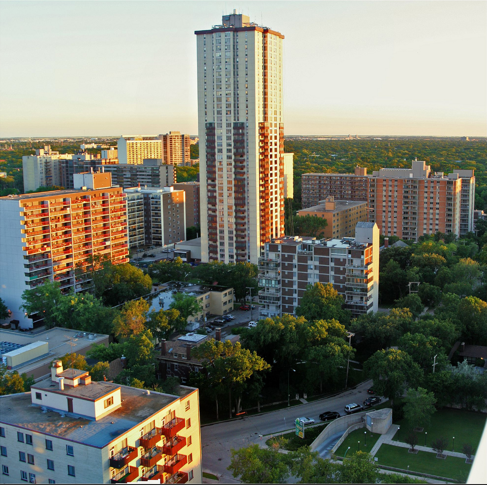
Osborne Village is a neighbourhood of Winnipeg, Manitoba. The area is bordered by the Assiniboine River on the north and west, Harkness Station on the east (see Winnipeg RT), and the Osborne Underpass on the south. History Osborne Village derives its name from Osborne Street ( Winnipeg Route 62), which runs through the centre of the village area. Osborne Street was named after Lieutenant Colonel William Osborne Smith (1831–1887) the first commanding officer of Military District 10, which included the City of Winnipeg. North of the Assiniboine River, Osborne Street was adjacent to the first Fort Osborne Barracks, on the site of which is now the Provincial Legislature. Osborne Village is part of the original Fort Rouge area, which became part of the City of Winnipeg as Ward 1 in 1882. The Fort Rouge area started with a population of only 150, but grew to a population of tens of thousands by 1994. The Fort Rouge area began developing as a residential suburb of Winnipeg after ... [...More Info...] [...Related Items...] OR: [Wikipedia] [Google] [Baidu] |
Pier (architecture)
A pier, in architecture, is an upright support for a structure or superstructure such as an arch or bridge. Sections of structural walls between openings (bays) can function as piers. External or free-standing walls may have piers at the ends or on corners. Description The simplest cross section of the pier is square, or rectangular, but other shapes are also common. In medieval architecture, massive circular supports called drum piers, cruciform (cross-shaped) piers, and compound piers are common architectural elements. Columns are a similar upright support, but stand on a round base. In buildings with a sequence of bays between piers, each opening (window or door) between two piers is considered a single bay. Bridge piers Single-span bridges have abutments at each end that support the weight of the bridge and serve as retaining walls to resist lateral movement of the earthen fill of the bridge approach. Multi-span bridges require piers to support the ends of spans betwe ... [...More Info...] [...Related Items...] OR: [Wikipedia] [Google] [Baidu] |
1950 Red River Flood
The 1950 Red River flood was a devastating flood that took place along the Red River in The Dakotas and Manitoba from April 15 to June 12, 1950. Damage was particularly severe in the city of Winnipeg and its environs, which were inundated on May 5, also known as Black Friday to some residents. An estimated 70,000–100,000 residents had to be evacuated, and four of eleven bridges were destroyed. In that year, the Red River reached its highest level since 1861 and flooded most of the Red River Valley, more than . One man died, and property losses due to the flood were estimated at more than $600 million to one billion. To prevent and reduce future damage, the government constructed the Red River Floodway, which was completed in 1968. It has been estimated to have prevented more than $100 billion (CAD) in cumulative flood damage. Winnipeg Although seasonal flooding was common, this flood surpassed the others. The north-flowing Red River was fed by flows resulting from meltin ... [...More Info...] [...Related Items...] OR: [Wikipedia] [Google] [Baidu] |
Transcona, Winnipeg
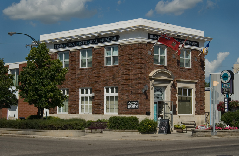
Transcona is a ward and suburb of Winnipeg, Manitoba, located about east of the downtown area. Until 1972, it was a separate municipality, having been incorporated first as the Town of Transcona on 6 April 1912 and then as the City of Transcona in 1961. The first Council for the Town of Transcona met in 1912, with Colin J. E. Maxwell as mayor; and the first Council for the City of Transcona met on 19 June 1961, with T. F. Copeland as mayor. Today, the ward is represented by a member of Winnipeg City Council, and the suburb is part of the Transcona neighbourhood cluster—composed of much larger boundaries including large areas that were part of the Municipality of North Kildonan, and much of the area west of Plessis. It is primarily a working-class residential area with some light industry. History Beginning in 1835, the area now known as Transcona was administered by the Council of Assiniboia until 1870, when the Province of Manitoba was created and took jurisdictio ... [...More Info...] [...Related Items...] OR: [Wikipedia] [Google] [Baidu] |
Cordite
Cordite is a family of smokeless propellants developed and produced in the United Kingdom since 1889 to replace black powder as a military propellant. Like modern gunpowder, cordite is classified as a low explosive because of its slow burning rates and consequently low brisance. These produce a subsonic deflagration wave rather than the supersonic detonation wave produced by brisants, or high explosives. The hot gases produced by burning gunpowder or cordite generate sufficient pressure to propel a bullet or shell to its target, but not so quickly as to routinely destroy the barrel of the gun. Cordite was used initially in the .303 British, Mark I and II, standard rifle cartridge between 1891 and 1915; shortages of cordite in World War I led to the creation of the "Devil's Porridge" munitions factory (HM Factory, Gretna) on the English-Scottish border, which produced 800 tonnes of cordite per annum. The UK also imported some United States–developed smokeless powders for us ... [...More Info...] [...Related Items...] OR: [Wikipedia] [Google] [Baidu] |
Sidewalk
A sidewalk (North American English), pavement (British English), footpath in Australia, India, New Zealand and Ireland, or footway, is a path along the side of a street, street, highway, terminals. Usually constructed of concrete, pavers, brick, stone, or asphalt, it is designed for pedestrians. A sidewalk is normally higher than the carriageway, roadway, and separated from it by a kerb (spelled "curb" in North America). There may also be a Road verge, planted strip between the sidewalk and the roadway and between the roadway and the adjacent land. In some places, the same term may also be used for a paved path, trail or footpath that is not next to a road, for example, a path through a park. Terminology The term "sidewalk" is preferred in most of North America. The term "pavement" is more common in the United Kingdom and other members of the Commonwealth of Nations, as well as parts of the Mid-Atlantic United States such as Philadelphia and parts of New Jersey. Many Commonwea ... [...More Info...] [...Related Items...] OR: [Wikipedia] [Google] [Baidu] |
Winnipeg Route 62
Route 62 is a major north–south arterial route in Winnipeg, Manitoba that has eight different street names. The route serves both the North End and St. Vital areas of Winnipeg, and forms the westernmost boundary of the downtown core. Osborne Street, between the Assiniboine and Red Rivers, is a major shopping district, especially in the area between Roslyn Road and Corydon Avenue, known as Osborne Village. Route description The official route begins on Salter Street in the city's suburb of West Kildonan; its northernmost point is often given on maps as the intersection of Salter Street and Southall Drive. As it passes southward over the CPR Winnipeg Rail Yards and past the West End, its name changes from Salter Street to Isabel Street, Balmoral Street, Colony Street, Memorial Boulevard, and Osborne Street North, all in a space of less than . It remains as Osborne Street North as it passes by the Manitoba Legislative Building, and then as Osborne Street as it crosses over ... [...More Info...] [...Related Items...] OR: [Wikipedia] [Google] [Baidu] |
Winnipeg Free Press
The ''Winnipeg Free Press'' (or WFP; founded as the ''Manitoba Free Press'') is a daily (excluding Sunday) broadsheet newspaper in Winnipeg, Manitoba, Canada. It provides coverage of local, provincial, national, and international news, as well as current events in sports, business, and entertainment and various consumer-oriented features, such as homes and automobiles appear on a weekly basis. The WFP was founded in 1872, only two years after Manitoba had joined Confederation (1870), and predated Winnipeg's own incorporation (1873). The ''Winnipeg Free Press'' has since become the oldest newspaper in Western Canada that is still active. Though there is competition, primarily with the print daily tabloid ''Winnipeg Sun'', the WFP has the largest readership of any newspaper in the province and is regarded as the newspaper of record for Winnipeg and the rest of Manitoba. Timeline November 30, 1872: The ''Manitoba Free Press'' was launched by William Fisher Luxton and John A. Kenny ... [...More Info...] [...Related Items...] OR: [Wikipedia] [Google] [Baidu] |
Roland Fairbairn McWilliams
Roland Fairbairn McWilliams (October 10, 1874 – December 10, 1957) was a Canadian politician and office-holder. He served as the 13th Lieutenant Governor of Manitoba from 1940 to 1953. McWilliams was born in Peterborough, Ontario. He received a Bachelor of Arts degree from the University of Toronto in 1896, and started his Bachelor of Laws degree at Osgoode Hall the following year. He subsequently worked as a barrister and solicitor. He campaigned for the Ontario Liberal Party in the 1905 provincial election, but was defeated. In 1906, McWilliams was elected Mayor of Peterborough. He moved to Winnipeg, Manitoba in 1910, and continued to practice law for several years. McWilliams was also a leading organizer within YMCA, serving as its North American Vice President in 1923 and 1924, and as its Canadian leader from 1922 to 1929. He also served as the leader of Winnipeg's Town Planning Institute from 1925 to 1929. He visited Russia in 1926, and later wrote a book on ... [...More Info...] [...Related Items...] OR: [Wikipedia] [Google] [Baidu] |
Toll Bridge
A toll bridge is a bridge where a monetary charge (or ''toll'') is required to pass over. Generally the private or public owner, builder and maintainer of the bridge uses the toll to recoup their investment, in much the same way as a toll road. History The practice of collecting tolls on bridges harks back to the days of ferry crossings where people paid a fee to be ferried across stretches of water. As boats became impractical to carry large loads, ferry operators looked for new sources of revenue. Having built a bridge, they hoped to recoup their investment by charging tolls for people, animals, vehicles, and goods to cross it. The original London Bridge across the river Thames opened as a toll bridge, but an accumulation of funds by the charitable trust that operated the bridge (Bridge House Estates) saw that the charges were dropped. Using interest on its capital assets, the trust now owns and runs all seven central London bridges at no cost to taxpayers or users. In t ... [...More Info...] [...Related Items...] OR: [Wikipedia] [Google] [Baidu] |
Residential Development
A residential area is a land used in which housing predominates, as opposed to industrial and commercial areas. Housing may vary significantly between, and through, residential areas. These include single-family housing, multi-family residential, or mobile homes. Zoning for residential use may permit some services or work opportunities or may totally exclude business and industry. It may permit high density land use or only permit low density uses. Residential zoning usually includes a smaller FAR (floor area ratio) than business, commercial or industrial/manufacturing zoning. The area may be large or small. Overview In certain residential areas, especially rural, large tracts of land may have no services whatever, such that residents seeking services must use a motor vehicle or other transportation, so the need for transportation has resulted in land development following existing or planned transport infrastructure such as rail and road. Development patterns may be reg ... [...More Info...] [...Related Items...] OR: [Wikipedia] [Google] [Baidu] |


