|
B5470
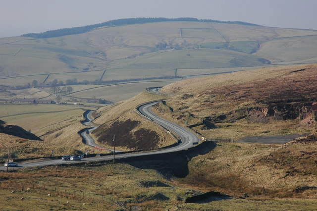
The B5470 is a road in England, running from Chapel-en-le-Frith, Derbyshire, to Macclesfield, Cheshire, via Whaley Bridge. The hilly and winding section between Whaley Bridge and Macclesfield is often called 'The Highwayman' after a prominent roadside pub, now closed. Much of the route follows former turnpike roads through a scenic area of the Peak District National Park. Route The B5470 starts in Town End on the eastern side of Chapel-en-le-Frith at a junction with the A624, which connects it to the A6. It then runs westwards, forming the main street of Chapel-en-le-Frith. It then continues to the hamlet of Tunstead Milton after which it runs along the valley of the Randall Carr in a series of sweeping bends to Whaley Bridge. This length of the road is generally level and prone to flooding in wet weather. In Whaley Bridge the B5470 crosses the A5004 at the Horwich End traffic lights. It then climbs rapidly out of Whaley Bridge to the village of Kettleshulme, Ches ... [...More Info...] [...Related Items...] OR: [Wikipedia] [Google] [Baidu] |
A5004 Road
The A5004 is an A road in Derbyshire, England running north from Buxton to Whaley Bridge. A large section of the road is called Long Hill. It was formerly part of the A6. It runs through a scenic area of the Peak District National Park. In 2010 it was named as the seventh most dangerous road in Britain. BBC News, 30 June 2010 Route The road starts at the junction with the A53 just north of , where it is called Manchester Road. It climbs out of Buxton in a series fairly gentl ...[...More Info...] [...Related Items...] OR: [Wikipedia] [Google] [Baidu] |
A6 Road (Great Britain)
The A6 is one of the main north–south roads in England. It runs from Luton in Bedfordshire to Carlisle in Cumbria, although it formerly started at a junction with the A1 at Barnet. It is the fourth longest numbered road in Britain; only the A1, A38 and A30 are longer. Running north-west from Luton, the road passes through Bedford, bypasses Rushden, Kettering and Market Harborough, continues through Leicester, Loughborough, Derby and Matlock before passing through the Peak District to Bakewell, Buxton, Stockport, Manchester, Salford, Pendleton, Irlams o' th' Height, Pendlebury, Swinton, Wardley, Linnyshaw, Walkden, Little Hulton, Westhoughton, Chorley, Preston, Lancaster, Kendal and Penrith before reaching Carlisle. South of Derby, the road is paralleled by the M1 motorway; between Manchester and Preston, the M6 and M61 motorways approximate its course; and from Preston to its northern terminus in Carlisle, it is paralleled by the M6 only. Between Derby and Manc ... [...More Info...] [...Related Items...] OR: [Wikipedia] [Google] [Baidu] |
Tunstead Milton
Tunstead Milton is a village in Derbyshire, England. It is situated on the B5470 road west of, and in the parish of Chapel-en-le-Frith, near the northern edge of the Combs Reservoir. It is the location of Tunstead Dickey, a "Screaming Skull", and is mentioned in ''Highways and Byways in Derbyshire'' by J B Frith, a guide published in 1905, and in '' Black's Guide'' published throughout the 19th century. The name Tunstead is likely derived from hundred homestead and Milton from mill town. The hamlet had in the past a post office, a garage and two public houses, all of which have now closed. It should not be confused with Tunstead, which is roughly five miles to the southeast, near Wormhill Wormhill is a village and civil parish in the High Peak district of Derbyshire, England, situated east by north of Buxton. The population of the civil parish including Peak Dale was 1,020 at the 2011 Census. Wormhill was mentioned in the Domes .... References External links Vi ... [...More Info...] [...Related Items...] OR: [Wikipedia] [Google] [Baidu] |
Chapel-en-le-Frith
Chapel-en-le-Frith () is a town and civil parish in the Borough of High Peak in Derbyshire, England. It has been dubbed the "Capital of the Peak", in reference to the Peak District, historically the upperland areas between the Saxon lands (below the River Trent) and the Vikings lands (which came as far south as Dore, Sheffield). The town was established by the Normans in the 12th century, originally as a hunting lodge within the Forest of High Peak. This led to the French-derived name Chapel-en-le-Frith ("chapel in the forest"). (It appears in an English form in a Latin record as 'Chapell in the ffryth', in 1401.) The population at the 2011 census was 8,635. Geography Although most of the area is outside the National Park boundary, the town is in the western part of the Peak District. To the north and south lie the Dark Peak highlands, which are made up of millstone grit and are heather-covered moorlands, rugged and bleak. These include Chinley Churn and South Head with, a lit ... [...More Info...] [...Related Items...] OR: [Wikipedia] [Google] [Baidu] |
Macclesfield
Macclesfield is a market town and civil parish in the unitary authority of Cheshire East in Cheshire, England. It is located on the River Bollin in the east of the county, on the edge of the Cheshire Plain, with Macclesfield Forest to its east; it is south of Manchester and east of Chester. Before the Norman Conquest, Macclesfield was held by Edwin, Earl of Mercia and was assessed at £8. The manor is recorded in the ''Domesday Book'' as "Maclesfeld", meaning "Maccel's open country". The medieval town grew up on the hilltop around what is now St Michael's Church. It was granted a charter by Edward I in 1261, before he became king. Macclesfield Grammar School was founded in 1502. The town had a silk-button industry from at least the middle of the 17th century and became a major silk-manufacturing centre from the mid-18th century. The Macclesfield Canal was constructed in 1826–31. Hovis breadmakers were another Victorian employer. Modern industries include pharmace ... [...More Info...] [...Related Items...] OR: [Wikipedia] [Google] [Baidu] |
Cat And Fiddle Road
The Cat and Fiddle is a road in England between Buxton, Derbyshire and Macclesfield, Cheshire, named after the Cat and Fiddle Inn public house at its summit. Formed by parts of the A537, A54 and A53, it is famous for its scenic views across the Greater Manchester conurbation, the Peak District National Park and the Cheshire Plain, and for its many bends. It is extremely popular with motorcyclists, and is often classed as the most dangerous road in the United Kingdom. Route The road takes its name from the Cat and Fiddle Inn which is at an elevation of . The road can be considered to start in Buxton at the junction of the A53 and A5004 Long Hill road just north of the Buxton Opera House. It follows the A53 through the western outskirts of Buxton until a right turn onto the A54 at Ladmanlow. It then climbs in a series of sharp bends onto the flat moorland of Goyt's Moss, where it runs as the A537 in a fairly straight line until it reaches the Cat and Fiddle Inn (which closed i ... [...More Info...] [...Related Items...] OR: [Wikipedia] [Google] [Baidu] |
Rainow
Rainow is a village and civil parish in Cheshire, England, in the valley of the River Dean and next to the B5470 road between Macclesfield and Kettleshulme. It straddles the eastern side of the Peak District border of Derbyshire and Cheshire, and is surrounded by pasture farmland. The Peak District Boundary Walk runs past the village. The village's name comes from the Old English ''hræfn'' + ''hōh'', meaning "hill-spur frequented by ravens". It is a former coal-mining village and has a population of around 2,500. To the east of the village is , the first concrete reservoir constructed in England, between 1958 and 1964. ... [...More Info...] [...Related Items...] OR: [Wikipedia] [Google] [Baidu] |
Kettleshulme
Kettleshulme (Old Norse ''Ketil's island'' or ''Ketil's watermeadow'') is a village and civil parish in Cheshire, England. The village is close to the border with Derbyshire, on the B5470 road from Whaley Bridge to Macclesfield in the valley of the Todd Brook, a tributary of the River Goyt. In 2001 it had a population of 353. Geology and climate The geology around Kettleshulme consists of Carboniferous limestone, shale and gritstone. The original settlement mainly consisted of a mixture of limestone and sandstone buildings, including the old church, built in the 19th century out of limestone quarried near Buxton, seven miles away. The village is above sea level; the nearest weather station in Buxton recorded that the area has a mean annual temperature of 7.8 °C and average annual rainfall of . Transport and accessibility The village is in the Pennines, from the centre of Manchester, making it popular with commuters. A bus service from Disley goes through Kettleshulme ... [...More Info...] [...Related Items...] OR: [Wikipedia] [Google] [Baidu] |
Roads In England
The United Kingdom has a network of roads, of varied quality and capacity, totalling about . Road distances are shown in miles or yards and UK speed limits are indicated in miles per hour (mph) or by the use of the national speed limit (NSL) symbol. Some vehicle categories have various lower maximum limits enforced by speed limiters. A unified numbering system is in place for Great Britain, whilst in Northern Ireland, there is no available explanation for the allocation of road numbers. The earliest specifically engineered roads were built during the British Iron Age. The road network was expanded during the Roman occupation. Some of these roads still remain to this day. New roads were added in the Middle Ages and from the 17th century onwards. Whilst control has been transferred between local and central bodies, current management and development of the road network is shared between local authorities, the devolved administrations of Scotland, Wales and Northern Ireland, a ... [...More Info...] [...Related Items...] OR: [Wikipedia] [Google] [Baidu] |
Turnpike Trusts
Turnpike trusts were bodies set up by individual acts of Parliament, with powers to collect road tolls for maintaining the principal roads in Britain from the 17th but especially during the 18th and 19th centuries. At the peak, in the 1830s, over 1,000 trusts administered around of turnpike road in England and Wales, taking tolls at almost 8,000 toll-gates and side-bars. During the early 19th century the concept of the turnpike trust was adopted and adapted to manage roads within the British Empire (Ireland, Canada, Australia, New Zealand, India, and South Africa) and in the United States. Turnpikes declined with the coming of the railways and then the Local Government Act 1888 gave responsibility for maintaining main roads to county councils and county borough councils. Etymology The term "turnpike" originates from the similarity of the gate used to control access to the road, to the barriers once used to defend against attack by cavalry (see Cheval de frise). The turnp ... [...More Info...] [...Related Items...] OR: [Wikipedia] [Google] [Baidu] |
Kerridge
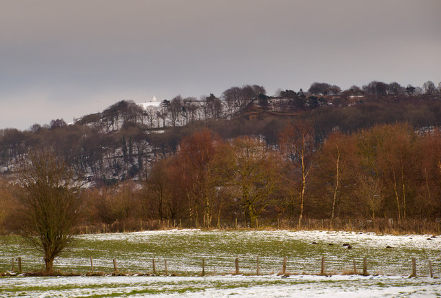
Kerridge is a village in Cheshire, England, part of the parish of Bollington. Kerridge borders the neighbouring parish of Rainow. It gives its name to Kerridge Ridge – one of the western foothills of the Pennines – by which it stands. It is overlooked by the local landmark of White Nancy. The local industries were quarrying and cotton mills, of which remnants remain. On 29 February 1912, the Macclesfield Canal at Kerridge burst its banks, flooding several nearby streets. Kerridge itself comes from 'key ridge', and was known in Old English Old English (, ), or Anglo-Saxon, is the earliest recorded form of the English language, spoken in England and southern and eastern Scotland in the early Middle Ages. It was brought to Great Britain by Anglo-Saxon settlement of Britain, Anglo ... as 'Gaeg Hrycg'. References External links Local webpage [...More Info...] [...Related Items...] OR: [Wikipedia] [Google] [Baidu] |


