|
Azat (river)
The Azat ( hy, Ազատ) is a river in the Kotayk Province of Armenia. Its source is on the western slope of the Geghama mountains. It flows through Garni, Lanjazat and Arevshat. It flows into the Aras near Artashat. The main purpose of the Azat dam is to serve for irrigation and hydro power generation. Its hazard potential is ranked to be high. The Azat is known in Armenia for its beauty. It flows for 55 kilometers and has a basin that occupies 578 square kilometers. The Azat passes through the Khosrov State Reserve. In its lower reaches, the river flows into the Ararat valley. The Azat is known for its numerous spectacular waterfalls and its rock choked river bed. Symphony of Stones One section of the Azat, where it meets River Goght, is particularly fascinating. It is a canyon known as Canyon of Garni. The canyon's formation is so unique that it almost looks artificial. The canyon is composed of regular hexagonal prisms. Near its end, the gorge's beautiful formation has prom ... [...More Info...] [...Related Items...] OR: [Wikipedia] [Google] [Baidu] |
Armenia
Armenia (), , group=pron officially the Republic of Armenia,, is a landlocked country in the Armenian Highlands of Western Asia.The UNbr>classification of world regions places Armenia in Western Asia; the CIA World Factbook , , and ''Oxford Reference Online'' also place Armenia in Asia. It is a part of the Caucasus region; and is bordered by Turkey to the west, Georgia to the north, the Lachin corridor (under a Russian peacekeeping force) and Azerbaijan to the east, and Iran and the Azerbaijani exclave of Nakhchivan to the south. Yerevan is the capital, largest city and the financial center. Armenia is a unitary, multi-party, democratic nation-state with an ancient cultural heritage. The first Armenian state of Urartu was established in 860 BC, and by the 6th century BC it was replaced by the Satrapy of Armenia. The Kingdom of Armenia reached its height under Tigranes the Great in the 1st century BC and in the year 301 became the first state in the world to adopt ... [...More Info...] [...Related Items...] OR: [Wikipedia] [Google] [Baidu] |
Aras (river)
, az, Araz, fa, ارس, tr, Aras The Aras (also known as the Araks, Arax, Araxes, or Araz) is a river in the Caucasus. It rises in eastern Turkey and flows along the borders between Turkey and Armenia, between Turkey and the Nakhchivan exclave of Azerbaijan, between Iran and both Azerbaijan and Armenia, and, finally, through Azerbaijan where it flows into the Kura river. It drains the south side of the Lesser Caucasus Mountains while the Kura drains the north side of the Lesser Caucasus. The river's total length is and its watershed covers an area of . The Aras is one of the longest rivers in the Caucasus. Names In classical antiquity, the river was known to the Greeks as Araxes ( gr, Ἀράξης). Its modern Armenian name is ''Arax'' or ''Araks'' ( hy, Արաքս). Historically it was also known as ''Yeraskh'' ( xcl, Երասխ) and its Old Georgian name is ''Rakhsi'' (). In Azerbaijani, the river's name is ''Araz''. In Persian and Kurdish its name is (''Aras''), an ... [...More Info...] [...Related Items...] OR: [Wikipedia] [Google] [Baidu] |
Kotayk Province
Kotayk ( hy, Կոտայք, ), is a province ('' marz'') of Armenia. It is located at the central part of the country. Its capital is Hrazdan and the largest city is Abovyan. It is named after the Kotayk canton of the historic Ayrarat province of Ancient Armenia. Kotayk is bordered by Lori Province from the north, Tavush Province from the northeast, Gegharkunik Province from the east, Aragatsotn Province from the west, and Ararat Province and the capital Yerevan from the south. Kotayk is the only province in Armenia that has no borders with foreign countries. The province is home to many ancient landmarks and tourist attractions in Armenia including the 1st-century Temple of Garni, the medieval Bjni Fortress, 11th-century Kecharis Monastery and the 13th-century monastery of Geghard. Kotayk is also home to the popular winter sports resort and the spa-town of Tsaghkadzor and the mountain resort of Aghveran. Etymology and symbol Kotayk Province is named after the historic Kotay ... [...More Info...] [...Related Items...] OR: [Wikipedia] [Google] [Baidu] |
Geghama Mountains
Gegham mountains (or Gegham Ridge, ISO 9985: Geġam), hy, Գեղամա լեռնաշղթա (''Geghama lernasheghta'') are a range of mountains in Armenia. The range is a tableland-type watershed basin of Sevan Lake from east, inflows of rivers Araks and Hrazdan from north and west, Azat and Vedi rivers from south-west and Arpachai river from south. The average elevation of the Gegham mountain range is near 2500m. The range is of volcanic origin including many extinct volcanoes. The range is 70 km length and 48 km width, and stretch between Lake Sevan and the Ararat plain. The highest peak of the Gegham mountains is the Azhdahak, at 3597m. They are formed by a volcanic field, containing Pleistocene-to-Holocene lava domes and cinder cones. The highland reaches a height of 1800–2000m up to 3000m in the dividing ridge. Geological history Volcanism in Armenia and in the Gegham mountains is related to mantle processes accompanying, but not necessarily related to the co ... [...More Info...] [...Related Items...] OR: [Wikipedia] [Google] [Baidu] |
Garni
Garni ( hy, Գառնի), is a major village in the Kotayk Province of Armenia. It is known for the nearby classical temple. As of the 2011 census, the population of the village is 6,910. History The settlement has an ancient history, and is best known for the Hellenistic Garni temple. The area was first occupied in the 3rd millennium BC along easily defensible terrain at one of the bends of the Azat River. In the 8th century BC the area was conquered by the Urartian King Argishti I. The fortification at Garni was erected probably sometime in the 3rd century BC as a summer residence for the Armenian Orontid and Artaxiad royal dynasties. Later around the 1st century AD the fortress of Garni became the last refuge of King Mithridates of Armenia and where he and his family were assassinated by his son-in-law and nephew Rhadamistus. The fortress was eventually sacked in 1386 by Timur Lenk. In 1679 an earthquake devastated the area destroying the temple. Monuments and landmark ... [...More Info...] [...Related Items...] OR: [Wikipedia] [Google] [Baidu] |
Lanjazat
Lanjazat ( hy, Լանջազատ, also Romanized as Landzhazat and Lendzhazat) is a town in the Ararat Province of Armenia. See also * Ararat Province Ararat ( hy, Արարատ, ), is a province ('' marz'') of Armenia. Its capital and largest city is the town of Artashat. The province is named after the biblical Mount Ararat. It is bordered by Turkey from the west and Azerbaijan's Nakhchivan ... References *World Gazeteer: Armenia– World-Gazetteer.com * Populated places in Ararat Province {{AraratAM-geo-stub ... [...More Info...] [...Related Items...] OR: [Wikipedia] [Google] [Baidu] |
Arevshat
Arevshat ( hy, Արևշատ) is a village in the Artashat Municipality of the Ararat Province of Armenia Armenia (), , group=pron officially the Republic of Armenia,, is a landlocked country in the Armenian Highlands of Western Asia.The UNbr>classification of world regions places Armenia in Western Asia; the CIA World Factbook , , and ' .... References *World Gazeteer: Armenia– World-Gazetteer.comReport of the results of the 2001 Armenian Census Populated places in Ararat Province {{AraratAM-geo-stub az:Ağ Baş ... [...More Info...] [...Related Items...] OR: [Wikipedia] [Google] [Baidu] |
Artashat, Armenia
Artashat ( hy, Արտաշատ), is a town and urban municipal community in Armenia serving as the administrative centre of Ararat Province. It is located on the Araks River in the Ararat plain, 30 km southeast of Yerevan. Artashat was founded in 1945 by the Soviet government of Armenia and named after the nearby ancient city of Artashat. Modern Artashat is on the Yerevan- Nakhchivan-Baku and Nakhchivan-Tabriz railway and on Yerevan-Goris-Stepanakert highway. The name of the city is derived from Iranian languages and means the "joy of Arta". Hewsen, Robert H.br>Artaxata Iranica. Accessed February 25, 2008. Tiratsyan, Gevorg. ''«Արտաշատ»'' rtashat Armenian Soviet Encyclopedia. Yerevan: Armenian Academy of Sciences, 1976, vol. 2, pp. 135-136. Founded by King Artashes I in 176 BC, ancient Artashat served as the capital of the Kingdom of Armenia from 185 BC until 120 AD, and was known as the "Vostan Hayots" or "court" or "seal of the Armenians". The town of Artashat ... [...More Info...] [...Related Items...] OR: [Wikipedia] [Google] [Baidu] |
Khosrov State Reserve
Khosrov Forest State Reserve ( hy, Խոսրովի անտառ պետական արգելոց), is a nature reserve in Ararat Province of Armenia. The reserve is one of the oldest protected areas in the world having a history of about 1700 years. It was founded in the 4th century (334–338) by the order of Khosrov Kotak, King of Armenia who gave it his name. It was founded to improve the natural climatic conditions of adjacent territories of Artashat – the capital city of Armenia of the given period and the newly established city of Dvin to ensure conservation and enrichment of flora and fauna species; serve as a ground for royal hunting, military exercises and entertainments. This area was designated as a state reserve in September 1958 and covers around at elevations from 700 to above sea level. The Khosrov reserve protects juniper (''Juniperus polycarpos'') and oak (''Quercus macranthera'') forests from Tertiary Period, arid associations of semi-desert and phrygana landsc ... [...More Info...] [...Related Items...] OR: [Wikipedia] [Google] [Baidu] |
Geography Of Armenia
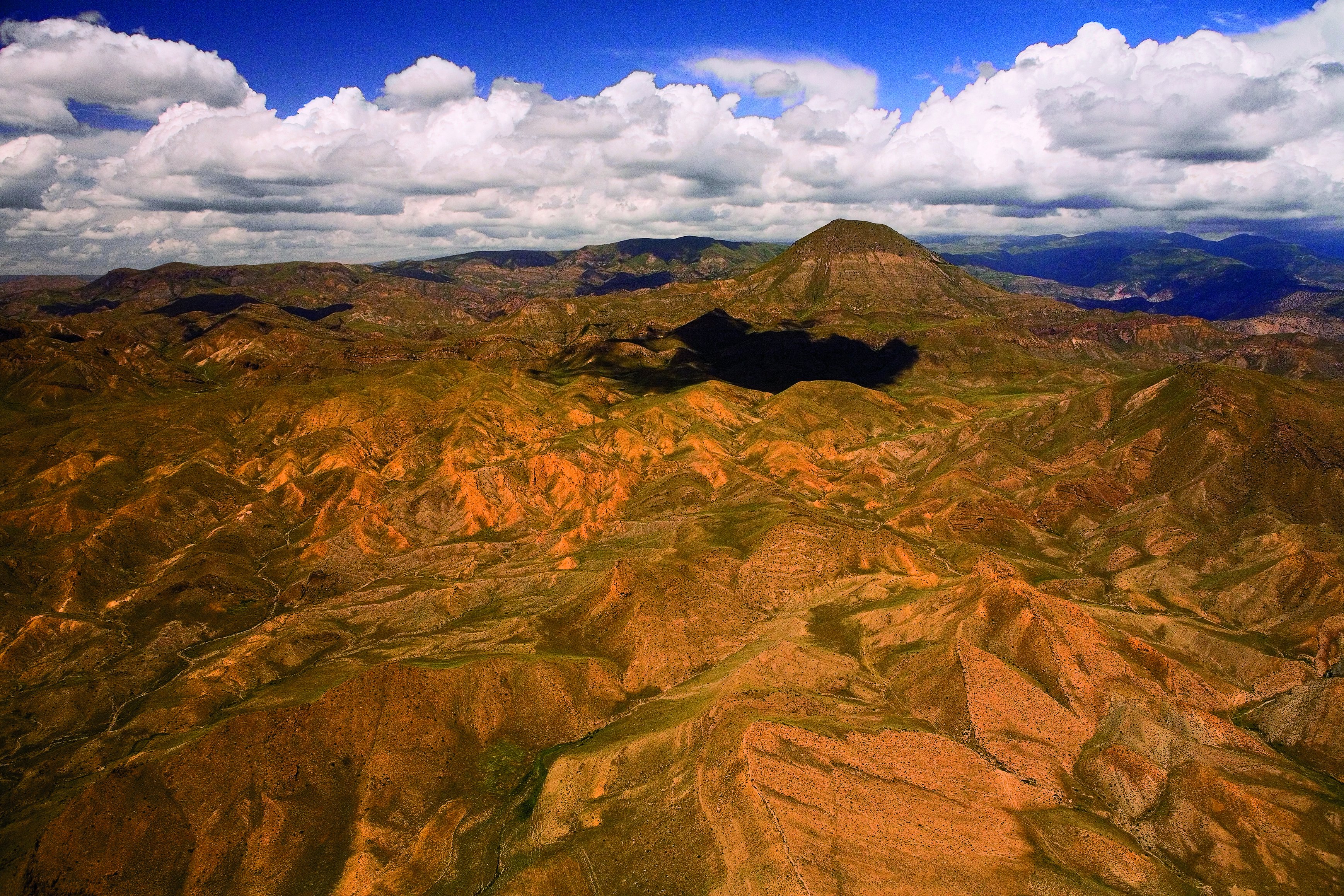
Armenia is a landlocked country in West Asia, situated in the Transcaucasus region of the South Caucasus, bordered on the north and east by Georgia and Azerbaijan and on the south and west by Iran, Azerbaijan's exclave Nakhchivan, and Turkey. The terrain is mostly mountainous and flat, with fast flowing rivers and few forests but with many trees. The climate is highland continental: hot summers and cold winters. The land rises to 4,090 m above sea-level at Mount Aragats. Physical environment Armenia is located in the southern Caucasus, the region southwest of Russia between the Black Sea and the Caspian Sea. Modern Armenia occupies part of historical Armenia, whose ancient centers were in the valley of the Araks River and the region around Lake Van in Turkey. Armenia is bordered on the north by Georgia, on the east by Azerbaijan, on the south by Iran, and on the west by Turkey. Topography and drainage Twenty-five million years ago, a geological upheaval pushed up the Eart ... [...More Info...] [...Related Items...] OR: [Wikipedia] [Google] [Baidu] |
List Of Rivers Of Armenia
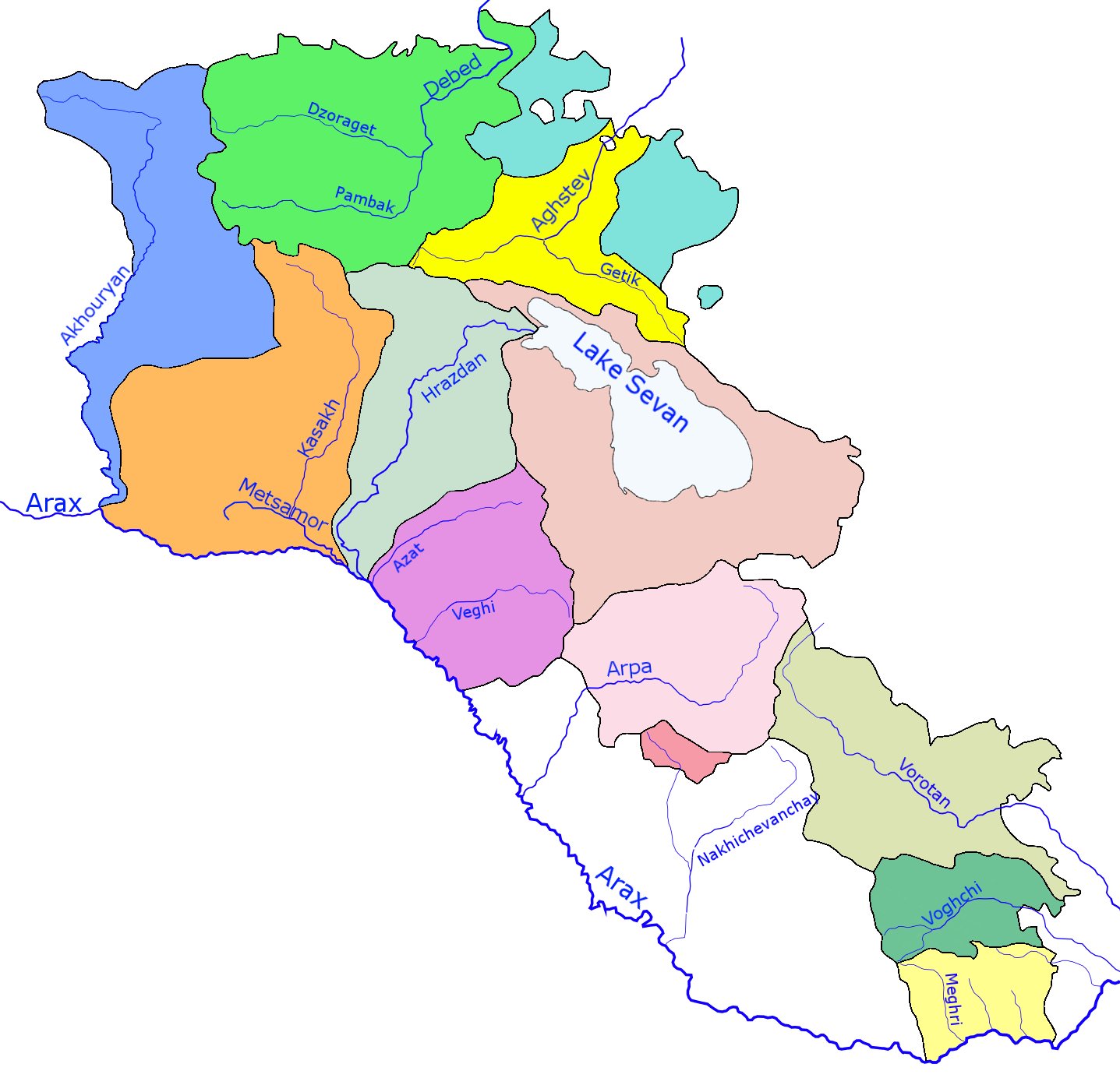
The rivers of Armenia are part of either the Caspian Sea or Lake Sevan watersheds. Throughout history Armenia has been called Nairi by the Assyrians meaning the "Land of the lakes and rivers" There are 16 rivers over long in or bordering Armenia. The longest river, Aras, has been mentioned in the Old Testament as one of the four sacred rivers of the Garden of Eden. There are about 9480 rivers and small streams in Armenia. List of rivers Approximately 4.7 percent of the territory of Armenia consists of rivers. The longest river of Armenia is the Aras (also called Araks, Arax), which lies on the country's border with Iran and a large part of the border with Turkey. Its major tributaries are the Akhuryan, Kasagh, Hrazdan, Azat, Arpa, Vorotan and Voghji rivers. The longest rivers in northwest part of the country are the Debed and Aghstafa, while shorter ones include the Dzoraget and the Pambak. Most of Armenia is drained into the Caspian Sea by the Araks or its tribu ... [...More Info...] [...Related Items...] OR: [Wikipedia] [Google] [Baidu] |
List Of Lakes Of Armenia ...
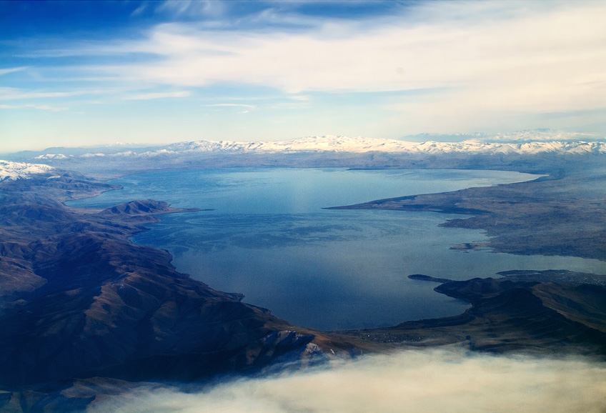
This is a list of lakes of Armenia. Lake Sevan, in Gegharkunik Province, is the largest body of water in Armenia and the entire Caucasus region. Armenia has one very large lake called Lake Sevan and more than 100 small mountain lakes. None of them, except Sevan and Lake Arpi, have yet been extensively studied. The water resources of the lakes amount to about , Sevan holding most of this, nearly (before the drainage it had almost ). Within the country's capital, Yerevan, it is possible to find small lakes, often in amusement parks. List See also * Geography of Armenia * List of rivers of Armenia References {{Asia topic, List of lakes of * lakes Armenia Armenia (), , group=pron officially the Republic of Armenia,, is a landlocked country in the Armenian Highlands of Western Asia.The UNbr>classification of world regions places Armenia in Western Asia; the CIA World Factbook , , and ''Ox ... [...More Info...] [...Related Items...] OR: [Wikipedia] [Google] [Baidu] |
.jpg)

.jpg)


