|
Axbridge
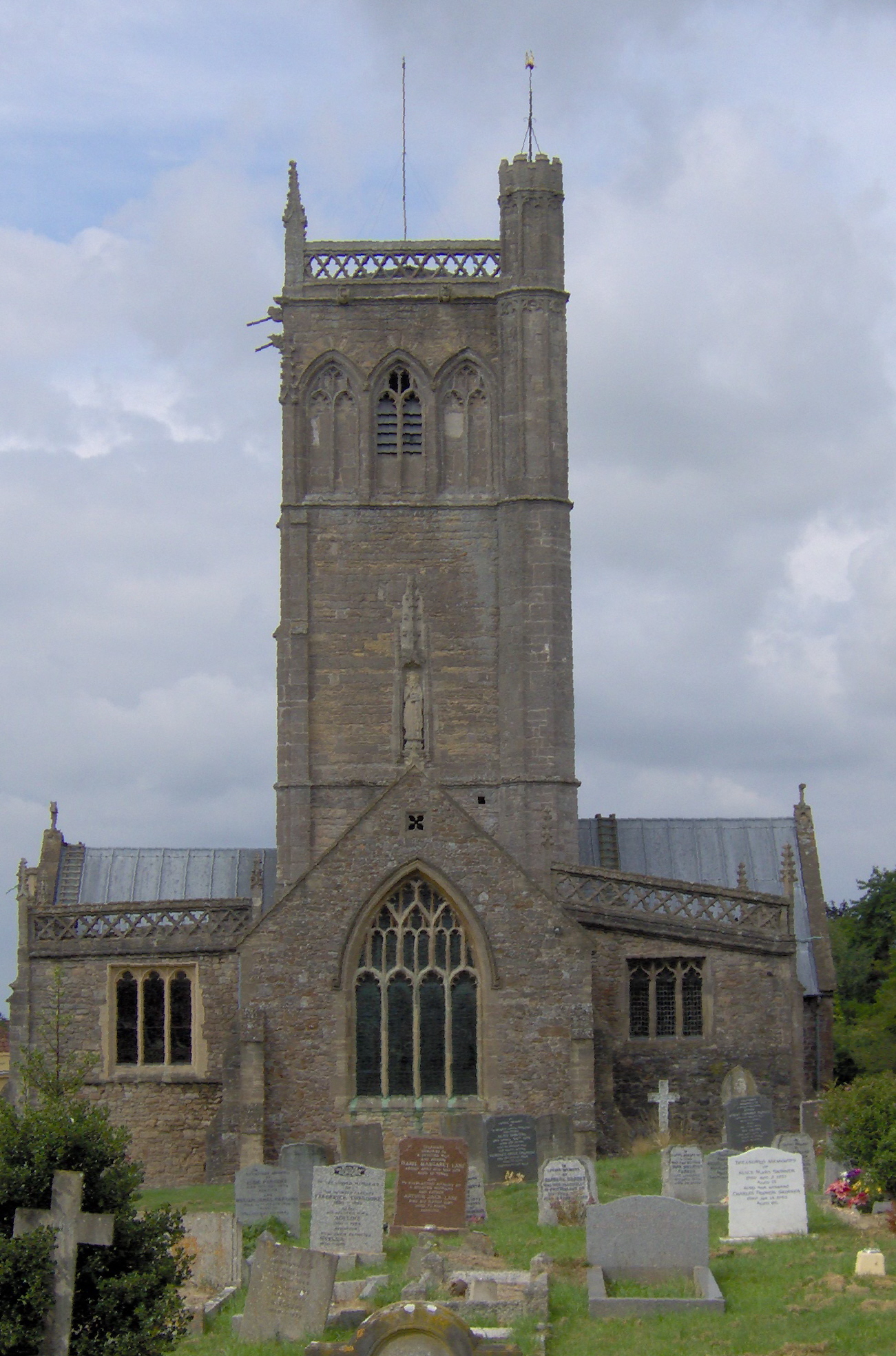
Axbridge is a small town in Somerset, England, in the Sedgemoor district on the River Axe, near the southern edge of the Mendip Hills. The town's population according to the 2011 census was 2,057. History ''Axanbrycg'' is suggested as the source of the name, meaning a bridge over the River Axe, in the early 9th century. Early inhabitants of the area almost certainly include the Romans (who are known to have mined lead on the top of the Mendips) and earlier still, prehistoric man, who lived in the local caves, and whose flint tools have been found on the slopes of the local hills. The history of Axbridge can be traced back to the reign of King Alfred when it was part of the Saxons' defence system for Wessex against the Vikings. In the Burghal Hidage, a list of ''burhs'' compiled in 910, it was listed as ''Axanbrycg''. A listing of Axbridge appears in the Domesday survey of 1086 as ', meaning 'axe bridge' from the Old English ' and '. It was part of the royal manor of Chedda ... [...More Info...] [...Related Items...] OR: [Wikipedia] [Google] [Baidu] |
King John's Hunting Lodge
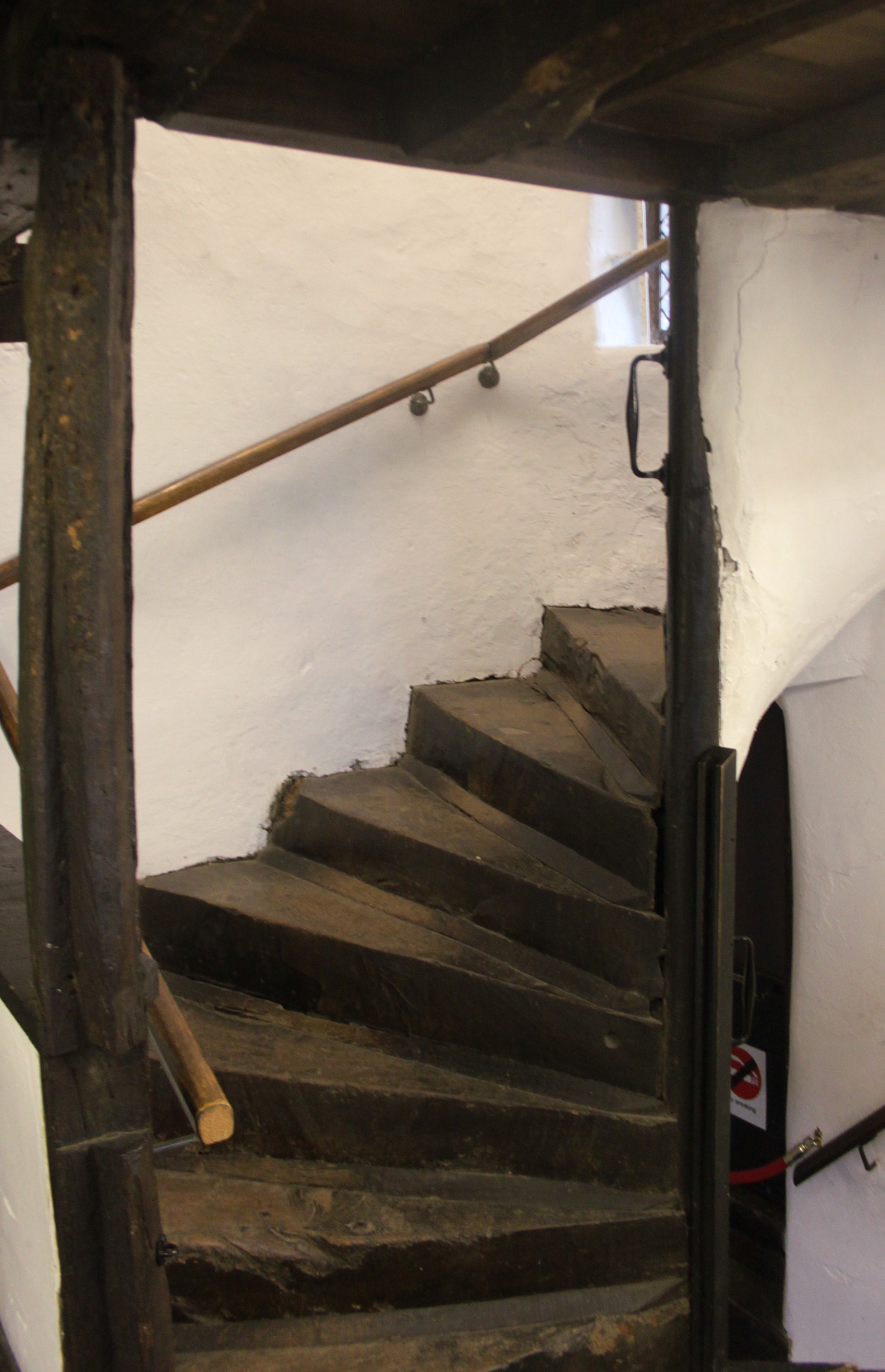
King John's Hunting Lodge is a wool-merchant's house built , long after the death of King John of England, King John in 1216, in Axbridge, a town in the English county of Somerset. It is a Jettying, jettied timber framing, timber-frame building of three storeys, occupying a corner plot on the town square. The building has served a variety of purposes with shops on the ground floor and workshops and living quarters on the first and second floors. At one time part of the building was occupied by the King's Head Inn; a sculpture of a king's head, which acted as a sign for the pub, is preserved within and a replica is attached to the outside. The lodge was bequeathed to the National Trust for Places of Historic Interest or Natural Beauty, National Trust in 1971, and repairs were undertaken to reverse significant deterioration to the building. The house is leased by the National Trust to Axbridge and District Museum Trust, who operate it as a local museum which includes exhibits rel ... [...More Info...] [...Related Items...] OR: [Wikipedia] [Google] [Baidu] |
Sedgemoor
Sedgemoor is a low-lying area of land in Somerset, England. It lies close to sea level south of the Polden Hills, historically largely marsh (or "moor" in its older sense). The eastern part is known as King's Sedgemoor, and the western part West Sedgemoor. Sedgemoor is part of the area now known as the Somerset Levels and Moors. Historically the area was known as the site of the Battle of Sedgemoor. Sedgemoor has given its name to a local government district formed on 1 April 1974, under the Local Government Act 1972, by a merger of the municipal borough of Bridgwater, the Burnham-on-Sea urban district, Bridgwater Rural District and part of Axbridge Rural District. The district covers a larger area than the historical Sedgemoor, extending north of the Polden Hills across the Somerset Levels and Moors to the Mendip Hills. On 1 April 2023 the district will be abolished and replaced by a new unitary district for the area at present served by Somerset County Council. The ne ... [...More Info...] [...Related Items...] OR: [Wikipedia] [Google] [Baidu] |
Axbridge Railway Station
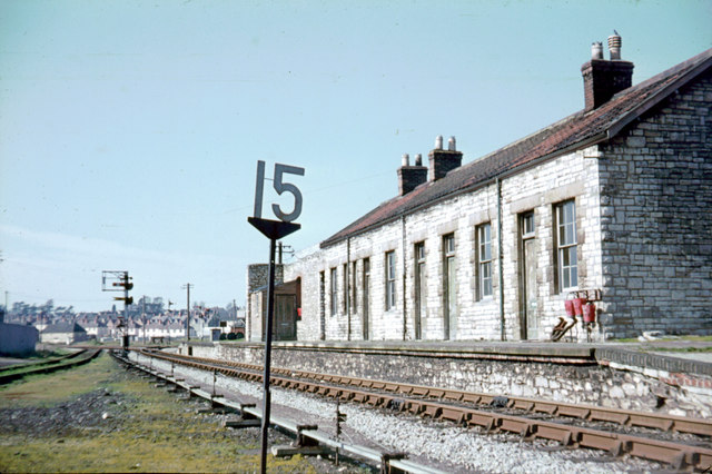
Axbridge railway station was a station on the Bristol and Exeter Railway's Cheddar Valley line in Axbridge, Somerset. Axbridge was one of the principal stations for the transport of strawberries, which led to the line's alternative name as The Strawberry Line. The station was opened with the broad gauge line to Cheddar in August 1869 as a two-platform station. The railway was extended to Wells in 1870, converted to standard gauge in the mid-1870s and then linked up to the East Somerset Railway to provide through services from Yatton to Witham in 1878. All the railways involved were absorbed into the Great Western Railway in the 1870s. This in turn was nationalised into the Western Region of British Railways on 1 January 1948. The site today The Yatton to Witham line closed to passengers in September 1963 and Yatton-Cheddar closed to goods in October 1964. Axbridge station buildings, which are of a substantial Bristol and Exeter Railway design in local Mendip stone, have been us ... [...More Info...] [...Related Items...] OR: [Wikipedia] [Google] [Baidu] |
Cheddar Valley Line
The Cheddar Valley line was a railway line in Somerset, England, running between Yatton and Witham. It was opened in parts: the first section connecting Shepton Mallet to Witham, later extended to Wells, was built by the East Somerset Railway from 1858. Later the Bristol and Exeter Railway built their branch line from Yatton to Wells, but the two lines were prevented for a time from joining up. Eventually the gap was closed, and the line became a simple through line, operated by the Great Western Railway. The line became known as ''The Strawberry Line'' because of the volume of locally-grown strawberries that it carried. It closed in 1963. Sections of the former trackbed have been opened as the ''Strawberry Line Trail'', which runs from Yatton to Cheddar. The southern section operates as a heritage railway using the name East Somerset Railway. History Main line railways Important inland market towns suddenly found themselves at a huge disadvantage when trunk railways connected ... [...More Info...] [...Related Items...] OR: [Wikipedia] [Google] [Baidu] |
Somerset
( en, All The People of Somerset) , locator_map = , coordinates = , region = South West England , established_date = Ancient , established_by = , preceded_by = , origin = , lord_lieutenant_office =Lord Lieutenant of Somerset , lord_lieutenant_name = Mohammed Saddiq , high_sheriff_office =High Sheriff of Somerset , high_sheriff_name = Mrs Mary-Clare Rodwell (2020–21) , area_total_km2 = 4171 , area_total_rank = 7th , ethnicity = 98.5% White , county_council = , unitary_council = , government = , joint_committees = , admin_hq = Taunton , area_council_km2 = 3451 , area_council_rank = 10th , iso_code = GB-SOM , ons_code = 40 , gss_code = , nuts_code = UKK23 , districts_map = , districts_list = County council area: , MPs = * Rebecca Pow (C) * Wera Hobhouse ( LD) * Liam Fox (C) * David Warburton (C) * Marcus Fysh (C) * Ian Liddell-Grainger (C) * James Heappey (C) * Jacob Rees-Mogg (C) * John Penrose (C) , police = Avon and Somerset Police ... [...More Info...] [...Related Items...] OR: [Wikipedia] [Google] [Baidu] |
Wells (UK Parliament Constituency)
Wells is a constituency represented in the House of Commons of the UK Parliament since 2015 by James Heappey of the Conservative Party. History The original two-member borough constituency was created in 1295, and abolished by the Reform Act 1867 with effect from the 1868 general election. Its revival saw a more comparable size of electorate across the country and across Somerset, with a large swathe of the county covered by this new seat, under the plans of the third Reform Act and the connected Redistribution of Seats Act 1885 which was enacted the following year. ;Political history The seat was largely Conservative-held during the 20th century and has never elected a Labour MP ever in its history. The only other political party to have been represented is the Liberal Democrats or their predecessor, the Liberal Party, who achieved a marginal victory in 2010, see marginal seat. ;Prominent frontbenchers Sir William Hayter was chief government whip of the Commons under t ... [...More Info...] [...Related Items...] OR: [Wikipedia] [Google] [Baidu] |
Winterstoke
The Hundred of Winterstoke is one of the 40 historical Hundreds in the ceremonial county of Somerset, England, dating from before the Norman conquest during the Anglo-Saxon era although exact dates are unknown. Each hundred had a 'fyrd', which acted as the local defence force and a court which was responsible for the maintenance of the frankpledge system. They also formed a unit for the collection of taxes. The role of the hundred court was described in the Dooms (laws) of King Edgar. The name of the hundred was normally that of its meeting-place. It consisted of the ancient parishes of: Axbridge, Badgworth, Banwell, Blagdon, Bleadon, Cheddar, Christon, Churchill, Compton Bishop, Congresbury, East Harptree, Hutton, Kenn, Kewstoke, Locking, Loxton, Puxton, Rodney Stoke, Rowberrow, Shipham, Uphill, Weston-super-Mare, Wick St Lawrence, Winscombe, Worle, Yatton. It also included the extra parochial area of Charterhouse-on-Mendip, covering in total approximately . The hundred ... [...More Info...] [...Related Items...] OR: [Wikipedia] [Google] [Baidu] |
Mendip Hills
The Mendip Hills (commonly called the Mendips) is a range of limestone hills to the south of Bristol and Bath in Somerset, England. Running from Weston-super-Mare and the Bristol Channel in the west to the Frome valley in the east, the hills overlook the Somerset Levels to the south and the Chew Valley and other tributaries of the Avon to the north. The hills give their name to the local government district of Mendip, which administers most of the area. The higher, western part of the hills, covering has been designated an Area of Outstanding Natural Beauty (AONB), which gives it a level of protection comparable to a national park. The hills are largely formed from Carboniferous Limestone, which is quarried at several sites. Ash–maple woodland, calcareous grassland and mesotrophic grassland which can be found across the Mendip Hills provide nationally important semi-natural habitats. With their temperate climate these support a range of flora and fauna including birds, but ... [...More Info...] [...Related Items...] OR: [Wikipedia] [Google] [Baidu] |
River Axe (Bristol Channel)
The River Axe is a river in South West England. The river is formed by water entering swallets in the limestone and rises from the ground at Wookey Hole Caves in the Mendip Hills in Somerset, and runs through a V-shaped valley. The geology of the area is limestone and the water reaches Wookey Hole in a series of underground channels that have eroded through the soluble limestone. The river mouth is in Weston Bay on the Bristol Channel. The river was navigable from the middle ages until 1915, during early centuries of which seeing some European trade. Geography The River Axe is formed by the water entering the cave systems and flows through the third and first chambers, from which it flows to the resurgence, through two sumps and long, where it leaves the cave and enters the open air. It is the second largest resurgence on Mendip, with an estimated catchment area of , and an average discharge of per second. Some of the water is allogenic in origin i.e. drained off ... [...More Info...] [...Related Items...] OR: [Wikipedia] [Google] [Baidu] |
Burghal Hidage
The Burghal Hidage () is an Anglo-Saxon document providing a list of over thirty fortified places (burhs), the majority being in the ancient Kingdom of Wessex, and the taxes (recorded as numbers of hides) assigned for their maintenance.Hill/ Rumble. The Defence of Wessex. p. 5 The document, so named by Frederic William Maitland in 1897, survives in two versions of medieval and early modern date. Version A, Cotton Otho B.xi was badly damaged in a fire at Ashburnham House in 1731 but the body of the text survives in a transcript made by the antiquary Laurence Nowell in 1562. Version B survives as a composite part of seven further manuscripts, usually given the title ''De numero hydarum Anglie in Britannia''.Hill/ Rumble. The Defence of Wessex. p. 14 There are several discrepancies in the lists recorded in the two versions of the document: Version A includes references to Burpham, Wareham and Bridport but omits Shaftesbury and Barnstaple which are listed in Version B. Version B also n ... [...More Info...] [...Related Items...] OR: [Wikipedia] [Google] [Baidu] |
Flint
Flint, occasionally flintstone, is a sedimentary cryptocrystalline form of the mineral quartz, categorized as the variety of chert that occurs in chalk or marly limestone. Flint was widely used historically to make stone tools and start fires. It occurs chiefly as nodules and masses in sedimentary rocks, such as chalks and limestones.''The Flints from Portsdown Hill'' Inside the nodule, flint is usually dark grey, black, green, white or brown in colour, and often has a glassy or waxy appearance. A thin layer on the outside of the nodules is usually different in colour, typically white and rough in texture. The nodules can often be found along s and |


