|
Aulnay, Charente-Maritime
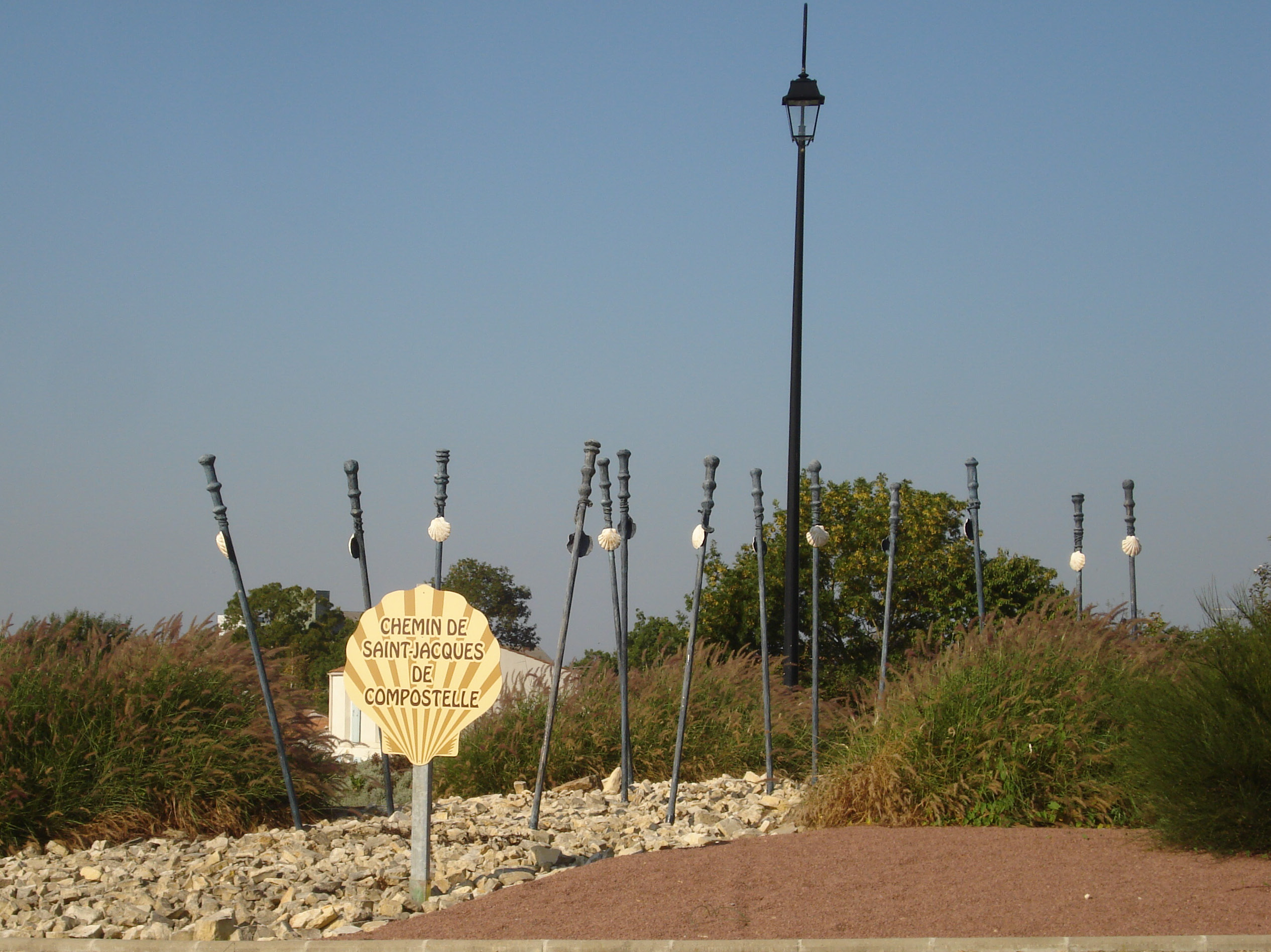
Aulnay, commonly referred to as Aulnay-de-Saintonge (), is a commune in the Charente-Maritime department, region of Nouvelle-Aquitaine (before 2015: Poitou-Charentes), France. The inhabitants of the commune are known as ''Aulnaysiens'' or ''Aulnaysiennes''. Geography Aulnay is located on the ''Via Turonensis''. one of the Ways of St. James some 45 km east by south-east of Surgères and 17 km north-east of Saint-Jean-d'Angély. Access to the commune is by the D950 from Les Églises-d'Argenteuil in the south-west which passes through the commune just west of the town and continues to La Villedieu in the north. The D121 comes from Saint-Georges-de-Longuepierre in the north-west passing through the town and continuing south to Cherbonnières. The D129 comes from Varaize in the south passing through the town and continuing north-east to Saint-Mandé-sur-Brédoire. The D133 goes from the town south-east to Néré. In the commune there is the village of La Cressoniere ... [...More Info...] [...Related Items...] OR: [Wikipedia] [Google] [Baidu] |
Communes Of France
The () is a level of administrative division in the French Republic. French are analogous to civil townships and incorporated municipalities in the United States and Canada, ' in Germany, ' in Italy, or ' in Spain. The United Kingdom's equivalent are civil parishes, although some areas, particularly urban areas, are unparished. are based on historical geographic communities or villages and are vested with significant powers to manage the populations and land of the geographic area covered. The are the fourth-level administrative divisions of France. vary widely in size and area, from large sprawling cities with millions of inhabitants like Paris, to small hamlets with only a handful of inhabitants. typically are based on pre-existing villages and facilitate local governance. All have names, but not all named geographic areas or groups of people residing together are ( or ), the difference residing in the lack of administrative powers. Except for the municipal arrondi ... [...More Info...] [...Related Items...] OR: [Wikipedia] [Google] [Baidu] |
Néré
Néré () is a commune in the Charente-Maritime department in southwestern France. Population See also *Communes of the Charente-Maritime department The following is a list of the 463 communes of the Charente-Maritime department of France. The communes cooperate in the following intercommunalities (as of 2020):Communes of Charente-Maritime Charente-Maritime communes articles needing translation from French Wikipedia {{CharenteMaritime-geo-stub ... [...More Info...] [...Related Items...] OR: [Wikipedia] [Google] [Baidu] |
Poitiers
Poitiers (, , , ; Poitevin: ''Poetàe'') is a city on the River Clain in west-central France. It is a commune and the capital of the Vienne department and the historical centre of Poitou. In 2017 it had a population of 88,291. Its agglomeration has 130,853 inhabitants in 2016 and is the center of an urban area of 261,795 inhabitants. With more than 29,000 students, Poitiers has been a major university city since the creation of its university in 1431, having hosted René Descartes, Joachim du Bellay and François Rabelais, among others. A city of art and history, still known as "''Ville aux cent clochers''" the centre of town is picturesque and its streets include predominantly historical architecture and half-timbered houses, especially religious architecture, mostly from the Romanesque period ; including notably the Saint-Jean baptistery (4th century), the hypogeum of the Dunes (7th century), the Notre-Dame-la-Grande church (12th century), the Saint-Porchaire church (12th ... [...More Info...] [...Related Items...] OR: [Wikipedia] [Google] [Baidu] |
Saintes, Charente-Maritime
Saintes (; Poitevin-Saintongeais: ''Sénte'') is a commune and historic town in western France, in the Charente-Maritime department of which it is a sub-prefecture, in Nouvelle-Aquitaine. Its inhabitants are called ''Saintaises'' and ''Saintais''. Saintes is the second-largest city in Charente-Maritime, with inhabitants in 2008. The city's immediate surroundings form the second-most populous metropolitan area in the department, with inhabitants. While a majority of the surrounding landscape consists of fertile, productive fields, a significant minority of the region remains forested, its natural state. In Roman times, Saintes was known as ''Mediolanum Santonum''. During much of its history, the name of the city was spelled Xaintes or Xainctes. Primarily built on the left bank of the Charente, Saintes became the first Roman capital of Aquitaine. Later it was designated as the capital of the province of Saintonge under the Ancien Régime. Following the French Revolution, it bri ... [...More Info...] [...Related Items...] OR: [Wikipedia] [Google] [Baidu] |
Roman Road
Roman roads ( la, viae Romanae ; singular: ; meaning "Roman way") were physical infrastructure vital to the maintenance and development of the Roman state, and were built from about 300 BC through the expansion and consolidation of the Roman Republic and the Roman Empire. They provided efficient means for the overland movement of armies, officials, civilians, inland carriage of official communications, and trade goods. Roman roads were of several kinds, ranging from small local roads to broad, long-distance highways built to connect cities, major towns and military bases. These major roads were often stone-paved and metaled, cambered for drainage, and were flanked by footpaths, bridleways and drainage ditches. They were laid along accurately surveyed courses, and some were cut through hills, or conducted over rivers and ravines on bridgework. Sections could be supported over marshy ground on rafted or piled foundations.Corbishley, Mike: "The Roman World", page 50. Warwick Press, ... [...More Info...] [...Related Items...] OR: [Wikipedia] [Google] [Baidu] |
Gallo-Roman
Gallo-Roman culture was a consequence of the Romanization of Gauls under the rule of the Roman Empire. It was characterized by the Gaulish adoption or adaptation of Roman culture, language, morals and way of life in a uniquely Gaulish context. The well-studied meld of cultures in Gaul gives historians a model against which to compare and contrast parallel developments of Romanization in other, less-studied Roman provinces. ''Interpretatio romana'' offered Roman names for Gaulish deities such as the smith-god Gobannus, but of Celtic deities only the horse-patroness Epona penetrated Romanized cultures beyond the confines of Gaul. The barbarian invasions beginning in the late third century forced upon Gallo-Roman culture fundamental changes in politics, in the economic underpinning, in military organization. The Gothic settlement of 418 offered a double loyalty, as Western Roman authority disintegrated at Rome. The plight of the highly Romanized governing class is examined by ... [...More Info...] [...Related Items...] OR: [Wikipedia] [Google] [Baidu] |
Tabula Peutingeriana
' (Latin Language, Latin for "The Peutinger Map"), also referred to as Peutinger's Tabula or Peutinger Table, is an illustrated ' (ancient Roman road map) showing the layout of the ''cursus publicus'', the road network of the Roman Empire. The map is a 13th-century parchment copy of a possible Roman original. It covers Europe (without the Iberian Peninsula and the British Isles), North Africa, and parts of Asia, including the Middle East, Persia, and India. According to one hypothesis, the existing map is based on a document of the 4th or 5th century that contained a copy of the world map originally prepared by Marcus Vipsanius Agrippa, Agrippa during the reign of the emperor Augustus (27 BC – AD 14). However, Emily Albu has suggested that the existing map could instead be based on an original from the Carolingian period. The map was likely stolen by the renowned humanist Conrad Celtes, who bequeathed it to his friend, the economist and archaeologist Konrad Peutinger, who gave ... [...More Info...] [...Related Items...] OR: [Wikipedia] [Google] [Baidu] |
Antoninus Pius
Antoninus Pius (Latin: ''Titus Aelius Hadrianus Antoninus Pius''; 19 September 86 – 7 March 161) was Roman emperor from 138 to 161. He was the fourth of the Five Good Emperors from the Nerva–Antonine dynasty. Born into a senatorial family, Antoninus held various offices during the reign of Emperor Hadrian. He married Hadrian's niece Faustina, and Hadrian adopted him as his son and successor shortly before his death. Antoninus acquired the cognomen Pius after his accession to the throne, either because he compelled the Senate to deify his adoptive father, or because he had saved senators sentenced to death by Hadrian in his later years. His reign is notable for the peaceful state of the Empire, with no major revolts or military incursions during this time. A successful military campaign in southern Scotland early in his reign resulted in the construction of the Antonine Wall. Antoninus was an effective administrator, leaving his successors a large surplus in the t ... [...More Info...] [...Related Items...] OR: [Wikipedia] [Google] [Baidu] |
Saint-Pierre-de-l'Isle
Saint-Pierre-de-l'Isle () is a Communes of France, commune in the Charente-Maritime Departments of France, department in southwestern France. INSEE Population Geography The commune is traversed by the river Boutonne.See also *Communes of the Charente-Maritime departmentReferences Communes of Charente-Maritime Charente-Maritime communes articles needing translation from French Wikipedia {{CharenteMaritime-geo-stub ...[...More Info...] [...Related Items...] OR: [Wikipedia] [Google] [Baidu] |
Paillé
Paillé () is a commune in the Charente-Maritime department in southwestern France. Population See also * Communes of the Charente-Maritime department The following is a list of the 463 communes of the Charente-Maritime department of France. The communes cooperate in the following intercommunalities (as of 2020):Communes of Charente-Maritime {{CharenteMaritime-geo-stub ... [...More Info...] [...Related Items...] OR: [Wikipedia] [Google] [Baidu] |
Contré
Contré () is a commune in the Charente-Maritime department in southwestern France. Population See also *Communes of the Charente-Maritime department The following is a list of the 463 communes of the Charente-Maritime department of France. The communes cooperate in the following intercommunalities (as of 2020):Communes of Charente-Maritime Charente-Maritime communes articles needing translation from French Wikipedia {{CharenteMaritime-geo-stub ... [...More Info...] [...Related Items...] OR: [Wikipedia] [Google] [Baidu] |
Saint-Pardoult
Saint-Pardoult () is a commune in the Charente-Maritime department in southwestern France. Geography The village lies on the right bank of the Boutonne, which forms all of the commune's eastern border. Population See also *Communes of the Charente-Maritime department The following is a list of the 463 communes of the Charente-Maritime department of France. The communes cooperate in the following intercommunalities (as of 2020):Communes of Charente-Maritime Charente-Maritime communes articles needing ... [...More Info...] [...Related Items...] OR: [Wikipedia] [Google] [Baidu] |


