|
Auburndale Station (MBTA)
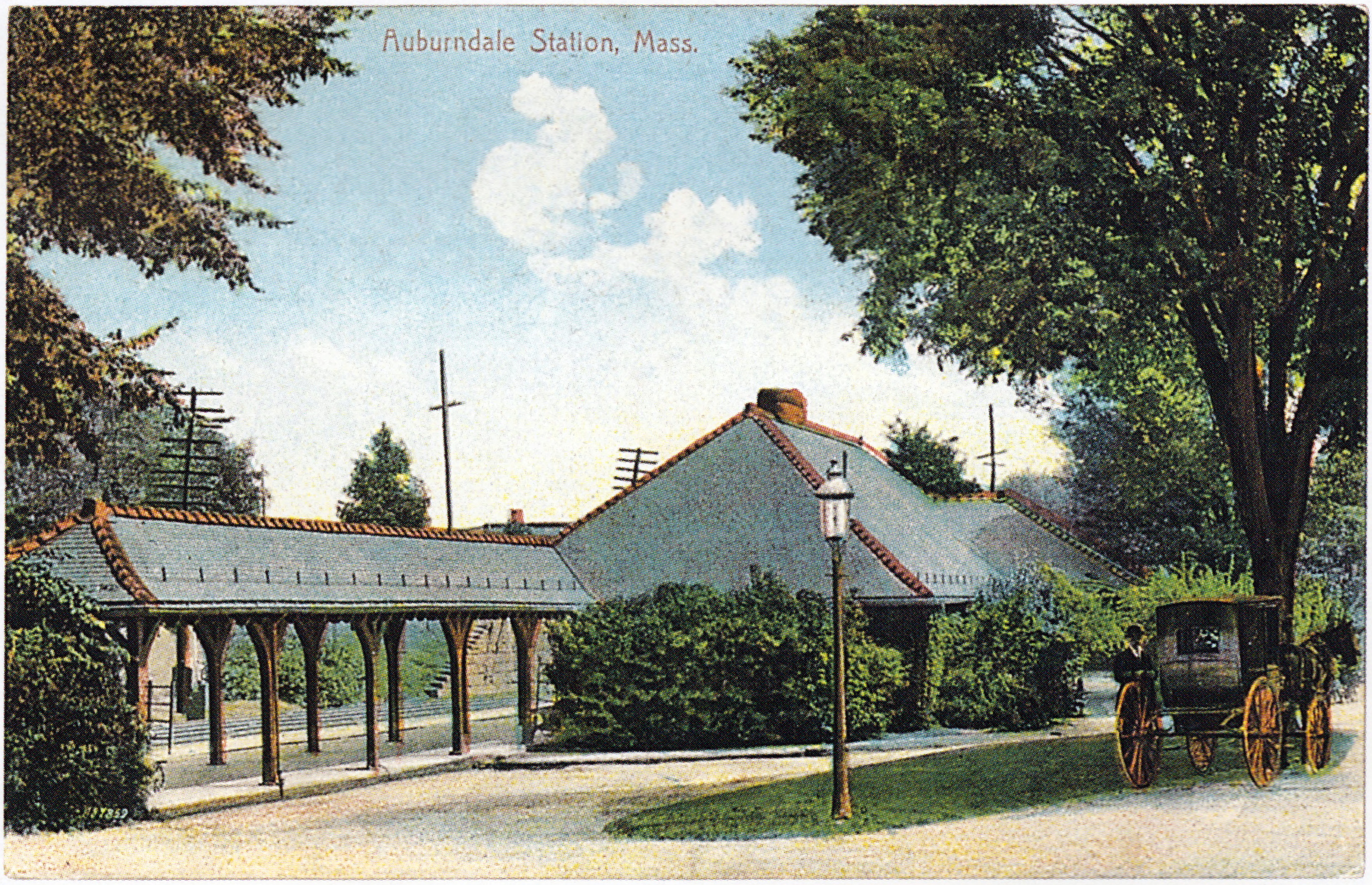
Auburndale station is an MBTA Commuter Rail station in Auburndale, Massachusetts. It serves the Framingham/Worcester Line. It is located next to the Massachusetts Turnpike near Lasell College. The modern station platform, built around 1961, replaced a highly acclaimed 1881 depot building designed by H. H. Richardson. A full renovation of the station for accessibility is planned. History Opening The Boston and Worcester Railroad opened the segment from West Newton to Wellesley Hills in July 1834. A second track was added in 1839, and in 1843 the railroad began offering season fares for around $60, making it one of the first commuter rail systems. Due to the popularity of the other Newton stops, a station at Auburndale was opened in the early 1850s. The depot was located on the south side of the tracks in a large open area at the intersection of Auburn Street, Lexington Street, and several other roads. In 1867, the Boston & Worcester joined with the Western Railroad to become the ... [...More Info...] [...Related Items...] OR: [Wikipedia] [Google] [Baidu] |
Auburndale, Massachusetts
Auburndale is one of the thirteen villages within the city of Newton in Middlesex County, Massachusetts, United States. It lies at the western end of Newton near the intersection of interstate highways 90 and 95. It is bisected by the Massachusetts Turnpike (Interstate 90). Auburndale is surrounded by three other Newton villages ( West Newton, Waban, and Newton Lower Falls) as well as the city of Waltham and the Charles River. Auburndale is the home of Williams and Burr elementary schools, as well as Lasell College. Auburndale Square is the location of the Plummer Memorial Library, which is run by the Auburndale Community Library and no longer affiliated with the Newton Free Library, the Turtle Lane Playhouse, and many small businesses. History The first major settler in the area was William Robinson who built a house in 1678 on what is now Freeman Street. The oldest house in Auburndale stands at 473 Auburn Street and was built in 1730 by William Robinson. Auburndale, once ... [...More Info...] [...Related Items...] OR: [Wikipedia] [Google] [Baidu] |
Union Station (Palmer, Massachusetts)
Union Station is a historic former railroad station located in downtown Palmer, Massachusetts. The building, which was designed by American architect H. H. Richardson, opened in June 1884 to consolidate two separate stations nearby. The grounds of the station were originally designed by Frederick Law Olmsted. It is located at the junction of the Boston and Albany Railroad (later part of the New York Central Railroad, and now the CSX Boston Subdivision), the New London Northern Railroad (later the Central Vermont Railway, now the New England Central Railroad), and the Ware River Railroad (later under the New York Central, and now operated by the Massachusetts Central Railroad). History Three railroads The Western Railroad opened from Worcester to Springfield, Massachusetts in 1839, and on to Albany, New York in 1841. In 1867, it joined with the Boston and Worcester Railroad to form the Boston and Albany Railroad. The B&A had a station, similar in design to the extant station ... [...More Info...] [...Related Items...] OR: [Wikipedia] [Google] [Baidu] |
MBTA Accessibility
The Massachusetts Bay Transportation Authority (MBTA) system is mostly but not fully accessible. Like most American mass transit systems, much of the MBTA subway and commuter rail were built before wheelchair access became a requirement under the Americans with Disabilities Act of 1990. The MBTA has renovated most stations to be compliant with the ADA, and all stations built since 1990 are accessible. The MBTA also has a paratransit program, The Ride, which provides accessible vehicles to transport passengers who cannot use the fixed-route system. Much of the MBTA subway system is accessible: all Orange and Red Line stations, and all but one Blue Line station, are accessible. Most of the underground portion of the Green Line is accessible, though only some surface stops are; all but one stop on the Ashmont–Mattapan High-Speed Line are accessible. About three-quarters of the MBTA Commuter Rail system is accessible, including the North Station and South Station terminals. All ... [...More Info...] [...Related Items...] OR: [Wikipedia] [Google] [Baidu] |
Woodland Road Stairs And Auburndale Platform
A woodland () is, in the broad sense, land covered with trees, or in a narrow sense, synonymous with wood (or in the U.S., the '' plurale tantum'' woods), a low-density forest forming open habitats with plenty of sunlight and limited shade (see differences between British, American, and Australian English explained below). Woodlands may support an understory of shrubs and herbaceous plants including grasses. Woodland may form a transition to shrubland under drier conditions or during early stages of primary or secondary succession. Higher-density areas of trees with a largely closed canopy that provides extensive and nearly continuous shade are often referred to as forests. Extensive efforts by conservationist groups have been made to preserve woodlands from urbanization and agriculture. For example, the woodlands of Northwest Indiana have been preserved as part of the Indiana Dunes. Definitions United Kingdom ''Woodland'' is used in British woodland management to mean ... [...More Info...] [...Related Items...] OR: [Wikipedia] [Google] [Baidu] |
Route 128 (Massachusetts)
Route 128, known as the Yankee Division Highway, is a state highway in the U.S. state of Massachusetts maintained by the Highway Division of the Massachusetts Department of Transportation (MassDOT). Spanning , it is one of two beltways (the other being Interstate 495) around Boston, and is known as the "inner" beltway, especially around areas where it is or less outside of Boston. The route's current southern terminus is at the junction of I-95 and I-93 in Canton, and it is concurrent with I-95 around Boston for before it leaves the interstate and continues on its own in a northeasterly direction towards Cape Ann. The northern terminus lies in Gloucester a few hundred feet from the Atlantic Ocean. All but the northernmost 3 miles are divided highway, with the remainder being a surface road. Its concurrency with I-95 makes up most of its length. Originally designated in 1927 along a series of surface streets, Route 128 provided a circumferential route around the city of Bos ... [...More Info...] [...Related Items...] OR: [Wikipedia] [Google] [Baidu] |
Auburndale Shelter Front
Auburndale may refer to: * Auburndale, Alberta * Auburndale, Nova Scotia * Auburndale, Florida * Auburndale, Louisville, Kentucky, a neighborhood * Auburndale, Massachusetts ** Auburndale station (MBTA) * Auburndale, Wisconsin * Auburndale (town), Wisconsin * Auburndale, Queens, a New York City neighborhood ** Auburndale station (LIRR) See also * Auburndale, a canceled product in the list of Intel microprocessors {{disambiguation, geo ... [...More Info...] [...Related Items...] OR: [Wikipedia] [Google] [Baidu] |
Orchard Park, New York
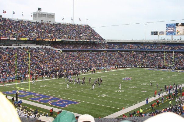
Orchard Park is a town in Erie County, New York. It is an outer ring suburb southeast of Buffalo. As of the 2010 census, the population was 29,054, representing an increase of 5.13% from the 2000 census figure. The town contains a village also named Orchard Park. Orchard Park is one of the "Southtowns" of Erie County and is best known as the site of Highmark Stadium, home of the National Football League's Buffalo Bills. History In 1803, Didymus C. Kinney and wife Phebe (Hartwell) purchased land and built a cabin in the southwest corner of the township, which has since been turned into a museum. The following year, a migration of Quaker settlers began. The town was separated from the town of Hamburg in 1850 and was first named "Ellicott", after Joseph Ellicott, an agent of the Holland Land Company. Within months, the name was changed to the town of "East Hamburgh". Around 1934, the town was renamed "Orchard Park" after its principal settlement. In the early 1900s, a large f ... [...More Info...] [...Related Items...] OR: [Wikipedia] [Google] [Baidu] |
Buffalo, Rochester And Pittsburgh Railway
The Buffalo, Rochester, and Pittsburgh Railway was one of the more than ten thousand railroad companies founded in North America. It lasted much longer than most, serving communities from the shore of Lake Ontario to the center of western Pennsylvania. Purpose By the middle of the 19th century, American industry had found the means of both utilizing the bituminous coal of western Pennsylvania and transporting it economically from the mines to those who needed it.That is to say, the technology had been proved. It had not yet been implemented. Initially, this meant steam power, in both the railroad locomotives and the factories. The immediate consequence was the need for a railroad line to haul coal from the hills of Pennsylvania to the cities of Rochester and Buffalo as well as the smaller towns and villages. The needs of the latter motivated them to invest, both individually and municipally, in the new rail companies that arose almost as profusely as spring flowers. In the ... [...More Info...] [...Related Items...] OR: [Wikipedia] [Google] [Baidu] |
Buffalo, Rochester And Pittsburgh Railway Station (Orchard Park, New York)
Orchard Park station is a historic railway station located at Orchard Park in Erie County, New York. It was constructed in 1911 and served passenger trains until the 1950s. History The property includes the passenger depot and brick freight house both constructed in 1911, tracks, a concrete bumper post, a semaphore signal, a portion of the entrance drive, and four period rail cars. The station's plan is based largely on one designed by Henry Hobson Richardson for the 1884 station at Auburndale, Massachusetts, which was demolished in 1961 after 80 years in service. ''Note:'' This includes an''Accompanying photographs''/ref> When the Buffalo, Rochester and Pittsburgh Railway (BR&P) was acquired by the Baltimore and Ohio Railroad, Orchard Park Station became a B&O station. It was a flag stop on day and nighttime trains on the BRP route between Lackawanna Terminal in Buffalo and Baltimore and Ohio Station in Pittsburgh. The B&O terminated passenger service in 1955, eight years ... [...More Info...] [...Related Items...] OR: [Wikipedia] [Google] [Baidu] |
Parthenocissus Tricuspidata
''Parthenocissus tricuspidata'' is a flowering plant in the grape family ( Vitaceae) native to eastern Asia in Korea, Japan, and northern and eastern China. Although unrelated to true ivy, it is commonly known as Boston ivy, grape ivy, and Japanese ivy, and also as Japanese creeper, and by the name woodbine (though the latter may refer to a number of different vine species). Description It is a deciduous woody vine growing to 30 m tall or more given suitable support, attaching itself by means of numerous small branched tendrils tipped with sticky disks. The leaves are simple, palmately lobed with three lobes, occasionally unlobed or with five lobes, or sufficiently deeply lobed to be palmately compound with (usually) three leaflets; the leaves range from 5 to 22 cm across. The flowers are inconspicuous, greenish, in clusters; the fruit is a small dark blue grape 5–10 mm diameter. The specific epithet ''tricuspidata'' means three-pointed, referring to the leaf shape ... [...More Info...] [...Related Items...] OR: [Wikipedia] [Google] [Baidu] |
Frederick Law Olmsted
Frederick Law Olmsted (April 26, 1822August 28, 1903) was an American landscape architect, journalist, social critic, and public administrator. He is considered to be the father of landscape architecture in the USA. Olmsted was famous for co-designing many well-known urban parks with his partner Calvert Vaux. Olmsted and Vaux's first project was Central Park, which led to many other urban park designs, including Prospect Park in what was then the City of Brooklyn (now the Borough of Brooklyn in New York City) and Cadwalader Park in Trenton, New Jersey. He headed the preeminent landscape architecture and planning consultancy of late nineteenth-century America, which was carried on and expanded by his sons, Frederick Jr. and John C., under the name Olmsted Brothers. Other projects that Olmsted was involved in include the country's first and oldest coordinated system of public parks and parkways in Buffalo, New York; the country's oldest state park, the Niagara Reservation in Ni ... [...More Info...] [...Related Items...] OR: [Wikipedia] [Google] [Baidu] |
Porte-cochère
A porte-cochère (; , late 17th century, literally 'coach gateway'; plural: porte-cochères, portes-cochères) is a doorway to a building or courtyard, "often very grand," through which vehicles can enter from the street or a covered porch-like structure at a main or secondary entrance to a building through which originally a horse and carriage and today a motor vehicle can pass to provide arriving and departing occupants protection from the elements. Portes-cochères are still found on such structures as major public buildings and hotels, providing covered access for visitors and guests arriving by motorized transport. A porte-cochère, a structure for vehicle passage, is to be distinguished from a portico, a columned porch or entry for human, rather than vehicular, traffic. History The porte-cochère was a feature of many late 18th- and 19th-century mansions and public buildings. A well-known example is at Buckingham Palace in London. A portico at the White House in Wa ... [...More Info...] [...Related Items...] OR: [Wikipedia] [Google] [Baidu] |


