|
Aspropotamos, Trikala
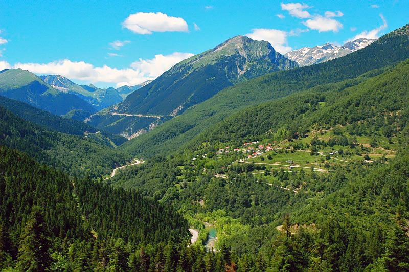
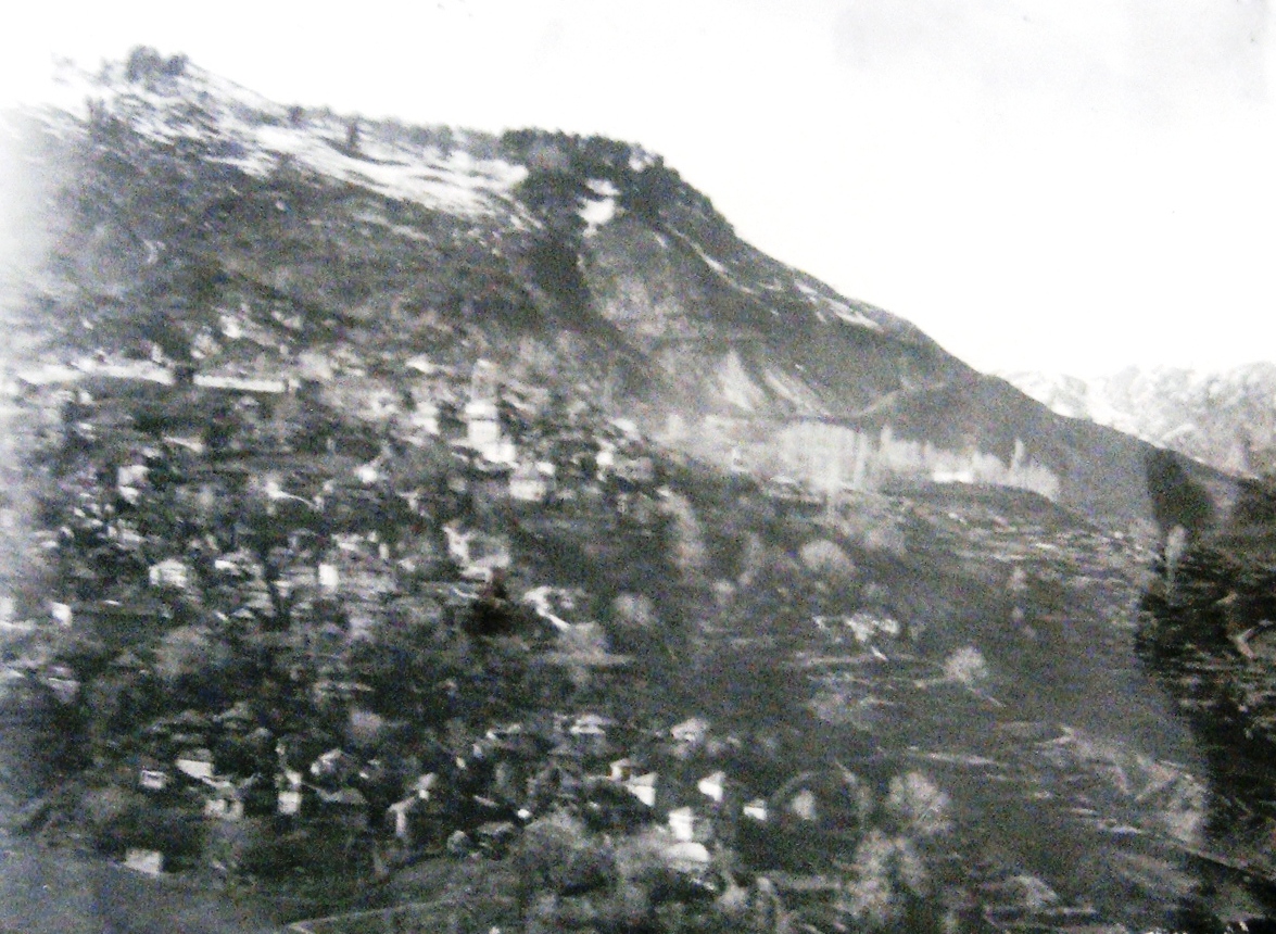
Aspropotamos (Greek: Ασπροπόταμος meaning the white river) is a former community in the Trikala regional unit, Thessaly, Greece. Since the 2011 local government reform it is part of the municipality Meteora, of which it is a municipal unit. The 2011 census recorded 419 residents in the municipal unit. The seat of the community was in Kallirroi (pop. 42). Name The community was named after the river Aspropotamos, a tributary of the Acheloos. Geography Aspropotamos is located in the southern Pindus mountains, in the westernmost part of Trikala regional unit, about 40 km west of Trikala and 20 km southeast of Metsovo. Aspropotamos covers an area of 297.082 km2. The largest settlement in the municipal unit is Agía Paraskeví (pop. 69). Subdivisions The municipal unit Aspropotamos is subdivided into the following communities (constituent villages in brackets): *Agia Paraskevi * Anthousa * Chaliki * Kallirroi * Katafyto (Katafyto, Milia) * Krania (Krania ... [...More Info...] [...Related Items...] OR: [Wikipedia] [Google] [Baidu] |
Thessaly
Thessaly ( el, Θεσσαλία, translit=Thessalía, ; ancient Thessalian: , ) is a traditional geographic and modern administrative region of Greece, comprising most of the ancient region of the same name. Before the Greek Dark Ages, Thessaly was known as Aeolia (, ), and appears thus in Homer's ''Odyssey''. Thessaly became part of the modern Greek state in 1881, after four and a half centuries of Ottoman rule. Since 1987 it has formed one of the country's 13 regions and is further (since the Kallikratis reform of 2011) sub-divided into five regional units and 25 municipalities. The capital of the region is Larissa. Thessaly lies in northern Greece and borders the regions of Macedonia on the north, Epirus on the west, Central Greece on the south, and the Aegean Sea on the east. The Thessaly region also includes the Sporades islands. Name and etymology Thessaly is named after the ''Thessaloi'', an ancient Greek tribe. The meaning of the name of this tribe is unknow ... [...More Info...] [...Related Items...] OR: [Wikipedia] [Google] [Baidu] |
Pindus
The Pindus (also Pindos or Pindhos; el, Πίνδος, Píndos; sq, Pindet; rup, Pindu) is a mountain range located in Northern Greece and Southern Albania. It is roughly 160 km (100 miles) long, with a maximum elevation of 2,637 metres (8652') (Mount Smolikas). Because it runs along the border of Thessaly and Epirus, the Pindus range is known colloquially as the ''spine of Greece''. The mountain range stretches from near the Greek-Albanian border in southern Albania, entering the Epirus and Macedonia regions in northern Greece down to the north of the Peloponnese. Geologically it is an extension of the Dinaric Alps, which dominate the western region of the Balkan Peninsula. History of the name Historically, the name Pindos refers to the mountainous territory that separates the greater Epirus region from the regions of Macedonia and Thessaly. According to John Tzetzes (a 12th-century Byzantine writer), the Pindos range was then called Metzovon. When translated (bet ... [...More Info...] [...Related Items...] OR: [Wikipedia] [Google] [Baidu] |
Stefani, Trikala
Stefani () is a village and a community of the Meteora municipality. Before the 2011 local government reform it was part of the community of Aspropotamos, of which it was a communal district. The 2011 census recorded 60 residents in the village. The community of Stefani covers an area of 44.587 km2. See also *List of settlements in the Trikala regional unit This is a list of settlements in the Trikala regional unit, Greece. * Achladea * Achladochori * Agia Kyriaki * Agia Paraskevi * Agiofyllo * Agios Nikolaos * Agios Prokopios * Agios Vissarion * Agnantia * Agrelia * Aidona * Amaranto * ... References {{Thessaly-geo-stub Populated places in Trikala (regional unit) Meteora (municipality) Aromanian settlements in Greece ... [...More Info...] [...Related Items...] OR: [Wikipedia] [Google] [Baidu] |
Polythea, Trikala
Polythea () is a village and a community of the Meteora municipality. Since the 2011 local government reform it was part of the community of Aspropotamos, of which it was a communal district. The 2011 census recorded 36 residents in the village. The community of Polythea covers an area of 24.293 km2. See also * List of settlements in the Trikala regional unit This is a list of settlements in the Trikala regional unit, Greece. * Achladea * Achladochori * Agia Kyriaki * Agia Paraskevi * Agiofyllo * Agios Nikolaos * Agios Prokopios * Agios Vissarion * Agnantia * Agrelia * Aidona * Amaranto * ... References Populated places in Trikala (regional unit) Meteora (municipality) Aromanian settlements in Greece {{Thessaly-geo-stub ... [...More Info...] [...Related Items...] OR: [Wikipedia] [Google] [Baidu] |
Anthousa, Trikala
Anthousa (Greek: Ανθούσα, before 1928: Λεπενίτσα - ''Lepenitsa'') is an Aromanian (Vlach) village in the municipal unit of Aspropotamos in the western part of the Trikala regional unit, Greece. It is located in the southern Pindus mountains, 36 km west of Kalambaka, and 12 km south of Metsovo. The 2011 census recorded 61 residents in Anthousa. The community of Anthousa covers an area of 38.723 km2. Population See also *List of settlements in the Trikala regional unit This is a list of settlements in the Trikala regional unit, Greece. * Achladea * Achladochori * Agia Kyriaki * Agia Paraskevi * Agiofyllo * Agios Nikolaos * Agios Prokopios * Agios Vissarion * Agnantia * Agrelia * Aidona * Amaranto * ... References External links lipinitsa.gr- Information on Anthoussa in the Trikala prefecture Anthoussa on GTP Travel Pages {{Meteora div Aromanian settlements in Greece Populated places in Trikala (regional unit) ... [...More Info...] [...Related Items...] OR: [Wikipedia] [Google] [Baidu] |
Agia Paraskevi, Aspropotamos
Agia Paraskevi (, Nicolae Saramandu, ed. Manuela Nevaci, ''Atlasul lingvistic al dialectului aromân'' he Linguistic Atlas of the Aromanian Dialect/ Romanian Academy Publishing Press (2014), p. XLVI) is a village and a community of the Meteora municipality. Since the 2011 local government reform it was part of the community of Aspropotamos, of which it was a communal district. The 2011 census recorded 69 residents in the village. The community of Agia Paraskevi covers an area of 29.641 km2. Aromanians of Agia Paraskevi The local Aromanians of Agia Paraskevi call themselves in singular ''armâń gurțań''. A particularity of the Aromanian dialect in Agia Paraskevi, who speak a Pindus dialect, is that they have preserved the Latin word for flower, ''floare'', as opposed to the majority of Aromanians that call it ''lilice'' or ''chitcă''. They are all Orthodox Christians who worship at the Meteora monasteries located nearby to the village. See also * List of settlements in ... [...More Info...] [...Related Items...] OR: [Wikipedia] [Google] [Baidu] |
Metsovo
Metsovo ( el, Μέτσοβο; rup, Aminciu) is a town in Epirus, in the mountains of Pindus in northern Greece, between Ioannina to the west and Meteora to the east. The largest centre of Aromanian (Vlach) life in Greece, Metsovo is a large regional hub for several small villages and settlements in the Pindus region, and it features many shops, schools, offices, services, museums, and galleries. The economy of Metsovo is dominated by agriculture and tourism, the latter of which flourishes in winter. Metsovo is served by Greek National Road 6 (Ioannina – Trikala) and by the Egnatia Odos motorway. Etymology From medieval times till well into the 19th century, Metsovo was known, in various sources, as ''Metzovo''. From the end of the 18th century on, the literary form of ''Messovon'' makes its appearance. The town is known as ''Aminciu'' in Aromanian (Vlach), and as ''Miçova'' in Ottoman Turkish. Ottoman census records In the Ottoman census records we see the word ''Mcwh'' ... [...More Info...] [...Related Items...] OR: [Wikipedia] [Google] [Baidu] |
Trikala
Trikala ( el, Τρίκαλα; rup, Trikolj) is a city in northwestern Thessaly, Greece, and the capital of the Trikala regional unit. The city straddles the Lithaios river, which is a tributary of Pineios. According to the Greek National Statistical Service, Trikala is populated by 81,355 inhabitants (2011), while in total the Trikala regional unit is populated by 131,085 inhabitants (2011). Trikala is a lively Greek city with picturesque monuments and old neighborhoods with traditional architecture. The city is near Meteora and also near the mountain range of south Pindus, where there are many destinations (i.e. Pyli's stone bridge, Elati, Pertouli, Palaiokarya's stone bridge and waterfall, Pertouli Ski Center etc.). History Antiquity The region of Trikala has been inhabited since prehistoric times. The first indications of permanent settlement have been uncovered in the cave of Theopetra, and date back to approx. 49,000 BC. Neolithic settlements dating back to 6,000 B ... [...More Info...] [...Related Items...] OR: [Wikipedia] [Google] [Baidu] |
Achelous River
The Achelous ( el, Αχελώος, grc, Ἀχελῷος ''Akhelôios''), also Acheloos, is a river in western Greece. It is long. It formed the boundary between Acarnania and Aetolia of antiquity. It empties into the Ionian Sea. In ancient times its spirit was venerated as the river god Achelous. Herodotus, taking notice of the shoreline-transforming power of the Acheloos River, even compared it to the Nile in this respect: :'There are other rivers as well which, though not as large as the Nile, have had substantial results. In particular (although I could name others), there is the Achelous, which flows through Acarnania into the sea and has already turned half the Echinades islands into mainland.' (2.10, trans. Waterfield) It is said to have been called more anciently ''Thoas'', ''Axenus'' and ''Thestius''. Course The river Achelous begins at about elevation on the eastern slope of Lakmos mountain in the Pindus range, near the village Anthousa in the westernmost part ... [...More Info...] [...Related Items...] OR: [Wikipedia] [Google] [Baidu] |


