|
Ashby Woulds
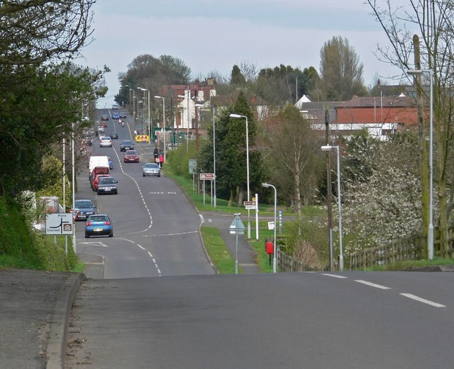
Ashby Woulds is a civil parish in Leicestershire, England. The population (including Albert Village) at the 2011 census was 3,763. It is in the North West Leicestershire district, to the west of Ashby de la Zouch. The main settlements in the parish are Moira and Norris Hill. Until 1974 the parish was an urban district of Leicestershire. See also * Ashby Woulds Heritage Trail *Albert Village Albert Village is a small post-industrial village in Leicestershire, England and is located approximately 1.5 miles (2.4 km) from the town of Swadlincote. The area's heritage is in coal-mining and pottery manufacture, both locally defunct ... References External links Districts of England abolished by the Local Government Act 1972 Civil parishes in Leicestershire North West Leicestershire District {{Leicestershire-geo-stub ... [...More Info...] [...Related Items...] OR: [Wikipedia] [Google] [Baidu] |
Civil Parish
In England, a civil parish is a type of administrative parish used for local government. It is a territorial designation which is the lowest tier of local government below districts and counties, or their combined form, the unitary authority. Civil parishes can trace their origin to the ancient system of ecclesiastical parishes, which historically played a role in both secular and religious administration. Civil and religious parishes were formally differentiated in the 19th century and are now entirely separate. Civil parishes in their modern form came into being through the Local Government Act 1894, which established elected parish councils to take on the secular functions of the parish vestry. A civil parish can range in size from a sparsely populated rural area with fewer than a hundred inhabitants, to a large town with a population in the tens of thousands. This scope is similar to that of municipalities in Continental Europe, such as the communes of France. However, ... [...More Info...] [...Related Items...] OR: [Wikipedia] [Google] [Baidu] |
Leicestershire
Leicestershire ( ; postal abbreviation Leics.) is a ceremonial and non-metropolitan county in the East Midlands, England. The county borders Nottinghamshire to the north, Lincolnshire to the north-east, Rutland to the east, Northamptonshire to the south-east, Warwickshire to the south-west, Staffordshire to the west, and Derbyshire to the north-west. The border with most of Warwickshire is Watling Street, the modern A5 road (Great Britain), A5 road. Leicestershire takes its name from the city of Leicester located at its centre and unitary authority, administered separately from the rest of the county. The ceremonial county – the non-metropolitan county plus the city of Leicester – has a total population of just over 1 million (2016 estimate), more than half of which lives in the Leicester Urban Area. History Leicestershire was recorded in the Domesday Book in four wapentakes: Guthlaxton, Framland, Goscote, and Gartree (hundred), Gartree. These later became hundred ... [...More Info...] [...Related Items...] OR: [Wikipedia] [Google] [Baidu] |
North West Leicestershire
North West Leicestershire is a local government district in Leicestershire, England. The population of the Local Authority at the 2011 census was 93,348. Its main towns are Ashby-de-la-Zouch, Castle Donington, Coalville and Ibstock. The district contains East Midlands Airport, which operates flights to the rest of Britain and to various places in Europe. It is also notable as the location of Castle Donington and Donington Park, a grand-prix circuit and a major venue for music festivals. The district is represented in the UK Parliament by the constituency of the same name. The area has a long history of mineral extraction, with coal, brick clay, gravel and granite amongst the products. All the deep coal mines in the area have closed, but opencast mining still continues. The district was formed in 1974 by a merger of Ashby de la Zouch Urban District, Ashby Woulds Urban District, Coalville Urban District, Ashby de la Zouch Rural District, Castle Donington Rural District and ... [...More Info...] [...Related Items...] OR: [Wikipedia] [Google] [Baidu] |
Ashby De La Zouch
Ashby-de-la-Zouch, sometimes spelt Ashby de la Zouch () and shortened locally to Ashby, is a market town and civil parish in the North West Leicestershire district of Leicestershire, England. The town is near to the Derbyshire and Staffordshire borders. Its 2001 census population of 11,410 rose to 12,370 in 2011. The castle in the town was an important fort in the 15th–17th centuries. In the 19th century the town's main industries were ribbon manufacture, coal mining, and brickmaking. The civil parish includes the hamlets of Shellbrook to the west and Boundary to the north-west. Swadlincote, Burton upon Trent, Melbourne and Coalville are within , with Derby due north. Ashby lies at the heart of The National Forest, about south of the Peak District National Park, on the A42 between Tamworth and Nottingham. In 2018, Ashby Market Street was named "Best Shopping Experience", and in 2019 it made the final of the rising-star category for UK high streets. History The town was ... [...More Info...] [...Related Items...] OR: [Wikipedia] [Google] [Baidu] |
Moira, Leicestershire
Moira is a former mining village about south-west of Ashby-de-la-Zouch in North West Leicestershire, England. The village is about south of Swadlincote and is close to the boundary with Derbyshire. The population is included in the civil parish of Ashby Woulds. For centuries North West Leicestershire has been quarried and mined for coal, limestone, granite and brick clay, and its environmental damage was one of the reasons that it was chosen in the 1990s as the site for the National Forest, which is part of a Government-funded programme to create more woodland. Proximate villages include Donisthorpe, Overseal, Oakthorpe and Spring Cottage. Etymology Moira's toponym is derived from the Irish earldom of Moira, one of the titles of the Hastings family, which held Ashby de la Zouch Castle. The former local coal pit, Rawdon Colliery, also bore a Hastings family name. In 2022, residents were amused when a road sign spelled the name ' Moria', suggesting a link with Tolkien's fic ... [...More Info...] [...Related Items...] OR: [Wikipedia] [Google] [Baidu] |
Urban District (Great Britain And Ireland)
In England and Wales, Northern Ireland, and the Republic of Ireland, an urban district was a type of local government district that covered an urbanised area. Urban districts had an elected urban district council (UDC), which shared local government responsibilities with a county council. England and Wales In England and Wales, urban districts and rural districts were created in 1894 (by the Local Government Act 1894) as subdivisions of administrative counties. They replaced the earlier system of urban and rural sanitary districts (based on poor law unions) the functions of which were taken over by the district councils. The district councils also had wider powers over local matters such as parks, cemeteries and local planning. An urban district usually contained a single parish, while a rural district might contain many. Urban districts were considered to have more problems with public health than rural areas, and so urban district councils had more funding and greater power ... [...More Info...] [...Related Items...] OR: [Wikipedia] [Google] [Baidu] |
Ashby Woulds Heritage Trail
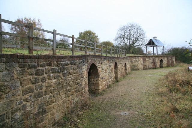
The Ashby Woulds Heritage Trail is a footpath and cycleway along what was formerly the Ashby and Nuneaton railway line between Spring Cottage and Measham, Leicestershire, England, a distance of some . There are links to Donisthorpe woodland park, Moira Furnace Moira Furnace is a nineteenth-century iron-making blast furnace located in Moira, Leicestershire, on the banks of the Ashby-de-la-Zouch Canal. Built by the Earl of Moira in 1804, the building has been preserved by North West Leicestershire Di ... and Conkers, the main visitor centre for The National Forest, in which the trail now lies. Features & Activities There are stone-surfaced paths suitable for cyclists, pedestrians and horse riders. External links Ashby Woulds Heritage Trail {{Authority control Parks and open spaces in Leicestershire Heritage trails ... [...More Info...] [...Related Items...] OR: [Wikipedia] [Google] [Baidu] |
Albert Village
Albert Village is a small post-industrial village in Leicestershire, England and is located approximately 1.5 miles (2.4 km) from the town of Swadlincote. The area's heritage is in coal-mining and pottery manufacture, both locally defunct. The National Forest's visitor attraction 'Conkers' is at nearby Moira. The population is included in the civil parish of Ashby Woulds. Governance Albert Village forms part of the civil parish of Ashby Woulds, which is part of the district of North West Leicestershire, and forms part of the border with Derbyshire Derbyshire ( ) is a ceremonial county in the East Midlands, England. It includes much of the Peak District National Park, the southern end of the Pennine range of hills and part of the National Forest. It borders Greater Manchester to the nor .... Sport Albert Village also has a children's football team - Albert Village Junior F.C. which caters for boys and girls from the ages of 3–7 years. References Villag ... [...More Info...] [...Related Items...] OR: [Wikipedia] [Google] [Baidu] |
Districts Of England Abolished By The Local Government Act 1972
A district is a type of administrative division that, in some countries, is managed by the local government. Across the world, areas known as "districts" vary greatly in size, spanning regions or counties, several municipalities, subdivisions of municipalities, school district, or political district. By country/region Afghanistan In Afghanistan, a district (Persian ps, ولسوالۍ ) is a subdivision of a province. There are almost 400 districts in the country. Australia Electoral districts are used in state elections. Districts were also used in several states as cadastral units for land titles. Some were used as squatting districts. New South Wales had several different types of districts used in the 21st century. Austria In Austria, the word is used with different meanings in three different contexts: * Some of the tasks of the administrative branch of the national and regional governments are fulfilled by the 95 district administrative offices (). The area a dist ... [...More Info...] [...Related Items...] OR: [Wikipedia] [Google] [Baidu] |
Civil Parishes In Leicestershire
{{disambiguation ...
Civil may refer to: *Civic virtue, or civility *Civil action, or lawsuit * Civil affairs *Civil and political rights *Civil disobedience *Civil engineering *Civil (journalism), a platform for independent journalism *Civilian, someone not a member of armed forces *Civil law (other), multiple meanings *Civil liberties *Civil religion *Civil service *Civil society *Civil war *Civil (surname) Civil is a surname. Notable people with the surname include: *Alan Civil (1929–1989), British horn player *François Civil (born 1989), French actor * Gabrielle Civil, American performance artist *Karen Civil (born 1984), American social media an ... [...More Info...] [...Related Items...] OR: [Wikipedia] [Google] [Baidu] |


