|
Arrubium
Arrubium was a fort in the Roman province of Moesia (today's Măcin, Romania). See also *List of castra Castra (Latin, singular castrum) were military forts of various sizes used by the Roman army throughout the Empire in various places of Europe, Asia and Africa. The largest castra were permanent legionary fortresses. Locations The disposition ... References *Oberländer-Târnoveanu, Ernest: Aspecte ale circulaţiei monetare greceşti în Dobrogea de Nord (sec. VI î.e.n - I e.n), Pontica, IX, Constanţa, 1978, p. 59-87. *Florescu, Radu: Limesul dunărean bizantin în vremea dinastiilor isauriană şi macedoneană, Pontica, XIX, Constanţa, 1986, p. 172. Notes External linksRoman castra from Romania - Google MapsEarth Roman legionary fortresses in Romania {{Dacia-stub ... [...More Info...] [...Related Items...] OR: [Wikipedia] [Google] [Baidu] |
Troesmis (castra)
Troesmis was an ancient Roman legionary fortress, a major site situated on the Danube and forming a key part of the Limes Moesiae frontier system. Around this fortress the Geto-Dacian town later developed.TOCILESCU 1883a, p. 101http://www.turcoaia.ro/istoric.htmlAl. Simionov Ștefan - Troesmis, considerații topograficeRadu Florescu - Ghid arheologic al Dobrogei It was situated in what is now Romania near Igliţa-Turcoaia. Between 107 and 161, it was the home of the Roman Legio V Macedonica. '' Notitia Dignitatum'' shows that during 337–361, it was the headquarters of Legio II Herculia. Destruction of the site The site was concessioned to Desire More by the Ottoman Empire for farming activities. In 1882 Desire More started excavations, and the stones from the ancient site were sold as construction materials in Galați and Brăila. Suspected by the local Muslim villagers that the scope of the excavation is a treasure hunt, a local revolt started. With the help of Engelhar ... [...More Info...] [...Related Items...] OR: [Wikipedia] [Google] [Baidu] |
Măcin
Măcin () is a town in Tulcea County, in the Northern Dobruja region of Romania. Location Măcin is located in the north-western part of the Northern Dobruja region, in Tulcea County. The city is located at the intersection of the DN22 ( E87) and DN22D national roads. The DN22 road links it to the Romanian capital, Bucharest (230 km to the West, via Brăila) and to cities of Isaccea and Tulcea (to the East). The DN22D road connects Măcin through a southern route with Tulcea and Constanța. According to the 2011 census, the population numbered 7,666 inhabitants, composed of 91.46% Romanians, 4.8% Roma, 2.92% Turks and 0.37% Russian Lipovans. History The town is located on an ancient Celtic settlement, named ''Arrubium''. It was included in the Getic polities of Rhemaxos and Zyraxes, then conquered by the Roman Empire, which stationed a cavalry unit in this place between 99 and 241 AD. The ruins of the old Roman fortifications can be seen today on the top of "Cetate" Hi ... [...More Info...] [...Related Items...] OR: [Wikipedia] [Google] [Baidu] |
Dinogetia (castra)
Dinogetia was a fort in the Roman province of Moesia. See also *List of castra Castra (Latin, singular castrum) were military forts of various sizes used by the Roman army throughout the Empire in various places of Europe, Asia and Africa. The largest castra were permanent legionary fortresses. Locations The disposition ... Notes External linksRoman castra from Romania - Google MapsEarth Roman legionary fortresses in Romania Roman fortifications in Moesia Inferior History of Dobruja Historic monuments in Tulcea County {{Dacia-stub ro:Castrul roman Dinogetia ... [...More Info...] [...Related Items...] OR: [Wikipedia] [Google] [Baidu] |
List Of Castra
Castra (Latin, singular castrum) were military forts of various sizes used by the Roman army throughout the Empire in various places of Europe, Asia and Africa. The largest castra were permanent legionary fortresses. Locations The disposition of the castra reflects the most important zones of the empire from a military point of view. Many castra were disposed along frontiers particularly in Northern and Central Europe. Another focal point was the Eastern border, where the Roman Empire confronted one of its long-term enemies, the Persian Empire. Other castra were located in strategically important zones, as in Egypt, from which most of the wealth of the empire came. Finally, other castra were located in zones in which the Romans experienced local unrest, such as Northern Spain and Judea. Provinces where the Roman power was unchallenged, such as Italy, Gaul, Africa and Greece, were provided with few or no castra. In the long history of the Roman Empire, the character of the mil ... [...More Info...] [...Related Items...] OR: [Wikipedia] [Google] [Baidu] |
Tabula Peutingeriana
' (Latin Language, Latin for "The Peutinger Map"), also referred to as Peutinger's Tabula or Peutinger Table, is an illustrated ' (ancient Roman road map) showing the layout of the ''cursus publicus'', the road network of the Roman Empire. The map is a 13th-century parchment copy of a possible Roman original. It covers Europe (without the Iberian Peninsula and the British Isles), North Africa, and parts of Asia, including the Middle East, Persia, and India. According to one hypothesis, the existing map is based on a document of the 4th or 5th century that contained a copy of the world map originally prepared by Marcus Vipsanius Agrippa, Agrippa during the reign of the emperor Augustus (27 BC – AD 14). However, Emily Albu has suggested that the existing map could instead be based on an original from the Carolingian period. The map was likely stolen by the renowned humanist Conrad Celtes, who bequeathed it to his friend, the economist and archaeologist Konrad Peutinger, who gave ... [...More Info...] [...Related Items...] OR: [Wikipedia] [Google] [Baidu] |
Legio V Macedonica
''Legio V Macedonica'' (the Fifth Macedonian Legion) was a Roman legion. It was probably originally levied in 43 BC by consul Gaius Vibius Pansa Caetronianus and Gaius Iulius Caesar Octavianus (later known as the Emperor Augustus). It was based in the Balkan provinces of Macedonia, Moesia and Dacia. In the Notitia Dignitatum records from beginning of the fifth century, the legion was still stationed in Dacia, with detachments stationed in the east and Egypt. The last known evidence shows the legion, or detachments from it, stationed in Egypt in the seventh century one or two years before the Islamic conquest of Egypt. It is often assumed that the legion fought in this war and was destroyed, although it is uncertain whether detachments or the whole legion were in Egypt, and there is no further evidence of the legion's eventual fate. Its symbol was the bull, but the eagle was used as well. History 1st century BC: Creation and deployment in Macedonia The Legio V was one of th ... [...More Info...] [...Related Items...] OR: [Wikipedia] [Google] [Baidu] |
Ala I Dardanorum
Ala, ALA, Alaa or Alae may refer to: Places * Ala, Hiiu County, Estonia, a village * Ala, Valga County, Estonia, a village * Ala, Alappuzha, Kerala, India, a village * Ala, Iran, a village in Semnan Province * Ala, Gotland, Sweden * Alad, Seydun or Ala, a village in Khuzestan Province, Iran * Ala, Trentino, Italy, a comune * Alà dei Sardi, Italy, a comune * Alabama, a state in the United States * Alae (Cilicia), a town of ancient Cilicia Science * Acetylated lanolin alcohol * Ala of nose, in human anatomy * Alae (nematode anatomy) * Alanine, an α-amino acid * Alpha lipoic acid, a nutritional supplement * Alpha-linolenic acid, an omega−3 fatty acid * δ-aminolevulinic acid or δ-ALA Mythology and religion * Ala (demon), a female demon in Serbian mythology * Ala (Luwian goddess), a Hittite and Luwian goddess * Ala (Odinani), an Alusi (deity) in the Odinani beliefs of the Igbo people of Nigeria Military * , a US Navy tugboat * Ala (Roman allied military unit), a ... [...More Info...] [...Related Items...] OR: [Wikipedia] [Google] [Baidu] |
Ala II Hispanorum Aravacorum
Ala, ALA, Alaa or Alae may refer to: Places * Ala, Hiiu County, Estonia, a village * Ala, Valga County, Estonia, a village * Ala, Alappuzha, Kerala, India, a village * Ala, Iran, a village in Semnan Province * Ala, Gotland, Sweden * Alad, Seydun or Ala, a village in Khuzestan Province, Iran * Ala, Trentino, Italy, a comune * Alà dei Sardi, Italy, a comune * Alabama, a state in the United States * Alae (Cilicia), a town of ancient Cilicia Science * Acetylated lanolin alcohol * Ala of nose, in human anatomy * Alae (nematode anatomy) * Alanine, an α-amino acid * Alpha lipoic acid, a nutritional supplement * Alpha-linolenic acid, an omega−3 fatty acid * δ-aminolevulinic acid or δ-ALA Mythology and religion * Ala (demon), a female demon in Serbian mythology * Ala (Luwian goddess), a Hittite and Luwian goddess * Ala (Odinani), an Alusi (deity) in the Odinani beliefs of the Igbo people of Nigeria Military * , a US Navy tugboat * Ala (Roman allied military unit), a ... [...More Info...] [...Related Items...] OR: [Wikipedia] [Google] [Baidu] |
Moesia
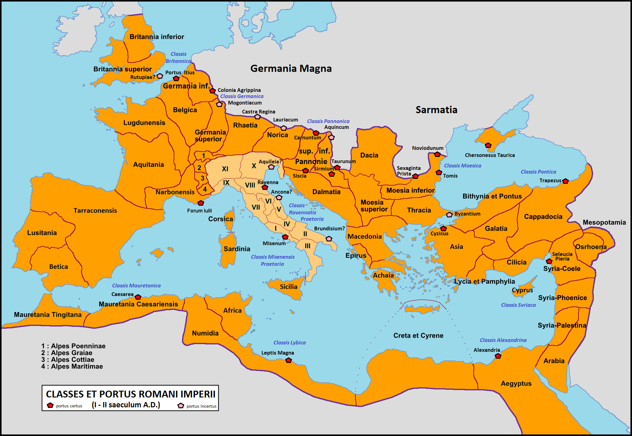
Moesia (; Latin: ''Moesia''; el, Μοισία, Moisía) was an ancient region and later Roman province situated in the Balkans south of the Danube River, which included most of the territory of modern eastern Serbia, Kosovo, north-eastern Albania, northern parts of North Macedonia (Moesia Superior), Northern Bulgaria, Romanian Dobruja and small parts of Southern Ukraine (Moesia Inferior). Geography In ancient geographical sources, Moesia was bounded to the south by the Haemus ( Balkan Mountains) and Scardus (Šar) mountains, to the west by the Drinus (Drina) river, on the north by the Donaris (Danube) and on the east by the Euxine (Black Sea). History The region was inhabited chiefly by Thracians, Dacians (Thraco-Dacian), Illyrian and Thraco-Illyrian peoples. The name of the region comes from Moesi, Thraco-Dacian peoples who lived there before the Roman conquest. Parts of Moesia belonged to the polity of Burebista, a Getae king who established his rule over a large pa ... [...More Info...] [...Related Items...] OR: [Wikipedia] [Google] [Baidu] |
Moesia Inferior
Moesia (; Latin: ''Moesia''; el, Μοισία, Moisía) was an ancient region and later Roman province situated in the Balkans south of the Danube River, which included most of the territory of modern eastern Serbia, Kosovo, north-eastern Albania, northern parts of North Macedonia (Moesia Superior), Northern Bulgaria, Romanian Dobruja and small parts of Southern Ukraine (Moesia Inferior). Geography In ancient geographical sources, Moesia was bounded to the south by the Haemus (Balkan Mountains) and Scardus (Šar) mountains, to the west by the Drinus (Drina) river, on the north by the Donaris (Danube) and on the east by the Euxine (Black Sea). History The region was inhabited chiefly by Thracians, Dacians (Thraco-Dacian), Illyrian and Thraco-Illyrian peoples. The name of the region comes from Moesi, Thraco-Dacian peoples who lived there before the Roman conquest. Parts of Moesia belonged to the polity of Burebista, a Getae king who established his rule over a large part o ... [...More Info...] [...Related Items...] OR: [Wikipedia] [Google] [Baidu] |
Noviodunum (castra)
Noviodunum, known also as ''Noviodunum ad Istrum'', was a fort and a port in the Roman province of Moesia located on the lower Danube. History The geographical position of this settlement offered to the Romans the possibility of supervision and control of the border of the entire Roman limes in the north of the Danube. The strategic importance has been determinant in the economic and administrative function around which developed the military and naval legionaries. Noviodunum was passed under Roman control with the annexation of Thrace in 46 AD, being then attached to the Roman province of Moesia. It became an important port of ''Classis Flavia Moesica'' and a military center of the region starting from Domitian–Trajan, after the conquest of Dacia. Here some ''vexillationes'' of Legio V Macedonica were detached, at least until the reign of Marcus Aurelius. Then followed ''vexillationes'' of Legio I Italica, and then from the Diocletian Legio I Iovia. It was probably dest ... [...More Info...] [...Related Items...] OR: [Wikipedia] [Google] [Baidu] |
Tulcea
Tulcea (; also known by other alternative names) is a city in Northern Dobruja, Romania. It is the administrative center of Tulcea County, and had a population of 73,707 . One village, Tudor Vladimirescu, is administered by the city. Names The city is known in Bulgarian, Russian and Ukrainian as Тулча, romanized: ''Tulcha''; in Greek as Αιγισσός, romanized: ''Aegyssus''; in Hungarian as ''Tulcsa''; and in Turkish as ''Tulça''. History Tulcea was founded in the 7th century B.C. under the name of ''Aegyssus'', mentioned in the documents of Procopius and Diodorus of Sicily (3rd century BC). In his ''Ex Ponto'', Ovid recorded a local tradition that ascribed its name to a mythical founder, ''Aegisos the Caspian''. After the fighting from 1215 AD the Romans conquered the town. They rebuilt it after their plans, their technique and architectural vision, reorganizing it. The fortified town was mentioned as late as the 10th century, in documents such as Notitia Epis ... [...More Info...] [...Related Items...] OR: [Wikipedia] [Google] [Baidu] |


